Related Research Articles
Lenox is an unincorporated community in western Dent County, Missouri, United States. The community is located approximately twelve miles west of Salem at the intersection of routes H and C. Edgar Springs is approximately four miles to the northwest in adjacent Phelps County and the community of Maples is 4.5 miles to the south in Texas County.
Cherryville is an unincorporated community in southeastern Crawford County, Missouri, United States. It is located on Route 19, approximately ten miles south of Steelville, at the northern terminus of Route 49. It is near the Mark Twain National Forest.
Berryman is an unincorporated community on the border between Crawford and Washington counties in the U.S. state of Missouri. Located along Route 8, it lies in the Mark Twain National Forest, approximately sixteen miles west of Potosi. Courtois Creek flows under Route 8, just west of the village. Berryman Recreation Area and trail lie to the northeast of the village.
Davisville is an unincorporated community in southeastern Crawford County, Missouri, United States. It is located in the Mark Twain National Forest, approximately 13 miles southeast of Steelville.
Wesco is an unincorporated community in southwest Crawford County, Missouri, United States. It is located on the Meramec River, approximately eight miles southwest of Steelville.

Dillard is an unincorporated community in southern Crawford County, Missouri, United States. It is located on Huzzah Creek and Missouri Route 49, approximately 22 miles south of Steelville in the Mark Twain National Forest. The Dillard Mill State Historic Site lies about one mile south of the community at the confluence of Indian Creek with Huzzah Creek.
Leann is an unincorporated community in northeast Barry County, in the U.S. state of Missouri. The community is on Missouri Route 39 approximately two miles north of Jenkins. Jenkins Creek flow past the east side of the site. Cassville is twelve miles to the southwest.
Argo is an unincorporated community in northwest Crawford County, in the U.S. state of Missouri. The community is on a ridge northwest of the Little Bourbeuse River. The site is located on Missouri Route C about five miles northwest of Bourbon and Interstate 44.
Butts is an unincorporated community in eastern Crawford County, in the U.S. state of Missouri. The community is on the north side of Henpeck Hollow about one-half mile east of Courtois Creek. Access is via a county road from Missouri Route 8, approximately five miles east of Elayer. The location is within the Mark Twain National Forest and a campground is located on the Courtois River to the west of the site.
Cherry Valley is an unincorporated community in Crawford County, in the U.S. state of Missouri.
Coffeyton is an unincorporated community in northern Crawford County, in the U.S. state of Missouri. The community is located on the railroad line, approximately two miles northeast of Leasburg and three miles southwest of Bourbon.
Czar is an unincorporated community in southeastern Crawford County, in the U.S. state of Missouri. The community was located on the east side of Shoal Creek on Missouri Route Y, approximately four miles north of Viburnum. The Czar church and cemetery are about one-half mile northwest and the Czar Lookout Tower is on a ridge about one mile northeast on Route Y.
Elayer is an unincorporated community in Crawford County, in the U.S. state of Missouri.
Kallambah Branch is a stream in Crawford County in the U.S. state of Missouri. It is a tributary of Crooked Creek. The stream headwaters arise in the Cooked Creek State Forest just north of Missouri Route VV and it flows to the northeast. The stream enters Crooked Creek just south of the community of Keysville.
Keysville is an unincorporated community in southwest Crawford County, in the U.S. state of Missouri. The community is located approximately six miles south of Steelville on Missouri Route AA and is on the banks of Crooked Creek.
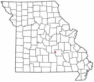
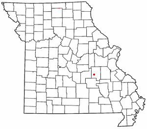
Midland is an unincorporated community in Crawford County, in the U.S. state of Missouri. The community was located along Missouri Route 8 near the Missouri Route TT intersection approximately two miles east of Steelville. The Midland School was about one-half mile to the northwest on a bluff above Whittenburg Creek.
Oak Hill is an unincorporated community in northwest Crawford County, in the U.S. state of Missouri. The community is located on the east bank of Brush Creek, one-quarter mile south of the Crawford-Gasconade county line and is on Missouri Route CC, one mile east of Missouri Route 19.
Patsy is an unincorporated community in Crawford County, in the U.S. state of Missouri. The community is located on Missouri Route BB, along a ridge southeast of Elayer.
Service is an unincorporated community in eastern Crawford County, in the U.S. state of Missouri. The community is located on a small tributary along the east bank of Courtois Creek, approximately 2.5 miles west of the Crawford-Washington county line. Missouri Route 8 passes on the ridge about one-half mile to the southwest. The community of Butts lies about 1.5 miles downstream (northwest) and Berryman is about four miles to the southeast (upstream). The old Service School was located at the site in the 1940s.
Westover is an unincorporated community in Crawford County, in the U.S. state of Missouri. The community is on Dry Creek at the end of Missouri Route BB, approximately seven miles south-southeast of Steelville and five miles northeast of Cherryville.
References
- ↑ U.S. Geological Survey Geographic Names Information System: Cook Station, Missouri
- ↑ Missouri Atlas & Gazetteer, DeLorme, 1998, First edition, p. 47 ISBN 0-89933-224-2
- 1 2 "Crawford County Place Names, 1928–1945 (archived)". The State Historical Society of Missouri. Archived from the original on June 24, 2016. Retrieved September 24, 2016.
{{cite web}}: CS1 maint: bot: original URL status unknown (link) - ↑ "Post Offices". Jim Forte Postal History. Archived from the original on March 6, 2016. Retrieved September 24, 2016.
Municipalities and communities of Crawford County, Missouri, United States | ||
|---|---|---|
| Cities |  | |
| Villages | ||
| Townships | ||
| CDP | ||
| Unincorporated communities | ||
| Ghost towns | ||
| Footnotes | ‡This populated place also has portions in an adjacent county or counties | |
37°48′46″N91°26′17″W / 37.81278°N 91.43806°W
| | This Crawford County, Missouri state location article is a stub. You can help Wikipedia by expanding it. |