Wayne County, Missouri

Last updated

Wayne County
Wayne County MO Courthouse 20151021-005.jpg
Wayne County Courthouse in Greenville
Map of Missouri highlighting Wayne County.svg
Location within the U.S. state of Missouri
Missouri in United States.svg
Missouri's location within the U.S.
Coordinates: 37°07′N90°28′W / 37.11°N 90.46°W / 37.11; -90.46
CountryFlag of the United States.svg United States
StateFlag of Missouri.svg  Missouri
FoundedDecember 11, 1818
Named for Anthony Wayne
Seat Greenville
Largest city Piedmont
Area
  Total774 sq mi (2,000 km2)
  Land759 sq mi (1,970 km2)
  Water15 sq mi (40 km2)  1.9%
Population
 (2020)
  Total10,974
  Density14/sq mi (5.5/km2)
Time zone UTC−6 (Central)
  Summer (DST) UTC−5 (CDT)
Congressional district 8th

Wayne County is a county located in the Ozark foothills in the U.S. state of Missouri. As of the 2020 census, the population was 10,974. [1] The county seat is Greenville. [2] The county was officially organized on December 11, 1818, and is named after General "Mad" Anthony Wayne, who served in the American Revolution. [3] As of August 28, 2023, Wayne County is designated the UFO Capital of Missouri, along with the city of Piedmont. [4]

Contents

History

Wayne County was created in December 1818 by the last Missouri Territorial Legislature from portions of Cape Girardeau and Lawrence counties. Wayne County thus actually predates statehood. In March 1819, Congress established the Territory of Arkansas, and most of Lawrence County became Lawrence County, Arkansas Territory. The small strip that had been excluded was added to Wayne County by the Missouri State Constitution of 1820. The Osage Strip on the Kansas border was added in 1825. Between 1825 and 1831, Wayne County was actually larger than the states of Massachusetts, Connecticut, Rhode Island, and Delaware combined. All or part of 32 present Missouri counties once belonged to Wayne County. Despite its size, the Census of 1820 revealed that Wayne County had a total population of just 1,239 white inhabitants and 204 African American slaves.

When Wayne County was formed in 1818, the territorial legislature appointed five commissioners to govern it. They chose a small settlement called Cedar Cabin on the St. Francis River to be the county seat. Renamed Greenville, it had grown to about 1,000 by the turn of the 20th century. By 1940, however, the population had declined to 572. In 1941, the remaining inhabitants were forced to relocate because of the construction of Lake Wappapello. This new town's population had fallen to 270 in 1950, but has now increased to about 563.

The Wayne County Courthouse was destroyed by a fire in 1854. In 1866, the records in new courthouse were stolen, and in 1892 the courthouse again burned down. Thus few county records survive from that time.

Geography

According to the U.S. Census Bureau, the county has a total area of 774 square miles (2,000 km2), of which 759 square miles (1,970 km2) is land and 15 square miles (39 km2) (1.9%) is water. [5]

The most populous community in Wayne County is Piedmont with a population of 2,401 people, [6] followed by Greenville with 563 and Williamsville with 386.

Adjacent counties

Major highways

National protected areas

Demographics

Historical population
CensusPop.Note
1820 1,443
1830 3,264126.2%
1840 3,4034.3%
1850 4,51832.8%
1860 5,62924.6%
1870 6,0687.8%
1880 9,09649.9%
1890 11,92731.1%
1900 15,30928.4%
1910 15,181−0.8%
1920 13,012−14.3%
1930 12,243−5.9%
1940 12,7944.5%
1950 10,514−17.8%
1960 8,638−17.8%
1970 8,546−1.1%
1980 11,27732.0%
1990 11,5432.4%
2000 13,25914.9%
2010 13,5212.0%
2020 10,974−18.8%
U.S. Decennial Census [7]
1790-1960 [8] 1900-1990 [9]
1990-2000 [10] 2010-2015 [11]

As of the 2010 Census, [12] there were 13,521 people, 5,717 households, and 3,850 families residing in the county. The population density was 18 people per square mile (6.9 people/km2). There were 8,083 housing units at an average density of 11 units per square mile (4.2/km2).

The racial makeup of the county was 97% White, 0.7% Black or African American, 0.4% Native American, 0.1% Asian, 0% Pacific Islander, 0% from other races, and 1.8% from two or more races. 1.5% of the population were Hispanic or Latino of any race. According to the 2000 Census, the most common first ancestries reported in Wayne County were 32.9% American, 15.0% German, 11.9% English, 11.7% Irish, 3.0% French (excluding Basque), 2.0% Dutch and 2.0% Italian.

There were 5,717 households, out of which 23.2% had children under the age of 18 living with them, 52.7% were husband-wife families. 32.7% were non-families. 27.7% of all households were made up of individuals, and 13% had someone living alone who was 65 years of age or older. The average household size was 2.34 and the average family size was 2.82.

In the county, the population was spread out, with 23.1% under the age of 19, 5% from 20 to 24, 14.2%% from 25 to 39, 36.4% from 40 to 64, and 21.4% who were 65 years of age or older. The median age was 45.8 years.

The median income for a household in the county was $33,954, and the median income for a family was $39,419. Males had a median income of $26,048 versus $18,250 for females. The per capita income for the county was $18,378. About 15.8% of families and 23% of the population were below the poverty line, including 31.9% of those under age 18 and 12.7% of those age 65 or over.

Religion

According to the Association of Religion Data Archives County Membership Report (2000), Wayne County is a part of the Bible Belt with evangelical Protestantism being the majority religion. The most predominant denominations among residents in Wayne County who adhere to a religion are Southern Baptists (62.76%), Methodists (10.08%), and Roman Catholics (7.07%).

2020 Census

Wayne County Racial Composition [13]
RaceNum.Perc.
White (NH)10,09392%
Black or African American (NH)500.45%
Native American (NH)670.6%
Asian (NH)230.21%
Pacific Islander (NH)50.05%
Other/Mixed (NH)5815.3%
Hispanic or Latino 1551.41%

Politics

Local

The Republican Party dominates politics at the local level in Wayne County and controls all but one county-wide offices.

Wayne County, Missouri
Elected countywide officials
Assessor Tara Smith Republican
Circuit Clerk Darren T. Garrison Republican
County Clerk Kent Sisco Republican
Collector Rhonda Cates Republican
Commissioner
(Presiding)
Brian M. Polk Republican
Commissioner
(District 1)
Doug Wood Republican
Commissioner
(District 2)
Steve Foster Republican
Coroner Michael Allen Republican
Prosecuting Attorney Michael Anderson Republican
Public Administrator Penny Schulz Republican
Recorder Cindy Stout Republican
Sheriff Dean Finch Democratic
Treasurer Amber Sturgeon Republican

State

Wayne County is divided among two legislative districts in the Missouri House of Representatives.

All of Wayne County is a part of Missouri's 27th District in the Missouri Senate and is currently represented by Holly Thompson Rehder (R)-Sikeston.

Missouri Senate – District 27 – Wayne County (2020) [14]
PartyCandidateVotes%±%
Republican Holly Rehder4,68482.81%
Democratic Donnie Owens97217.19%
Missouri Senate – District 27 – Wayne County (2016) [14]
PartyCandidateVotes%±%
Republican Wayne Wallingford3,95673.60%
Democratic Donnie Owens1,41926.40%
Past Gubernatorial Elections Results
Year Republican Democratic Third Parties
2020 82.60%4,80115.50% 9001.60% 93
2016 72.00%4,09825.00% 1,4251.40% 80
2012 46.82% 2,64250.77%2,8652.41% 136
2008 44.62% 2,72753.49%3,2691.88% 115
2004 58.84%3,64939.86% 2,4721.31% 81
200051.84%3,00846.25% 2,6841.92% 111
199642.84% 2,42155.11%3,1142.05% 116
199242.65% 2,49357.35%3,3522.05% 116
198860.16%3,04739.76% 2,0140.08% 4
198453.79%2,78746.21% 2,3940.00% 0
198051.05%2,76948.89% 2,6520.06% 3
197649.37% 2,42850.61%2,4890.02% 1

Federal

Wayne County is included in Missouri's 8th Congressional District and is currently represented by Jason T. Smith (R-Salem) in the U.S. House of Representatives. Smith won a special election on Tuesday, June 4, 2013, to finish out the remaining term of U.S. Representative Jo Ann Emerson (R-Cape Girardeau). Emerson announced her resignation a month after being reelected with over 70 percent of the vote in the district. She resigned to become CEO of the National Rural Electric Cooperative.

U.S. House of Representatives - District 8 – Wayne County (2012)
PartyCandidateVotes%±%
Republican Jo Ann Emerson4,23274.65+5.61
Democratic Jack Rushin1,31123.13-4.40
Libertarian Rick Vandeven1262.22+1.07
U.S. House of Representatives - District 8 - Special Election – Wayne County (2013)
PartyCandidateVotes%±%
Republican Jason T. Smith81756.34
Democratic Steve Hodges33222.90
Constitution Doug Enyart27819.17
Libertarian Bill Slantz231.59
U.S. House of Representatives - District 8 – Wayne County (2020) [15]
PartyCandidateVotes%±%
Republican Jason T. Smith4,82384.20
Democratic Kathy Ellis82114.30
Libertarian Tom Schmitz851.50

Political culture

United States presidential election results for Wayne County, Missouri [16]
Year Republican Democratic Third party
No.%No.%No.%
2020 4,98784.84%84514.38%460.78%
2016 4,65880.84%94816.45%1562.71%
2012 3,79066.26%1,81331.70%1172.05%
2008 3,78461.49%2,24336.45%1272.06%
2004 3,91963.17%2,25036.27%350.56%
2000 3,34657.22%2,38740.82%1151.97%
1996 2,17238.45%2,75448.75%72312.80%
1992 2,10134.91%3,07351.05%84514.04%
1988 2,64851.80%2,45648.04%80.16%
1984 2,86754.82%2,36345.18%00.00%
1980 2,82351.86%2,54946.82%721.32%
1976 1,96339.59%2,98760.25%80.16%
1972 3,09163.90%1,74636.10%00.00%
1968 2,15647.79%1,71438.00%64114.21%
1964 2,01940.19%3,00559.81%00.00%
1960 3,06958.78%2,15241.22%00.00%
1956 2,51350.62%2,45149.38%00.00%
1952 2,42349.08%2,50050.64%140.28%
1948 1,93741.80%2,69558.16%20.04%
1944 2,17149.92%2,16949.87%90.21%
1940 2,73547.66%2,99152.12%130.23%
1936 2,49443.41%3,23556.31%160.28%
1932 1,95537.82%3,17261.37%420.81%
1928 2,66256.82%2,01142.92%120.26%
1924 1,95844.11%2,28351.43%1984.46%
1920 2,38052.28%2,07245.52%1002.20%
1916 1,52847.32%1,59449.37%1073.31%
1912 1,05235.46%1,43248.26%48316.28%
1908 1,55447.11%1,64149.74%1043.15%
1904 1,67850.38%1,56747.04%862.58%
1900 1,64848.09%1,74550.92%340.99%
1896 1,41847.14%1,56852.13%220.73%
1892 96439.85%1,39357.59%622.56%
1888 1,00141.13%1,42858.67%50.21%

At the presidential level, Wayne County was traditionally a fairly independent county or battleground, though in recent years the county has become strongly Republican. President Donald Trump received a record 85% of the vote in 2020, building on his former record of 81% he set, in 2016. Bill Clinton also carried the county both times in 1992 and 1996, and since that point the county has been solidly Republican to Extremely Republican. Like many rural counties in Missouri and throughout the United States in 2008, voters in Wayne County favored John McCain over Barack Obama, and favored Mitt Romney by a significantly larger margin in 2012.

In 2004, Missourians voted on a constitutional amendment to define marriage as the union between a man and a woman—it overwhelmingly passed Wayne County with 87.75 percent of the vote. The initiative passed the state with 71 percent of support from voters as Missouri became the first state to ban same-sex marriage. In 2006, Missourians voted on a constitutional amendment to fund and legalize embryonic stem cell research in the state—it failed in Wayne County with 55.15 percent voting against the measure. The initiative narrowly passed the state with 51 percent of support from voters as Missouri became one of the first states in the nation to approve embryonic stem cell research. Despite Wayne County's longstanding tradition of supporting socially conservative platforms, voters in the county have a penchant for advancing populist causes like increasing the minimum wage. In 2006, Missourians voted on a proposition (Proposition B) to increase the minimum wage in the state to $6.50 an hour—it passed Wayne County with 77.36 percent of the vote. The proposition strongly passed every single county in Missouri with 75.94 percent voting in favor as the minimum wage was increased to $6.50 an hour in the state. During the same election, voters in five other states also strongly approved increases in the minimum wage.

Missouri presidential preference primary (2008)

In the 2008 presidential primary, voters in Wayne County from both political parties supported candidates who finished in second place in the state at large and nationally.

Former U.S. Senator Hillary Clinton (D-New York) received more votes, a total of 1,458, than any candidate from either party in Wayne County during the 2008 presidential primary. Wayne County was Clinton's second best county in Missouri; her only better result was in Dunklin County.

Education

Of all adults 25 years of age and older in Wayne County, 87% possessed a high school diploma or higher while 30.3% had a bachelor's degree or higher as their highest educational attainment.

Public schools

Private schools

Public libraries

Communities

Cities

Village

Unincorporated communities

Ghost towns

See also

Related Research Articles

<span class="mw-page-title-main">Wright County, Missouri</span> County in Missouri, United States

Wright County is a county located in the southern portion of the U.S. state of Missouri. As of the 2020 census, the population was 18,188. Its county seat is Hartville. The county was officially organized on January 29, 1841, and is named after Silas Wright, a former Congressman, U.S. Senator and Governor of New York.

<span class="mw-page-title-main">Washington County, Missouri</span> County in Missouri, United States

Washington County is located in the southeastern part of the U.S. state of Missouri. As of the 2020 United States census, the population was 23,514. The county seat and largest city is Potosi. The county was officially organized on August 21, 1813, and was named in honor of George Washington, the first President of the United States.

<span class="mw-page-title-main">Texas County, Missouri</span> County in Missouri, United States

Texas County is a county located in the southern portion of the U.S. state of Missouri. As of the 2020 census, the population was 24,487. Its county seat is Houston. The county was organized in 1843 as Ashley County. Its name was changed in 1845 to Texas County, after the Republic of Texas. The 2010 U.S. Census indicates that the county was the center of population for the United States.

<span class="mw-page-title-main">Taney County, Missouri</span> County in Missouri, United States

Taney County is a county in the southwestern portion of the U.S. state of Missouri. As of the 2020 census, the population was 56,066. Its county seat is Forsyth. It is included in the Branson, Missouri, Micropolitan Statistical Area.

<span class="mw-page-title-main">Stoddard County, Missouri</span> County in Missouri, United States

Stoddard County is a county located in the southeastern portion of the U.S. state of Missouri. As of the 2020 census, the population was 28,672. The county seat is Bloomfield. The county was officially organized on January 2, 1835, and is named for Amos Stoddard, the first American commandant of Upper Louisiana.

<span class="mw-page-title-main">Ste. Genevieve County, Missouri</span> County in Missouri, United States

Sainte Genevieve County, often abbreviated Ste. Genevieve County, is a county located in the eastern portion of the U.S. state of Missouri. As of the 2020 census, the population was 18,479. The largest city and county seat is Ste. Genevieve. The county was officially organized on October 1, 1812, and is named after the Spanish district once located in the region, after Saint Genevieve, patroness of Paris, France.

<span class="mw-page-title-main">Shannon County, Missouri</span> County in Missouri, United States

Shannon County is a county in the southern portion of the U.S. state of Missouri. As of the 2020 census, the population was 7,031. Its county seat is Eminence. The county was officially organized on January 29, 1841, and was named in honor of George F. "Peg-Leg" Shannon, a member of the Lewis and Clark Expedition. It is the second-largest county by area in Missouri.

<span class="mw-page-title-main">Ripley County, Missouri</span> County in Missouri, United States

Ripley County is a county in the Ozarks of Missouri. At the 2020 census, it had a population of 10,679. The largest city and county seat is Doniphan. The county was officially organized on January 5, 1833, and is named after Brigadier General Eleazer Wheelock Ripley, a soldier who served with distinction in the War of 1812.

<span class="mw-page-title-main">Reynolds County, Missouri</span> County in Missouri, United States

Reynolds County is a county located in the Ozark Foothills Region in the Lead Belt of Missouri. As of the 2020 census, the population was 6,096. Its county seat is Centerville. The county was officially organized on February 25, 1845, and was named in honor of former Governor of Missouri Thomas Reynolds.

<span class="mw-page-title-main">Ozark County, Missouri</span> County in Missouri, United States

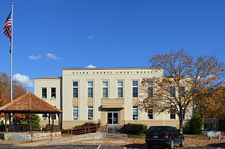
Ozark County is a county in the southern portion of the U.S. state of Missouri. As of the 2020 census, the population was 8,553. The largest city and county seat is Gainesville. The county was organized as Ozark County, named after the Ozark Mountains, on January 29, 1841. It was renamed Decatur County, after Commodore Stephen Decatur, from 1843 to 1845, after which the name Ozark County was restored.

<span class="mw-page-title-main">Oregon County, Missouri</span> County in Missouri

Oregon County is a county located in the southern portion of the U.S. state of Missouri. As of the 2020 census, the population was 8,635. Its county seat is Alton. The county was officially organized on February 14, 1845, and was named for the Oregon Territory in the northwestern United States.

<span class="mw-page-title-main">New Madrid County, Missouri</span> County in Missouri, United States

New Madrid County is a county located in the Bootheel of the U.S. state of Missouri. As of the 2020 census, the population was 16,434. The largest city is Portageville and county seat is New Madrid, located on the northern side of the Kentucky Bend in the Mississippi River, where it has formed an oxbow around an exclave of Fulton County, Kentucky. This feature has also been known as New Madrid Bend or Madrid Bend, for the city.

<span class="mw-page-title-main">McDonald County, Missouri</span> County in Missouri, United States

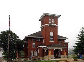
McDonald County is a county located in the southwestern corner of the U.S. state of Missouri. As of the 2020 census, the population was 23,303. Its county seat is Pineville. The county was organized in 1849 and named for Sergeant Alexander McDonald, a soldier in the American Revolutionary War. The county has three sites on the National Register of Historic Places, including the Old McDonald County Courthouse and the Powell Bridge.

<span class="mw-page-title-main">Iron County, Missouri</span> County in Missouri, United States

Iron County is a county located in the Lead Belt region in the U.S. state of Missouri. As of the 2020 census, the population was 9,537. The largest city and county seat is Ironton. Iron County was officially organized on February 17, 1857, and was named after the abundance of iron ore found within its borders.

<span class="mw-page-title-main">Howell County, Missouri</span> County in Missouri, United States

Howell County is in southern Missouri. As of the 2020 census, the population was 39,750. The largest city and county seat is West Plains. The county was officially organized on March 2, 1851, and is named after Josiah Howell, a pioneer settler in the Howell Valley.

<span class="mw-page-title-main">Gentry County, Missouri</span> County in Missouri, United States

Gentry County is a county located in the northwestern portion of the U.S. state of Missouri. As of the 2020 census, the population was 6,162. Its county seat is Albany. The county was organized February 14, 1841 and named for Colonel Richard Gentry of Boone County, who fell in the Seminole War in 1837.

<span class="mw-page-title-main">Dunklin County, Missouri</span> County in Missouri, United States

Dunklin County is located in the Bootheel of the U.S. state of Missouri. As of the 2020 census, the population was 28,283. The largest city and county seat is Kennett. The county was officially organized on February 14, 1845, and is named in honor of Daniel Dunklin, a Governor of Missouri who died the year before the county was organized.

<span class="mw-page-title-main">Douglas County, Missouri</span> County in Missouri, United States

Douglas County is a county located in the south-central portion of the U.S. state of Missouri. As of the 2020 census, the population was 11,578. The county seat and only incorporated community is Ava. The county was officially organized on October 19, 1857, and is named after U.S. Senator Stephen A. Douglas (D-Illinois) and later Democratic presidential candidate.

<span class="mw-page-title-main">Christian County, Missouri</span> County in Missouri, United States

Christian County is located in the southwestern part of the U.S. state of Missouri. As of the 2020 census, its population was 88,842. Its county seat is Ozark. The county was organized in 1859 and is named after Christian County, Kentucky, which in turn is named for William Christian, a Kentucky soldier of the American Revolutionary War.

<span class="mw-page-title-main">Greenville, Missouri</span> City in Missouri, United States

Greenville is a city located on U.S. Route 67 near the intersection with Route D and E in Wayne County, Missouri, United States, along the St. Francis River. The population was 443 at the 2020 census. Greenville was incorporated and founded as the county seat of Wayne County in 1819.

References

  1. "Explore Census Data". data.census.gov. Retrieved January 9, 2022.
  2. "Find a County". National Association of Counties. Retrieved June 7, 2011.
  3. Eaton, David Wolfe (1918). How Missouri Counties, Towns and Streams Were Named. The State Historical Society of Missouri. p. 370.
  4. "10.247". revisor.mo.gov. Retrieved September 1, 2023.
  5. "2010 Census Gazetteer Files". United States Census Bureau. August 22, 2012. Archived from the original on October 21, 2013. Retrieved November 22, 2014.
  6. Bureau, U.S. Census. "American FactFinder - Results". factfinder.census.gov. Archived from the original on February 13, 2020. Retrieved September 12, 2018.
  7. "U.S. Decennial Census". United States Census Bureau. Retrieved November 22, 2014.
  8. "Historical Census Browser". University of Virginia Library. Retrieved November 22, 2014.
  9. "Population of Counties by Decennial Census: 1900 to 1990". United States Census Bureau. Retrieved November 22, 2014.
  10. "Census 2000 PHC-T-4. Ranking Tables for Counties: 1990 and 2000" (PDF). United States Census Bureau. Archived (PDF) from the original on March 27, 2010. Retrieved November 22, 2014.
  11. "State & County QuickFacts". United States Census Bureau. Retrieved September 14, 2013.
  12. Bureau, U.S. Census. "American FactFinder - Community Facts". factfinder.census.gov. Archived from the original on February 13, 2020. Retrieved September 12, 2018.
  13. "P2 HISPANIC OR LATINO, AND NOT HISPANIC OR LATINO BY RACE – 2020: DEC Redistricting Data (PL 94-171) – Wayne County, Missouri".
  14. 1 2 "Our Campaigns - MO State Senate 27 Race - Nov 03, 2020". www.ourcampaigns.com.
  15. "Missouri Election Results: Eighth Congressional District". The New York Times. November 3, 2020.
  16. Leip, David. "Dave Leip's Atlas of U.S. Presidential Elections". uselectionatlas.org. Retrieved March 27, 2018.
  17. Breeding, Marshall. "Piedmont Public Library". Libraries.org. Retrieved May 8, 2017.

37°07′N90°28′W / 37.11°N 90.46°W / 37.11; -90.46