Salem, Missouri | |
---|---|
City of Salem | |
Coordinates: 37°38′24″N91°32′05″W / 37.64000°N 91.53472°W | |
Country | United States |
State | Missouri |
County | Dent |
Township | Spring Creek East, Spring Creek West |
Government | |
• Type | Mayor–council government |
• Mayor | Greg Parker [1] |
Area | |
• Total | 3.48 sq mi (9.01 km2) |
• Land | 3.48 sq mi (9.01 km2) |
• Water | 0.00 sq mi (0.00 km2) |
Elevation | 1,168 ft (356 m) |
Population (2020) | |
• Total | 4,608 |
• Density | 1,324.52/sq mi (511.41/km2) |
Time zone | UTC-6 (Central (CST)) |
• Summer (DST) | UTC-5 (CDT) |
ZIP code | 65560 |
Area code | 573 |
FIPS code | 29-65234 [4] |
GNIS feature ID | 2396528 [3] |
Website | www.salemmo.com |
Salem is the county seat of Dent County, Missouri, United States. The population was 4,608 at the 2020 census, [5] which allows Salem to become a Class 3 city in Missouri; however, the city has chosen to remain a Class 4 city under Missouri Revised Statutes. [6] [7] [8] Salem is located a few miles[ quantify ] north of the Ozark Scenic Riverways and close to Montauk State Park, which contains the headwaters of the Current River.
The name Salem is derived from the Hebrew word Shalom , meaning "peace". [9]
Dent County was first explored by Dustin Counts and settled between 1818 and 1829. In 1851, the Missouri Assembly created Dent County from portions of Crawford Shannon and Texas counties. It was named for early settler Lewis Dent, who served as the first representative. A log courthouse, built c. 1851–1852, was Dent County's first and was located on the Wingfield farm northeast of Salem. W. P. Williams became the first mayor of Salem in 1860, just after the Missouri State Legislature passed laws regarding the administration of village government. [10] During the American Civil War, units of the 5th Missouri State Militia would sometimes garrison in Salem. [11] Village governments were suspended during the Civil War. [12] In 1881, Salem was incorporated as a town. [13] The town's museums include the Dent County Museum, the Ozark Natural & Cultural Resource Center, the Bonebrake Center of Nature and History, and a historic Downtown Walking Tour. [14] [15]
The Dam and Spillway in the Hatchery Area at Montauk State Park, Dent County Courthouse, Lower Parker School, Montauk State Park Open Shelter, Nova Scotia Ironworks Historic District, Old Mill at Montauk State Park, and W.A. Young House are listed on the National Register of Historic Places. [16]
According to the United States Census Bureau, the city has a total area of 3.18 square miles (8.24 km2), all land.
Salem has a humid subtropical climate (Köppen climate classification Cfa). It has cool winters and warm summers with consistent rainfall year-round.
Climate data for Salem, Missouri (1991–2020 normals, extremes 1903–present) | |||||||||||||
---|---|---|---|---|---|---|---|---|---|---|---|---|---|
Month | Jan | Feb | Mar | Apr | May | Jun | Jul | Aug | Sep | Oct | Nov | Dec | Year |
Record high °F (°C) | 84 (29) | 85 (29) | 92 (33) | 93 (34) | 97 (36) | 112 (44) | 111 (44) | 112 (44) | 106 (41) | 93 (34) | 86 (30) | 79 (26) | 112 (44) |
Mean daily maximum °F (°C) | 42.6 (5.9) | 47.9 (8.8) | 57.3 (14.1) | 68.0 (20.0) | 75.5 (24.2) | 83.2 (28.4) | 87.6 (30.9) | 86.8 (30.4) | 79.5 (26.4) | 68.8 (20.4) | 55.7 (13.2) | 45.2 (7.3) | 66.5 (19.2) |
Daily mean °F (°C) | 32.2 (0.1) | 36.7 (2.6) | 45.8 (7.7) | 56.1 (13.4) | 64.3 (17.9) | 72.0 (22.2) | 76.3 (24.6) | 75.1 (23.9) | 67.5 (19.7) | 56.8 (13.8) | 45.2 (7.3) | 35.6 (2.0) | 55.3 (12.9) |
Mean daily minimum °F (°C) | 21.8 (−5.7) | 25.6 (−3.6) | 34.2 (1.2) | 44.2 (6.8) | 53.1 (11.7) | 60.9 (16.1) | 64.9 (18.3) | 63.4 (17.4) | 55.5 (13.1) | 44.9 (7.2) | 34.7 (1.5) | 26.0 (−3.3) | 44.1 (6.7) |
Record low °F (°C) | −28 (−33) | −23 (−31) | −8 (−22) | 13 (−11) | 29 (−2) | 30 (−1) | 44 (7) | 39 (4) | 27 (−3) | 16 (−9) | −2 (−19) | −21 (−29) | −28 (−33) |
Average precipitation inches (mm) | 2.69 (68) | 2.81 (71) | 4.04 (103) | 4.98 (126) | 5.63 (143) | 4.22 (107) | 3.68 (93) | 4.33 (110) | 4.03 (102) | 3.71 (94) | 3.93 (100) | 2.95 (75) | 47.00 (1,194) |
Average snowfall inches (cm) | 0.2 (0.51) | 0.4 (1.0) | 0.5 (1.3) | 0.0 (0.0) | 0.0 (0.0) | 0.0 (0.0) | 0.0 (0.0) | 0.0 (0.0) | 0.0 (0.0) | 0.0 (0.0) | 0.1 (0.25) | 0.1 (0.25) | 1.3 (3.3) |
Average precipitation days (≥ 0.01 in) | 8.7 | 9.0 | 10.4 | 10.6 | 12.0 | 9.5 | 9.0 | 8.2 | 7.0 | 8.3 | 9.3 | 9.0 | 111.0 |
Average snowy days (≥ 0.1 in) | 0.2 | 0.2 | 0.1 | 0.0 | 0.0 | 0.0 | 0.0 | 0.0 | 0.0 | 0.0 | 0.1 | 0.1 | 0.7 |
Source: NOAA [17] [18] |
Census | Pop. | Note | %± |
---|---|---|---|
1870 | 280 | — | |
1880 | 1,624 | 480.0% | |
1890 | 1,815 | 11.8% | |
1900 | 1,481 | −18.4% | |
1910 | 1,796 | 21.3% | |
1920 | 1,771 | −1.4% | |
1930 | 2,250 | 27.0% | |
1940 | 3,151 | 40.0% | |
1950 | 3,611 | 14.6% | |
1960 | 3,870 | 7.2% | |
1970 | 4,363 | 12.7% | |
1980 | 4,454 | 2.1% | |
1990 | 4,486 | 0.7% | |
2000 | 4,854 | 8.2% | |
2010 | 4,950 | 2.0% | |
2020 | 4,608 | −6.9% | |
U.S. Decennial Census [19] |
As of the census [20] of 2010, there were 4,950 people, 2,152 households, and 1,248 families living in the city. The population density was 1,556.6 inhabitants per square mile (601.0/km2). There were 2,408 housing units at an average density of 757.2 per square mile (292.4/km2). The racial makeup of the city was 95.94% White, 0.53% Black or African American, 1.13% Native American, 0.16% Asian, 0.08% Native Hawaiian or Pacific Islander, 0.32% from other races, and 1.84% from two or more races. Hispanic or Latino of any race were 1.17% of the population.
There were 2,152 households, of which 28.5% had children under the age of 18 living with them, 40.1% were married couples living together, 13.6% had a female householder with no husband present, 4.3% had a male householder with no wife present, and 42.0% were non-families. 37.3% of all households were made up of individuals, and 17.9% had someone living alone who was 65 years of age or older. The average household size was 2.24 and the average family size was 2.93.
The median age in the city was 39.5 years. 24.2% of residents were under the age of 18; 8.8% were between the ages of 18 and 24; 22.5% were from 25 to 44; 24.1% were from 45 to 64; and 20.3% were 65 years of age or older. The gender makeup of the city was 46.5% male and 53.5% female.
As of the census [4] of 2000, there were 4,854 people, 2,115 households, and 1,269 families living in the city. The population density was 1,607.4 inhabitants per square mile (620.6/km2). There were 2,368 housing units at an average density of 784.2 per square mile (302.8/km2). The racial makeup of the city was 97.05% White, 0.74% African American, 0.54% Native American, 0.16% Asian, 0.25% from other races, and 1.26% from two or more races. Hispanic or Latino of any race were 0.82% of the population.
There were 2,115 households, out of which 28.2% had children under the age of 18 living with them, 44.3% were married couples living together, 12.7% had a female householder with no husband present, and 40.0% were non-families. 36.3% of all households were made up of individuals, and 21.1% had someone living alone who was 65 years of age or older. The average household size was 2.21 and the average family size was 2.86.
In the city, the population was spread out, with 24.4% under the age of 18, 8.9% from 18 to 24, 24.7% from 25 to 44, 18.9% from 45 to 64, and 23.1% who were 65 years of age or older. The median age was 39 years. For every 100 females, there were 81.6 males. For every 100 females age 18 and over, there were 74.9 males.
The median income for a household in the city was $21,648, and the median income for a family was $29,460. Males had a median income of $27,006 versus $17,285 for females. The per capita income for the city was $12,766. About 12.9% of families and 17.4% of the population were below the poverty line, including 22.8% of those under age 18 and 11.3% of those age 65 or over.
Salem High School is the only high school located within the city. Salem is also home to an extension of Southwest Baptist University.
Salem has a lending library, the Salem Public Library. [21]
National Register of Historic Places listings in Dent County, Missouri
Dent County is a county in Missouri. As of the 2020 census, the population was 14,421. The largest city and county seat is Salem. The county was officially organized on February 10, 1851, and is named after state representative Lewis Dent, a pioneer settler who arrived in Missouri from Virginia in 1835.
Fulton County is a county located in the U.S. state of Arkansas. As of the 2020 census, the population was 12,075. The county seat is Salem. Fulton County was formed on December 21, 1842, and named for William Fulton, the last governor of the Arkansas Territory. It is an alcohol prohibition or dry county.
St. Donatus is a city in Jackson County, Iowa, United States. The population was 120 at the time of the 2020 census. St. Donatus is known for its status as a Luxembourger village, with historic architecture and views along U.S. Route 52. It is the home of a historic Catholic church, which is dedicated to Saint Donatus of Muenstereifel, the town's namesake. It was formerly named Tete Des Morts, which is the name of a creek that flows through the village.
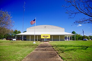
Nebo is a home rule-class city in Hopkins County, Kentucky, in the United States. The population was 236 as of the 2010 census.
Deale is a census-designated place (CDP) in Anne Arundel County, Maryland, United States. The population was 4,945 at the 2010 census. It has a scenic view of Chesapeake Bay and is popular with boaters. Sudley was listed on the National Register of Historic Places in 1973.
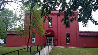
Dent is a city in Otter Tail County, Minnesota, United States. The population was 173 at the 2020 census.
Norborne is a city in southwest Carroll County, Missouri, United States. The population was 634 at the 2020 census.
Harrisonville is a city in Cass County, Missouri, United States. The population was 10,121 at the 2020 census. It is the county seat of Cass County. It is part of the Kansas City metropolitan area.
Stockton is a city in Cedar County, Missouri, United States. The population was 1,683 at the 2020 census. It is the county seat of Cedar County.
Liberty is a city in and the county seat of Clay County, Missouri, United States and is a suburb of Kansas City, located in the Kansas City Metropolitan Area. As of the 2020 United States Census the population was 30,167. Liberty is home to William Jewell College.
Ava is the only incorporated city in Douglas County, Missouri, United States. The population was 2,894 at the 2020 census. Ava is the county seat of Douglas County. The city was founded in 1871. It was renamed Ava in 1881, the town's original name having been "Militia Springs."
Troy is a city in Lincoln County, Missouri, United States. As of 2019, the estimated population was 12,820. It is the county seat of Lincoln County. Troy is an exurb of St. Louis, and is part of the St. Louis Metropolitan Statistical Area.
Linneus is a small city in Linn County, Missouri, United States. The population was 281 at the 2020 census. It is the county seat of Linn County.
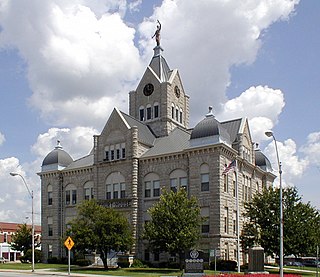
Versailles is a city in Morgan County, Missouri, United States. The population was 2,482 at the 2010 census. It is the county seat of Morgan County. Locally, the town's name is pronounced “Ver-sails”, rather than “Ver-seye,” as in the French pronunciation of the royal palace for which the town is named.
Alton is a city and the county seat of Oregon County, Missouri, United States. The population was 707 at the 2020 census.
Bolivar is a city and county seat of Polk County, Missouri, United States.
Sycamore Hills is a village in St. Louis County, Missouri, United States. The population is 560 at the 2020 census.
Northwest Ithaca is a census-designated place (CDP) in Tompkins County, New York, United States. The population was 1,115 at the 2000 census.
Brecknock Township is a township in northeastern Lancaster County, Pennsylvania, United States. The population was 7,585 at the 2020 census.
Yuba is a village in Richland County, Wisconsin, United States. The population was 74 at the 2010 census. Yuba is 11 miles southwest of Hillsboro and 17 miles north of Richland Center. County Hwy C runs through the village.
37°38′29″N91°32′20″W / 37.64139°N 91.53889°W