Kingston, Missouri

Last updated

Kingston, Missouri
Caldwell County Missouri Courthouse 20191027-7106.jpg
Caldwell County Missouri Incorporated and Unincorporated areas Kingston Highlighted.svg
Location of Kingston, Missouri
Coordinates: 39°38′33″N94°02′18″W / 39.64250°N 94.03833°W / 39.64250; -94.03833
Country United States
State Missouri
County Caldwell
Area
[1]
  Total0.52 sq mi (1.35 km2)
  Land0.52 sq mi (1.34 km2)
  Water0.00 sq mi (0.01 km2)
Elevation
[2]
909 ft (277 m)
Population
 (2020)
  Total290
  Density558.77/sq mi (215.73/km2)
Time zone UTC-6 (Central (CST))
  Summer (DST) UTC-5 (CDT)
ZIP code
64650
Area code 816
FIPS code 29-38846 [3]
GNIS feature ID2395539 [2]

Kingston is a city in Caldwell County, Missouri, and is part of the Kansas City metropolitan area with the United States. The population was 290 at the 2020 census. [4] It is the county seat of Caldwell County. [5]

Contents

History

Kingston was laid out in 1843, and named for Austin Augustus King, at the time judge, and afterward 10th Governor of Missouri. [6] [7] A post office has been in operation at Kingston since 1843. [8]

The Caldwell County Courthouse and Far West are listed on the National Register of Historic Places. [9]

Geography

According to the United States Census Bureau, the city has a total area of 0.52 square miles (1.35 km2), all land. [10]

Demographics

Historical population
CensusPop.Note
1870 414
1880 47013.5%
1890 465−1.1%
1900 65540.9%
1910 535−18.3%
1920 371−30.7%
1930 3956.5%
1940 394−0.3%
1950 338−14.2%
1960 311−8.0%
1970 291−6.4%
1980 280−3.8%
1990 279−0.4%
2000 2872.9%
2010 34821.3%
2020 290−16.7%
U.S. Decennial Census [11]

2010 census

As of the census [12] of 2010, there were 348 people, 107 households, and 62 families living in the city. The population density was 669.2 inhabitants per square mile (258.4/km2). There were 133 housing units at an average density of 255.8 per square mile (98.8/km2). The racial makeup of the city was 76.4% White, 5.7% African American, 0.9% Asian, 16.1% from other races, and 0.9% from two or more races. Hispanic or Latino of any race were 17.5% of the population.

There were 107 households, of which 24.3% had children under the age of 18 living with them, 48.6% were married couples living together, 6.5% had a female householder with no husband present, 2.8% had a male householder with no wife present, and 42.1% were non-families. 38.3% of all households were made up of individuals, and 16.8% had someone living alone who was 65 years of age or older. The average household size was 2.15 and the average family size was 2.87.

The median age in the city was 37.7 years. 12.6% of residents were under the age of 18; 13.2% were between the ages of 18 and 24; 37% were from 25 to 44; 23.8% were from 45 to 64; and 13.2% were 65 years of age or older. The gender makeup of the city was 63.5% male and 36.5% female.

2000 census

As of the census [3] of 2000, there were 287 people, 123 households, and 76 families living in the city. The population density was 493.9 inhabitants per square mile (190.7/km2). There were 137 housing units at an average density of 235.7 per square mile (91.0/km2). The racial makeup of the city was 98.95% White, 0.35% African American, and 0.70% from two or more races. Hispanic or Latino of any race were 0.35% of the population.

There were 123 households, out of which 30.1% had children under the age of 18 living with them, 54.5% were married couples living together, 6.5% had a female householder with no husband present, and 38.2% were non-families. 35.0% of all households were made up of individuals, and 21.1% had someone living alone who was 65 years of age or older. The average household size was 2.33 and the average family size was 3.09.

In the city, the population was spread out, with 25.8% under the age of 18, 10.8% from 18 to 24, 25.4% from 25 to 44, 21.3% from 45 to 64, and 16.7% who were 65 years of age or older. The median age was 37 years. For every 100 females, there were 88.8 males. For every 100 females age 18 and over, there were 85.2 males.

The median income for a household in the city was $23,889, and the median income for a family was $27,500. Males had a median income of $25,417 versus $18,125 for females. The per capita income for the city was $11,867. About 15.4% of families and 17.2% of the population were below the poverty line, including 30.9% of those under the age of eighteen and 10.0% of those 65 or over.

Education

Kingston 42 School District operates the Kingston Elementary School in the city. [13]

The city has a public library, the Caldwell County Library. [14]

Notable person

Related Research Articles

<span class="mw-page-title-main">Caldwell, Kansas</span> City in Sumner County, Kansas

Caldwell is a city in Sumner County, Kansas, United States. As of the 2020 census, the population of the city was 1,025.

<span class="mw-page-title-main">Breckenridge, Missouri</span> City in Missouri, United States

Breckenridge is a city in northeast Caldwell County, Missouri, and is part of the Kansas City metropolitan area with the United States. The population was 258 at the 2020 census.

<span class="mw-page-title-main">Kidder, Missouri</span> City in Missouri, United States

Kidder is a city in northwest Caldwell County, Missouri, The population was 267 at the 2020 census.

<span class="mw-page-title-main">Polo, Missouri</span> City in Missouri, United States

Polo is a city in southwest Caldwell County, Missouri, and is part of the Kansas City metropolitan area with the United States. The population was 509 at the 2020 census.

<span class="mw-page-title-main">De Witt, Missouri</span> City in Missouri, United States

De Witt is a city in Carroll County, Missouri, United States. The population was 83 at the 2020 census.

<span class="mw-page-title-main">Ironton, Missouri</span> City in Missouri, United States

Ironton is a city and the county seat of Iron County, Missouri, United States. The population was 1,475 at the 2020 census.

<span class="mw-page-title-main">Grain Valley, Missouri</span> City in Missouri, United States

Grain Valley is a city in Jackson County, Missouri, United States. Grain Valley is located in the Kansas City Metropolitan Area and is a suburb of Kansas City. The population was 12,854 at the 2010 census and an estimated 15,627 in 2020. It is 23 miles (37 km) east of downtown Kansas City.

<span class="mw-page-title-main">Purdin, Missouri</span> City in Missouri, United States

Purdin is a city in northwest Linn County, Missouri, United States. The population was 141 at the 2020 census.

<span class="mw-page-title-main">Ethel, Missouri</span> Town in Missouri, United States

Ethel is a town in Macon County, Missouri, United States. The population was 41 at the 2020 census, down from 62 in 2010.

<span class="mw-page-title-main">Marquand, Missouri</span> City in Missouri, United States

Marquand is a small city in eastern Madison County, Missouri, United States. The population was 186 at the 2020 census. Marquand was officially recognized and incorporated as a town in 1906.

<span class="mw-page-title-main">Chamois, Missouri</span> City in Missouri, United States

Chamois is a city in Osage County, Missouri, United States. The population was 377 at the 2020 census. It is part of the Jefferson City, Missouri Metropolitan Statistical Area.

<span class="mw-page-title-main">Fair Play, Missouri</span> City in Missouri, United States

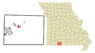
Fair Play is a city in western Polk County, Missouri, United States. The population was 475 at the 2010 census. It is part of the Springfield, Missouri Metropolitan Statistical Area.

<span class="mw-page-title-main">Clarence, Missouri</span> City in Missouri, United States

Clarence is a city in western Shelby County, Missouri, United States. The population was 738 at the 2020 census.

<span class="mw-page-title-main">Leadwood, Missouri</span> City in Missouri, United States

Leadwood is a city in St. Francois County, Missouri, United States. The population was 1,282 at the 2010 census.

<span class="mw-page-title-main">Pine Lawn, Missouri</span> City in Missouri, United States

Pine Lawn is a city in St. Louis County, Missouri, United States. The population was 3,275 at the 2010 census.

<span class="mw-page-title-main">Grant City, Missouri</span> City in Missouri, United States

Grant City is a city in, and the county seat of, Worth County, Missouri, United States. The population was 817 at the 2020 census.

<span class="mw-page-title-main">Braymer, Missouri</span> City in Missouri, United States

Braymer is a city in southeast Caldwell County, Missouri. The population was 737 at the 2020 census.

<span class="mw-page-title-main">Cowgill, Missouri</span> City in Missouri, United States

Cowgill is a city in southern Caldwell County, Missouri, and is part of the Kansas City metropolitan area with the United States. The population was 168 at the 2020 census.

<span class="mw-page-title-main">Bourbon, Missouri</span> City in Missouri, United States

Bourbon is a city in Crawford County, Missouri, United States. At the time of the 2010 census, it had a population of 1,632.

<span class="mw-page-title-main">Forsyth, Missouri</span> City in Missouri, United States

Forsyth is a city in Taney County, Missouri, United States. The population was 2,730 at the 2020 census. It is the county seat of Taney County. The town is part of the Branson, Missouri Micropolitan Statistical Area. Forsyth is located on Lake Taneycomo on U.S. Route 160.

References

  1. "ArcGIS REST Services Directory". United States Census Bureau. Retrieved August 28, 2022.
  2. 1 2 U.S. Geological Survey Geographic Names Information System: Kingston, Missouri
  3. 1 2 "U.S. Census website". United States Census Bureau . Retrieved January 31, 2008.
  4. "Explore Census Data". data.census.gov. Retrieved December 27, 2021.
  5. "Find a County". National Association of Counties. Archived from the original on May 31, 2011. Retrieved June 7, 2011.
  6. Eaton, David Wolfe (1916). How Missouri Counties, Towns and Streams Were Named. The State Historical Society of Missouri. pp.  265–266.
  7. "Disappearing Missouri Names". The Kansas City Star. March 19, 1911. p. 15. Retrieved August 15, 2014 via Newspapers.com. Open Access logo PLoS transparent.svg
  8. "Post Offices". Jim Forte Postal History. Retrieved September 7, 2016.
  9. "National Register Information System". National Register of Historic Places . National Park Service. July 9, 2010.
  10. "US Gazetteer files 2010". United States Census Bureau. Archived from the original on January 25, 2012. Retrieved July 8, 2012.
  11. "Census of Population and Housing". Census.gov. Retrieved June 4, 2015.
  12. "U.S. Census website". United States Census Bureau . Retrieved July 8, 2012.
  13. "Kingston 42 School District". Greatschools. Retrieved March 18, 2018.
  14. "County Library". Caldwell County Commission. Retrieved March 18, 2018.