Braymer, Missouri

Last updated

Braymer, Missouri
Nickname: 
Biggest Little Town in Missouri
Caldwell County Missouri Incorporated and Unincorporated areas Braymer Highlighted.svg
Location of Braymer, Missouri
Coordinates: 39°35′26″N93°47′46″W / 39.59056°N 93.79611°W / 39.59056; -93.79611
Country United States
State Missouri
County Caldwell
Area
[1]
  Total0.59 sq mi (1.53 km2)
  Land0.59 sq mi (1.53 km2)
  Water0.00 sq mi (0.00 km2)
Elevation
[2]
774 ft (236 m)
Population
 (2020)
  Total737
  Density1,247.04/sq mi (481.38/km2)
Time zone UTC-6 (Central (CST))
  Summer (DST) UTC-5 (CDT)
ZIP code
64624
Area code 660
FIPS code 29-08038 [3]
GNIS feature ID2393402 [2]

Braymer is a city in southeast Caldwell County, Missouri. [2] The population was 737 at the 2020 census. [4]

Contents

History

Braymer was laid out in 1887, and named for Judge Daniel Braymer, a local banker. [5] A post office has been in operation at Braymer since 1887. [6]

Geography

The community is at the intersection of Missouri routes 116, A and N. Cowgill is approximately seven miles to the west-southwest and Ludlow in adjacent Livingston County is 6.5 miles to the northeast. Mud Creek flows past the east side of the location. [7]

According to the United States Census Bureau, the city has a total area of 0.59 square miles (1.53 km2), all land. [8]

Demographics

Historical population
CensusPop.Note
1890 399
1900 76792.2%
1910 1,02733.9%
1920 1,018−0.9%
1930 933−8.3%
1940 9754.5%
1950 955−2.1%
1960 874−8.5%
1970 9195.1%
1980 9867.3%
1990 886−10.1%
2000 9102.7%
2010 878−3.5%
2020 737−16.1%
U.S. Decennial Census [9]

2010 census

As of the census [10] of 2010, there were 878 people, 368 households, and 234 families residing in the city. The population density was 1,488.1 inhabitants per square mile (574.6/km2). There were 429 housing units at an average density of 727.1 per square mile (280.7/km2). The racial makeup of the city was 98.1% White, 0.1% Native American, 0.1% Asian, and 1.7% from two or more races. Hispanic or Latino of any race were 0.2% of the population.

There were 368 households, of which 35.1% had children under the age of 18 living with them, 45.4% were married couples living together, 13.6% had a female householder with no husband present, 4.6% had a male householder with no wife present, and 36.4% were non-families. 31.5% of all households were made up of individuals, and 17.6% had someone living alone who was 65 years of age or older. The average household size was 2.39 and the average family size was 2.99.

The median age in the city was 36.6 years. 28.2% of residents were under the age of 18; 6.9% were between the ages of 18 and 24; 25.1% were from 25 to 44; 22.2% were from 45 to 64; and 17.8% were 65 years of age or older. The gender makeup of the city was 48.4% male and 51.6% female.

2000 census

As of the census [3] of 2000, there were 910 people, 392 households, and 248 families residing in the city. The population density was 1,617.1 inhabitants per square mile (624.4/km2). There were 451 housing units at an average density of 801.4 per square mile (309.4/km2). The racial makeup of the city was 98.57% White, 0.22% Native American, 0.33% Asian, and 0.88% from two or more races. Hispanic or Latino of any race were 0.33% of the population.

There were 392 households, out of which 32.1% had children under the age of 18 living with them, 46.7% were married couples living together, 12.5% had a female householder with no husband present, and 36.7% were non-families. 32.1% of all households were made up of individuals, and 17.9% had someone living alone who was 65 years of age or older. The average household size was 2.32 and the average family size was 2.93.

In the city the population was spread out, with 28.2% under the age of 18, 8.1% from 18 to 24, 23.7% from 25 to 44, 22.0% from 45 to 64, and 17.9% who were 65 years of age or older. The median age was 37 years. For every 100 females, there were 86.9 males. For every 100 females age 18 and over, there were 85.0 males.

The median income for a household in the city was $26,667, and the median income for a family was $35,391. Males had a median income of $28,304 versus $20,000 for females. The per capita income for the city was $14,518. About 7.8% of families and 12.4% of the population were below the poverty line, including 14.9% of those under age 18 and 8.8% of those age 65 or over.

Notable people

Related Research Articles

<span class="mw-page-title-main">Belton, Missouri</span> City in Missouri, United States

Belton is a city in northwestern Cass County, Missouri, United States. The population was 23,953 at the 2020 census.

<span class="mw-page-title-main">Smithville, Missouri</span> City in Missouri, United States

Smithville is a city in Clay and Platte counties in the U.S. state of Missouri and is part of the Kansas City metropolitan area, along the Little Platte River. The population was 10,406 at the 2020 United States Census.

<span class="mw-page-title-main">Pattonsburg, Missouri</span> City in Missouri, United States

Pattonsburg is a city in northwest Daviess County, Missouri, United States. The population was 314 at the 2020 census.

<span class="mw-page-title-main">Craig, Missouri</span> City in Missouri, United States

Craig is a city in Holt County, Missouri, United States. The population was 105 at the 2020 census.

<span class="mw-page-title-main">Linneus, Missouri</span> City in Missouri, United States

Linneus is a small city in Linn County, Missouri, United States. The population was 281 at the 2020 census. It is the county seat of Linn County.

<span class="mw-page-title-main">Tallapoosa, Missouri</span> City in Missouri, United States

Tallapoosa is a city in New Madrid County, Missouri, United States. The population was 78 at the 2020 census.

<span class="mw-page-title-main">Green Ridge, Missouri</span> City in Missouri, United States

Green Ridge is a city located along Route 127 in Pettis County, Missouri, United States. The population was 476 at the 2010 census.

<span class="mw-page-title-main">Tracy, Missouri</span> City in Missouri, United States

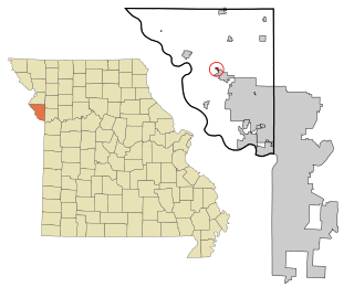
Tracy is a city in Platte County, Missouri within the United States, located along the Platte River. The population was 269 at the 2020 census. The city is part of the Kansas City metropolitan area.

<span class="mw-page-title-main">Nelson, Missouri</span> City in Missouri, United States

Nelson is a city in Saline County, Missouri, United States. The population was 152 at the 2020 census.

<span class="mw-page-title-main">Bella Villa, Missouri</span> City in Missouri, United States

Bella Villa is a city in St. Louis County, Missouri, in the United States. As of the 2010 census, the city population was 729.

<span class="mw-page-title-main">Hazelwood, Missouri</span> City in Missouri, United States

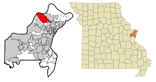
Hazelwood is a city in St. Louis County, Missouri, within Greater St. Louis. It is a second-ring northern suburb of St. Louis. Based on the 2020 United States census, the city had a total population of 25,485. It is located north of St. Louis-Lambert International Airport and is situated on Interstates 270 and 170, as well as the much-traveled Lindbergh Boulevard and Highway 370.

<span class="mw-page-title-main">Jennings, Missouri</span> City in Missouri, United States

Jennings is a city in St. Louis County, Missouri, United States. Per the 2020 census, the population was 12,895.

<span class="mw-page-title-main">Lakeshire, Missouri</span> City in Missouri, United States

Lakeshire is a city in St. Louis County, Missouri, United States. The population was 1,432 at the 2010 census.

<span class="mw-page-title-main">Manchester, Missouri</span> City in Missouri, United States

Manchester is a city in St. Louis County, Missouri, United States. The population was 18,333 at the 2020 census.

<span class="mw-page-title-main">Pasadena Hills, Missouri</span> City in Missouri, United States

Pasadena Hills is a city in St. Louis County, Missouri, United States. The population was 930 at the 2010 census. The entire city is listed on the National Register of Historic Places.

<span class="mw-page-title-main">Velda City, Missouri</span> City in Missouri, United States

Velda City is a city in St. Louis County, Missouri, United States. The population was 1,420 at the 2010 census.

<span class="mw-page-title-main">Wildwood, Missouri</span> City in Missouri, United States

Wildwood is a city in St. Louis County, Missouri, United States. It is located in the far western portion of the county. As of the 2020 census, the population was 35,417. Wildwood is the home of the Al Foster Trail, and numerous other trails, parks, and reserves such as Rockwoods Reservation and Babler State Park.

<span class="mw-page-title-main">Cowgill, Missouri</span> City in Missouri, United States

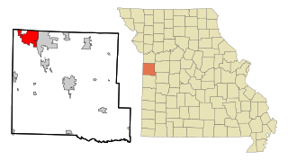
Cowgill is a city in southern Caldwell County, Missouri, and is part of the Kansas City metropolitan area with the United States. The population was 168 at the 2020 census.

<span class="mw-page-title-main">Clarkson Valley, Missouri</span> City in Missouri, United States

Clarkson Valley is a city in St. Louis County, Missouri, United States. The population was 2,609 at the 2020 census.

<span class="mw-page-title-main">Moline Acres, Missouri</span> City in Missouri, United States

Moline Acres is a city in St. Louis County, Missouri, United States. The population was 2,442 at the 2010 census.

References

  1. "ArcGIS REST Services Directory". United States Census Bureau. Retrieved August 28, 2022.
  2. 1 2 3 U.S. Geological Survey Geographic Names Information System: Braymer, Missouri
  3. 1 2 "U.S. Census website". United States Census Bureau . Retrieved January 31, 2008.
  4. "Explore Census Data". data.census.gov. Retrieved December 27, 2021.
  5. Eaton, David Wolfe (1916). How Missouri Counties, Towns and Streams Were Named. The State Historical Society of Missouri. pp.  266.
  6. "Post Offices". Jim Forte Postal History. Archived from the original on March 6, 2016. Retrieved September 7, 2016.
  7. Missouri Atlas & Gazetteer, DeLorme, 1st ed., 1998, p. 28 ISBN   0899332242
  8. "US Gazetteer files 2010". United States Census Bureau. Archived from the original on January 25, 2012. Retrieved July 8, 2012.
  9. "Census of Population and Housing". Census.gov. Retrieved June 4, 2015.
  10. "U.S. Census website". United States Census Bureau . Retrieved July 8, 2012.