Montgomery City, Missouri

Last updated

Montgomery City, Missouri
Montgomery County Missouri Incorporated and Unincorporated areas Montgomery City Highlighted.svg
Location in Montgomery County and the state of Missouri
Coordinates: 38°58′25″N91°30′09″W / 38.97361°N 91.50250°W / 38.97361; -91.50250
Country United States
State Missouri
County Montgomery
Founded1853
Incorporated1857
Government
  MayorMike Spirz
  City AdministratorSteven Deves
Area
[1]
  Total3.40 sq mi (8.82 km2)
  Land3.38 sq mi (8.74 km2)
  Water0.03 sq mi (0.07 km2)
Elevation
[2]
837 ft (255 m)
Population
 (2020) [3]
  Total2,811
  Density832.89/sq mi (321.54/km2)
Time zone UTC-6 (Central (CST))
  Summer (DST) UTC-5 (CDT)
ZIP code
63361
Area code 573
FIPS code 29-49574 [4]
GNIS feature ID2395382 [2]
Website www.montgomerycitymo.org

Montgomery City is a city in and the county seat of Montgomery County, Missouri, United States. [5] The population was 2,811 at the 2020 census. [6]

Contents

History

Montgomery was platted in 1853, taking its name from Montgomery County. [7] A post office called Montgomery City has been in operation since 1857. [8]

The Sylvester Marion and Frances Anne Stephens Baker House was listed on the National Register of Historic Places in 1999. [9]

Geography

Montgomery City is in central Montgomery County. Two state highways pass through the city center: Missouri Route 19 follows Sturgeon Street, leading northwest 8 miles (13 km) to Wellsville and southeast 5 miles (8 km) to New Florence, while Missouri Route 161 follows West 2nd Street and East 3rd Street, leading north-northeast 14 miles (23 km) to Middletown and southwest 5 miles (8 km) to Danville.

According to the U.S. Census Bureau, Montgomery City has a total area of 3.40 square miles (8.81 km2), of which 3.38 square miles (8.75 km2) are land and 0.03 square miles (0.08 km2), or 0.85%, are water. [1] The city is oriented along a slight ridge which drains northeast toward Elkhorn Creek, part of the Cuivre River watershed flowing east to the Mississippi; and drains southwest to Clear Fork, part of the Loutre River watershed leading to the Missouri River.

Demographics

Historical population
CensusPop.Note
1880 1,165
1890 2,19988.8%
1900 2,026−7.9%
1910 1,789−11.7%
1920 1,688−5.6%
1930 1,510−10.5%
1940 1,67110.7%
1950 1,6790.5%
1960 1,91814.2%
1970 2,18714.0%
1980 2,101−3.9%
1990 2,2818.6%
2000 2,4427.1%
2010 2,83416.1%
2020 2,811−0.8%
U.S. Decennial Census [10]

2010 census

As of the census [11] of 2010, there were 2,834 people, 1,141 households, and 711 families living in the city. The population density was 894.0 inhabitants per square mile (345.2/km2). There were 1,279 housing units at an average density of 403.5 per square mile (155.8/km2). The racial makeup of the city was 92.6% White, 3.6% African American, 0.2% Native American, 0.1% Asian, 1.9% from other races, and 1.5% from two or more races. Hispanic or Latino of any race were 2.6% of the population.

There were 1,141 households, of which 33.1% had children under the age of 18 living with them, 44.8% were married couples living together, 12.8% had a female householder with no husband present, 4.7% had a male householder with no wife present, and 37.7% were non-families. 32.5% of all households were made up of individuals, and 13.6% had someone living alone who was 65 years of age or older. The average household size was 2.36 and the average family size was 2.97.

The median age in the city was 35.3 years. 26.6% of residents were under the age of 18; 8.2% were between the ages of 18 and 24; 26.4% were from 25 to 44; 24.7% were from 45 to 64; and 14.3% were 65 years of age or older. The gender makeup of the city was 48.7% male and 51.3% female.

2000 census

As of the census [4] of 2000, there were 2,442 people, 1,032 households, and 666 families living in the city. The population density was 858.6 inhabitants per square mile (331.5/km2). There were 1,162 housing units at an average density of 408.5 per square mile (157.7/km2). The racial makeup of the city was 94.19% White, 3.81% African American, 0.25% Native American, 0.16% Asian, 0.25% from other races, and 1.35% from two or more races. Hispanic or Latino of any race were 0.33% of the population.

There were 1,032 households, out of which 30.7% had children under the age of 18 living with them, 49.7% were married couples living together, 11.7% had a female householder with no husband present, and 35.4% were non-families. 31.3% of all households were made up of individuals, and 15.4% had someone living alone who was 65 years of age or older. The average household size was 2.29 and the average family size was 2.88.

In the city, the population was spread out, with 24.2% under the age of 18, 9.2% from 18 to 24, 27.4% from 25 to 44, 22.4% from 45 to 64, and 16.7% who were 65 years of age or older. The median age was 37 years. For every 100 females, there were 91.8 males. For every 100 females age 18 and over, there were 85.7 males.

The median income for a household in the city was $30,446, and the median income for a family was $38,063. Males had a median income of $28,906 versus $17,857 for females. The per capita income for the city was $15,735. About 10.9% of families and 14.0% of the population were below the poverty line, including 18.7% of those under age 18 and 12.8% of those age 65 or over.

Education

Public education in Montgomery City is administered by Montgomery County R-II School District. [12]

Montgomery City has a lending library, the Montgomery City Public Library. [13]

Notable people

Related Research Articles

<span class="mw-page-title-main">Brooks, Kentucky</span> Census-designated place in Kentucky, United States

Brooks is a census-designated place (CDP) in Bullitt County, Kentucky, United States. The population was 2,469 as of the 2020 census, stagnant from 2,401 in the 2010 census. Brooks was struck by a tornado in 1996.

<span class="mw-page-title-main">Rocheport, Missouri</span> City in Missouri, United States

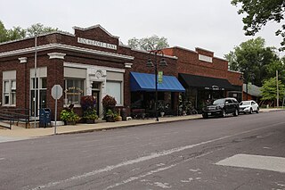
Rocheport is a city in Boone County, Missouri, United States. It is part of the Columbia, Missouri Metropolitan Statistical Area. The population was 239 at the 2010 census. Rocheport includes the Rocheport Historic District, an area with buildings dating from 1830 and which is listed on the National Register of Historic Places.

<span class="mw-page-title-main">Bogard, Missouri</span> City in Missouri, United States

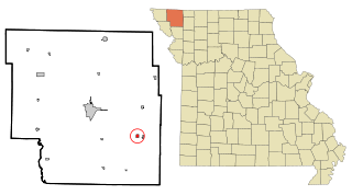
Bogard is a city in Carroll County, Missouri, United States. The population was 167 at the 2020 census.

<span class="mw-page-title-main">Alexandria, Missouri</span> City in Missouri, United States

Alexandria is a city in eastern Clark County, Missouri, United States. As of the 2020 census, its population was 105.

<span class="mw-page-title-main">Kahoka, Missouri</span> City in Missouri, United States

Kahoka is a city in and the county seat of Clark County, in the northeast tip of Missouri, United States. As of the 2020 census, its population was 1,961.

<span class="mw-page-title-main">Gray Summit, Missouri</span> Census-designated place in Missouri, United States

Gray Summit is an unincorporated community and census-designated place (CDP) in Franklin County, Missouri, United States. The population was 2,701 at the 2010 census. Also called "Gray's Summit", it was founded by Daniel Gray of New York, who built a hotel here in 1845. It is located on Missouri Route 100 just north of Interstate 44.

<span class="mw-page-title-main">Urich, Missouri</span> City in Missouri, United States

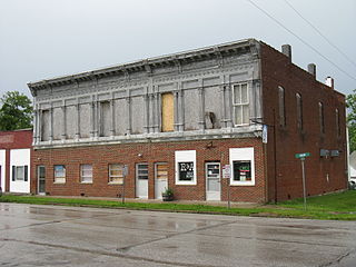
Urich is a city in Henry County, Missouri, United States. The population was 505 at the 2010 census.

<span class="mw-page-title-main">Oronogo, Missouri</span> City in Missouri, United States

Oronogo is a city in Jasper County, Missouri, United States. The population was 2,558 at the 2020 census. It is part of the Joplin, Missouri Metropolitan Statistical Area.

<span class="mw-page-title-main">Bellflower, Missouri</span> City in Missouri, United States

Bellflower is a city in Montgomery County, Missouri, United States. The population was 325 at the 2020 census, down from 393 in 2010.

<span class="mw-page-title-main">High Hill, Missouri</span> City in Missouri, United States

High Hill is a city in Montgomery County, Missouri, United States. The population was 186 at the 2020 census.

<span class="mw-page-title-main">Jonesburg, Missouri</span> City in Missouri, US

Jonesburg is a city in Montgomery County, Missouri, United States. The population was 726 at the 2020 census.

<span class="mw-page-title-main">McKittrick, Missouri</span> City in Missouri, United States

McKittrick is a city in Montgomery County, Missouri, United States. The population was 77 at the 2020 census.

<span class="mw-page-title-main">Middletown, Missouri</span> City in Missouri, United States

Middletown is a city in Montgomery County, Missouri, United States. The population was 171 at the 2020 census.

<span class="mw-page-title-main">New Florence, Missouri</span> City in Missouri, United States

New Florence is a city in Montgomery County, Missouri, United States. The population was 641 at the 2020 census, down from 769 in 2010.

<span class="mw-page-title-main">Wellsville, Missouri</span> City in Missouri, United States

Wellsville is a city in Montgomery County, Missouri, United States. The population was 998 at the 2020 census.

<span class="mw-page-title-main">Conception Junction, Missouri</span> City in Missouri, United States

Conception Junction is a city in Nodaway County, Missouri, United States, near the Platte River. The population was 177 at the 2020 census.

<span class="mw-page-title-main">Shelbyville, Missouri</span> City in Missouri, United States

Shelbyville is a city in Shelby County, Missouri, United States. The population was 518 at the 2020 census. It is the county seat of Shelby County.

<span class="mw-page-title-main">Manchester, Missouri</span> City in Missouri, United States

Manchester is a city in St. Louis County, Missouri, United States. The population was 18,333 at the 2020 census.

<span class="mw-page-title-main">Moline Acres, Missouri</span> City in Missouri, United States

Moline Acres is a city in St. Louis County, Missouri, United States. The population was 2,442 at the 2010 census.

<span class="mw-page-title-main">Montgomery, West Virginia</span> City in West Virginia

Montgomery is a city in West Virginia, United States, along the Kanawha River. Most of the city is in Fayette County, with the remainder in Kanawha County. The population was 1,280 at the 2020 census.

References

  1. 1 2 "2023 U.S. Gazetteer Files: Missouri". United States Census Bureau. Retrieved May 7, 2024.
  2. 1 2 U.S. Geological Survey Geographic Names Information System: Montgomery City, Missouri
  3. "P1. Race – Montgomery City city, Missouri: 2020 DEC Redistricting Data (PL 94-171)". U.S. Census Bureau. Retrieved May 7, 2024.
  4. 1 2 "U.S. Census website". United States Census Bureau . Retrieved January 31, 2008.
  5. "Find a County". National Association of Counties. Retrieved June 7, 2011.
  6. "Explore Census Data". data.census.gov. Retrieved January 11, 2022.
  7. "Montgomery County Place Names, 1928–1945". The State Historical Society of Missouri. Archived from the original on June 24, 2016. Retrieved November 11, 2016.
  8. "Post Offices". Jim Forte Postal History. Retrieved November 11, 2016.
  9. "National Register Information System". National Register of Historic Places . National Park Service. July 9, 2010.
  10. "Census of Population and Housing". Census.gov. Retrieved June 4, 2015.
  11. "U.S. Census website". United States Census Bureau . Retrieved July 8, 2012.
  12. "Homepage". Montgomery County R-Ii School District. Retrieved June 4, 2019.
  13. "Missouri Public Libraries". PublicLibraries.com. Archived from the original on June 10, 2017. Retrieved June 2, 2019.