High Hill, Missouri

Last updated

High Hill, Missouri
High Hill School (High Hill, MO) 2.JPG
High Hill School
Montgomery County Missouri Incorporated and Unincorporated areas High Hill Highlighted.svg
Location in Montgomery County and the state of Missouri
Coordinates: 38°52′31″N91°22′34″W / 38.87528°N 91.37611°W / 38.87528; -91.37611
Country United States
State Missouri
County Montgomery
Area
[1]
  Total0.46 sq mi (1.19 km2)
  Land0.46 sq mi (1.19 km2)
  Water0.00 sq mi (0.00 km2)
Elevation
[2]
896 ft (273 m)
Population
 (2020) [3]
  Total186
  Density404.35/sq mi (156.27/km2)
Time zone UTC-6 (Central (CST))
  Summer (DST) UTC-5 (CDT)
ZIP code
63350
Area code 636
FIPS code 29-31996 [4]
GNIS feature ID2394374 [2]

High Hill is a city in Montgomery County, Missouri, United States. The population was 186 at the 2020 census. [5]

Contents

History

A post office called High Hill has been in operation since 1837. [6] The community was so named on account of its lofty elevation. [7]

Farmers Mercantile Co. Building and High Hill School are listed on the National Register of Historic Places. [8]

Geography

High Hill is in eastern Montgomery County, adjacent to Interstate 70. The city is accessible from the expressway via Highway F. I-70 leads west 4 miles (6 km) to New Florence and east 5 miles (8 km) to Jonesburg. St. Louis is 75 miles (121 km) to the east, and Columbia is 55 miles (89 km) to the west. The Norfolk Southern Railway passes through the city, leading east to St. Louis and northwest to Moberly and thence to Kansas City. [9]

According to the U.S. Census Bureau, High Hill has a total area of 0.46 square miles (1.19 km2), all land. [1] The ridge on which the city sits drains north toward Bear Creek, a tributary of the West Fork of the Cuivre River, which continues east to the Mississippi; and south to a different Bear Creek, a tributary of the Loutre River, which continues south to the Missouri River.

Demographics

Historical population
CensusPop.Note
1880 223
1920 253
1930 244−3.6%
1940 188−23.0%
1950 22419.1%
1960 173−22.8%
1970 19211.0%
1980 25432.3%
1990 204−19.7%
2000 23113.2%
2010 195−15.6%
2020 186−4.6%
U.S. Decennial Census [10]

2010 census

As of the census [11] of 2010, there were 195 people, 85 households, and 51 families living in the city. The population density was 423.9 inhabitants per square mile (163.7/km2). There were 102 housing units at an average density of 221.7 per square mile (85.6/km2). The racial makeup of the city was 95.9% White, 1.0% Native American, 2.1% Asian, 0.5% from other races, and 0.5% from two or more races. Hispanic or Latino of any race were 1.0% of the population.

There were 85 households, of which 28.2% had children under the age of 18 living with them, 48.2% were married couples living together, 8.2% had a female householder with no husband present, 3.5% had a male householder with no wife present, and 40.0% were non-families. 36.5% of all households were made up of individuals, and 18.8% had someone living alone who was 65 years of age or older. The average household size was 2.29 and the average family size was 2.98.

The median age in the city was 43.9 years. 20.5% of residents were under the age of 18; 5.2% were between the ages of 18 and 24; 25.1% were from 25 to 44; 27.7% were from 45 to 64; and 21.5% were 65 years of age or older. The gender makeup of the city was 51.3% male and 48.7% female.

2000 census

As of the census [4] of 2000, there were 231 people, 102 households, and 62 families living in the city. The population density was 502.2 inhabitants per square mile (193.9/km2). There were 120 housing units at an average density of 260.9 per square mile (100.7/km2). The racial makeup of the city was 96.10% White, 0.43% Native American, 1.30% Asian, and 2.16% from two or more races.

There were 102 households, out of which 27.5% had children under the age of 18 living with them, 49.0% were married couples living together, 6.9% had a female householder with no husband present, and 39.2% were non-families. 35.3% of all households were made up of individuals, and 21.6% had someone living alone who was 65 years of age or older. The average household size was 2.26 and the average family size was 2.98.

In the city, the population was spread out, with 22.9% under the age of 18, 10.4% from 18 to 24, 18.2% from 25 to 44, 29.9% from 45 to 64, and 18.6% who were 65 years of age or older. The median age was 44 years. For every 100 females, there were 97.4 males. For every 100 females age 18 and over, there were 95.6 males.

The median income for a household in the city was $31,429, and the median income for a family was $36,250. Males had a median income of $32,500 versus $17,188 for females. The per capita income for the city was $18,155. About 4.7% of families and 10.7% of the population were below the poverty line, including 2.6% of those under the age of eighteen and 22.2% of those sixty-five or over.

Related Research Articles

<span class="mw-page-title-main">Rich Hill, Missouri</span> City in Missouri, United States

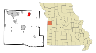
Rich Hill is a city in southern Bates County, Missouri, and is part of the Kansas City metropolitan area within the United States. The population was 1,232 at the 2020 census.

<span class="mw-page-title-main">Pleasant Hill, Missouri</span> City in Missouri, United States

Pleasant Hill is a city in Cass and Jackson counties, Missouri, United States. The population was 8,113 at the 2010 census. It is part of the Kansas City metropolitan area.

<span class="mw-page-title-main">Fremont Hills, Missouri</span> City in Missouri, United States

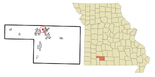
Fremont Hills is a city in Christian County, Missouri, United States. The population was 1,049 at the 2020 census. It is part of the Springfield, Missouri Metropolitan Statistical Area.

<span class="mw-page-title-main">Smithville, Missouri</span> City in Missouri, United States

Smithville is a city in Clay and Platte counties in the U.S. state of Missouri and is part of the Kansas City metropolitan area, along the Little Platte River. The population was 10,406 at the 2020 United States Census.

<span class="mw-page-title-main">Grain Valley, Missouri</span> City in Missouri, United States

Grain Valley is a city in Jackson County, Missouri, United States. Grain Valley is located in the Kansas City Metropolitan Area and is a suburb of Kansas City. The population was 12,854 at the 2010 census and an estimated 15,627 in 2020. It is 23 miles (37 km) east of downtown Kansas City.

<span class="mw-page-title-main">Parkville, Missouri</span> City in Missouri, United States

Parkville is a city in Platte County, Missouri, United States and is a part of the Kansas City Metropolitan Area. The population was 7,177 at the 2020 census, According to 2022 census estimates, the city is estimated to have a population of 8,541. Parkville is known for its antique shops, art galleries, and historic downtown. The city is home to Park University, English Landing Park, Platte Landing Park, and the National Golf Club of Kansas City. Large neighborhoods in Parkville include: Riss Lake, The National, Thousand Oaks, Creekside, Parkville Heights, River Hills, Riverchase, The Bluffs, Downtown, and Pinecrest.

<span class="mw-page-title-main">Clifton Hill, Missouri</span> City in Missouri, United States

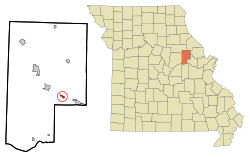
Clifton Hill is a city in Randolph County, Missouri, United States. The population was 114 at the 2010 census.

<span class="mw-page-title-main">Morley, Missouri</span> City in Missouri, United States

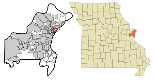
Morley is a city in Scott County, Missouri, United States. The population was 697 at the 2010 census.

<span class="mw-page-title-main">Flint Hill, Missouri</span> City in Missouri, United States

Flint Hill is a town in northwestern St. Charles County, Missouri, United States. The population was 525 at the 2010 census.

<span class="mw-page-title-main">Park Hills, Missouri</span> City in Missouri, United States

Park Hills is a city in St. Francois County, Missouri, United States. The population was 8,587 at the 2020 census.

<span class="mw-page-title-main">Beverly Hills, Missouri</span> City in Missouri, United States

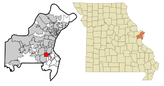
Beverly Hills is a city in St. Louis County, Missouri, United States. As of the 2010 census, the city population was 574.

<span class="mw-page-title-main">Breckenridge Hills, Missouri</span> City in Missouri, United States

Breckenridge Hills is a city in St. Louis County, Missouri, United States. As of the 2010 census, the city population was 4,746.

<span class="mw-page-title-main">Country Club Hills, Missouri</span> City in Missouri, United States

Country Club Hills is a city in St. Louis County, Missouri, United States. The population was 1,274 at the 2010 census.

<span class="mw-page-title-main">Crestwood, Missouri</span> City in the United States

Crestwood is a city in south St. Louis County, Missouri, United States, part of the Metropolitan Statistical Area known as Greater St. Louis. The population was 11,912 at the 2010 census.

<span class="mw-page-title-main">Flordell Hills, Missouri</span> City in Missouri, United States

Flordell Hills is a city in St. Louis County, Missouri, United States. The population was 822 at the 2010 census.

<span class="mw-page-title-main">Manchester, Missouri</span> City in Missouri, United States

Manchester is a city in St. Louis County, Missouri, United States. The population was 18,333 at the 2020 census.

<span class="mw-page-title-main">Pasadena Hills, Missouri</span> City in Missouri, United States

Pasadena Hills is a city in St. Louis County, Missouri, United States. The population was 930 at the 2010 census. The entire city is listed on the National Register of Historic Places.

<span class="mw-page-title-main">Sappington, Missouri</span> CDP in Missouri, United States

Sappington is an unincorporated census-designated place in St. Louis County, Missouri, United States. The population was 7,995 at the 2020 census.

<span class="mw-page-title-main">Velda Village Hills, Missouri</span> City in Missouri, United States

Velda Village Hills is a city in northeastern St. Louis County, Missouri, United States. The population was 1,055 at the 2010 census.

<span class="mw-page-title-main">Sunset Hills, Missouri</span> City in Missouri, United States

Sunset Hills is a city in south St. Louis County, Missouri, United States. As of the 2020 United States Census, the city's population was 9,198.

References

  1. 1 2 "2023 U.S. Gazetteer Files: Missouri". United States Census Bureau. Retrieved May 3, 2024.
  2. 1 2 U.S. Geological Survey Geographic Names Information System: High Hill, Missouri
  3. "P1. Race – High Hill city, Missouri: 2020 DEC Redistricting Data (PL 94-171)". U.S. Census Bureau. Retrieved May 3, 2024.
  4. 1 2 "U.S. Census website". United States Census Bureau . Retrieved January 31, 2008.
  5. "Explore Census Data". data.census.gov. Retrieved January 11, 2022.
  6. "Post Offices". Jim Forte Postal History. Retrieved November 11, 2016.
  7. "Montgomery County Place Names, 1928–1945". The State Historical Society of Missouri. Archived from the original on June 24, 2016. Retrieved November 11, 2016.
  8. "National Register Information System". National Register of Historic Places . National Park Service. July 9, 2010.
  9. "Our Rail Network: Download See Rail Network Map". Norfolk Southern. March 2016. Retrieved May 3, 2024.
  10. "Census of Population and Housing". Census.gov. Retrieved June 4, 2015.
  11. "U.S. Census website". United States Census Bureau . Retrieved July 8, 2012.