Jonesburg, Missouri

Last updated

Jonesburg, Missouri
Jonesburg MO.png
Jonesburg in May 2024
Montgomery County Missouri Incorporated and Unincorporated areas Jonesburg Highlighted.svg
Location in Montgomery County and the state of Missouri
Coordinates: 38°51′17″N91°18′10″W / 38.85472°N 91.30278°W / 38.85472; -91.30278
Country United States
State Missouri
County Montgomery
Area
[1]
  Total1.72 sq mi (3.98 km2)
  Land1.72 sq mi (3.98 km2)
  Water0.00 sq mi (0.00 km2)
Elevation
[2]
889 ft (271 m)
Population
 (2020) [3]
  Total726
  Density472.96/sq mi (182.59/km2)
Time zone UTC-6 (Central (CST))
  Summer (DST) UTC-5 (CDT)
ZIP code
63351
Area code 636
FIPS code 29-37574 [4]
GNIS feature ID2395481 [2]
Website www.cityofjonesburg.com

Jonesburg is a city in Montgomery County, Missouri, United States. The population was 726 at the 2020 census. [5]

Contents

History

Jonesburg was platted in 1858 and named in honor of James Jones, a pioneer citizen. [6] A post office called "Jonesburgh" was established in 1868, and the name was changed to Jonesburg in 1893. [7]

Geography

Jonesburg is in eastern Montgomery County, with a portion of its southern border following the Warren County line. Interstate 70/U.S. Route 40 passes through the north side of the city, with access from Exit 183 (North 1st Street). I-70 leads east 66 miles (106 km) to St. Louis and west 58 miles (93 km) to Columbia.

According to the U.S. Census Bureau, Jonesburg has a total area of 1.72 square miles (4.45 km2), all land. [1] The city lies on a wide ridge which drains north toward Little Bear Creek, part of the Cuivre River watershed flowing directly to the Mississippi; and drains south toward Bear Creek, part of the Loutre River watershed leading to the Missouri River.

Demographics

Historical population
CensusPop.Note
1880 445
1890 437−1.8%
1900 407−6.9%
1910 45612.0%
1920 4733.7%
1930 432−8.7%
1940 422−2.3%
1950 4332.6%
1960 415−4.2%
1970 47915.4%
1980 61428.2%
1990 6302.6%
2000 69510.3%
2010 76810.5%
2020 726−5.5%
U.S. Decennial Census [8]

2010 census

As of the census [9] of 2010, there were 768 people, 281 households, and 175 families living in the city. The population density was 656.4 inhabitants per square mile (253.4/km2). There were 325 housing units at an average density of 277.8 per square mile (107.3/km2). The racial makeup of the city was 94.3% White, 0.8% African American, 0.3% Native American, 0.1% Asian, 1.2% from other races, and 3.4% from two or more races. Hispanic or Latino of any race were 2.2% of the population.

There were 281 households, of which 31.7% had children under the age of 18 living with them, 43.8% were married couples living together, 12.1% had a female householder with no husband present, 6.4% had a male householder with no wife present, and 37.7% were non-families. 32.0% of all households were made up of individuals, and 17.1% had someone living alone who was 65 years of age or older. The average household size was 2.42 and the average family size was 3.02.

The median age in the city was 41.3 years. 24.1% of residents were under the age of 18; 6.5% were between the ages of 18 and 24; 22.8% were from 25 to 44; 21.3% were from 45 to 64; and 25.3% were 65 years of age or older. The gender makeup of the city was 45.1% male and 54.9% female.

2000 census

As of the census [4] of 2000, there were 695 people, 269 households, and 161 families living in the city. The population density was 553.3 inhabitants per square mile (213.6/km2). There were 296 housing units at an average density of 235.7 per square mile (91.0/km2). The racial makeup of the city was 96.69% White, 1.44% African American, 0.14% Native American, and 1.73% from two or more races. Hispanic or Latino of any race were 0.58% of the population.

There were 269 households, out of which 27.9% had children under the age of 18 living with them, 42.0% were married couples living together, 11.5% had a female householder with no husband present, and 40.1% were non-families. 34.9% of all households were made up of individuals, and 21.2% had someone living alone who was 65 years of age or older. The average household size was 2.40 and the average family size was 3.03.

In the city the population was spread out, with 23.9% under the age of 18, 9.6% from 18 to 24, 26.3% from 25 to 44, 17.4% from 45 to 64, and 22.7% who were 65 years of age or older. The median age was 38 years. For every 100 females there were 85.3 males. For every 100 females age 18 and over, there were 84.3 males.

The median income for a household in the city was $26,875, and the median income for a family was $31,786. Males had a median income of $25,446 versus $20,000 for females. The per capita income for the city was $13,230. About 14.7% of families and 16.8% of the population were below the poverty line, including 18.9% of those under age 18 and 23.6% of those age 65 or over.

Related Research Articles

<span class="mw-page-title-main">Belton, Missouri</span> City in Missouri, United States

Belton is a city in northwestern Cass County, Missouri, United States. The population was 23,953 at the 2020 census.

<span class="mw-page-title-main">Urbana, Missouri</span> City in Missouri, United States

Urbana is a city in Dallas County, Missouri, United States. The population was 414 at the 2010 census. It is part of the Springfield, Missouri Metropolitan Statistical Area.

<span class="mw-page-title-main">Linneus, Missouri</span> City in Missouri, United States

Linneus is a small city in Linn County, Missouri, United States. The population was 281 at the 2020 census. It is the county seat of Linn County.

<span class="mw-page-title-main">Marston, Missouri</span> City in Missouri, United States

Marston is a city in New Madrid County, Missouri, United States. The population was 503 at the 2010 census.

<span class="mw-page-title-main">Conception Junction, Missouri</span> City in Missouri, United States

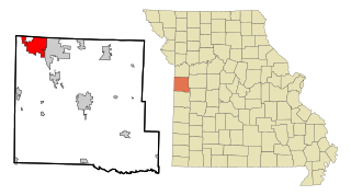
Conception Junction is a city in Nodaway County, Missouri, United States, near the Platte River. The population was 177 at the 2020 census.

<span class="mw-page-title-main">Green Ridge, Missouri</span> City in Missouri, United States

Green Ridge is a city located along Route 127 in Pettis County, Missouri, United States. The population was 476 at the 2010 census.

<span class="mw-page-title-main">Pleasant Hope, Missouri</span> City in Missouri, United States

Pleasant Hope is a city in Polk County, Missouri, United States. The population was 614 at the 2010 census. It is part of the Springfield, Missouri Metropolitan Statistical Area.

<span class="mw-page-title-main">Nelson, Missouri</span> City in Missouri, United States

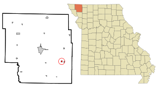
Nelson is a city in Saline County, Missouri, United States. The population was 152 at the 2020 census.

<span class="mw-page-title-main">Leadwood, Missouri</span> City in Missouri, United States

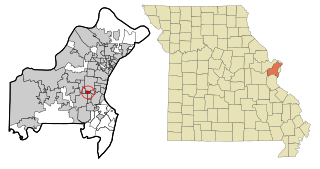
Leadwood is a city in St. Francois County, Missouri, United States. The population was 1,282 at the 2010 census.

<span class="mw-page-title-main">Bella Villa, Missouri</span> City in Missouri, United States

Bella Villa is a city in St. Louis County, Missouri, in the United States. As of the 2010 census, the city population was 729.

<span class="mw-page-title-main">Country Club Hills, Missouri</span> City in Missouri, United States

Country Club Hills is a city in St. Louis County, Missouri, United States. The population was 1,274 at the 2010 census.

<span class="mw-page-title-main">Flordell Hills, Missouri</span> City in Missouri, United States

Flordell Hills is a city in St. Louis County, Missouri, United States. The population was 822 at the 2010 census.

<span class="mw-page-title-main">Jennings, Missouri</span> City in Missouri, United States

Jennings is a city in St. Louis County, Missouri, United States. Per the 2020 census, the population was 12,895.

<span class="mw-page-title-main">Lakeshire, Missouri</span> City in Missouri, United States

Lakeshire is a city in St. Louis County, Missouri, United States. The population was 1,432 at the 2010 census.

<span class="mw-page-title-main">Manchester, Missouri</span> City in Missouri, United States

Manchester is a city in St. Louis County, Missouri, United States. The population was 18,333 at the 2020 census.

<span class="mw-page-title-main">Pasadena Hills, Missouri</span> City in Missouri, United States

Pasadena Hills is a city in St. Louis County, Missouri, United States. The population was 930 at the 2010 census. The entire city is listed on the National Register of Historic Places.

<span class="mw-page-title-main">Wildwood, Missouri</span> City in Missouri, United States

Wildwood is a city in St. Louis County, Missouri, United States. It is located in the far western portion of the county. As of the 2020 census, the population was 35,417. Wildwood is the home of the Al Foster Trail, and numerous other trails, parks, and reserves such as Rockwoods Reservation and Babler State Park.

<span class="mw-page-title-main">Winchester, Missouri</span> City in Missouri, United States

Winchester is a city in St. Louis County, Missouri, United States. The population was 1,447 at the 2020 census.

<span class="mw-page-title-main">Moline Acres, Missouri</span> City in Missouri, United States

Moline Acres is a city in St. Louis County, Missouri, United States. The population was 2,442 at the 2010 census.

<span class="mw-page-title-main">Warson Woods, Missouri</span> City in Missouri, United States

Warson Woods is a city in St. Louis County, Missouri, United States. The population was 1,962 at the 2010 census.

References

  1. 1 2 "2023 U.S. Gazetteer Files: Missouri". United States Census Bureau. Retrieved May 6, 2024.
  2. 1 2 U.S. Geological Survey Geographic Names Information System: Jonesburg, Missouri
  3. "P1. Race – Jonesburg city, Missouri: 2020 DEC Redistricting Data (PL 94-171)". U.S. Census Bureau. Retrieved May 6, 2024.
  4. 1 2 "U.S. Census website". United States Census Bureau . Retrieved January 31, 2008.
  5. "Explore Census Data". data.census.gov. Retrieved January 11, 2022.
  6. "Montgomery County Place Names, 1928–1945". The State Historical Society of Missouri. Archived from the original on June 24, 2016. Retrieved November 11, 2016.
  7. "Post Offices". Jim Forte Postal History. Retrieved November 11, 2016.
  8. "Census of Population and Housing". Census.gov. Retrieved June 4, 2015.
  9. "U.S. Census website". United States Census Bureau . Retrieved July 8, 2012.