
Jadwin is an unincorporated community in southern Dent County, Missouri, United States. It is located at the intersection of Missouri routes K and BB approximately eleven miles south of Salem and six miles east of Montauk State Park.

Lake Spring is an unincorporated community in northwest Dent County, Missouri, United States. It is located approximately twelve miles southeast of Rolla on Route 72.
Lecoma is an unincorporated community in northwestern Dent County, Missouri, United States. It is located approximately twelve miles south of Rolla.
Doss is a small unincorporated community in Dent County, Missouri, United States. It is located approximately five miles south of Salem.

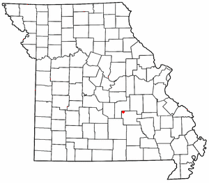
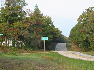
Gladden is an unincorporated community in Dent County, Missouri, United States. It is located approximately ten miles south of Salem on Route 19.

Hartshorn is an unincorporated community in eastern Texas County, Missouri, United States. The community is located on Missouri Route KK, approximately six miles north of Summersville and fifteen miles east of Houston.

Morse Mill is an unincorporated community in western Jefferson County, Missouri, United States. It is located approximately five miles northwest of Hillsboro along Missouri Route B. The community and mill were located along Big River.
Anutt is an unincorporated community in western Dent County, in the U.S. state of Missouri.
Coulstone is an unincorporated community in western Dent County, in the U.S. state of Missouri.
Howes is an unincorporated community in Dent County, in the U.S. state of Missouri. The community is on Missouri Route 19 approximately 4.5 miles north of Salem.
Howes Mill is an unincorporated community in eastern Dent County, in the U.S. state of Missouri.
Joy is an unincorporated community in southwest Dent County, in the U.S. state of Missouri.
Rhyse is an unincorporated community in Dent County, in the U.S. state of Missouri.
Short Bend is an unincorporated community in Dent County, in the U.S. state of Missouri.
Stone Hill is an unincorporated community in eastern Dent County, Missouri.
Turtle is an extinct town in Dent County, in the U.S. state of Missouri. The GNIS classifies it as a populated place.
Cedargrove is an extinct town in the northwest corner of Shannon County, in the Ozarks of southern Missouri. The GNIS classifies it as a populated place. The community is located just south of the Shannon - Dent county line on the Current River, just north of the Big Creek confluence with the Current. It lies at the end of Missouri Route B, two miles east of the Shannon - Texas county line.
Ashley Creek is an unincorporated community in northeastern Texas County, in the U.S. state of Missouri. The community is located along South Ashley Creek, approximately 1.5 miles south of its confluence with North Ashley Creek to form Ashley Creek. The community is on a sharp meander of the stream and Ashley Creek church and cemetery are about one mile downstream. Montauk State Park on Pigeon Creek is about three miles to the north in Dent County.
Big Creek is an unincorporated community in Texas County, in the U.S. state of Missouri. The community was located along Big Creek, approximately 2.5 miles south of Yukon and one-half mile east of Missouri Route 137. The Big Creek school was south of the creek and the Big Creek church was about one-half mile north along a county road.
Samoa is an unincorporated community in Texas County, in the U.S. state of Missouri.

