Mill Spring, Missouri

Last updated

Mill Spring, Missouri
Wayne County Missouri Incorporated and Unincorporated areas Mill Spring Highlighted.svg
Location of Mill Spring, Missouri
Coordinates: 37°03′54″N90°40′40″W / 37.06500°N 90.67778°W / 37.06500; -90.67778 [1]
Country United States
State Missouri
County Wayne
Area
[2]
  Total0.44 sq mi (1.14 km2)
  Land0.44 sq mi (1.14 km2)
  Water0.00 sq mi (0.00 km2)
Elevation
[1]
466 ft (142 m)
Population
 (2020)
  Total159
  Density361.36/sq mi (139.52/km2)
Time zone UTC-6 (Central (CST))
  Summer (DST) UTC-5 (CDT)
ZIP code
63952
Area code 573
FIPS code 29-48386 [3]
GNIS feature ID2399349 [1]

Mill Spring is a village in Wayne County, Missouri, United States, along the Black River. The population was 159 at the 2020 census. [4]

Contents

History

Mill Spring was laid out in 1871. [5] The community took its name from a nearby spring of the same name which once powered lumber mills. [6] A post office called Mill Spring has been in operation since 1874. [7] Millspring post office was shut down in 2014

Geography

Mill Spring is located in a tributary valley on the northeast edge of the Black River floodplain. The community of Leeper is approximately one mile to the northwest along Missouri Route 49. [8]

According to the United States Census Bureau, the village has a total area of 0.44 square miles (1.14 km2), all land. [9]

Demographics

Historical population
CensusPop.Note
1880 174
1960 226
1970 207−8.4%
1980 25724.2%
1990 252−1.9%
2000 219−13.1%
2010 189−13.7%
2020 159−15.9%
U.S. Decennial Census [10]

2010 census

At the 2010 census, [11] there were 189 people, 81 households and 46 families living in the village. The population density was 429.5 per square mile (165.8/km2). There were 106 housing units at an average density of 240.9 per square mile (93.0/km2). The racial makeup was 96.8% White, 1.1% African American, 0.5% from other races, and 1.6% from two or more races. Hispanic or Latino of any race were 0.5% of the population.

There were 81 households, of which 25.9% had children under the age of 18 living with them, 38.3% were married couples living together, 13.6% had a female householder with no husband present, 4.9% had a male householder with no wife present, and 43.2% were non-families. 30.9% of all households were made up of individuals, and 13.6% had someone living alone who was 65 years of age or older. The average household size was 2.33 and the average family size was 3.02.

The median age was 37.8 years. 21.7% of residents were under the age of 18; 9.9% were between the ages of 18 and 24; 26% were from 25 to 44; 27% were from 45 to 64; and 15.3% were 65 years of age or older. The gender makeup was 51.9% male and 48.1% female.

2000 census

At the 2000 census, [3] there were 219 people, 81 households and 55 families living in the village. The population density was 1,041.8 inhabitants per square mile (402.2/km2). There were 104 housing units at an average density of 494.7 per square mile (191.0/km2). The racial makeup was 96.35% White, 0.46% Native American, 0.91% Pacific Islander and 2.28% from two or more races.

There were 81 households, of which 30.9% had children under the age of 18 living with them, 45.7% were married couples living together, 13.6% had a female householder with no husband present, and 30.9% were non-families. 24.7% of all households were made up of individuals, and 16.0% had someone living alone who was 65 years of age or older. The average household size was 2.70 and the average family size was 3.13.

28.8% of the population were under the age of 18, 8.7% from 18 to 24, 24.2% from 25 to 44, 17.8% from 45 to 64, and 20.5% who were 65 years of age or older. The median age was 37 years. For every 100 females, there were 104.7 males. For every 100 females age 18 and over, there were 97.5 males.

The median household income was $22,750 and the median family income was $26,389. Males had a median income of $18,125 and females $14,063. The per capita income was $9,723. About 13.5% of families and 22.7% of the population were below the poverty line, including 25.0% of those under the age of eighteen and 20.0% of those 65 or over.

Notable person

Related Research Articles

<span class="mw-page-title-main">Spring Lake, Michigan</span> Village in Michigan, United States

Spring Lake is a village in Ottawa County in the U.S. state of Michigan. The population was 2,497 at the 2020 census. The village is located within Spring Lake Township; the two share a ZIP code.

<span class="mw-page-title-main">Jerico Springs, Missouri</span> Village in Missouri, United States

Jerico Springs is a village in Cedar County, Missouri, United States. The population was 160 at the 2020 census.

<span class="mw-page-title-main">Smithville, Missouri</span> City in Missouri, United States

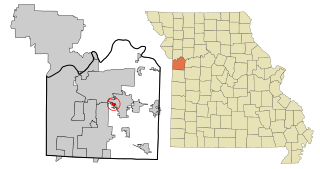
Smithville is a city in Clay and Platte counties in the U.S. state of Missouri and is part of the Kansas City metropolitan area, along the Little Platte River. The population was 10,406 at the 2020 United States Census.

<span class="mw-page-title-main">Washington, Missouri</span> City in the United States

Washington is a city on the south banks of the Missouri River, 50 miles west of St. Louis, Missouri, and the largest in Franklin County, Missouri, United States. The estimated population in July 2022 was 15,075, which is an increase of 3.97% since the 2020 U.S. census. It is notable for being the "corncob pipe capital of the world," with Missouri Meerschaum located on the riverfront.

<span class="mw-page-title-main">Willow Springs, Missouri</span> City in Missouri, United States

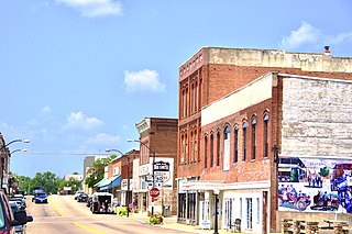
Willow Springs is a city in Howell County, Missouri, in the Ozark Mountains of the United States. The population was 2,164 at the 2020 census.

<span class="mw-page-title-main">Lake Tapawingo, Missouri</span> City in Missouri, United States

Lake Tapawingo is a city in Jackson County, Missouri, United States. The population was 730 at the 2010 census.

<span class="mw-page-title-main">Alba, Missouri</span> City in Missouri, United States

Alba is a city in Jasper County, Missouri, United States. The population was 544 at the 2020 census.

<span class="mw-page-title-main">Purcell, Missouri</span> City in Missouri, United States

Purcell is a city in Jasper County, Missouri, United States. As of the 2020 census, the city population was 318.

<span class="mw-page-title-main">Byrnes Mill, Missouri</span> City in Missouri, United States

Byrnes Mill is a city in northern Jefferson County, Missouri, United States. The population was 3,173 at the 2020 census.

<span class="mw-page-title-main">Anniston, Missouri</span> City in Missouri, United States

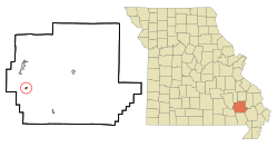
Anniston is a city in Mississippi County, Missouri, United States. The population was 180 at the 2020 census, down from 232 in 2010.

<span class="mw-page-title-main">Gravois Mills, Missouri</span> Town in Missouri, United States

Gravois Mills is a town in Morgan County, Missouri, United States. The population was 129 at the 2020 census.

<span class="mw-page-title-main">Laurie, Missouri</span> City in Missouri, US

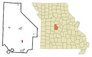
Laurie is a city in southern Morgan and northern Camden counties, Missouri, United States. The population was 939 at the 2020 census.

<span class="mw-page-title-main">Crystal Lakes, Missouri</span> City in Missouri, United States

Crystal Lakes is a city in western Ray County, Missouri, and part of the Kansas City metropolitan area within the United States. The population was 390 at the 2020 census.

<span class="mw-page-title-main">Leonard, Missouri</span> Village in Missouri, United States

Leonard is a village in northwestern Shelby County, Missouri, United States. The population was 57 at the 2020 census.

<span class="mw-page-title-main">Hazelwood, Missouri</span> City in Missouri, United States

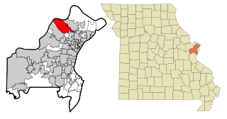
Hazelwood is a city in St. Louis County, Missouri, within Greater St. Louis. It is a second-ring northern suburb of St. Louis. Based on the 2020 United States census, the city had a total population of 25,485. It is located north of St. Louis-Lambert International Airport and is situated on Interstates 270 and 170, as well as the much-traveled Lindbergh Boulevard and Highway 370.

<span class="mw-page-title-main">Hurley, Missouri</span> City in Missouri, United States

Hurley is a city in Stone County, Missouri, United States. The population was 176 at the 2020 census. It is part of the Branson, Missouri Micropolitan Statistical Area.

<span class="mw-page-title-main">Greencastle, Missouri</span> City in Missouri, United States

Greencastle is a city in eastern Sullivan County, Missouri, United States. The population was 224 at the 2020 census.

<span class="mw-page-title-main">Lock Springs, Missouri</span> Village in Missouri, United States

Lock Springs is a village in southeast Daviess County, Missouri, United States. The population was 40 at the 2020 census.

<span class="mw-page-title-main">Moscow Mills, Missouri</span> Town in Missouri, US

Moscow Mills is a city in Lincoln County, Missouri, United States. The population was 2,509 at the 2010 census.

<span class="mw-page-title-main">Redings Mill, Missouri</span> Village in Missouri, United States

Redings Mill is a village in Newton County, Missouri, United States. The population was 151 at the 2010 census. It is part of the Joplin, Missouri Metropolitan Statistical Area.

References

  1. 1 2 3 U.S. Geological Survey Geographic Names Information System: Mill Spring, Missouri
  2. "ArcGIS REST Services Directory". United States Census Bureau. Retrieved August 28, 2022.
  3. 1 2 "U.S. Census website". United States Census Bureau . Retrieved January 31, 2008.
  4. "Explore Census Data". data.census.gov. Retrieved January 10, 2022.
  5. Eaton, David Wolfe (1918). How Missouri Counties, Towns and Streams Were Named. The State Historical Society of Missouri. p. 371.
  6. History of Southeast Missouri: A Narrative Account of Its Historical Progress, Its People and Its Principal Interests, Volume 1. Lewis Publishing Company. 1912. p. 393.
  7. "Post Offices". Jim Forte Postal History. Retrieved January 1, 2017.
  8. Mill Spring, Missouri, 7.5 Minute Topographic Quadrangle, USGS, 1968 (1985 rev.)
  9. "US Gazetteer files 2010". United States Census Bureau. Archived from the original on July 2, 2012. Retrieved July 8, 2012.
  10. "Census of Population and Housing". Census.gov. Retrieved June 4, 2015.
  11. "U.S. Census website". United States Census Bureau . Retrieved July 8, 2012.