Perry County, Illinois

Last updated

Perry County
Perry County Courthouse in Pinckneyville.jpg
Perry County Courthouse in Pinckneyville
Map of Illinois highlighting Perry County.svg
Location within the U.S. state of Illinois
Illinois in United States.svg
Illinois's location within the U.S.
Coordinates: 38°05′N89°22′W / 38.09°N 89.37°W / 38.09; -89.37
CountryFlag of the United States.svg United States
StateFlag of Illinois.svg  Illinois
Founded29 January 1827
Named for Oliver Hazard Perry
Seat Pinckneyville
Largest city Du Quoin
Area
  Total447 sq mi (1,160 km2)
  Land442 sq mi (1,140 km2)
  Water5.2 sq mi (13 km2)  1.2%
Population
 (2020)
  Total20,945
  Density47/sq mi (18/km2)
Time zone UTC−6 (Central)
  Summer (DST) UTC−5 (CDT)
Congressional district 12th
Website perryil.com

Perry County is in Illinois. According to the 2020 census, it had a population of 20,945. [1] Its county seat is Pinckneyville. [2] It is located in the southern portion of Illinois known as "Little Egypt".

Contents

History

Perry County was formed in 1827 out of Jackson and Randolph counties. It was named in honor of Oliver Hazard Perry who defeated the British fleet at the decisive Battle of Lake Erie in the War of 1812.

In its early history, Perry County was mainly an inland pioneer outpost. Early settlers, including some Revolutionary War veterans bearing land grants, moved here from the Eastern United States. These were primarily Protestant settlers. Growth boomed in the 1850s for two reasons: construction of the Illinois Central Railroad through the eastern portion of the county, and the discovery of large coal reserves. Immigrants from Ireland, Poland, Germany, Italy and elsewhere steadily increased the county's population from 1850 through the 1920s. African Americans also were established in the county during northward migration following the Civil War.

Mining continued to be the dominant employment sector through the 1990s.

Geography

According to the U.S. Census Bureau, the county has a total area of 447 square miles (1,160 km2), of which 442 square miles (1,140 km2) is land and 5.2 square miles (13 km2) (1.2%) is water. [3]

Perry County is located in Southern Illinois. Pinckneyville, at the center of the county, is approximately 70 miles (110 km) southeast of St. Louis, Missouri and 300 miles (480 km) southwest of Chicago. The Mississippi River lies about 10 miles (16 km) west and southwest of the County at its closest point.

The county's topography is mainly flat with some rolling hills. The part of the county's eastern border, the part shared with Franklin County, is formed by the Little Muddy River. Beaucoup Creek runs north to south through the county and lies just east of Pinckneyville.

The county's topography also features many "strip cut" lakes, lakes left behind following above-ground coal mining. Lakes at two of the county's chief recreation areas, the Du Quoin State Fairgrounds and Pyramid State Recreation Area, were formed this way.

Climate and weather

Pinckneyville, Illinois
Climate chart (explanation)
J
F
M
A
M
J
J
A
S
O
N
D
 
 
2.8
 
 
40
22
 
 
2.6
 
 
46
26
 
 
4.3
 
 
57
36
 
 
4.3
 
 
68
45
 
 
4.8
 
 
77
55
 
 
4.2
 
 
86
64
 
 
3.5
 
 
90
68
 
 
3.3
 
 
88
65
 
 
3.3
 
 
81
57
 
 
3.2
 
 
71
45
 
 
4.4
 
 
56
36
 
 
3.5
 
 
44
26
Average max. and min. temperatures in °F
Precipitation totals in inches
Source: The Weather Channel [4]
Metric conversion
J
F
M
A
M
J
J
A
S
O
N
D
 
 
70
 
 
4
−6
 
 
66
 
 
8
−3
 
 
109
 
 
14
2
 
 
108
 
 
20
7
 
 
122
 
 
25
13
 
 
107
 
 
30
18
 
 
90
 
 
32
20
 
 
85
 
 
31
18
 
 
83
 
 
27
14
 
 
81
 
 
22
7
 
 
113
 
 
13
2
 
 
88
 
 
7
−3
Average max. and min. temperatures in °C
Precipitation totals in mm

In recent years, average temperatures in the county seat of Pinckneyville have ranged from a low of 22 °F (−6 °C) in January to a high of 90 °F (32 °C) in July, although a record low of −22 °F (−30 °C) was recorded in January 1912 and a record high of 113 °F (45 °C) was recorded in July 1934. Average monthly precipitation ranged from 2.61 inches (66 mm) in February to 4.81 inches (122 mm) in May. [4]

Public transit

Major highways

Adjacent counties

Demographics

Historical population
CensusPop.Note
1830 1,215
1840 3,222165.2%
1850 5,27863.8%
1860 9,55281.0%
1870 13,72343.7%
1880 16,00716.6%
1890 17,5299.5%
1900 19,83013.1%
1910 22,08811.4%
1920 22,9013.7%
1930 22,767−0.6%
1940 23,4382.9%
1950 21,684−7.5%
1960 19,184−11.5%
1970 19,7573.0%
1980 21,7149.9%
1990 21,412−1.4%
2000 23,0947.9%
2010 22,350−3.2%
2020 20,945−6.3%
2023 (est.)20,503 [5] −2.1%
U.S. Decennial Census [6]
1790-1960 [7] 1900-1990 [8]
1990-2000 [9] 2010 [10]

As of the 2010 United States Census, there were 22,350 people, 8,335 households, and 5,622 families residing in the county. [11] The population density was 50.6 inhabitants per square mile (19.5/km2). There were 9,426 housing units at an average density of 21.3 per square mile (8.2/km2). [3] The racial makeup of the county was 87.9% white, 8.3% black or African American, 0.4% Asian, 0.2% American Indian, 1.6% from other races, and 1.4% from two or more races. Those of Hispanic or Latino origin made up 2.7% of the population. [11] In terms of ancestry, 32.8% were German, 14.3% were Irish, 10.6% were English, 8.1% were American, and 6.3% were Polish. [12]

Of the 8,335 households, 30.4% had children under the age of 18 living with them, 51.5% were married couples living together, 11.3% had a female householder with no husband present, 32.5% were non-families, and 28.6% of all households were made up of individuals. The average household size was 2.38 and the average family size was 2.90. The median age was 39.4 years. [11]

The median income for a household in the county was $40,696 and the median income for a family was $50,130. Males had a median income of $40,768 versus $28,377 for females. The per capita income for the county was $17,926. About 11.5% of families and 14.0% of the population were below the poverty line, including 22.6% of those under age 18 and 6.9% of those age 65 or over. [13]

Communities

Perry County never adopted a township form of government. Federal township plats were prepared for each township which include legal descriptions of 14 townships. [14]

Perry County has been divided into precincts: Beaucoup, Cutler, Denmark, DuQuoin, Paradise, Pinckneyville, Sunfield, Swanwick, Tamaroa and Willisville. [15] To provide election precincts of similar population based on recent census data, precincts are divided or combined to form election precincts. The election precincts in 2020 were: Beaucoup, Cutler, Du Quoin Number 1, Du Quoin Number 2, Du Quoin Number 3, Du Quoin Number 4, Du Quoin Number 5, Du Quoin Number 6, Du Quoin Number 7, Du Quoin Number 8, Du Quoin Number 9, Du Quoin Number 10, Du Quoin Number 11, Du Quoin Number 12, Pinckneyville Number 1, Pinckneyville Number 2, Pinckneyville Number 3, Pinckneyville Number 4, Pinckneyville Number 5, Pinckneyville Number 6, Pinckneyville Number 7, Pinckneyville Number 8, Sunfield, Swanwick, Tamaroa Number 1, Tamaroa Number 2, and Willisville. [16]

Cities

Villages

Unincorporated communities

Politics

Perry County has been reliably Republican county since 2012, when it backed Mitt Romney (R) by nearly 18 points over Illinois native Barack Obama, even as Obama won both Illinois and the country. By 2020 it was so heavily Republican that incumbent Donald Trump beat Democrat Joe Biden by nearly 45 points in his bid for reelection, even as Biden won the race nationally (and Illinois). The county last voted blue, by a very narrow margin of 0.6%, in 2000. The table below includes a list of Perry County's election results at the presidential level.

United States presidential election results for Perry County, Illinois [17]
Year Republican Democratic Third party
No.%No.%No.%
2020 7,31372.61%2,61225.94%1461.45%
2016 6,85569.42%2,46224.93%5575.64%
2012 5,50757.67%3,81939.99%2232.34%
2008 5,08650.89%4,70147.03%2082.08%
2004 5,58953.61%4,77045.76%660.63%
2000 4,80248.30%4,86248.90%2782.80%
1996 3,23732.63%5,34753.90%1,33713.48%
1992 3,10528.01%6,00954.20%1,97217.79%
1988 4,57646.78%5,16752.83%380.39%
1984 5,85255.88%4,58443.77%360.34%
1980 5,88855.49%4,33740.88%3853.63%
1976 5,28646.39%5,97652.44%1331.17%
1972 6,96862.98%4,08436.91%120.11%
1968 5,38449.02%4,44940.51%1,15010.47%
1964 4,28739.24%6,63960.76%00.00%
1960 6,70857.47%4,95842.48%60.05%
1956 6,51357.06%4,90142.94%00.00%
1952 6,58055.19%5,34044.79%30.03%
1948 5,10949.96%5,04349.32%740.72%
1944 6,23656.97%4,67742.73%330.30%
1940 7,24352.35%6,53947.26%550.40%
1936 5,48242.94%7,04355.16%2431.90%
1932 3,77832.85%7,40064.34%3242.82%
1928 4,63647.47%5,02951.49%1011.03%
1924 3,69339.76%3,00732.37%2,58927.87%
1920 4,59858.47%2,47831.51%78810.02%
1916 4,79649.70%4,44546.07%4084.23%
1912 89418.89%2,10744.53%1,73136.58%
1908 2,39246.27%2,48248.01%2965.73%
1904 2,45152.65%1,46631.49%73815.85%
1900 2,33648.25%2,32147.94%1843.80%
1896 2,34248.57%2,37049.15%1102.28%
1892 1,84044.14%1,98047.49%3498.37%

See also

Related Research Articles

<span class="mw-page-title-main">Eaton County, Michigan</span> County in Michigan, United States

Eaton County is a county in the U.S. state of Michigan. As of the 2020 United States Census, the population was 109,175. The county seat is Charlotte. The county was organized in 1837 and was named for John Eaton, who was Secretary of War under U.S. President Andrew Jackson, making it one of Michigan's Cabinet counties. Eaton County is included in the Lansing-East Lansing, Metropolitan Statistical area in Central Michigan.

<span class="mw-page-title-main">Washington County, Illinois</span> County in Illinois, United States

Washington County is a county located in the U.S. state of Illinois. As of the 2020 census, it had a population of 13,761. Its county seat is Nashville. It is located in the southern portion of Illinois known locally as "Little Egypt".

<span class="mw-page-title-main">Randolph County, Illinois</span> County in Illinois, United States

Randolph County is a county located in the U.S. state of Illinois. According to the 2020 census, it had a population of 30,163. Its county seat is Chester.

<span class="mw-page-title-main">Pike County, Illinois</span> County in Illinois, United States

Pike County is a county in the U.S. state of Illinois. It is located between the Mississippi River and the Illinois River in western Illinois. According to the 2020 United States Census, it had a population of 14,739. Its county seat is Pittsfield.

<span class="mw-page-title-main">Monroe County, Illinois</span> County in Illinois, United States

Monroe County is a county located in the U.S. state of Illinois. According to the 2020 census, it had a population of 34,962. Its county seat and largest city is Waterloo.

<span class="mw-page-title-main">Edwards County, Illinois</span> County in Illinois, United States

Edwards County is a county located in the U.S. state of Illinois. As of the 2020 census, the population was 6,245. Its county seat is Albion.

<span class="mw-page-title-main">Wamac, Illinois</span> City in Illinois, United States

Wamac is a city in Washington, Marion, and Clinton counties in the U.S. state of Illinois. The population was 985 at the 2020 census, down from 1,185 in 2010. Incorporated as a city on July 25, 1916, Wamac derives its name from the three counties.

<span class="mw-page-title-main">Dowell, Illinois</span> Village in Illinois, United States

Dowell is a village in Jackson County, Illinois, United States. The population was estimated to be 385 at the 2020 census, down from 408 at the 2010 census.

<span class="mw-page-title-main">Du Quoin, Illinois</span> City in Illinois, United States

Du Quoin is a city in Perry County, Illinois. It is best known for hosting the annual DuQuoin State Fair and the Street Machine Nationals. The population is estimated at 5,761 in the 2020 census.

<span class="mw-page-title-main">Pinckneyville, Illinois</span> City in Illinois, United States

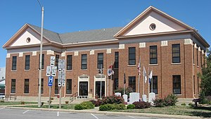
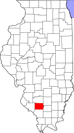
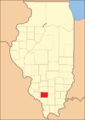
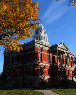
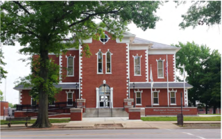
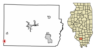
Pinckneyville is a city in and the county seat of Perry County, Illinois, United States. The population was 5,066 at the 2020 census. It is named for Charles Cotesworth Pinckney, an early American diplomat and presidential candidate.

<span class="mw-page-title-main">Tamaroa, Illinois</span> Village in Illinois, United States

Tamaroa is a village in the Tamaroa Precinct of Perry County, Illinois, United States. The population was 638 at the 2010 census.

<span class="mw-page-title-main">Willisville, Illinois</span> Village in Illinois, United States

Willisville is a village in Perry County, Illinois, United States. The population was 633 at the 2010 census.

Lusk's Ferry Road was an early road in Illinois that provided an overland connection between the main settlement, Fort Kaskaskia, on the Mississippi River, and Lusk's Ferry, an important crossing point on the Ohio River. The overland route afforded an alternative to the river route, which required a difficult trip upstream on the Mississippi.

<span class="mw-page-title-main">Du Quoin State Fairgrounds</span> United States historic place

The Du Quoin State Fairgrounds are located in the city of Du Quoin in Perry County, Illinois, United States. The fairgrounds are located along U.S. Route 51 north of Illinois Route 14. The facilities include the DuQuoin State Fairgrounds Racetrack, an oval track that has hosted AAA, USAC and ARCA races since 1948. The fairgrounds are also home to a horse racing track which hosted the Hambletonian Stakes from 1957 to 1980 and the World Trotting Derby from 1981 to 2009.

<span class="mw-page-title-main">Barrington Township, Cook County, Illinois</span> Township in Illinois, United States

Barrington Township is one of 29 townships in Cook County, Illinois, USA. As of the 2020 census, its population was 16,514 and it contained 6,172 housing units. The northwestern corner of the Cook County panhandle, it is the county's northwesternmost township. It is also by far the least densely populated township in the county, with less than half the population density of the next least Lemont Township.

<span class="mw-page-title-main">Metro Lakeland</span> Area of Southern Illinois, United States

Metro Lakeland is a name that was coined in the 1960s for an area of southern Illinois that is centered on the intersections of Interstate 57, Interstate 24, and Illinois Route 13 — a four-lane east-west highway connecting the communities of Murphysboro, Carbondale, Carterville, Herrin, Marion, and Harrisburg. Metro Lakeland was defined as Jackson, Williamson, Franklin, Saline, and Perry counties, with a combined population of approximately 210,000. Carbondale, Herrin, and Marion are the key urban areas, with a combined city-proper population of over 65,000 Carbondale, the site of Southern Illinois University, is the region's largest city. Metro Lakeland is about 88 miles (142 km) southeast of St. Louis, Missouri, or 120 miles (190 km) by Interstate highway.

<span class="mw-page-title-main">Elk Township, Jackson County, Illinois</span> Township in Illinois, United States

Elk Township is one of sixteen townships in Jackson County, Illinois, USA. As of the 2010 census, its population was 1,907 and it contained 873 housing units.

Sunfield is an unincorporated community in Perry County, Illinois, United States. Sunfield is 3.5 miles (5.6 km) north of Du Quoin. An F5 tornado struck 1 mile north of the village at the US Route 51/State Route 154 intersection on December 18, 1957, killing one person.

Paul Jacobs is a Republican member of the Illinois House from the 115th district since January 13, 2021. The 115th district includes all or parts of Alto Pass, Anna, Ashley, Ava, Belle Rive, Bluford, Bonnie, Campbell Hill, Carbondale, Centralia, Cobden, De Soto, Dix, Dongola, Du Bois, Du Quoin, Elkville, Gorham, Grand Tower, Harrison, Ina, Jonesboro, Makanda, Mill Creek, Mount Vernon, Murphysboro, Nashville, Opdyke, Pinckneyville, Radom, Richview, St. Johns, Tamaroa, Vergennes, Waltonville, and Woodlawn.

References

  1. "Perry County, Illinois". United States Census Bureau . Retrieved June 10, 2023.
  2. "Find a County". National Association of Counties. Retrieved June 7, 2011.
  3. 1 2 "Population, Housing Units, Area, and Density: 2010 - County". United States Census Bureau. Archived from the original on February 13, 2020. Retrieved July 12, 2015.
  4. 1 2 "Monthly Averages for Pinckneyville, Illinois". The Weather Channel. Retrieved January 27, 2011.
  5. "Annual Estimates of the Resident Population for Counties: April 1, 2020 to July 1, 2023". United States Census Bureau. Retrieved April 2, 2024.
  6. "U.S. Decennial Census". United States Census Bureau. Retrieved July 8, 2014.
  7. "Historical Census Browser". University of Virginia Library. Retrieved July 8, 2014.
  8. "Population of Counties by Decennial Census: 1900 to 1990". United States Census Bureau. Retrieved July 8, 2014.
  9. "Census 2000 PHC-T-4. Ranking Tables for Counties: 1990 and 2000" (PDF). United States Census Bureau. Retrieved July 8, 2014.
  10. "State & County QuickFacts". United States Census Bureau. Archived from the original on June 7, 2011. Retrieved July 8, 2014.
  11. 1 2 3 "DP-1 Profile of General Population and Housing Characteristics: 2010 Demographic Profile Data". United States Census Bureau. Archived from the original on February 13, 2020. Retrieved July 12, 2015.
  12. "DP02 SELECTED SOCIAL CHARACTERISTICS IN THE UNITED STATES – 2006-2010 American Community Survey 5-Year Estimates". United States Census Bureau. Archived from the original on February 13, 2020. Retrieved July 12, 2015.
  13. "DP03 SELECTED ECONOMIC CHARACTERISTICS – 2006-2010 American Community Survey 5-Year Estimates". United States Census Bureau. Archived from the original on February 13, 2020. Retrieved July 12, 2015.
  14. T4S_R1W_3PM (1). Perry County Township Plats. U.S. Surveyor General's Records for Illinois: Federal Township Plats. Illinois State Archives. Accessed 25 July 2021.
  15. Perry County, IL History. Accessed Jul 2021.
  16. Illinois Gazeteer: Perry County. Hometown Locator. Accessed July 2021.
  17. Leip, David. "Dave Leip's Atlas of U.S. Presidential Elections". uselectionatlas.org. Retrieved November 11, 2018.

38°05′N89°22′W / 38.09°N 89.37°W / 38.09; -89.37