
Clinton County is located in the U.S. state of Illinois. As of the 2010 United States Census, the population was 37,762. Its county seat is Carlyle.

Winnebago County is a county located in the U.S. state of Illinois. According to the 2020 census, it had a population of 285,350 making it the seventh most populous county in Illinois behind Cook County and its five surrounding collar counties. Its county seat is Rockford. Winnebago County is the central county of the Rockford Metropolitan Statistical Area.
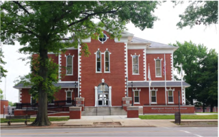
Washington County is a county located in the U.S. state of Illinois. As of the 2010 census, it had a population of 14,716. Its county seat is Nashville. It is located in the southern portion of Illinois known locally as "Little Egypt".

St. Clair County is the oldest county in Illinois; its western border is formed by the Mississippi River, bordering Missouri. It is a part of the Metro East in southern Illinois. According to the 2020 United States Census, it had a population of 257,400, making it the eighth-most populous county in Illinois and the most populous in the southern portion of the state. Its county seat is Belleville. The county was founded in 1790 by the government of the Northwest Territory, from the western half of Knox County, before the establishment of Illinois as a state as the base for the Illinois Territory. Cahokia Village in the county was founded in 1697 and was a French settlement and former Jesuit mission.

Randolph County is a county located in the U.S. state of Illinois. According to the 2020 census, it had a population of 30,163. Its county seat is Chester.

Pulaski County is a county located in the U.S. state of Illinois. According to the 2020 census, it had a population of 5,193. Its county seat is Mound City. It is located along the Ohio River in the southwestern portion of the state, known locally as "Little Egypt".
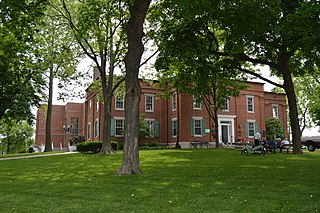
Monroe County is a county located in the U.S. state of Illinois. According to the 2020 census, it had a population of 34,962. Its county seat and largest city is Waterloo.

Madison County is a county in the U.S. state of Illinois. It is a part of the Metro East in southern Illinois. According to the 2020 census, it had a population of 264,776. The county seat is Edwardsville, and the largest city is Granite City.

Lee County is a county located in the U.S. state of Illinois. According to the 2010 census, it has a population of 36,031. Its county seat is Dixon.
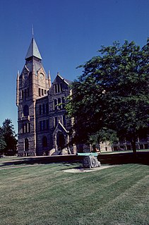
Knox County is a county in the U.S. state of Illinois. According to the 2020 census, it had a population of 49,967. Its county seat is Galesburg.
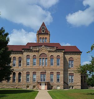
Greene County is a county located in the U.S. state of Illinois. According to the 2020 United States Census, it has a population of 11,843. Its county seat is Carrollton.

Crawford County is a county located in the U.S. state of Illinois. As of the 2010 census, the population was 19,817. Its county seat is Robinson.

Columbia is a city mainly in Monroe County with a small portion in St. Clair County in the U.S. state of Illinois, about 12 miles (19 km) south of St. Louis, Missouri. The population was 10,999 at the 2020 census.

Caseyville is a village in St. Clair County, Illinois, United States. The population was 4,245 at the 2010 census, a decline from 4,310 in 2000.

Lebanon is a city in St. Clair County, Illinois, United States. The population was 4,418 at the 2010 census and had decreased to an estimated 4,256 as of 2018. Like many other places in "Little Egypt" or Southern Illinois, Lebanon was named after the Eastern Mediterranean country of the same name. It is a part of the Metro-East region of the Greater St. Louis metropolitan area.
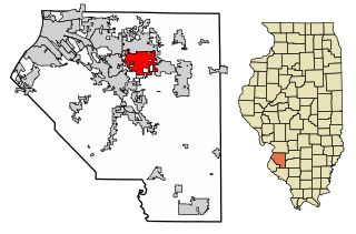
Shiloh is a village in St. Clair County, Illinois, United States. The 2010 census recorded a population of 12,651. Shiloh is located within the St. Louis metropolitan area

St. Clair County is a county located in the central portion of the U.S. state of Alabama. As of the 2020 census, the population was 91,103. It has two county seats: Ashville and Pell City. It is one of two counties in Alabama, and one of 33 in the United States, with more than one county seat. Its name is in honor of General Arthur St. Clair, an officer in the French and Indian War. St. Clair County is included in the Birmingham-Hoover, Alabama Metropolitan Statistical Area.
Floraville is a census-designated place in St. Clair County, Illinois, United States. Its population was 53 as of the 2010 census.
Paderborn is a census-designated place in St. Clair County, Illinois, United States. Its population was 43 as of the 2010 census.

Rentchler is a census-designated place in St. Clair County, Illinois, United States. Its population was 34 as of the 2010 census.


