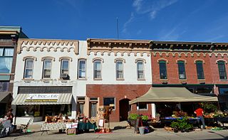
Fulton is a city in Whiteside County, Illinois, United States. The population was 3,481 at the 2010 census, down from 3,881 in 2000. Fulton is located across the Mississippi River from Clinton, Iowa.

Morrison is a city in Whiteside County, Illinois, United States. The population was 4,188 at the 2010 census, down from 4,447 in 2000. It is the county seat of Whiteside County. It is located on the Historic Lincoln Highway, the nation's first transcontinental highway and in Morrison was the site of two concrete "seedling miles", which served as prototypes of what an improved highway could do for the nation.
Elmhurst is an unincorporated community in Langlade County, Wisconsin, United States. It is in the town of Rolling at latitude 45°3'30" North, longitude 89°11'3" West. The community is located near the headwaters of the Middle Branch Embarrass River, approximately 1½ miles west of the junction of WIS 47, WIS 52 and U.S. Highway 45 in the Town of Rolling. A track of the Chicago and North Western Railway runs along the west side of the community. Elmhurst is located at 1,476 feet (450 m) above sea level.

Triumph is an unincorporated community and Census Designated Place located just east of Interstate 39 in LaSalle County, Illinois, United States. Students in Triumph attend nearby Mendota public schools. The village is home to one restaurant and is known for its curling club. The community has many farms surrounding it and contains fewer than 100 people.

Hahnaman Township is located in Whiteside County, Illinois. As of the 2010 census, its population was 399 and it contained 148 housing units.
Langley is an unincorporated community in Bureau County, Illinois, United States. Langley is located at the junction of U.S. Route 6, U.S. Route 34, and Illinois Route 40. Langley is east of Sheffield and north of Buda.
Galt is an unincorporated community in Whiteside County, Illinois, United States. Galt is 3 miles (4.8 km) west of Sterling and has a post office with ZIP code 61037.
Ridgefield is an unincorporated community and census-designated place in McHenry County, Illinois, United States. Ridgefield is 3 miles (4.8 km) northwest of Crystal Lake. It was named a CDP before the 2020 census, at which time it had a population of 210.

Flagg is an unincorporated community in the southeastern portion of Ogle County in Flagg Township, Illinois, United States. It may be found at the crossroads of Grange and Titus Roads.
Rollo is an unincorporated community in DeKalb County, Illinois, United States, located 5 miles (8.0 km) east-southeast of Paw Paw.
Shabbona Grove is an unincorporated community in DeKalb County, Illinois, United States. Shabbona Grove is located on the south edge of Shabbona Lake State Park, 2.5 miles (4.0 km) south-southeast of Shabbona.
Akron is an unincorporated community in Peoria County, in the U.S. state of Illinois.
Almora is an unincorporated community in Kane County, in the U.S. state of Illinois.
Eddy is an unincorporated community in Lake County, in the U.S. state of Illinois. Eddy is located at 42°27′41″N87°53′54″W.
Freeman is an unincorporated community in Kane County, in the U.S. state of Illinois.
Harlem is an unincorporated community in Winnebago County, in the U.S. state of Illinois. It was incorporated into Loves Park in the 1980s. Harlem is the closest city to Rock Cut State Park.
Round Grove is an unincorporated community in Whiteside County, in the U.S. state of Illinois.
Terra Cotta is an unincorporated community in McHenry County, in the U.S. state of Illinois.
Union Grove is an unincorporated community in Whiteside County, in the U.S. state of Illinois.
Womac is an unincorporated community in Macoupin County, in the U.S. state of Illinois.


