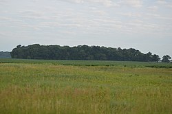
Tampico is a village located in Tampico Township, Whiteside County, Illinois, United States next to Rock Falls and Sterling IL. As of the 2010 census the village had a total population of 790, up from 772 at the 2000 census. It is known as the birthplace of Ronald Reagan, the 40th President of the United States.
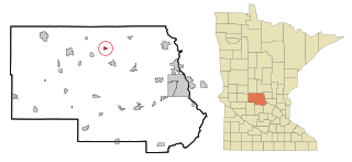
St. Anthony is a city in Stearns County, Minnesota, United States. The population was 86 at the 2010 census. It is part of the St. Cloud Metropolitan Statistical Area. Main routes include Minnesota State Highway 238, Stearns County Road 153, and Trobec Street.

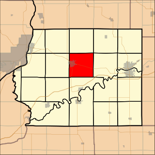
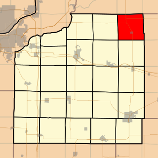
Montmorency Township is located in Whiteside County, Illinois. As of the 2010 census, its population was 2,612 and it contained 1,027 housing units. It is located south of the city of Rock Falls.

Grand Detour Township is located in Ogle County, Illinois. As of the 2010 census, its population was 698 and it contained 385 housing units.
Mount Pleasant Township is located in Whiteside County, Illinois. As of the 2010 census, its population was 4,939 and it contained 2,176 housing units.

Newton Township is located in Whiteside County, Illinois. As of the 2010 census, its population was 450 and it contained 178 housing units.

Portland Township is located in Whiteside County, Illinois. As of the 2010 census, its population was 422 and it contained 186 housing units.

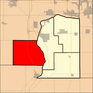
Prophetstown Township is located in Whiteside County, Illinois. As of the 2010 census, its population was 2,615 and it contained 1,162 housing units.

Tampico Township is located in Whiteside County in the U.S. state of Illinois. As of the 2010 census, its population was 1,148 and it contained 449 housing units.

Union Grove Township is located in Whiteside County, Illinois. As of the 2010 census, its population was 1,244 and it contained 519 housing units.

Ustick Township is located in Whiteside County, Illinois. As of the 2010 census, its population was 613 and it contained 250 housing units.

Amboy Township is one of twenty-two townships in Lee County, Illinois, USA. As of the 2010 census, its population was 3,108 and it contained 1,360 housing units.

May Township is located in Lee County, Illinois. As of the 2010 census, its population was 304 and it contained 141 housing units. May Township was formed from Hamilton Township in September, 1854.

Nachusa Township is located in Lee County, Illinois. As of the 2010 census, its population was 493 and it contained 204 housing units. Nachusa Township was formed from China Township on February 8, 1872.
Senachwine Township is located in Putnam County, Illinois. As of the 2010 census, its population was 745 and it contained 651 housing units.

Clear Lake Township is located in Sangamon County, Illinois. As of the 2010 census, its population was 8,527 and it contained 3,418 housing units.

Rosefield Township is located in Peoria County, Illinois. At the 2010 census, its population was 1,217 and it contained 489 housing units.

Osceola Township is located in Stark County, Illinois. As of the 2010 census, its population was 1,014 and it contained 428 housing units.
Yorktown Township is one of twenty-four townships in Henry County, Illinois, USA. As of the 2010 census, its population was 431 and it contained 190 housing units.

May Township is one of seventeen townships in Christian County, Illinois, USA. As of the 2010 census, its population was 1,581 and it contained 668 housing units.