Sterling, Colorado

Last updated

Sterling, Colorado
Sterling CO main street.jpg
Main Street in Sterling.
Nickname: 
A Colorado Treasure
Logan County Colorado Incorporated and Unincorporated areas Sterling Highlighted 0873935.svg
Location of the City of Sterling in Logan County, Colorado.
Usa edcp location map.svg
Red pog.svg
Sterling
Location of the City of Sterling in the United States.
Coordinates: 40°37′32″N103°12′42″W / 40.62556°N 103.21167°W / 40.62556; -103.21167
Country Flag of the United States.svg  United States
State Flag of Colorado.svg  Colorado
County Logan County [2]
City Sterling [1]
Settled 1868
Platted 1890
Incorporated December 3, 1884 [3]
Government
  Type Home rule municipality [1]
  MayorBrenda Desormeaux
  City ManagerKevin L. Blankenship
  Police ChiefTyson Kerr
Area
[4]
  Total7.43 sq mi (19.25 km2)
  Land7.43 sq mi (19.25 km2)
  Water0.00 sq mi (0.00 km2)  0.0%
Elevation
3,937 ft (1,181 m)
Population
 (2020) [5]
  Total13,735
  Density1,800/sq mi (710/km2)
Time zone UTC−7 (MST)
  Summer (DST) UTC−6 (MDT)
ZIP code [6]
80751
Area code 970
FIPS code 08-73935
GNIS feature ID 0202901
Website City of Sterling

Sterling is a home rule municipality and the county seat and most populous municipality of Logan County, Colorado, United States. [7] Sterling is the principal city of the Sterling, CO Micropolitan Statistical Area. The city population was 13,735 at the 2020 census. [5]

Contents

Sterling is the largest city in the Eastern Plains region of Colorado and the site of the domed Logan County Courthouse, built in 1909.

History

A post office called Sterling has been in operation since 1874. [8] The community was named for Sterling, Illinois, the native home of a railroad official. [9]

A postcard view taken from the corner of South Second Street and Cedar Street and mailed on March 28, 1911 Sterling Co Mar 28 1911.jpg
A postcard view taken from the corner of South Second Street and Cedar Street and mailed on March 28, 1911

Geography

Sterling is 128 miles (206 km) northeast of Denver, and is located on Interstate 76, on the 'eastern plains' of northeastern Colorado.

According to the United States Census Bureau, the city has a total area of 7.43 square miles (19.2 km2), all land.

Climate

According to the Köppen Climate Classification system, Sterling has a semi-arid climate, abbreviated "BSk" on climate maps. [10]

Climate data for Sterling, Colorado (1981–2010)
MonthJanFebMarAprMayJunJulAugSepOctNovDecYear
Mean daily maximum °F (°C)42
(6)
46
(8)
56
(13)
64
(18)
74
(23)
84
(29)
91
(33)
89
(32)
80
(27)
67
(19)
53
(12)
42
(6)
66
(19)
Mean daily minimum °F (°C)14
(−10)
18
(−8)
26
(−3)
35
(2)
46
(8)
56
(13)
61
(16)
59
(15)
48
(9)
35
(2)
24
(−4)
15
(−9)
36
(3)
Average precipitation inches (mm)0.30
(7.6)
0.36
(9.1)
0.96
(24)
1.33
(34)
2.31
(59)
2.76
(70)
2.66
(68)
1.88
(48)
1.18
(30)
1.09
(28)
0.54
(14)
0.34
(8.6)
15.72
(399)
Average snowfall inches (cm)4.0
(10)
4.0
(10)
3.7
(9.4)
1.8
(4.6)
0.0
(0.0)
0.0
(0.0)
0.0
(0.0)
0.0
(0.0)
0.4
(1.0)
1.0
(2.5)
4.1
(10)
5.8
(15)
24.8
(63)
Source: Weather.com [11]

Demographics

Historical population
CensusPop.Note
1890 540
1900 99884.8%
1910 3,044205.0%
1920 6,415110.7%
1930 7,19512.2%
1940 7,4113.0%
1950 7,5341.7%
1960 10,75142.7%
1970 10,636−1.1%
1980 11,3857.0%
1990 10,362−9.0%
2000 11,3609.6%
2010 14,77730.1%
2020 13,735−7.1%
U.S. Decennial Census
Sterling Railroad Station 1880s SterlingStation.jpg
Sterling Railroad Station 1880s

As of the 2020 census, there were 13,753 people, 4,604 households, and 2,790 families living in the city. The population density was 1,653.1 inhabitants per square mile (638.3/km2). There were 5,171 housing units at an average density of 752.5 per square mile (290.5/km2). The racial makeup of the city was 90.75% Caucasian American, 0.75% African American, 0.79% Native American, 0.41% Asian, 0.08% Pacific Islander, 5.60% from other races, and 1.62% from two or more races. Hispanic or Latino of any race were 14.20% of the population.

There were 4,604 households, out of which 30.6% had children under the age of 18 living with them, 46.2% were married couples living together, 10.8% had a female householder with no husband present, and 39.4% were non-families. 34.1% of all households were made up of individuals, and 14.7% had someone living alone who was 65 years of age or older. The average household size was 2.34 and the average family size was 3.03.

In the city, the population was spread out, with 25.5% under the age of 18, 12.9% from 18 to 24, 25.5% from 25 to 44, 19.6% from 45 to 64, and 16.4% who were 65 years of age or older. The median age was 35 years. For every 100 females, there were 94.7 males. For every 100 females age 18 and over, there were 91.2 males.

The median income for a household in the city was $27,337, and the median income for a family was $39,103. Males had a median income of $27,921 versus $20,508 for females. The per capita income for the city was $15,287.

Economy

Logan County Courthouse today LoganCountyCourthouse.jpg
Logan County Courthouse today
Northeastern Junior College Northeastern Junior College, Colorado.jpg
Northeastern Junior College

Major employers in Sterling include Northeastern Junior College, the RE-1 Valley School system, and the Sterling Correctional Facility.[ citation needed ]

Sterling is the major shopping hub for most of northeastern Colorado and hosts big box retailers, as well as many local stores located primarily on Main Street. Six different banks have branches in Sterling and there are local AM and FM radio stations as well as a local television station, and a long-established regional newspaper, the Sterling Journal-Advocate and South Platte Sentinel .

The Overland Trail Museum in Sterling Overland Trail Museum.JPG
The Overland Trail Museum in Sterling

Government

The Colorado Department of Corrections operates the Sterling Correctional Facility in Sterling. [12]

Education

Sterling is the home of Northeastern Junior College, a residential two-year college in Colorado.

Sterling is also the location of the RE-1 Valley School District.

Infrastructure

Transportation

Crosson Field serves as Sterling's airport, but there are no scheduled flights available from there. The closest airport served by scheduled flights is Denver International Airport, located 121 miles (195 km) away.

Sterling is also served by railroads, although only freight carriers serve the town. The main rail operator is Burlington Northern Santa Fe (BNSF), but other operators, like Union Pacific, serve Sterling as well. The closest Amtrak station is located in Fort Morgan, about 47 miles (76 km) away.

Intercity bus service is offered by Burlington Trailways and Express Arrow with service to Denver, as well as number of cities in Nebraska including North Platte, Kearney, and Omaha. Sterling is also part of Colorado's Bustang network, as the eastern terminus of the Sterling–Denver and Sterling–Greeley routes, which operate two days per week and three days per week respectively. [13]

Highways

Health care

Sterling is a regional center for health care as well and is the home of the Sterling Regional Medical Center.

Media

Radio

  • KSRX (97.5 FM), Branded as Bob FM, plays "80's, 90's... and whatever!" [14] [15] [16]

See also

Related Research Articles

<span class="mw-page-title-main">Adams County, Colorado</span> County in Colorado, United States

Adams County is a county located in the U.S. state of Colorado. As of the 2020 census, the population was 519,572. The county seat is Brighton, and the largest city is Thornton. The county is named for Alva Adams, an early Governor of the State of Colorado in 1887–1889. Adams County is part of the Denver–Aurora–Lakewood, CO Metropolitan Statistical Area.

<span class="mw-page-title-main">Alamosa, Colorado</span> City in Colorado, United States

Alamosa is a home rule municipality and the county seat of Alamosa County, Colorado, United States. The city population was 9,806 in the 2020 United States Census. The city is the commercial center of the San Luis Valley in south-central Colorado, and is the home of Adams State University.

<span class="mw-page-title-main">Arvada, Colorado</span> City in Colorado, United States

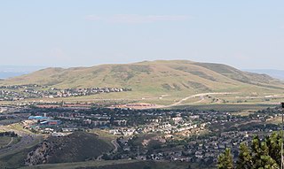
Arvada is a home rule municipality on the border between Jefferson and Adams counties, Colorado, United States. The city population was 124,402 at the 2020 United States Census, with 121,510 residing in Jefferson County and 2,892 in Adams County. Arvada is the seventh most populous city in Colorado. The city is a part of the Denver–Aurora–Lakewood, CO Metropolitan Statistical Area and the Front Range Urban Corridor. The Olde Town Arvada historic district is 7 miles (11 km) northwest of the Colorado State Capitol in Denver.

<span class="mw-page-title-main">Buena Vista, Colorado</span> Town in Colorado, United States

Buena Vista is a Statutory Town located in Chaffee County, Colorado, United States. The town population was 2,855 at the 2020 United States Census.

<span class="mw-page-title-main">Avon, Colorado</span> Town in Colorado, United States

Avon is a home rule municipality located in Eagle County, Colorado, United States. The town population was 6,072 at the 2020 United States Census. The town is a part of the Edwards, CO Micropolitan Statistical Area. Avon is the gateway to the Beaver Creek Resort which lies about two miles (3 km) south of the town. It was the previous site of Vail Resorts before the company moved its physical headquarters to Broomfield, Colorado, in 2006. The town is the home of Liberty Skis, an independent ski manufacturing company.

<span class="mw-page-title-main">Eagle, Colorado</span> Town in Colorado, United States

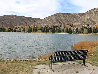
Eagle is the Statutory Town that is the county seat of Eagle County, Colorado, United States. The town population was 7,511 at the 2020 United States Census, a +15.41% increase since the 2010 United States Census. Eagle is the part of the Edwards, CO Micropolitan Statistical Area.

<span class="mw-page-title-main">Cañon City, Colorado</span> Home rule municipality in Colorado, United States

Cañon City is a home rule municipality that is the county seat and the most populous municipality of Fremont County, Colorado, United States. The city population was 17,141 at the 2020 United States Census. Cañon City is the principal city of the Cañon City, CO Micropolitan Statistical Area and is a part of the Front Range Urban Corridor. Cañon City straddles the easterly flowing Arkansas River and is a popular tourist destination for sightseeing, whitewater rafting, and rock climbing. The city is known for its many public parks, fossil discoveries, Skyline Drive, The Royal Gorge railroad, the Royal Gorge, and extensive natural hiking paths. In 1994, the United States Board on Geographic Names approved adding the tilde to the official name of Cañon City, a change from Canon City as the official name in its decisions of 1906 and 1975. It is one of the few U.S. cities to have the Spanish Ñ in its name, others being La Cañada Flintridge, California; Española, New Mexico; Peñasco, New Mexico; and Peñitas, Texas.

<span class="mw-page-title-main">Rifle, Colorado</span> City in Colorado, United States

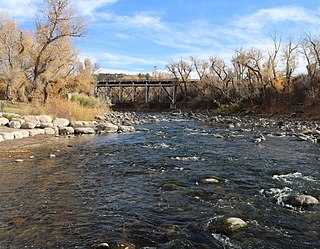
Rifle is a home rule municipality in, and the most populous community of, Garfield County, Colorado, United States. The population was 10,437 at the 2020 census. Rifle is a regional center of the cattle ranching industry located along Interstate 70 and the Colorado River just east of the Roan Plateau, which dominates the western skyline of the town. The town was founded in 1882 by Abram Maxfield, and was incorporated in 1905 along Rifle Creek, near its mouth on the Colorado. The community takes its name from the creek.

<span class="mw-page-title-main">Loveland, Colorado</span> City in Colorado, United States

Loveland is the home rule municipality that is the second most populous municipality in Larimer County, Colorado, United States. Loveland is situated 46 miles (74 km) north of the Colorado State Capitol in Denver and is the 14th most populous city in Colorado. As of the 2020 census the population of Loveland was 76,378. The city forms part of the Fort Collins-Loveland Metropolitan Statistical Area and the Front Range Urban Corridor. The city's public schools are part of the Thompson R2-J School District.

<span class="mw-page-title-main">Limon, Colorado</span> Town in Colorado, United States

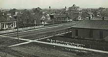
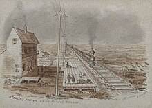
Limon is a statutory town that is the most populous municipality in Lincoln County, Colorado, United States. The population was 2,043 at the 2020 United States Census. Limon lies at the intersection of Interstate 70, U.S. Highways 24, 40, 287, and Colorado Highway 71. The Limon Correctional Facility is part of the Colorado Department of Corrections system and is a major employer in the area with employment of roughly 350.

<span class="mw-page-title-main">Craig, Colorado</span> City in Moffat County, Colorado, U.S.

Craig is a home rule municipality that is the county seat and the most populous municipality of Moffat County, Colorado, United States. The city population was 9,060 at the 2020 United States Census. Craig is the principal city of the Craig, CO Micropolitan Statistical Area.

<span class="mw-page-title-main">Cortez, Colorado</span> City in Colorado, United States

Cortez is a home rule municipality that is the county seat and the most populous municipality of Montezuma County, Colorado, United States. The city population was 8,766 at the 2020 United States Census.

<span class="mw-page-title-main">Brush, Colorado</span> City in Colorado, United States

Brush is a Statutory City located in Morgan County, Colorado, United States. The city population was 5,339 at the 2020 United States Census. Brush is a part of the Fort Morgan, CO Micropolitan Statistical Area.

<span class="mw-page-title-main">Fort Morgan, Colorado</span> City in Colorado, United States

Fort Morgan is the home rule municipality city that is the county seat and the most populous municipality of Morgan County, Colorado, United States. The city population was 11,597 at the 2020 United States Census. Fort Morgan is the principal city of the Fort Morgan, CO Micropolitan Statistical Area.

<span class="mw-page-title-main">Log Lane Village, Colorado</span> Town in Colorado, United States

Log Lane Village is a statutory town in Morgan County, Colorado, United States. The population was 913 at the 2020 census.

<span class="mw-page-title-main">La Junta, Colorado</span> City in Otero County, Colorado, United States

La Junta is a home rule municipality in, the county seat of, and the most populous municipality of Otero County, Colorado, United States. The city population was 7,322 at the 2020 United States Census. La Junta is located on the Arkansas River in southeastern Colorado 68 miles (109 km) east of Pueblo. The city is home to Otero College.

<span class="mw-page-title-main">Rocky Ford, Colorado</span> City in Otero County, Colorado, United States

Rocky Ford is a statutory city located in Otero County, Colorado, United States. The population was 3,876 at the 2020 census.

<span class="mw-page-title-main">Fairplay, Colorado</span> Town in Park County, Colorado, United States

Fairplay is a statutory town that is the county seat and the most populous municipality of Park County, Colorado, United States. The town population was 724 at the 2020 United States Census. Fairplay is located in South Park at an elevation of 9,953 feet (3,034 m). The town is the fifth-highest incorporated place in the State of Colorado. Fairplay is now a part of the Denver–Aurora–Lakewood, CO Metropolitan Statistical Area and the Front Range Urban Corridor.

<span class="mw-page-title-main">Moffat, Colorado</span> Town in Saguache County, Colorado, United States

The Town of Moffat is a statutory town in Saguache County, Colorado, United States. The town population was 108 at the 2020 United States Census.

<span class="mw-page-title-main">Lakewood, Colorado</span> City in Colorado, United States

Lakewood is the home rule municipality that is the most populous municipality in Jefferson County, Colorado, United States. The city population was 155,984 at the 2020 U.S. Census, making Lakewood the fifth most populous city in Colorado and the 167th most populous city in the United States. Lakewood is a suburb of Denver and is a principal city of the Denver–Aurora–Lakewood, CO Metropolitan Statistical Area and a major city of the Front Range Urban Corridor.

References

  1. 1 2 3 "Active Colorado Municipalities". State of Colorado, Colorado Department of Local Affairs, Division of Local Government. Retrieved January 27, 2021.
  2. "Colorado Counties". State of Colorado, Colorado Department of Local Affairs, Division of Local Government. Retrieved January 27, 2021.
  3. "Colorado Municipal Incorporations". State of Colorado, Department of Personnel & Administration, Colorado State Archives. December 1, 2004. Retrieved September 2, 2007.
  4. "2019 U.S. Gazetteer Files". United States Census Bureau. Retrieved July 1, 2020.
  5. 1 2 United States Census Bureau. "Sterling city; Colorado" . Retrieved April 21, 2023.
  6. "ZIP Code Lookup". United States Postal Service. Archived from the original (JavaScript/HTML) on November 22, 2010. Retrieved January 5, 2008.
  7. "Find a County". National Association of Counties. Retrieved June 7, 2011.
  8. "Post offices". Jim Forte Postal History. Retrieved July 11, 2016.
  9. Dawson, John Frank (1954). Place names in Colorado: why 700 communities were so named, 150 of Spanish or Indian origin. Denver, CO: The J. Frank Dawson Publishing Co. p. 48.
  10. Climate Summary for Sterling, Colorado
  11. "Average Weather for Sterling, Colorado - Precipitation and Temperatures". Weather.com . Retrieved October 22, 2014.
  12. "SCF - Sterling Correctional Facility." Colorado Department of Corrections. Retrieved on April 19, 2012. "Facility Location: 12101 Hwy 61 Sterling, CO, 80751"
  13. "Bustang Outrider Schedules & Rates" (PDF). Colorado Department of Transportation. Retrieved October 5, 2023.
  14. "97.5 Bob FM".
  15. "BOB FM | 80s, 90s... and whatever!" . Retrieved March 15, 2022.
  16. "FM Station KSRX - FCC Public Inspection File". publicfiles.fcc.gov. Retrieved March 15, 2022.