Akron, Colorado

Last updated

Akron, Colorado
Akron, Colorado.JPG
Entering Akron from the east (2013)
Washington County Colorado Incorporated and Unincorporated areas Akron Highlighted 0800925.svg
Location within County and State
Coordinates: 40°09′52″N103°13′14″W / 40.164382°N 103.220685°W / 40.164382; -103.220685 [2]
Country Flag of the United States.svg  United States
State Flag of Colorado.svg  Colorado
County Washington County seat [3]
Incorporated 1887-09-22 [4]
Government
  Type Statutory Town [1]
Area
[5]
  Total2.77 sq mi (7.18 km2)
  Land2.77 sq mi (7.18 km2)
  Water0.00 sq mi (0.00 km2)
Elevation
[6]
4,659 ft (1,420 m)
Population
 (2020)
  Total1,757
  Density633.84/sq mi (244.70/km2)
Time zone UTC−07:00 (MST)
  Summer (DST) UTC−06:00 (MDT)
ZIP code
80720 [7]
Area code 970
FIPS code 08-00925
GNIS ID 182984
Highways US 34, SH 63
Website Town website

Akron is the Statutory Town that is the county seat and the most populous municipality of Washington County, Colorado, United States. [1] [3] [8] The town population was 1,757 at the 2020 United States Census. [9]

Contents

History

Akron was platted in 1882. [10] Originally, Akron was a small camp on the railroad, being halfway between McCook and Denver. [11] The community was named after Akron, Ohio, the native home of the wife of a railroad employee. [12] The town was incorporated in 1887.

Hotel Akron, from a postcard sent in 1908 HotelAkronPostcardAkronColorado.jpg
Hotel Akron, from a postcard sent in 1908

Geography

Akron is located at 40°9′42″N103°12′43″W / 40.16167°N 103.21194°W / 40.16167; -103.21194 (40.161530, -103.211850), [13] at the intersection of U.S. Highway 34 and State Highway 63.

At the 2020 United States Census, the town had a total area of 1,774 acres (7.180 km2), all of it land. [9]

Climate

Akron experiences a semi-arid climate (Köppen BSk) with cold, dry winters and hot, dry summers. [14]

Climate data for Akron, Colorado (Colorado Plains Regional Airport), 19912020 normals, extremes 1937present
MonthJanFebMarAprMayJunJulAugSepOctNovDecYear
Record high °F (°C)74
(23)
78
(26)
85
(29)
91
(33)
97
(36)
107
(42)
107
(42)
109
(43)
100
(38)
91
(33)
82
(28)
80
(27)
109
(43)
Mean maximum °F (°C)61.2
(16.2)
65.5
(18.6)
75.7
(24.3)
82.2
(27.9)
89.2
(31.8)
96.9
(36.1)
99.9
(37.7)
97.6
(36.4)
93.8
(34.3)
84.8
(29.3)
73.0
(22.8)
62.3
(16.8)
100.9
(38.3)
Mean daily maximum °F (°C)41.1
(5.1)
43.5
(6.4)
54.1
(12.3)
60.9
(16.1)
70.5
(21.4)
82.5
(28.1)
88.7
(31.5)
86.5
(30.3)
78.3
(25.7)
63.8
(17.7)
50.9
(10.5)
41.1
(5.1)
63.5
(17.5)
Daily mean °F (°C)29.1
(−1.6)
31.3
(−0.4)
40.5
(4.7)
47.2
(8.4)
56.9
(13.8)
68.2
(20.1)
74.5
(23.6)
72.5
(22.5)
64.1
(17.8)
50.2
(10.1)
38.3
(3.5)
29.3
(−1.5)
50.2
(10.1)
Mean daily minimum °F (°C)17.2
(−8.2)
19.0
(−7.2)
26.8
(−2.9)
33.5
(0.8)
43.4
(6.3)
53.8
(12.1)
60.3
(15.7)
58.5
(14.7)
49.9
(9.9)
36.6
(2.6)
25.8
(−3.4)
17.5
(−8.1)
36.9
(2.7)
Mean minimum °F (°C)−3.8
(−19.9)
−0.5
(−18.1)
9.3
(−12.6)
17.9
(−7.8)
29.4
(−1.4)
43.2
(6.2)
51.7
(10.9)
48.9
(9.4)
35.9
(2.2)
18.9
(−7.3)
6.6
(−14.1)
−2.9
(−19.4)
−10.4
(−23.6)
Record low °F (°C)−28
(−33)
−29
(−34)
−21
(−29)
−3
(−19)
19
(−7)
28
(−2)
38
(3)
39
(4)
17
(−8)
0
(−18)
−11
(−24)
−25
(−32)
−29
(−34)
Average precipitation inches (mm)0.17
(4.3)
0.20
(5.1)
0.71
(18)
1.43
(36)
2.65
(67)
2.24
(57)
2.78
(71)
2.36
(60)
1.24
(31)
0.99
(25)
0.42
(11)
0.20
(5.1)
15.39
(390.5)
Average snowfall inches (cm)5.6
(14)
5.1
(13)
8.6
(22)
5.4
(14)
0.4
(1.0)
0.0
(0.0)
0.0
(0.0)
0.0
(0.0)
0.9
(2.3)
2.7
(6.9)
7.8
(20)
6.9
(18)
43.4
(111.2)
Average precipitation days (≥ 0.01 in)3.23.45.48.610.79.610.49.26.26.04.12.879.6
Average snowy days (≥ 0.1 in)3.94.14.92.70.30.00.00.00.51.74.44.126.6
Source 1: National Weather Service [15]
Source 2: NOAA(average snowfall/snowy days 1981–2010) [16] [17]

Demographics

Historical population
CensusPop.Note
1890 559
1900 351−37.2%
1910 64784.3%
1920 1,401116.5%
1930 1,135−19.0%
1940 1,41724.8%
1950 1,60513.3%
1960 1,89017.8%
1970 1,775−6.1%
1980 1,716−3.3%
1990 1,599−6.8%
2000 1,7117.0%
2010 1,702−0.5%
2020 1,7573.2%
U.S. Decennial Census

At the 2000 census there were 1,711 people in 734 households, including 457 families, in the town. The population density was 1,179.3 inhabitants per square mile (455.3/km2). There were 835 housing units at an average density of 575.5 per square mile (222.2/km2). The racial makeup of the town was 93.51% White, 0.12% African American, 1.23% Native American, 0.12% Asian, 0.06% Pacific Islander, 4.32% from other races, and 0.64% from two or more races. Hispanic or Latino of any race were 11.75%. [18]

Of the 734 households 29.3% had children under the age of 18 living with them, 50.8% were married couples living together, 9.4% had a female householder with no spouse present, and 37.7% were non-families. 33.8% of households were one person and 16.8% were one person aged 65 or older. The average household size was 2.28 and the average family size was 2.94.

The age distribution was 26.2% under the age of 18, 6.3% from 18 to 24, 23.4% from 25 to 44, 21.0% from 45 to 64, and 23.1% 65 or older. The median age was 40 years. For every 100 females, there were 97.3 males. For every 100 females age 18 and over, there were 89.8 males.

The median household income was $29,420 and the median family income was $35,156. Males had a median income of $25,875 versus $21,000 for females. The per capita income for the town was $15,772. About 8.1% of families and 11.0% of the population were below the poverty line, including 13.9% of those under age 18 and 11.3% of those age 65 or over.

See also

Related Research Articles

<span class="mw-page-title-main">Washington County, Colorado</span> County in Colorado, United States

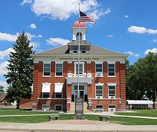
Washington County is a county located in the eastern side of the U.S. state of Colorado. As of the 2020 census, the population was 4,817, making it the least populous “Washington County” in the United States. The county seat is Akron. The county was named in honor of the United States President George Washington.

<span class="mw-page-title-main">Morgan County, Colorado</span> County in Colorado, United States

Morgan County is a county located in the U.S. state of Colorado. As of the 2020 census, the population was 29,111. The county seat is Fort Morgan. The county was named after old Fort Morgan, which in turn was named in honor of Colonel Christopher A. Morgan.

<span class="mw-page-title-main">Campo, Colorado</span> Town in Colorado, United States

Campo is a Statutory Town located in Baca County, Colorado, United States. The town population was 103 at the 2020 United States Census. The town is situated on the High Plains, straddling U.S. Route 287/385.

<span class="mw-page-title-main">Empire, Colorado</span> Town in Colorado, United States

The historic Town of Empire is a Statutory Town located in Clear Creek County, Colorado, United States. The town population was 345 at the 2020 United States Census, a +22.34% increase since the 2010 United States Census. The town is a former mining settlement that flourished during the Colorado Silver Boom in the late 19th century. Empire is now a part of the Denver–Aurora–Lakewood, CO Metropolitan Statistical Area and the Front Range Urban Corridor.

<span class="mw-page-title-main">Branson, Colorado</span> Town in Colorado, United States

Branson is a Statutory Town located in Las Animas County, Colorado, United States. The town population was 57 at the 2020 United States Census. Branson is the southernmost town in the State of Colorado, located just 0.3 miles (0.48 km) from the New Mexico border.

<span class="mw-page-title-main">Kim, Colorado</span> Town in Colorado, United States

Kim is a Statutory Town in Las Animas County, Colorado, United States. The population was 63 at the time of the 2020 United States Census.

<span class="mw-page-title-main">Arriba, Colorado</span> Town in Lincoln County, Colorado, United States

Arriba is a Statutory Town located in Lincoln County, Colorado, United States. The town population was 202 at the 2020 United States census. Arriba is the Spanish word for "on high" or "above others."

<span class="mw-page-title-main">Genoa, Colorado</span> Town in Lincoln County, Colorado, United States

Genoa is a statutory town located in Lincoln County, Colorado, United States. The town population was 153 at the 2020 United States Census.

<span class="mw-page-title-main">Crook, Colorado</span> Town in Colorado, United States

The Town of Crook is a Statutory Town in Logan County, Colorado, United States. The town population was 133 at the 2020 United States Census. Crook is a part of the Sterling, CO Micropolitan Statistical Area.

<span class="mw-page-title-main">Fleming, Colorado</span> Town in Colorado, United States

The Town of Fleming is a Statutory Town in Logan County, Colorado, United States. The town population was 428 at the 2020 United States Census. Fleming is a part of the Sterling, CO Micropolitan Statistical Area.

<span class="mw-page-title-main">Hillrose, Colorado</span> Town in Colorado, United States

The Town of Hillrose is a statutory town located in Morgan County, Colorado, United States. The town population was 312 at the 2020 United States Census, an 18.18% increase since the 2010 United States Census.

<span class="mw-page-title-main">Log Lane Village, Colorado</span> Town in Colorado, United States

Log Lane Village is a statutory town in Morgan County, Colorado, United States. The population was 913 at the 2020 census.

<span class="mw-page-title-main">Cheraw, Colorado</span> Town in Otero County, Colorado, United States

Cheraw is a Statutory Town located in Otero County, Colorado, United States. The town population was 237 at the 2020 United States Census.

<span class="mw-page-title-main">Manzanola, Colorado</span> Town in Otero County, Colorado, United States

Manzanola is a Statutory Town in Otero County, Colorado, United States. The town population was 341 at the 2020 United States Census.

<span class="mw-page-title-main">Holyoke, Colorado</span> City in Colorado, United States

Holyoke is the home rule municipality that is the county seat and the most populous municipality of Phillips County, Colorado, United States. The city population was 2,346 at the 2020 United States Census.

<span class="mw-page-title-main">Platteville, Colorado</span> Town in Colorado, United States

Platteville is a Statutory Town in Weld County, Colorado, United States. The population was 2,955 at the 2020 census. It is adjacent to Fort Vasquez on U.S. Highway 85.

<span class="mw-page-title-main">Eckley, Colorado</span> Town in Colorado, United States

Eckley is a statutory town located in Yuma County, Colorado, United States. The town population was 232 at the 2020 United States Census.

<span class="mw-page-title-main">Reamstown, Pennsylvania</span> Census-designated place in Pennsylvania, United States

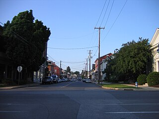
Reamstown is an unincorporated community and census-designated place (CDP) in Lancaster County, Pennsylvania, United States. The population was 3,361 at the 2010 census.

<span class="mw-page-title-main">Jennerstown, Pennsylvania</span> Borough in Pennsylvania, United States

Jennerstown is a borough in Somerset County, Pennsylvania, United States. It is part of the Johnstown, Pennsylvania Metropolitan Statistical Area. The population was 679 at the 2020 census. The borough is the home of Jennerstown Speedway. The town was named for Edward Jenner.

<span class="mw-page-title-main">Coleman, Texas</span> City in Texas, United States

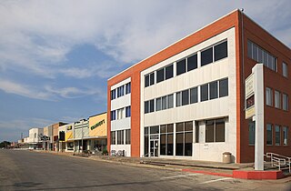
Coleman is a town in and the county seat of Coleman County, Texas, United States. As of the 2010 census, its population was 4,709.

References

  1. 1 2 3 "Active Colorado Municipalities". Colorado Department of Local Affairs . Retrieved October 15, 2021.
  2. "2014 U.S. Gazetteer Files: Places". United States Census Bureau. July 1, 2014. Retrieved January 5, 2015.
  3. 1 2 "Colorado County Seats". State of Colorado, Department of Public Health and Environment. Archived from the original on January 8, 2008. Retrieved December 31, 2007.
  4. "Colorado Municipal Incorporations". State of Colorado, Department of Personnel & Administration, Colorado State Archives. December 1, 2004. Archived from the original on September 27, 2007. Retrieved August 18, 2007.
  5. "2020 U.S. Gazetteer Files". United States Census Bureau. Retrieved October 31, 2021.
  6. "US Board on Geographic Names". United States Geological Survey. October 25, 2007. Retrieved January 31, 2008.
  7. "ZIP Code Lookup". United States Postal Service. August 18, 2007. Archived from the original (JavaScript/HTML) on August 18, 2007. Retrieved August 18, 2007.
  8. "Find a County". National Association of Counties. Archived from the original on May 31, 2011. Retrieved June 7, 2011.
  9. 1 2 "Decennial Census P.L. 94-171 Redistricting Data". United States Census Bureau, United States Department of Commerce. August 12, 2021. Retrieved September 2, 2021.
  10. "Place Names of Colorado" (PDF). Colorado Council of Genealogical Societies. 1999. p. 5. Archived from the original (PDF) on October 27, 2017. Retrieved July 1, 2019.
  11. "About us | Town of Akron". townofakron.colorado.gov. Retrieved April 11, 2024.
  12. Dawson, John Frank (1954). Place names in Colorado: why 700 communities were so named, 150 of Spanish or Indian origin. Denver, CO: The J. Frank Dawson Publishing Co. p. 5.
  13. "US Gazetteer files: 2010, 2000, and 1990". United States Census Bureau. February 12, 2011. Retrieved April 23, 2011.
  14. Climate Summary for Akron, Colorado
  15. "NOAA Online Weather Data". National Weather Service. Retrieved August 7, 2022.
  16. "U.S. Climate Normals Quick Access (1991–2020)". National Oceanic and Atmospheric Administration.
  17. "U.S. Climate Normals Quick Access (1981–2010)". National Oceanic and Atmospheric Administration.
  18. "U.S. Census website". United States Census Bureau . Retrieved January 31, 2008.