Ordway, Colorado

Last updated

Ordway, Colorado
Ordway, Colorado.JPG
Main Street in Ordway, June 2017
Crowley County Colorado Incorporated and Unincorporated areas Ordway Highlighted 0856145.svg
Location of Ordway in Crowley County, Colorado.
Coordinates: 38°13′11″N103°45′26″W / 38.21972°N 103.75722°W / 38.21972; -103.75722
Country Flag of the United States (23px).png  United States
State Flag of Colorado.svg  State of Colorado
County [1] Crowley County Seat
Incorporated (town) September 4, 1900 [2]
Government
  Type Statutory Town [1]
Area
[3]
  Total0.77 sq mi (2.00 km2)
  Land0.77 sq mi (2.00 km2)
  Water0.00 sq mi (0.00 km2)
Elevation
[4]
4,311 ft (1,314 m)
Population
 (2020) [5]
  Total1,066
  Density1,400/sq mi (530/km2)
Time zone UTC-7 (Mountain (MST))
  Summer (DST) UTC-6 (MDT)
ZIP code [6]
81063
Area code 719
FIPS code 08-56145
GNIS feature ID 0203804
Website townofordway.colorado.gov

Ordway is a Statutory Town in and the county seat of Crowley County, Colorado, United States, that is also the most populous community in the county. [7] The population was 1,066 at the 2020 census. [5]

Contents

History

A post office called Ordway has been in operation since 1890. [8] The community was named after George N. Ordway, a Denver politician. [9]

Geography

Ordway is located in south-central Crowley County at 38°13′11″N103°45′26″W / 38.21972°N 103.75722°W / 38.21972; -103.75722 (38.219633, -103.757264). [10] State Highway 96 runs along the southern edge of the town, leading west 49 miles (79 km) to Pueblo and east 60 miles (97 km) to Eads. Highway 71 runs along the eastern edge of the town and leads south 11 miles (18 km) to U.S. Route 50 near Rocky Ford and north 75 miles (121 km) to Interstate 70 at Limon.

According to the United States Census Bureau, Ordway has a total area of 0.8 square miles (2.1 km2), all of it land.

Demographics

Historical population
CensusPop.Note
1900 138
1910 705410.9%
1920 1,18668.2%
1930 1,139−4.0%
1940 1,1501.0%
1950 1,29012.2%
1960 1,254−2.8%
1970 1,017−18.9%
1980 1,13511.6%
1990 1,025−9.7%
2000 1,24821.8%
2010 1,080−13.5%
2020 1,066−1.3%
U.S. Decennial Census

See also

Related Research Articles

<span class="mw-page-title-main">Crowley County, Colorado</span> County in Colorado, United States

Crowley County is a county in Colorado. As of the 2020 census, the population was 5,922. The county seat is Ordway. It is also the poorest county in the country, with a per capita personal income of $22,240.

<span class="mw-page-title-main">Campo, Colorado</span> Town in Colorado, United States

Campo is a Statutory Town located in Baca County, Colorado, United States. The town population was 103 at the 2020 United States Census. The town is situated on the High Plains, straddling U.S. Route 287/385.

<span class="mw-page-title-main">Pritchett, Colorado</span> Town in Colorado, United States

Pritchett is a Statutory Town in Baca County, Colorado, United States. The population was 112 at the 2020 census.

<span class="mw-page-title-main">Vilas, Colorado</span> Town in Colorado, United States

Vilas is a statutory town located in Baca County, Colorado, United States. The population was 98 at the 2020 census.

<span class="mw-page-title-main">Walsh, Colorado</span> Town in Colorado, United States

Walsh is a Statutory Town in Baca County, Colorado, United States. The population was 543 at the 2020 census.

<span class="mw-page-title-main">Romeo, Colorado</span> Town in Colorado, United States

Romeo is a Statutory Town in Conejos County, Colorado, United States. The population was 302 at the 2020 census. A post office called Romeo was established in 1901. The community derives its name from the surname Romero.

<span class="mw-page-title-main">Crowley, Colorado</span> Town in Crowley County, Colorado, United States

The Town of Crowley is a Statutory Town in Crowley County, Colorado, United States. The town population was 166 at the 2020 United States Census.

<span class="mw-page-title-main">Olney Springs, Colorado</span> Town in Crowley County, Colorado, United States

Olney Springs is a Statutory Town in Crowley County, Colorado, United States. The population was 315 at the 2020 census.

<span class="mw-page-title-main">Sugar City, Colorado</span> Town in Colorado, United States

Sugar City is a Statutory Town in Crowley County, Colorado, United States. The population was 259 at the 2020 census.

<span class="mw-page-title-main">Larkspur, Colorado</span> Town in Colorado, United States

Larkspur is a home rule municipality in Douglas County, Colorado, United States. The town population was 206 at the 2020 census. Each year, on weekends in June, July and August, the Colorado Renaissance Festival is held in the hills just west of the town. The town is served by Larkspur Elementary School, a K-6 school in the Douglas County school district. The according to William Bright the town was named for the plains larkspur.

<span class="mw-page-title-main">Haswell, Colorado</span> Town in Colorado, United States

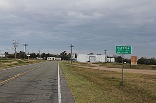
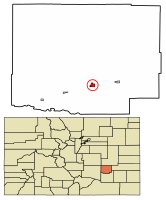
Haswell is a Statutory Town located in Kiowa County, Colorado, United States. The town population was 71 at the 2020 United States Census.

<span class="mw-page-title-main">Sheridan Lake, Colorado</span> Town in Colorado, United States

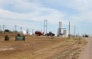
Sheridan Lake is a Statutory Town located in Kiowa County, Colorado, United States. The population was 55 at the 2020 census.

<span class="mw-page-title-main">Kim, Colorado</span> Town in Colorado, United States

Kim is a Statutory Town in Las Animas County, Colorado, United States. The population was 63 at the time of the 2020 United States Census.

<span class="mw-page-title-main">Iliff, Colorado</span> Town in Colorado, United States

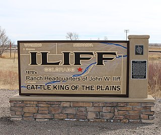
The Town of Iliff is a Statutory Town located in Logan County, Colorado, United States. The population was 246 at the 2020 United States Census.

<span class="mw-page-title-main">Merino, Colorado</span> Town in Colorado, United States

The Town of Merino is a Statutory Town in Logan County, Colorado, United States. The town population was 281 at the 2020 United States Census.

<span class="mw-page-title-main">Wiggins, Colorado</span> Town in Colorado, United States

Wiggins is a statutory town in Morgan County, Colorado, United States. The population was 1,401 as of the 2020 census, up from 893 at the 2010 census.

<span class="mw-page-title-main">Manzanola, Colorado</span> Town in Otero County, Colorado, United States

Manzanola is a Statutory Town in Otero County, Colorado, United States. The town population was 341 at the 2020 United States Census.

<span class="mw-page-title-main">Akron, Colorado</span> Town in Colorado, United States

Akron is the Statutory Town that is the county seat and the most populous municipality of Washington County, Colorado, United States. The town population was 1,757 at the 2020 United States Census.

<span class="mw-page-title-main">Wray, Colorado</span> City in Colorado, United States

Wray is the home rule municipality that is the county seat of Yuma County, Colorado, United States. Located in the Colorado Plains, the city is 170 miles east of Denver, 9 miles west of the Nebraska state line, and 25 miles northwest of the Kansas state line. The population was 2,358 at the 2020 United States census.

<span class="mw-page-title-main">Orchard, Colorado</span> Unincorporated community in Colorado, United States

Orchard is an unincorporated town, a post office, and a census-designated place (CDP) located in and governed by Morgan County, Colorado, United States. The CDP is a part of the Fort Morgan, CO Micropolitan Statistical Area. The Orchard post office has the ZIP Code 80649. As of the 2020 census, the population of the Orchard CDP was 76.

References

  1. 1 2 "Active Colorado Municipalities". State of Colorado, Department of Local Affairs. Archived from the original on December 12, 2009. Retrieved September 1, 2007.
  2. "Colorado Municipal Incorporations". State of Colorado, Department of Personnel & Administration, Colorado State Archives. December 1, 2004. Retrieved September 2, 2007.
  3. "2019 U.S. Gazetteer Files". United States Census Bureau. Retrieved July 1, 2020.
  4. "US Board on Geographic Names". United States Geological Survey. October 25, 2007. Retrieved January 31, 2008.
  5. 1 2 United States Census Bureau. "Ordway town; Colorado" . Retrieved April 25, 2023.
  6. "ZIP Code Lookup". United States Postal Service. Archived from the original (JavaScript/HTML) on November 4, 2010. Retrieved November 28, 2007.
  7. "Find a County". National Association of Counties. Archived from the original on May 31, 2011. Retrieved June 7, 2011.
  8. "Post offices". Jim Forte Postal History. Retrieved July 6, 2016.
  9. Dawson, John Frank. Place names in Colorado: why 700 communities were so named, 150 of Spanish or Indian origin. Denver, CO: The J. Frank Dawson Publishing Co. p. 38.
  10. "US Gazetteer files: 2010, 2000, and 1990". United States Census Bureau. February 12, 2011. Retrieved April 23, 2011.