Limon, Colorado

Last updated

Limon, Colorado
Limon Colorado.JPG
Limon, Colorado
Nickname: 
Hub City of Eastern Colorado
Lincoln County Colorado Incorporated and Unincorporated areas Limon Highlighted 0844980.svg
Location of Limon in Lincoln County, Colorado.
Coordinates: 39°15′50″N103°41′32″W / 39.26389°N 103.69222°W / 39.26389; -103.69222
CountryUnited States
State Colorado
County [1] Lincoln
Incorporated (town) November 18, 1909 [2]
Government
[3]
  Type Statutory Town [1]
   Mayor Bo Randolph
  Town ManagerGreg Tacha
Area
[4]
  Total3.19 sq mi (8.27 km2)
  Land3.16 sq mi (8.19 km2)
  Water0.03 sq mi (0.08 km2)
Elevation
[5]
5,377 ft (1,639 m)
Population
 (2020) [6]
  Total2,043
  Density640/sq mi (250/km2)
Time zone UTC−7 (Mountain (MST))
  Summer (DST) UTC−6 (MDT)
ZIP codes [7]
80826, 80828
Area code 719
FIPS code 08-44980
GNIS feature ID 0204819
Website townoflimon.com

Limon is a statutory town that is the most populous municipality in Lincoln County, Colorado, United States. The population was 2,043 at the 2020 United States Census. [6] Limon lies at the intersection of Interstate 70, U.S. Highways 24, 40, 287, and Colorado Highway 71. The Limon Correctional Facility is part of the Colorado Department of Corrections system and is a major employer in the area with employment of roughly 350.

Contents

Limon is the western terminus of the Kyle Railroad and it is here the regional interchanges with the Union Pacific Railroad. Trains previously stopped at Limon Railroad Depot.

History

Railroads were the major factor for Limon's original founding and location. The Kansas Pacific Railroad made its way across the plains from southern Kansas following the Smoky Hill Trail in 1870. In 1888, the Chicago, Rock Island, and Pacific Railroad (now the Kyle Railroad) made its way west to east from Colorado Springs, entering Lincoln County and intersecting the Kansas Pacific (now Union Pacific) at the present day location of Limon. This union of the two railroads was the earliest founding of the "Hub City".[ citation needed ]

Porter lynching

Limon was the site of a lynching on November 16, 1900. Preston Porter Jr, a sixteen-year-old African-American male, had confessed under duress to the murder of eleven-year-old Louise Frost who was Caucasian. Porter was apparently being held some 90 miles away in Denver, but was sent back to Limon by request of unspecified people and against the wishes of Sheriff Freeman. When the train carrying Porter stopped in Limon, sixteen men selected from a mob of 300 "marked by calmness and determination" took Porter from Freeman's custody despite the sheriff's protestations "in the name of law." Originally it was announced that Porter would be hanged but many in the crowd including R. W. Frost, the girl's father, objected "that such a death would be too easy." The method was left to Frost who decided upon burning at the stake. Frost also refused to allow mutilation of Porter's body before burning. While waiting for his execution, Porter sat next to a bonfire reading the Gospel of Luke from the Bible. Porter was chained to an iron railroad rail set in the ground on the exact spot where the murder had taken place and burned to death, the match to start the fire being set by the girl's father. Lynchings of this type were apparently rare, as reporters on the scene wrote: "The general sentiment expressed approves the execution of the negro, but deprecates the method adopted." [8]

1990 tornado

On June 6, 1990, an F3 tornado touched down near Matheson (about 16 miles west of Limon), tearing roughly east-northeast through fields. Minutes later, the then rain-wrapped tornado arrived, devastating the city. The storm injured 14 people, but remarkably no one was killed. Most of Limon's business district had been laid to ruins in just moments.

Governor Roy Romer declared Limon a disaster area the next day. [9]

Limon successfully rebuilt its business district adding streetscaping, a new Town Hall, relocating a medical clinic and Limon Memorial Library, creating Hub City Senior Center and a new fire station. Downtown Limon is now a thriving center of the community demonstrating the strength of this rural community. [10]

Education

Limon Schools

Limon Schools has a new K-12 facility that opened in the fall of 2015. The $22.5 million project built two stories of new classrooms that accommodate up to 600 students.

Limon Elementary School is a public coed school with 240 students in grades K-5. According to state standards, 82% of students at this school are considered proficient in math or reading.

Limon Junior-Senior High School has 233 students in grades 6-12. According to state standards, 77% of students at this school are considered proficient in reading. Graduation rate is 90%.

Morgan Community College

Morgan Community College: Limon Center serves Arickaree, Flagler, Genoa-Hugo, Karval, Kit Carson, Limon, and Woodlin high schools. It currently offers A.A., A.S., A.A.S. & A.G.S. degrees; Transfer courses; Nursing pre-requisites; Agriculture & Business Management; GED preparation & testing; Specialty classes for teacher re-licensure; EMS training; and Computer classes.

Limon Child Development Center

Limon Child Development Center (Limon Head Start) offers a full-day, full-year preschool program for children ages 3–5. There are various funding programs available for children including Head Start, Colorado Preschool Program (CPP), CCCAP through the Lincoln County Department of Human Services, and private pay tuition.

Geography

Limon is located at 39°15′50″N103°41′32″W / 39.26389°N 103.69222°W / 39.26389; -103.69222 at an elevation of 5,377 feet (1,639 m). [5] Although entirely in Lincoln County, Limon is located immediately east of the Elbert County line. It lies on the north side of Big Sandy Creek, a tributary of the Arkansas River, on the eastern edge of the Colorado Piedmont region of the Great Plains, and is near the eastern end of the Palmer Divide. [11] [12] Located in east-central Colorado at the junction of Interstate 70, U.S. Highway 287, U.S. Highway 40, U.S. Highway 24, and State Highway 71, Limon is far from any major city or town, being 72 miles (116 km) northeast of Colorado Springs, 83 miles (134 km) southeast of Denver, and 486 miles (782 km) west of Kansas City. [13] [14]

According to the United States Census Bureau, the town has a total area of 1.9 square miles (4.9 km2), all land. [15]

Climate

Limon has a semi-arid steppe climate (Köppen BSk) with cold, dry winters and warm, mildly wetter summers. Due to its location on the eastern plains, the town is often subject to severe, sometimes violent thunderstorms throughout the summer. Large hail, damaging winds, heavy rain, and tornadoes are common in the summer months. The high temperature reaches or exceeds 90 °F (32 °C) an average of 32.3 days a year and reaches or exceeds 100 °F (38 °C) an average of 0.8 days a year. The minimum temperature falls below the freezing point 32 °F (0 °C) an average of 195.9 days a year. [16] Typically, the first fall freeze occurs by the fourth week of September, and the last spring freeze occurs by the third week of May. In a typical year, Limon receives 14.97 inches (380 mm) of precipitation, and there are 81.3 days of measurable precipitation. The hottest temperature recorded in Limon was 104 °F (40 °C) on July 20, 2005; the coldest temperature recorded was −28 °F (−33 °C) on February 14, 2021. [17]

Climate data for Limon, Colorado, 19912020 normals, extremes 1948present
MonthJanFebMarAprMayJunJulAugSepOctNovDecYear
Record high °F (°C)74
(23)
79
(26)
82
(28)
88
(31)
97
(36)
103
(39)
104
(40)
102
(39)
98
(37)
90
(32)
88
(31)
75
(24)
104
(40)
Mean maximum °F (°C)64.0
(17.8)
65.4
(18.6)
74.3
(23.5)
80.6
(27.0)
86.8
(30.4)
94.9
(34.9)
97.8
(36.6)
94.7
(34.8)
91.0
(32.8)
83.7
(28.7)
73.8
(23.2)
65.1
(18.4)
98.1
(36.7)
Mean daily maximum °F (°C)42.7
(5.9)
43.9
(6.6)
53.9
(12.2)
60.5
(15.8)
69.8
(21.0)
81.1
(27.3)
87.2
(30.7)
84.5
(29.2)
77.1
(25.1)
64.1
(17.8)
51.9
(11.1)
42.3
(5.7)
63.2
(17.4)
Daily mean °F (°C)26.5
(−3.1)
28.2
(−2.1)
37.3
(2.9)
44.3
(6.8)
53.9
(12.2)
64.3
(17.9)
70.4
(21.3)
68.5
(20.3)
59.9
(15.5)
46.7
(8.2)
34.9
(1.6)
26.1
(−3.3)
46.8
(8.2)
Mean daily minimum °F (°C)10.3
(−12.1)
12.5
(−10.8)
20.6
(−6.3)
28.2
(−2.1)
38.0
(3.3)
47.6
(8.7)
53.6
(12.0)
52.5
(11.4)
42.7
(5.9)
29.3
(−1.5)
17.9
(−7.8)
9.9
(−12.3)
30.3
(−1.0)
Mean minimum °F (°C)−9.4
(−23.0)
−6.8
(−21.6)
4.9
(−15.1)
14.1
(−9.9)
25.6
(−3.6)
37.2
(2.9)
46.1
(7.8)
44.3
(6.8)
30.6
(−0.8)
13.1
(−10.5)
−0.4
(−18.0)
−8.9
(−22.7)
−14.7
(−25.9)
Record low °F (°C)−30
(−34)
−28
(−33)
−22
(−30)
−4
(−20)
17
(−8)
26
(−3)
36
(2)
36
(2)
17
(−8)
−9
(−23)
−21
(−29)
−27
(−33)
−30
(−34)
Average precipitation inches (mm)0.27
(6.9)
0.36
(9.1)
0.80
(20)
1.37
(35)
2.21
(56)
2.20
(56)
2.53
(64)
2.72
(69)
0.96
(24)
0.84
(21)
0.40
(10)
0.31
(7.9)
14.97
(378.9)
Average snowfall inches (cm)5.7
(14)
5.4
(14)
6.9
(18)
5.0
(13)
1.5
(3.8)
0.0
(0.0)
0.0
(0.0)
0.0
(0.0)
0.2
(0.51)
3.1
(7.9)
8.8
(22)
5.4
(14)
42.0
(107)
Average precipitation days (≥ 0.01 in)3.94.46.57.910.18.710.310.05.85.44.73.681.3
Average snowy days (≥ 0.1 in)4.54.45.53.50.70.00.00.00.41.64.65.130.3
Source 1: National Weather Service [17]
Source 2: NOAA (average snowfall/snowy days 1981–2010) [16] [18]

Demographics

Historical population
CensusPop.Note
1910 534
1920 1,04796.1%
1930 1,1005.1%
1940 1,053−4.3%
1950 1,47139.7%
1960 1,81123.1%
1970 1,8140.2%
1980 1,805−0.5%
1990 1,8311.4%
2000 2,07113.1%
2010 1,880−9.2%
2020 2,0438.7%
U.S. Decennial Census

As of the 2010 census, there were 1,880 people, 828 households, and 476 families residing in the town. The population density was 989.5 inhabitants per square mile (382.0/km2). There were 963 housing units at an average density of 506.8 per square mile (195.7/km2). The racial makeup of the town was 93.2% White, 0.9% American Indian, 0.8% African American, 0.8% Asian, 0.1% Pacific Islander, 2.8% from some other race, and 1.5% from two or more races. 9.4% of the population was Hispanic or Latino of any race. [19]

There were 828 households, out of which 32.9% had children under the age of 18 living with them, 41.9% were married couples living together, 4.7% had a male householder with no wife present, 10.9% had a female householder with no husband present, and 42.5% were non-families. 37.1% of all households were made up of individuals, and 18.0% had someone living alone who was 65 years of age or older. The average household size was 2.27, and the average family size was 3.00. [19]

In the town, the population was spread out, with 27.4% under the age of 18, 8.4% from 18 to 24, 23.0% from 25 to 44, 25.0% from 45 to 64, and 16.2% who were 65 years of age or older. The median age was 37.6 years. For every 100 females, there were 90.7 males. For every 100 females age 18 and over, there were 85.6 males age 18 and over. [19]

As of 2009, the median income for a household in the town was $40,903, and the median income for a family was $46,061. Males had a median income of $49,097 versus $31,615 for females. The per capita income for the town was $22,442. About 16.6% of families and 18.2% of the population were below the poverty line, including 25.5% of those under age 18 and 4.8% of those age 65 or over. [20]

Media

Print

The Limon Leader is the city's weekly newspaper, published by Hoffman Publications, LLC and has a circulation of about 3,200 copies. [21]

Radio

The following radio stations are licensed to or broadcast from Limon:

AM

Frequency Callsign [22] Format [23] City of License Notes
1120 KCRN Adult Contemporary Limon, Colorado-

FM

Frequency Callsign [24] Format [23] City of License Notes
89.1KYCOLimon, Colorado-
89.9 K210CC Public Limon, Colorado NPR; Translator of KRCC, Colorado Springs, Colorado [25]
91.9 K220IK Religious Limon, ColoradoTranslator of KAWZ, Twin Falls, Idaho [26]
93.7 KBUD Classic Hits Limon, Colorado-

Television

Limon is in the Denver television market. [27]

Transportation

Highways

Limon is connected by Interstate 70 east to Kansas and west to Denver. The Ports-to-Plains Corridor, including US 40/287 south and Colorado Highway 71 to the north, connects to Texas and South Dakota.[ citation needed ]

Colorado State Highway 71 connects south from Limon to Pueblo. U.S. Route 24 is a direct passage southwest from Limon to Colorado Springs.[ citation needed ]

Railroads

Limon is served by the Union Pacific Railroad and the Kyle Railroad, a short-line railroad owned by Genesee & Wyoming, Inc. The Kyle Railroad runs from North Central Kansas into Eastern Colorado with Limon as the western terminus where it interchanges with the Union Pacific Railroad.[ citation needed ]

Aviation

The Town of Limon is 83 miles (134 km) from Denver International Airport, the largest airport in the state. Colorado Springs Airport is located about 74 miles (119 km) from Limon.[ citation needed ]

Limon Municipal Airport is a public use airport located at the eastern edge of town. The two-runway airport encompasses approximately 397 acres (161 ha) and is owned and operated by the town government. The general aviation airport utilized by a range of aircraft ranging from single-engine aircraft up to small sized multi-engine business jets.[ citation needed ]

See also

Related Research Articles

<span class="mw-page-title-main">Denver</span> Capital of Colorado, United States

Denver is a consolidated city and county, the capital, and most populous city of the U.S. state of Colorado. Its population was 715,522 at the 2020 census, a 19.22% increase since 2010. It is the 19th-most populous city in the United States and the fifth most populous state capital. It is the principal city of the Denver–Aurora–Lakewood metropolitan statistical area, the most populous metropolitan statistical area in Colorado and the first city of the Front Range Urban Corridor.

<span class="mw-page-title-main">Adams County, Colorado</span> County in Colorado, United States

Adams County is a county located in the U.S. state of Colorado. As of the 2020 census, the population was 519,572. The county seat is Brighton, and the largest city is Thornton. The county is named for Alva Adams, an early Governor of the State of Colorado in 1887–1889. Adams County is part of the Denver–Aurora–Lakewood, CO Metropolitan Statistical Area.

<span class="mw-page-title-main">Russell County, Kansas</span> County in Kansas, United States

Russell County is a county in the U.S. state of Kansas. Its county seat and largest city is Russell. As of the 2020 census, the population was 6,691. The county was named for Avra Russell. The city of Russell was the home of former U.S. Senate Majority leader and 1996 GOP presidential nominee Bob Dole for many years.

<span class="mw-page-title-main">Weld County, Colorado</span> County in Colorado, United States

Weld County is a county located in the U.S. state of Colorado. As of the 2020 census, the population was 328,981. The county seat is Greeley.

<span class="mw-page-title-main">Lincoln County, Colorado</span> County in Colorado, United States

Lincoln County is a county located in the U.S. state of Colorado. As of the 2020 census, the population was 5,675. The county seat is Hugo. The county obtains its name in memory of the United States President Abraham Lincoln. County was formed from portions of Bent and Elbert counties in 1889 from a restructuring of Colorado counties.

<span class="mw-page-title-main">Kiowa County, Colorado</span> County in Colorado, United States

Kiowa County is a county located in the U.S. state of Colorado. As of the 2020 census, the population was 1,446, making it the fifth-least populous county in Colorado. The county seat is Eads. The county was named for the Kiowa Nation of Native Americans.

<span class="mw-page-title-main">Elbert County, Colorado</span> County in the United States

Elbert County is a county located in the U.S. state of Colorado. As of the 2020 census, the population was 26,062. The county seat is Kiowa and the largest town is Elizabeth.

<span class="mw-page-title-main">Cheyenne County, Colorado</span> County in Colorado, United States

Cheyenne County is a county located in the U.S. state of Colorado. The county population was 1,748 at 2020 census. The county seat is Cheyenne Wells.

<span class="mw-page-title-main">Baca County, Colorado</span> County in Colorado, United States

Baca County is a county located in the U.S. state of Colorado. As of the 2020 census, the population was 3,506. The county seat is Springfield. Located at the southeast corner of Colorado, the county shares state borders with Kansas, New Mexico, and Oklahoma.

<span class="mw-page-title-main">Arvada, Colorado</span> City in Colorado, United States

Arvada is a home rule municipality on the border between Jefferson and Adams counties, Colorado, United States. The city population was 124,402 at the 2020 United States Census, with 121,510 residing in Jefferson County and 2,892 in Adams County. Arvada is the seventh most populous city in Colorado. The city is a part of the Denver–Aurora–Lakewood, CO Metropolitan Statistical Area and the Front Range Urban Corridor. The Olde Town Arvada historic district is 7 miles (11 km) northwest of the Colorado State Capitol in Denver.

<span class="mw-page-title-main">Erie, Colorado</span> Town in Colorado, United States

The Town of Erie is a Home Rule Town located in Weld and Boulder counties, Colorado, United States. The town population was 30,038 at the 2020 United States Census, a +65.64% increase since the 2010 United States Census. At the 2020 census, 17,387 (58%) Erie residents lived in Weld County and 12,651 (42%) lived in Boulder County. Erie is a part of the Denver-Aurora, CO Combined Statistical Area and the Front Range Urban Corridor.

<span class="mw-page-title-main">Eagle, Colorado</span> Town in Colorado, United States

Eagle is the Statutory Town that is the county seat of Eagle County, Colorado, United States. The town population was 7,511 at the 2020 United States Census, a +15.41% increase since the 2010 United States Census. Eagle is the part of the Edwards, CO Micropolitan Statistical Area.

<span class="mw-page-title-main">Calhan, Colorado</span> Town in Colorado, United States

The Town of Calhan is a statutory town located in El Paso County, Colorado, United States. The town population was 762 at the 2020 United States Census. Calhan is a part of the Colorado Springs, CO Metropolitan Statistical Area and the Front Range Urban Corridor. The town straddles U.S. Highway 24. With Calhan sitting at an elevation of 6,535 feet above sea level, Calhan is the highest non-mountain town in the United States. It is the site of the Calhan Paint Mines Archeological District, a popular natural attraction.

<span class="mw-page-title-main">Cimarron Hills, Colorado</span> Census Designated Place in Colorado, United States

Cimarron Hills is an unincorporated community and a census-designated place (CDP) located in and governed by El Paso County, Colorado, United States. Cimarron Hills is an enclave of the City of Colorado Springs. The CDP is a part of the Colorado Springs, CO Metropolitan Statistical Area. The population of the Cimarron Hills CDP was 19,311 at the United States Census 2020. The Colorado Springs post office serves the area.

<span class="mw-page-title-main">Sterling, Colorado</span> City in Colorado, United States

Sterling is a home rule municipality and the county seat and most populous municipality of Logan County, Colorado, United States. Sterling is the principal city of the Sterling, CO Micropolitan Statistical Area. The city population was 13,735 at the 2020 census.

<span class="mw-page-title-main">Rochelle, Illinois</span> City in Illinois, United States

Rochelle is a city in Ogle County, Illinois. The population was 9,446 at the 2020 census. Rochelle is approximately 80 miles (130 km) west of Chicago and 25 miles (40 km) south of Rockford.

<span class="mw-page-title-main">Lincoln Center, Kansas</span> City in Lincoln County, Kansas

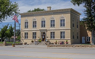
Lincoln Center, more commonly known as Lincoln, is a city in and the county seat of Lincoln County, Kansas, United States. As of the 2020 census, the population of the city was 1,171.

<span class="mw-page-title-main">Manhattan, Kansas</span> City in and county seat of Riley County, Kansas, United States

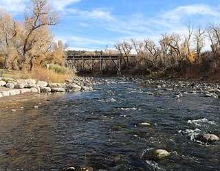
Manhattan is a city in and the county seat of Riley County, Kansas, U.S., although the city extends into Pottawatomie County. It is located in northeastern Kansas at the junction of the Kansas River and Big Blue River. As of the 2020 Census, the population of the city was 54,100.

Bovina is an unincorporated community in Lincoln County, Colorado, United States. The ZIP Code of Bovina (80818) is held at the Genoa Post Office.

<span class="mw-page-title-main">Limon Railroad Depot</span>

Limon Railroad Depot was a major Union Pacific and Chicago, Rock Island and Pacific Railroad station in Limon, Colorado. It has been on the National Register of Historic Places since 2003. It is included in what is now the Limon Heritage Museum and Railroad Park. It is one of seven still standing Rock Island Line stations in Colorado, and the only one restored.

References

  1. 1 2 "Active Colorado Municipalities". State of Colorado, Department of Local Affairs. Archived from the original on December 12, 2009. Retrieved September 1, 2007.
  2. "Colorado Municipal Incorporations". State of Colorado, Department of Personnel & Administration, Colorado State Archives. December 1, 2004. Retrieved September 2, 2007.
  3. "Town of Limon, Colorado - Officials/Staff". Town of Limon. Retrieved November 14, 2007.
  4. "2019 U.S. Gazetteer Files". Census.gov . United States Census Bureau. Retrieved July 1, 2020.
  5. 1 2 "US Board on Geographic Names". United States Geological Survey. October 25, 2007. Retrieved January 31, 2008.
  6. 1 2 United States Census Bureau. "Limon town; Colorado" . Retrieved April 22, 2023.
  7. "ZIP Code Lookup". United States Postal Service. Archived from the original (JavaScript/HTML) on November 4, 2010. Retrieved November 14, 2007.
  8. "BOY BURNED AT THE STAKE IN COLORADO; Terrible Vengeance on Negro Murderer by a Mob. REPORTERS ON THE SCENE Taken There to Send the News -- Wires Tapped for Them. Victim Killed Little Louise Frost on the Same Spot -- Her Father Applied the Torch -- Mob Very Orderly". The New York Times. November 17, 1900. Retrieved April 28, 2024.
  9. Colorado Tornadoes
  10. Gutierrez, Barry (May 25, 2013). "Rebirth after the big storm: How one small town dug out, spruced up and lived on". NBC News. Retrieved July 13, 2016.
  11. "Limon City Map" (PDF). Colorado Department of Transportation . Retrieved December 6, 2011.[ permanent dead link ]
  12. "Physiographic Provinces of Colorado". Colorado Geological Survey. Archived from the original on May 24, 2012. Retrieved December 6, 2011.
  13. "Colorado Travel Map" (PDF). Colorado Department of Transportation. Archived from the original (PDF) on May 30, 2012. Retrieved December 6, 2011.
  14. "City Distance Tool". Geobytes. Archived from the original on October 5, 2010. Retrieved December 6, 2011.
  15. "Colorado: 2000 - Population and Housing Counts" (PDF). United States Census Bureau. July 2003. p. 18. Retrieved December 6, 2011.
  16. 1 2 "U.S. Climate Normals Quick Access (1991–2020)". National Oceanic and Atmospheric Administration.
  17. 1 2 "NOAA Online Weather Data". National Weather Service. Retrieved August 9, 2022.
  18. "U.S. Climate Normals Quick Access (1981–2010)". National Oceanic and Atmospheric Administration.
  19. 1 2 3 "U.S. Census website". United States Census Bureau . Retrieved December 5, 2011.
  20. "Limon town, Colorado - Selected Economic Characteristics: 2005-2009". 2005-2009 American Community Survey 5-Year Estimates. United States Census Bureau. Archived from the original on February 16, 2020. Retrieved December 5, 2011.
  21. "Limon Leader". Mondo Times. Retrieved December 5, 2011.
  22. "AMQ AM Radio Database Query". Federal Communications Commission . Retrieved December 5, 2011.
  23. 1 2 "Radio Stations in Limon, Colorado". Radio-Locator. Retrieved December 5, 2011.
  24. "FMQ FM Radio Database Query". Federal Communications Commission . Retrieved December 5, 2011.
  25. "Frequencies". Radio Colorado College . Retrieved December 5, 2011.
  26. "CSN Stations". CSN International . Retrieved December 5, 2011.
  27. "Colorado TV Markets Map". EchoStar Knowledge Base. Archived from the original on July 4, 2014. Retrieved December 5, 2011.