Kimmswick, Missouri

Last updated

Kimmswick, Missouri
Kimmswick, MO.jpg
Jefferson County Missouri Incorporated and Unincorporated areas Kimmswick Highlighted.svg
Location of Kimmswick, Missouri
Coordinates: 38°21′56″N90°21′53″W / 38.36556°N 90.36472°W / 38.36556; -90.36472
Country United States
State Missouri
County Jefferson
Area
[1]
  Total0.24 sq mi (0.61 km2)
  Land0.23 sq mi (0.61 km2)
  Water0.00 sq mi (0.00 km2)
Elevation
[2]
407 ft (124 m)
Population
 (2020)
  Total133
  Density568.38/sq mi (219.71/km2)
Time zone UTC-6 (Central (CST))
  Summer (DST) UTC-5 (CDT)
ZIP code
63053
Area code 636
FIPS code 29-38684 [3]
GNIS feature ID2395533 [2]
Website cityofkimmswick.org

Kimmswick is a city in Jefferson County, Missouri, United States. The population was 157 at the 2010 census.

Contents

Geography

Kimmswick is next to the Mississippi River.

According to the United States Census Bureau, the city has a total area of 0.23 square miles (0.60 km2), all land. [4]

Nearby Imperial was once known as West Kimmswick. Today, Kimmswick is an enclave of Imperial.[ citation needed ]

History

Kimmswick was platted in 1859 by Theodore Kimm, who gave the town his last name. [5] [6] A post office called Kimmswick was established in 1858, and remains open. [7]

The Kimmswick Historic District and Windsor Harbor Road Bridge are listed on the National Register of Historic Places. [8]

Demographics

Historical population
CensusPop.Note
1890 182
1900 21216.5%
1910 23510.8%
1920 141−40.0%
1930 17222.0%
1940 1720.0%
1950 20720.3%
1960 30346.4%
1970 268−11.6%
1980 207−22.8%
1990 135−34.8%
2000 94−30.4%
2010 15767.0%
2020 133−15.3%
U.S. Decennial Census [9]

2010 census

As of the census [10] of 2010, there were 157 people, 56 households, and 41 families living in the city. The population density was 682.6 inhabitants per square mile (263.6/km2). There were 68 housing units at an average density of 295.7 per square mile (114.2/km2). The racial makeup of the city was 90.4% White, 1.3% African American, 6.4% Asian, and 1.9% from two or more races. Hispanic or Latino of any race were 1.3% of the population.

There were 56 households, of which 39.3% had children under the age of 18 living with them, 57.1% were married couples living together, 16.1% had a female householder with no husband present, and 26.8% were non-families. 23.2% of all households were made up of individuals, and 7.1% had someone living alone who was 65 years of age or older. The average household size was 2.80 and the average family size was 3.34.

The median age in the city was 32.5 years. 26.8% of residents were under the age of 18; 9.5% were between the ages of 18 and 24; 26.1% were from 25 to 44; 28.6% were from 45 to 64; and 8.9% were 65 years of age or older. The gender makeup of the city was 45.9% male and 54.1% female.

2000 census

As of the census [3] of 2000, there were 94 people, 35 households, and 24 families living in the city. The population density was 1,186.5 people per square mile (453.7/km2). There were 36 housing units at an average density of 454.4 per square mile (175.4/km2). The racial makeup of the city was 89.36% White, 1.06% African American, and 9.57% from two or more races.

There were 35 households, out of which 22.9% had children under the age of 18 living with them, 54.3% were married couples living together, 17.1% had a female householder with no husband present, and 28.6% were non-families. 25.7% of all households were made up of individuals, and 14.3% had someone living alone who was 65 years of age or older. The average household size was 2.69 and the average family size was 3.24.

In the city the population was spread out, with 21.3% under the age of 18, 10.6% from 18 to 24, 27.7% from 25 to 44, 17.0% from 45 to 64, and 23.4% who were 65 years of age or older. The median age was 40 years. For every 100 females there were 84.3 males. For every 100 females age 18 and over, there were 80.5 males.

The median income for a household in the city was $54,688, and the median income for a family was $66,250. Males had a median income of $44,250 versus $34,375 for females. The per capita income for the city was $23,359. There were 3.6% of families and 7.0% of the population living below the poverty line, including 8.3% of under eighteens and 21.4% of those over 64.

Apple Butter Festival

The Kimmswick Apple Butter Festival is an annual Fall celebration and the city's largest event with typically over 100,000 visitors attending. The streets are lined with 500 – 600 food, drink and craft vendors as well as live entertainment throughout the town including bluegrass, country rock, and dulcimer music. While there is some parking in the ballfields on Highway K as you enter the festival, visitors are encouraged to park at nearby Windsor High School where there will be buses running throughout the day shuttling visitors to-and-from the festival. The festival is scheduled each year at the end of October [11]

Education

Kimmswick is within the Windsor C-1 School District. [12]

Related Research Articles

<span class="mw-page-title-main">Hartsburg, Missouri</span> Village in Missouri, United States

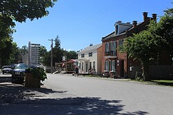
Hartsburg is a village in southern Boone County, Missouri, United States. It is part of the Columbia, Missouri Metropolitan Statistical Area. The population was 133 per the 2020 census.

<span class="mw-page-title-main">Harrisonville, Missouri</span> City in Missouri, United States

Harrisonville is a city in Cass County, Missouri, United States. The population was 10,121 at the 2020 census. It is the county seat of Cass County. It is part of the Kansas City metropolitan area.

<span class="mw-page-title-main">Kearney, Missouri</span> City in Missouri, United States

Kearney is a city in Clay County, Missouri, United States. The population per the 2020 U.S. Census was 10,404. The city was the birthplace of Jesse James, and there is an annual festival in the third weekend of September to recognize the outlaw. It is part of the Kansas City metropolitan area.

<span class="mw-page-title-main">Centertown, Missouri</span> Village in Missouri, United States

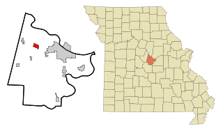
Centertown is a village in Cole County, Missouri, United States. The population was 284 at the 2020 census. It is part of the Jefferson City, Missouri Metropolitan Statistical Area.

<span class="mw-page-title-main">St. Martins, Missouri</span> City in Missouri, United States

St. Martins or Saint Martins is a city in Cole County, Missouri, United States. The population was 1,191 at the 2020 census. It is part of the Jefferson City, Missouri Metropolitan Statistical Area.

<span class="mw-page-title-main">Urbana, Missouri</span> City in Missouri, United States

Urbana is a city in Dallas County, Missouri, United States. The population was 414 at the 2010 census. It is part of the Springfield, Missouri Metropolitan Statistical Area.

<span class="mw-page-title-main">Barnhart, Missouri</span> CDP in Missouri, United States

Barnhart is a census-designated place (CDP) in Jefferson County, Missouri, United States. Barnhart is also a suburb of St. Louis.

<span class="mw-page-title-main">Byrnes Mill, Missouri</span> City in Missouri, United States

Byrnes Mill is a city in northern Jefferson County, Missouri, United States. The population was 3,173 at the 2020 census.

<span class="mw-page-title-main">Hillsboro, Missouri</span> City in Missouri, United States

Hillsboro is a city and county seat of Jefferson County, Missouri, United States. The population was 3,473 at the 2020 census, up from 2,821 in 2010.

<span class="mw-page-title-main">Imperial, Missouri</span> Census-designated place in Missouri, United States

Imperial is a census-designated place (CDP) in Jefferson County, Missouri, United States, and is a suburb of St. Louis. The population was 4,947 at the 2020 census. Imperial was originally known as West Kimmswick, the historic Catholic church of St. John’s in Imperial, became an independent parish in 1869.

<span class="mw-page-title-main">Pevely, Missouri</span> City in Missouri, United States

Pevely is a city in Jefferson County, Missouri, United States, and is also a suburb of St. Louis. The population was 6,107, at the 2020 United States Census.

<span class="mw-page-title-main">Linneus, Missouri</span> City in Missouri, United States

Linneus is a small city in Linn County, Missouri, United States. The population was 281 at the 2020 census. It is the county seat of Linn County.

<span class="mw-page-title-main">Marston, Missouri</span> City in Missouri, United States

Marston is a city in New Madrid County, Missouri, United States. The population was 503 at the 2010 census.

<span class="mw-page-title-main">Chamois, Missouri</span> City in Missouri, United States

Chamois is a city in Osage County, Missouri, United States. The population was 377 at the 2020 census. It is part of the Jefferson City, Missouri Metropolitan Statistical Area.

<span class="mw-page-title-main">Nelson, Missouri</span> City in Missouri, United States

Nelson is a city in Saline County, Missouri, United States. The population was 152 at the 2020 census.

<span class="mw-page-title-main">St. John, Missouri</span> City in Missouri, United States

St. John or Saint John is a city in St. Louis County, Missouri, United States, with its commercial district centered along St. Charles Rock Road. It is a few miles southeast of Lambert-St. Louis International Airport.

<span class="mw-page-title-main">St. Mary, Missouri</span> City in Missouri, United States

St. Mary is a city in Ste. Genevieve County, Missouri, United States. The population was 309 at the 2020 census.

<span class="mw-page-title-main">Merriam Woods, Missouri</span> City in Missouri, United States

Merriam Woods is a city in Taney County, Missouri, United States. The population was 2,006 at the 2020 census. It is part of the Branson, Missouri Micropolitan Statistical Area.

<span class="mw-page-title-main">Bland, Missouri</span> City in Missouri, United States

Bland is a city in Gasconade and Osage counties in the U.S. state of Missouri. The population was 506 at the 2020 census.

<span class="mw-page-title-main">Windsor, Missouri</span> City in Missouri, United States

Windsor is a city in Henry and Pettis counties, Missouri, United States. The population was 2,901 at the 2010 census.

References

  1. "ArcGIS REST Services Directory". United States Census Bureau. Retrieved August 28, 2022.
  2. 1 2 U.S. Geological Survey Geographic Names Information System: Kimmswick, Missouri
  3. 1 2 "U.S. Census website". United States Census Bureau . Retrieved January 31, 2008.
  4. "US Gazetteer files 2010". United States Census Bureau. Archived from the original on January 25, 2012. Retrieved July 8, 2012.
  5. "Jefferson County Place Names, 1928–1945 (archived)". The State Historical Society of Missouri. Archived from the original on June 24, 2016. Retrieved October 19, 2016.{{cite web}}: CS1 maint: bot: original URL status unknown (link)
  6. Eaton, David Wolfe (1916). How Missouri Counties, Towns and Streams Were Named. The State Historical Society of Missouri. p. 181.
  7. "Post Offices". Jim Forte Postal History. Retrieved October 19, 2016.
  8. "National Register Information System". National Register of Historic Places . National Park Service. July 9, 2010.
  9. "Census of Population and Housing". Census.gov. Retrieved June 4, 2015.
  10. "U.S. Census website". United States Census Bureau . Retrieved July 8, 2012.
  11. "https://gokimmswick.com/events/apple-butter-festival/
  12. "SCHOOL DISTRICT REFERENCE MAP (2010 CENSUS): Jefferson County, MO" (Archive). U.S. Census Bureau. Retrieved on June 13, 2014.