
Bloemfontein, also known as Bloem, is the capital and the largest city of the Free State province. It is often, and has been traditionally referred to as the country's "judicial capital", alongside the legislative capital Cape Town and administrative capital Pretoria, although the highest court in South Africa, the Constitutional Court has been in Johannesburg since 1994.
A townhouse, townhome, town house, or town home, is a type of terraced housing. A modern townhouse is often one with a small footprint on multiple floors. In a different British usage, the term originally referred to any type of city residence of someone whose main or largest residence was a country house.

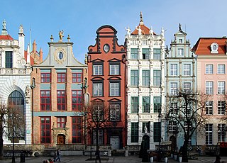
In architecture and city planning, a terrace or terraced house (UK) or townhouse (US) is a form of medium-density housing that originated in Europe in the 16th century, whereby a row of attached dwellings share side walls. In the United States and Canada they are also known as row houses or row homes, found in older cities such as Philadelphia, Baltimore, and Toronto.
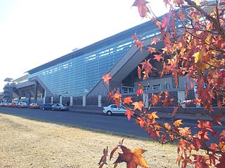
Centurion is an area with 236,580 inhabitants in the Gauteng Province of South Africa, between Pretoria and Midrand. Formerly an independent municipality, with its own town council, it has been part of the City of Tshwane Metropolitan Municipality since 2000. Its heart is at the intersection of the N1 and N14 freeways. The R21 freeway also passes through the eastern part of Centurion.
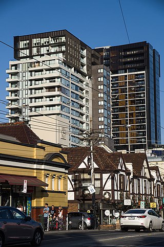
South Yarra is an inner-city suburb in Melbourne, Victoria, Australia, 4 km south-east of Melbourne's Central Business District, located within the Cities of Melbourne and Stonnington local government areas. South Yarra recorded a population of 25,028 at the 2021 census.
Sunninghill is a commercial and residential suburb of Johannesburg in Sandton South Africa. It is located in Region A of the City of Johannesburg Metropolitan Municipality. The N1 freeway, which at this area is eight lanes across, forms its southern boundary with access at Rivonia offramp. The K60 road runs through the centre of Sunninghill to assist in easing traffic. Sunninghill is bordered by the suburbs of Paulshof, Kyalami and Woodmead.

Lyneham is a suburb of Canberra, Australia in the North Canberra district. It is named after Sir William Lyne, premier of New South Wales from 1899 to 1901. The suburb name was gazetted in 1928, but development did not commence until 1958. The streets of Lyneham are named after artists and people associated with the development of early Canberra.

Parmelia is a southern suburb of Perth, Western Australia, located in the City of Kwinana.

Jindalee is a south-western residential suburb in the City of Brisbane, Queensland, Australia. In the 2016 census, Jindalee had a population of 5,320 people.

Punchbowl is a suburb south west of Sydney, 17 kilometres (11 mi) west of the Sydney central business district, in the local government area of the City of Canterbury-Bankstown, in the state of New South Wales, Australia. At the 2016 census, Punchbowl had a population of 20,236.

Gungahlin is a suburb in the Canberra, Australia district with the same name; Gungahlin. The postcode is 2912. Gungahlin is the name for the entire district, and also the town centre, but it is also the name of the suburb which Gungahlin Town Centre is in.

Bonython is a suburb of Tuggeranong, a township in southern Canberra, capital city of Australia.
Angle Park is a north-western suburb of Adelaide 10 km from the CBD, in the state of South Australia, Australia and falls under the City of Port Adelaide Enfield. It is adjacent to Wingfield, Mansfield Park, Ferryden Park, and Regency Park. The post code for Angle Park is 5010. It is bounded to the north by Grand Junction Road, west by Trafford Street, and to the east by Days Road and the North-South Motorway.
There are various neighbourhoods within the city of Charlottetown, Prince Edward Island.

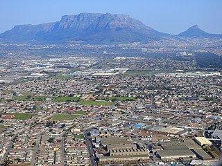
Constantia is an affluent suburb of Cape Town, South Africa, situated about 15 kilometres south of the centre of Cape Town. It is considered to be one of the most prestigious suburbs in South Africa. The Constantia Valley lies to the east of and at the foot of the Constantiaberg mountain. Constantia Nek is a low pass linking to Hout Bay in the west. Constantia is a beautiful family orientated place for families to grow, with the leafy canopies of trees and top schools.
Elermore Vale is a suburb on the western outskirts of Newcastle, New South Wales. Before becoming a residential suburb in the 1900s, the area was used for chicken farming, cattle farming, and coal mining. By the 1960s, the school and the other facilities of the suburb had been established.
Randpark Ridge is an upmarket suburb of Randburg, South Africa. It is located in the Randburg region of the City of Johannesburg. It fell into the town of Randburg during the apartheid era. Developed in the early 1980s and still relatively new, Randpark Ridge is bordered by several other suburbs including Weltevreden Park, Sundowner, Boskruin, Bromhof, Honeydew and Fairland. It is located on the north-west extremity of Johannesburg.
Elsie's River is a suburb of Cape Town, South Africa.
Seaford is a metropolitan suburb of Adelaide, South Australia. It lies within the City of Onkaparinga. Seaford railway station is the southern terminus of the Seaford railway line from Adelaide railway station.
Ashley Walters is a South African-born and based artist who works with photography and film.


