This article needs additional citations for verification .(March 2024) |
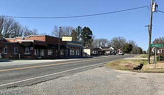
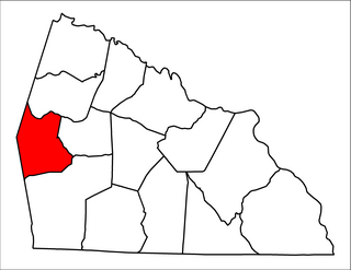
Ulah is an unincorporated community in Randolph County, North Carolina, United States. [1] south of the neighboring county seat of Asheboro.
This article needs additional citations for verification .(March 2024) |
Ulah is an unincorporated community in Randolph County, North Carolina, United States. [1] south of the neighboring county seat of Asheboro.
Ulah has, for most of its existence, been a little known community. The origin of the name Ulah may refer to Ulaid, a Gaelic over-kingdom in north-eastern Ireland during the Middle Ages. Ulaid gave its name to the province of Ulster where many settlers of North-Western Piedmont backcountry frontier came from via the Great Wagon road from Pennsylvania. [2] Ulah hosted a station and a crew section house for the Aberdeen & Asheboro Railroad. Trains continued to run through Ulah until the line was abandoned in 1952. The section house, built in 1897, can be seen next to US 220 alternate near station road. It has a commemorative plaque denoting its heritage.
The Ulah area is home to many people who work in Asheboro.
There has been talk about incorporating Ulah. The area is densely populated. If incorporated, Ulah would possibly be a tough competitor for Trinity in the title of second most populated city in Randolph County.
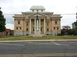
Randolph County is a county located in the U.S. state of North Carolina. As of the 2020 census, the population was 144,171. Its county seat is Asheboro.

Asheboro is a city in and the county seat of Randolph County, North Carolina, United States. The population was 27,156 at the 2020 census. It is part of the Greensboro–High Point Metropolitan Area of the Piedmont Triad and is home of the state-owned North Carolina Zoo.

The Piedmont Triad is a metropolitan region in the north-central part of the U.S. state of North Carolina anchored by three cities: Greensboro, Winston-Salem, and High Point. This close group of cities lies in the Piedmont geographical region of the United States and forms the basis of the Greensboro–Winston-Salem–High Point, NC Combined Statistical Area. As of 2012, the Piedmont Triad has an estimated population of 1,611,243 making it the 33rd largest combined statistical area in the United States.
WKRR is a commercial radio station licensed to serve Asheboro, North Carolina in the Piedmont Triad radio market. It broadcasts a classic rock radio format, branded as Rock 92, and is the Triad's affiliate for the Carolina Panthers Radio Network. WKRR is owned by Dick Broadcasting, along with WKZL 107.5 KZL in Winston-Salem. Both stations broadcast from studios and offices on East Lewis Street in Greensboro. The transmitter is off Island Ford Road in Randleman, North Carolina.
The Caraway Mountains are a mountain range located in western Randolph County and a section of eastern Davidson County, North Carolina. The mountains are located between the cities of Asheboro and Lexington and are bisected by US Highway 64. The mountains are known for their rugged and steep terrain and rise to over 1,000 feet (300 m). Typically the Caraways are said to be a part of the Uwharrie Mountains and make up the northern extent of this range. They extend from roughly south of High Point and transition into the Uwharries, stretching roughly 30 miles (48 km). The range is only about 10 miles (16 km) wide. The range takes its name from Caraway Creek, which was named after a Native American tribe that lived in the area before European settlement. The area was once a highly used Indian trading area and many early settlers noted that the Indian trading paths tended to "disappear" into the mountains. Prominent peaks in the area are Caraway Mountain, Back Creek Mountain, Daves Mountain, Ridges Mountain, and Mount Shepherd, the latter at 1,150 feet (350 m) being the highest point in Randolph County. Its foothills are in Chatham County.

North Carolina Highway 49 (NC 49) is a 177.8-mile primary state highway in the U.S. state of North Carolina. It traverses much of the Piedmont region, connecting the cities of Charlotte, Asheboro, and Burlington.
The Old North State Council (ONSC) is a local council of the Boy Scouts of America that serves the eastern and southern portions of the Piedmont Triad region of North Carolina. The council is headquartered at the Royce Reynolds Family Scout Office in Greensboro, North Carolina and operates four camps; one of which is outside the council boundaries. The ONSC represents Boy Scouting in Davie, Davidson, Randolph, Guilford, Alamance, Rockingham, Caswell, and Person counties of North Carolina. The council's name is derived from the state's official song, The Old North State.
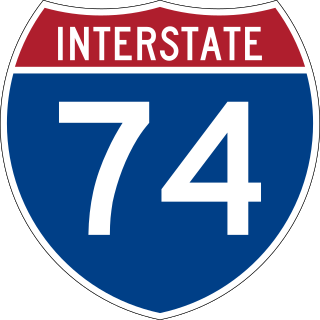
Interstate 74 (I-74) is a partially completed part of the Interstate Highway System that is planned to run from Davenport, Iowa, to Myrtle Beach, South Carolina. In the US state of North Carolina, I-74 currently exists in three distinct segments; from I-77 at the Virginia state line to US Highway 52 (US 52) near Mount Airy, from I-40 in Winston-Salem to US 220 near Ellerbe, and from US 74 and US 74 Business near Maxton to US 74/North Carolina Highway 41 (NC 41) near Lumberton. I-74 has an extensive concurrency with I-73 from Randleman to Ellerbe in the Piedmont. When completed, I-74 will link the cities of Mount Airy, Winston-Salem, High Point, Rockingham, Laurinburg, and Lumberton.
Bennett is a town in Chatham County, North Carolina, United States.
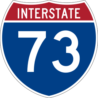
Interstate 73 (I-73) is a partially completed Interstate Highway in the US state of North Carolina, traversing the state from south of Ellerbe to near Summerfield through Asheboro and Greensboro. When completed, it will continue south toward Myrtle Beach, South Carolina, and north to Price, North Carolina at the Virginia-North Carolina border.
Mount Ulla Township is one of fourteen townships in Rowan County, North Carolina, United States. It is currently the smallest township in Rowan County by population.

Coleridge is an unincorporated community along the Deep River in Randolph County, North Carolina, United States. It lies near Ramseur and southeast of Greensboro. Major roads through the town are Highway 22, which is joined in the middle by Highway 42, which then travels to Bennett.This community was named for James A. Cole, a local merchant. It is in the Eastern Standard Time zone UTC-5. The elevation is 436 feet. Former and merged names include Foust's Mill.

U.S. Route 220 is a north–south U.S. highway which travels from Rockingham, North Carolina, to South Waverly, Pennsylvania. In the U.S. state of North Carolina, US 220 travels 123.4 miles (198.6 km) from an intersection with US 1 in Rockingham to the Virginia state line near Price, North Carolina. The highway is an important north–south route in Central North Carolina, connecting Rockingham, Asheboro, Greensboro, and Summerfield. US 220 runs concurrently with Interstate 73 from north of Rockingham to Greensboro, and from Summerfield to Stokesdale; while US 220 runs concurrently with I-74 from Rockingham to Randleman.
Steeds is an unincorporated community located in the northeastern part of Montgomery County, North Carolina, United States.
Black Ankle is an unincorporated community in the northeastern part of Montgomery County, North Carolina, United States.
Randolph Community College is a public community college in Randolph County, North Carolina. It is part of the North Carolina Community College System.
Kiamichi is a former community in northern Pushmataha County, Oklahoma, United States. It is six miles east of Tuskahoma.
Several special routes of U.S. Route 220 exist. In order from south to north they are as follows.
Randolph Early College High School is a non-traditional public high school in Randolph County, North Carolina, United States. It is located on the campus of Randolph Community College and is part of the Randolph County School System, based in Asheboro, North Carolina. Founded in 2005, RECHS requires dual enrollment at Randolph Community College as students pursue an Associate Degree. Students who are economically disadvantaged or belong to a racial minority are targeted by the school for enrollment. Extracurricular activities are limited and typically student-led due to the small student body and limited staff.
The Courier-Tribune is the daily newspaper of Asheboro, North Carolina and the surrounding county of Randolph County, North Carolina. It has been published daily, except Saturday, since 1978.
35°38′07″N79°49′36″W / 35.63528°N 79.82667°W
Municipalities and communities of Randolph County, North Carolina, United States | ||
|---|---|---|
| Cities |  | |
| Towns | ||
| Unincorporated communities | ||
| Footnotes | ‡This populated place also has portions in an adjacent county or counties | |