
South Africa occupies the southern tip of Africa, its coastline stretching more than 2,850 kilometres from the desert border with Namibia on the Atlantic (western) coast southwards around the tip of Africa and then northeast to the border with Mozambique on the Indian (eastern) coast. The low-lying coastal zone is narrow for much of that distance, soon giving way to a mountainous escarpment that separates the coast from the high inland plateau. In some places, notably the province of KwaZulu-Natal in the east, a greater distance separates the coast from the escarpment. Although much of the country is classified as semi-arid, it has considerable variation in climate as well as topography. The total land area is 1,220,813 km2 (471,359 sq mi). It has the 23rd largest Exclusive Economic Zone of 1,535,538 km2 (592,875 sq mi).

KwaZulu-Natal is a province of South Africa that was created in 1994 when the Zulu bantustan of KwaZulu and Natal Province were merged. It is located in the southeast of the country, with a long shoreline on the Indian Ocean and sharing borders with three other provinces and the countries of Mozambique, Eswatini and Lesotho. Its capital is Pietermaritzburg, and its largest city is Durban. It is the second-most populous province in South Africa, with slightly fewer residents than Gauteng.
KwaDukuza, previously known as Stanger, is a city in KwaZulu-Natal, South Africa. In 2006, the municipal name was changed to KwaDukuza, but the Zulu people in the area called it "Dukuza" well before then.

Margate is a coastal resort town in the KwaZulu-Natal province, about 20 kilometres south-west of Port Shepstone and 127 kilometres south-west of Durban. The river which flows into the sea at Margate is called "Nkhongweni" (place of entreaty) as the original inhabitants of the area were reputed to be so mean resulting
Port Edward is a small resort town situated on the south coast of KwaZulu-Natal in South Africa and lies on the border between KwaZulu-Natal and the Eastern Cape. It is situated on the R61 road between Port Shepstone and Lusikisiki.

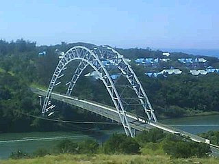
The Umgeni River or Mgeni River is a river in KwaZulu-Natal, South Africa. It rises in the "Dargle" in the KZN Midlands, and its mouth is at Durban, some distance north of Durban's natural harbour. It is generally agreed its name means "the river of entrance" in Zulu, though other meanings have been suggested.

The Mzimkulu River is a river in South Africa. In the past, the Mzimkulu formed part of the border between Eastern Cape and KwaZulu-Natal provinces. Presently this river is part of the Mvoti to Umzimkulu Water Management Area. In late February of every year, the river is host to one of South Africa's most popular canoe races, the Drak Challenge.
Cedarville is a town in the Alfred Nzo District Municipality of Eastern Cape, South Africa.

Matatiele Municipality is a local municipality within the Alfred Nzo District Municipality, in the Eastern Cape province of South Africa. It adjoins Lesotho to the north, Elundini to the south-west, and Greater Kokstad to the east and its 4,352 km² makes the Matatiele Municipality largest of four municipalities in the district at almost half of its geographical area. According to the South African National Census of 2011, its 203,483 residents and 49,527 households makes Matatiele Municipality the second largest populated area in the Alfred Nzo District Municipality behind Mbizana.

Umzimkhulu Municipality is a local municipality within the Harry Gwala District Municipality, in the KwaZulu-Natal province of South Africa. Umzimkhulu is an isiXhosa and isiZulu word meaning "big/great house". Prior to the Twelfth Amendment of the Constitution of South Africa in 2005, confirmed by the Thirteenth in 2007, it was part of the Eastern Cape.

Greater Kokstad Municipality is a local municipality within the Harry Gwala District Municipality, in the KwaZulu-Natal province of South Africa. Kokstad is derived from Dutch, meaning "town of Kok". It was named after Adam Kok III.

The Twelfth Amendment of the Constitution of South Africa altered the boundaries of seven of South Africa's nine provinces. It also redefined all of the provinces' geographical areas in terms of the areas of district and metropolitan municipalities, and repealed the provisions introduced by the Third Amendment that allowed municipal areas to cross provincial boundaries. A number of the boundary changes were highly controversial and led to popular protest and court challenges.
Bisi is a town in Umzimkhulu Local Municipality in the KwaZulu-Natal province of South Africa.
Marburg is a settlement in the Ugu District Municipality in the KwaZulu-Natal province of South Africa, situated approximately 112 kilometres south-west of the city of Durban. Marburg was a Norwegian settlement given the name Marburg for a nearby German mission. The Norwegian founders played a significant role in the development of Marburg and Port Shepstone, which it forms part of today. The British colonial government gave the settlers a free voyage to South Africa and also houses and 100 acres of land. Marburg was the only successful Scandinavian settlement in South Africa.
Impendle is a town in Umgungundlovu District Municipality in the KwaZulu-Natal province of South Africa.
Mpumalanga, also widely known as Hammarsdale, is a township located in the eThekwini Metropolitan Municipality in the KwaZulu-Natal province of South Africa. It is situated some 10 km south-south-east of Cato Ridge and some 50 km west of Durban. Derived from Zulu, the name means 'sunrise', 'the sun comes out'.
St Faith’s is a village in the Umzumbe Local Municipality in the KwaZulu-Natal province of South Africa.

KwaZulu-Natal South Coast is a region along the southern stretch of coastline of KwaZulu-Natal, South Africa, south of the coastal city of Durban.
The 2019–20 CSA Provincial T20 Cup was a domestic Twenty cricket tournament that took place in South Africa in September 2019, as a curtain-raiser to the 2019–20 South African domestic season. It was played between the thirteen South African provincial teams, along with Limpopo and Mpumalanga. This was the sixth edition of the CSA Provincial T20 Cup, which was last played in the 2015–16 season. With only domestic teams from South Africa taking part, the tournament returned in place of the Africa T20 Cup, which had been held since 2015.
Before 1994, South Africa had only four provinces: Cape Province, Natal Province, Orange Free State and Transvaal. Each province had its own identifying lettering: Cape – C, Natal – N, Orange Free State – O and Transvaal – T.


