History
Aboriginal period
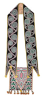
A branch of the Creek (Muscogian) people living on the boundary of the Chattahoochee and Cherokee lands existed since the 15th century in this area hunting local deer and farming maize, peas, squash, the polk plant and other items. They lived in wood cabins known as lodges which were filled with clay. Early settlers were taught to subsist in the Muscogian manner and to survive the winter using local herbs and plants. They were peaceful farmers who subsisted well with their neighbors.
In 1521, the vicinity was likely visited by Spanish Explorer Juan Ponce de León in his travels looking for both gold and the fountain of youth. He traveled to modern day Atlanta up the Indian Sandtown Trail, today's Cascade Road.
Colonial period
At the time of the American Revolution the Muscogee (Creek) people maintained peaceful relations with the white settlers to the south who were fighting the British Army. In return in 1789 they were granted a treaty from the United States Senate ostensibly guaranteeing the sanctity of their lands.
In 1816 a South Carolina Missionary from the Methodist Church named Gilbert ministered to the local Indians at the village of Utoy.
In 1821 the US Government forcibly moved the local Creek Indians to Oklahoma on what is referred to as the so-called Trail of Tears.
In 1822 the First US Post Office was established here the first in Dekalb at the former site of the Utoy Trading Post.
The first settlers in the Atlanta area settled here as the lands had already been cleared and were ready for immediate farming. Existing trails, taking the form today of Sandtown Road, provided a major trading path that developed trade into the new county seat of Decatur from the Chattahoochee River.
Civil War period
- Full article: Battle of Utoy Creek
In 1864 the town of Utoy was visited by US Forces moving to break the railroads at East Point. August 267th 1864 the Entire US Army moved down the Fairburn Road in the vicinity of the town of Utoy en route to Shadnar Church (Red Oak) to cut the West Point Railroad bringing supplies to the Confederate Army.
Post-war years
In 1933 the postal function was moved to Adamsville (The former village of Lick Skillet, named for the "Lickskillet Pub") and the Utoy post office was closed.
In the 1950s the area became one of the most affluent suburbs of Atlanta with many prominent citizens residing here in Cascade heights. The housing boom with US Army veterans purchasing homes utilizing the VA Housing Guarantee caused great expansion of the former farmlands
In 1975 the area became predominantly African American 85% and still maintained as one of Atlanta's affluent suburbs. Former Mayor Andrew Young, Shirley Franklin, Hank Aaron and the first president of the Savannah College of Art and Design are all from the area.
The Muscogee, also known as the Mvskoke, Muscogee Creek, and the Muscogee Creek Confederacy in the Muscogee language, are a group of related indigenous peoples of the Southeastern Woodlands in the United States of America. Their original homelands are in what now comprises southern Tennessee, much of Alabama, western Georgia and parts of northern Florida.
Fulton County is located in the north-central portion of the U.S. state of Georgia. As of the 2020 United States census, the population was 1,066,710, making it the state's most-populous county and its only one with over 1 million inhabitants. Its county seat is Atlanta, the state capital. Approximately 90% of the City of Atlanta is within Fulton County; the other 10% lies within DeKalb County. Fulton County is part of the Atlanta-Sandy Springs-Roswell, GA Metropolitan Statistical Area.

Dallas is a city in, and the county seat of, Paulding County, Georgia, United States. The estimated population, as of 2010, was 11,544. Dallas is a northwestern suburb of Atlanta, located approximately 38 miles (61 km) from the downtown area. It was named for George M. Dallas, Vice President of the United States, under James K. Polk.

The Chattahoochee River forms the southern half of the Alabama and Georgia border, as well as a portion of the Florida - Georgia border. It is a tributary of the Apalachicola River, a relatively short river formed by the confluence of the Chattahoochee and Flint rivers and emptying from Florida into Apalachicola Bay in the Gulf of Mexico. The Chattahoochee River is about 430 miles (690 km) long. The Chattahoochee, Flint, and Apalachicola rivers together make up the Apalachicola–Chattahoochee–Flint River Basin. The Chattahoochee makes up the largest part of the ACF's drainage basin.

The American Indian Wars, also known as the American Frontier Wars, the First Nations Wars in Canada, and the Indian Wars, were fought by European governments and colonists, and later by the United States and Canadian governments and American and Canadian settlers, against various American Indian and First Nation tribes. These conflicts occurred in North America from the time of the earliest colonial settlements in the 17th century until the early 20th century. The various wars resulted from a wide variety of factors. The European powers and their colonies also enlisted allied Indian tribes to help them conduct warfare against each other's colonial settlements. After the American Revolution, many conflicts were local to specific states or regions and frequently involved disputes over land use; some entailed cycles of violent reprisal.

The Atlanta campaign was a series of battles fought in the Western Theater of the American Civil War throughout northwest Georgia and the area around Atlanta during the summer of 1864. Union Maj. Gen. William Tecumseh Sherman invaded Georgia from the vicinity of Chattanooga, Tennessee, beginning in May 1864, opposed by the Confederate general Joseph E. Johnston.
East Atlanta is a neighborhood on the east side of Atlanta, Georgia, United States The name East Atlanta Village primarily refers to the neighborhood's commercial district.
Standing Peachtree was a Creek Indian village and the closest Indian settlement to what is now the Buckhead area of Atlanta, Georgia. It was located where Peachtree Creek flows into the Chattahoochee River, in today's Paces neighborhood. It was located in the borderlands of the Cherokee and Creek nations. It is referred to in several documents dating as far back as 1762.
The Battle of Utoy Creek was fought August 4–7, 1864, during the Atlanta Campaign of the American Civil War. Maj. Gen. William T. Sherman's Union armies had partially encircled the city of Atlanta, Georgia, which was being held by Confederate forces under the command of General John Bell Hood. Sherman had at this point adopted a strategy of attacking the railroad lines into Atlanta, hoping to cut off his enemies' supplies. This was the third direct attack on Confederate positions during the campaign and the effect of success would have ended the siege and won Atlanta on 6 August 1864.
Sandtown is a neighborhood located southwest of Atlanta, Georgia.
There were several historic mills around the metro Atlanta area, for which many of its current-day roads are still named. Most of the mills date back to the 1820s and 1830s, and were built along the area's many streams. The locations of many of these mills are shown on a map of 1875 showing U. S. military operations around Atlanta in 1864. This map is now located in the U. S. Library of Congress but can be seen on the webpage linked here.
Historic ferries operated on rivers around Atlanta, Georgia area, and became namesakes for numerous current-day roads in north Georgia. Most of the ferries date to the early years of European-American settlement in the 1820s and 1830s, when Cherokee and other Native Americans still occupied part of what became Georgia.

Sope Creek is an 11.6-mile-long (18.7 km) stream located in Cobb County, Georgia, United States. It is a significant tributary of the Chattahoochee River. It was known as Soap Creek during the 19th century. A section of Sope Creek runs through the Chattahoochee River National Recreation Area.

Cascade Heights is an affluent neighborhood in southwest Atlanta. It is bisected by Cascade Road, which was known as the Sandtown Road in the nineteenth century. The road follows the path of the ancient Sandtown Trail which ran from Stone Mountain to the Creek village of Sandtown on the Chattahoochee and from there on into Alabama. Ironically, the name lived on even after the Indians were expelled in the 1830s.
The Rogue River Wars were an armed conflict in 1855–1856 between the U.S. Army, local militias and volunteers, and the Native American tribes commonly grouped under the designation of Rogue River Indians, in the Rogue River Valley area of what today is southern Oregon. The conflict designation usually includes only the hostilities that took place during 1855–1856, but there had been numerous previous skirmishes, as early as the 1830s, between European-American settlers and the Native Americans, over territory and resources.
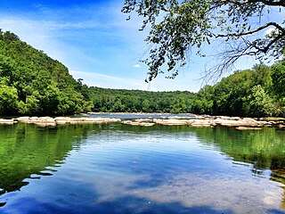
Chattahoochee River National Recreation Area (CRNRA) preserves a series of sites between Atlanta and Lake Sidney Lanier along the Chattahoochee River in Georgia, U.S. The 48-mile (77 km) stretch of the river affords public recreation opportunities and access to historic sites. The national recreation area, a National Park Service unit, was established on August 15, 1978, by President Jimmy Carter.
The Cascade Mansion is the name of an antebellum home built in south west Atlanta, Georgia, south of the Sandtown built by Dr. William Poole and Elizabeth Gilbert Poole, son in law of the first physician Dr. William Gilbert in Fulton County, Georgia. The home was begun in construction in 1860 and was incorrectly identified by soldiers of the US XXIII Army Corps during the siege of Atlanta as the "Head House." The home served briefly as the Headquarters of Confederate Major General William B. Bate, attached to S.D Lee's Corps during the Battle of Utoy Creek, August 1–7, 1864. The home and grounds served as a US Army Hospital during the Siege of Atlanta for the XXIII and later XIV Corps in August 1864. The home is of the antebellum style on the former East Point Road in Atlanta. The interior was finished in the Victorian style in 1869–70.
Connolly's Grist and Saw Mills were formerly located at East Point, Georgia.
Uptoi Indian village is located in Columbus, Georgia.