Venango, Nebraska

Last updated

Venango, Nebraska
Venango, Nebraska downtown 5.JPG
Downtown Venango: Pennsylvania Avenue
Perkins County Nebraska Incorporated and Unincorporated areas Venango Highlighted.svg
Location of Venango, Nebraska
Coordinates: 40°45′49″N102°02′39″W / 40.76361°N 102.04417°W / 40.76361; -102.04417
Country United States
State Nebraska
County Perkins
Area
[1]
  Total0.76 sq mi (1.96 km2)
  Land0.76 sq mi (1.96 km2)
  Water0.00 sq mi (0.00 km2)
Elevation
[2]
3,593 ft (1,095 m)
Population
 (2020)
  Total157
  Density207.40/sq mi (80.03/km2)
Time zone UTC-7 (Mountain (MST))
  Summer (DST) UTC-6 (MDT)
ZIP code
69168
Area code 308
FIPS code 31-50230 [3]
GNIS feature ID2400051 [2]

Venango is a village in Perkins County, Nebraska, United States. The population was 157 at the 2020 U.S. census. [4]

Contents

History

Venango was platted in 1887 when the railroad was extended to that point. [5] It was likely named after Venango County, Pennsylvania. [6]

Geography

According to the United States Census Bureau, the village has a total area of 0.25 square miles (0.65 km2), all land. [7]

Demographics

Historical population
CensusPop.Note
1920 285
1930 2860.4%
1940 214−25.2%
1950 2338.9%
1960 227−2.6%
1970 218−4.0%
1980 2305.5%
1990 192−16.5%
2000 175−8.9%
2010 164−6.3%
2020 157−4.3%
U.S. Decennial Census [8]
2020 [4]

2010 census

As of the census [9] of 2010, there were 164 people, 74 households, and 52 families residing in the village. The population density was 656.0 inhabitants per square mile (253.3/km2). There were 89 housing units at an average density of 356.0 per square mile (137.5/km2). The racial makeup of the village was 93.3% White, 0.6% Native American, and 6.1% from other races. Hispanic or Latino of any race were 9.8% of the population.

There were 74 households, of which 20.3% had children under the age of 18 living with them, 62.2% were married couples living together, 4.1% had a female householder with no husband present, 4.1% had a male householder with no wife present, and 29.7% were non-families. 25.7% of all households were made up of individuals, and 10.9% had someone living alone who was 65 years of age or older. The average household size was 2.22 and the average family size was 2.54.

The median age in the village was 49.7 years. 17.7% of residents were under the age of 18; 8.5% were between the ages of 18 and 24; 16.4% were from 25 to 44; 32.9% were from 45 to 64; and 24.4% were 65 years of age or older. The gender makeup of the village was 51.2% male and 48.8% female.

2000 census

As of the census [3] of 2000, there were 175 people, 68 households, and 51 families residing in the village. The population density was 706.8 inhabitants per square mile (272.9/km2). There were 85 housing units at an average density of 343.3 per square mile (132.5/km2). The racial makeup of the village was 94.86% White, 5.14% from other races. Hispanic or Latino of any race were 10.29% of the population.

There were 68 households, out of which 29.4% had children under the age of 18 living with them, 69.1% were married couples living together, 4.4% had a female householder with no husband present, and 25.0% were non-families. 22.1% of all households were made up of individuals, and 8.8% had someone living alone who was 65 years of age or older. The average household size was 2.57 and the average family size was 3.00.

In the village, the population was spread out, with 28.0% under the age of 18, 5.7% from 18 to 24, 21.1% from 25 to 44, 33.7% from 45 to 64, and 11.4% who were 65 years of age or older. The median age was 40 years. For every 100 females, there were 105.9 males. For every 100 females age 18 and over, there were 93.8 males.

As of 2000 the median income for a household in the village was $24,444, and the median income for a family was $29,688. Males had a median income of $23,125 versus $18,750 for females. The per capita income for the village was $12,281. About 15.7% of families and 21.8% of the population were below the poverty line, including 30.2% of those under the age of eighteen and 8.0% of those 65 or over.

Related Research Articles

<span class="mw-page-title-main">Amherst, Nebraska</span> Village in Nebraska, United States

Amherst is a village in Buffalo County, Nebraska, United States. It is part of the Kearney, Nebraska Micropolitan Statistical Area. The population was 248 at the 2010 census.

<span class="mw-page-title-main">Cedar Creek, Nebraska</span> Village in Nebraska, United States

Cedar Creek is a village in Cass County, Nebraska, United States. The population was 465 at the 2020 census.

<span class="mw-page-title-main">Eagle, Nebraska</span> Village in Nebraska, United States

Eagle is a village in southwest Cass County, Nebraska, United States. As of the 2020 census, the village population was 1,065.

<span class="mw-page-title-main">Elmwood, Nebraska</span> Village in Nebraska, United States

Elmwood is a village in southeast Cass County, Nebraska, United States. The population was 654 at the 2020 census.

<span class="mw-page-title-main">Greenwood, Nebraska</span> Village in Nebraska, United States

Greenwood is a village in northwest Cass County, Nebraska, United States. The population was 595 at the 2020 census.

<span class="mw-page-title-main">South Bend, Nebraska</span> Village in Nebraska, United States

South Bend is a village in Cass County, Nebraska, United States. The population was 92 at the 2020 census. The main landmark is a pedestrian bridge across the Platte River which leads to Schramm Park State Recreation Area. It was built in 2004 on the pillars of the abandoned Rock Island Railroad bridge. Thirty-five trains a day—most of them coal trains—still pass through the area on the BNSF Railway main.

<span class="mw-page-title-main">Boys Town, Nebraska</span> Village in Douglas County, Nebraska, United States

Boys Town is a village in Douglas County, Nebraska, United States. The population was 410 at the 2020 census. Boys Town is an enclave and a suburb of Omaha.

<span class="mw-page-title-main">Waterloo, Nebraska</span> Village in Douglas County, Nebraska, United States

Waterloo is a village in Douglas County, Nebraska, United States. The population was 935 at the 2020 census.

<span class="mw-page-title-main">Page, Nebraska</span> Village in Holt County, Nebraska, United States

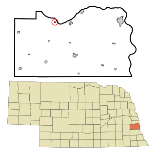
Page is a village in Holt County, Nebraska, United States. The population was 166 at the 2010 census.

<span class="mw-page-title-main">Stuart, Nebraska</span> Village in Nebraska, United States

Stuart is a village in Holt County, Nebraska, United States. The population was 590 at the 2010 census.

<span class="mw-page-title-main">Springview, Nebraska</span> Village in Nebraska, United States

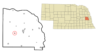
Springview is a village in, and the county seat of, Keya Paha County, Nebraska, United States. The population was 242 at the 2010 census.

<span class="mw-page-title-main">Stapleton, Nebraska</span> Village in and county seat of Logan County, Nebraska, United States

Stapleton is a village in and the county seat of Logan County, Nebraska, United States. The population was 267 at the 2020 census.

<span class="mw-page-title-main">Ithaca, Nebraska</span> Village in Saunders County, Nebraska, United States

Ithaca is a village in Saunders County, Nebraska, United States. The population was 160 at the 2020 census.

<span class="mw-page-title-main">Malmo, Nebraska</span> Village in Saunders County, Nebraska, United States

Malmo is a village in Saunders County, Nebraska, United States. The population was 94 at the 2020 census.

<span class="mw-page-title-main">Memphis, Nebraska</span> Village in Nebraska, United States

Memphis is a village in Saunders County, Nebraska, United States. The population was 109 at the 2020 census.

<span class="mw-page-title-main">Morse Bluff, Nebraska</span> Village in Saunders County, Nebraska, United States

Morse Bluff is a village in Saunders County, Nebraska, United States. The population was 117 at the 2020 census.

<span class="mw-page-title-main">Weston, Nebraska</span> Village in Saunder County, Nebraska, United States

Weston is a village in Saunders County, Nebraska, United States. The population was 250 at the 2020 census.

<span class="mw-page-title-main">Herman, Nebraska</span> Village in Washington County, Nebraska, United States

Herman is a village in Washington County, Nebraska, United States. The population was 268 at the 2010 census.

<span class="mw-page-title-main">Washington, Nebraska</span> Village in Washington County, Nebraska, United States

Washington is a village in Washington County, Nebraska, United States. The population was 150 at the 2010 census.

<span class="mw-page-title-main">Bartlett, Nebraska</span> Village in and county seat of Wheeler County, Nebraska, United States

Bartlett is a village in, and the county seat of, Wheeler County, Nebraska, United States. The population was 117 at the 2010 census.

References

  1. "ArcGIS REST Services Directory". United States Census Bureau. Retrieved September 18, 2022.
  2. 1 2 U.S. Geological Survey Geographic Names Information System: Venango, Nebraska
  3. 1 2 "U.S. Census website". United States Census Bureau . Retrieved January 31, 2008.
  4. 1 2 "Venango village, Nebraska". United States Census Bureau. Retrieved July 7, 2022.
  5. "Venango, Perkins County". Center for Advanced Land Management Information Technologies. University of Nebraska. Retrieved August 21, 2014.
  6. Fitzpatrick, Lillian L. (1960). Nebraska Place-Names. University of Nebraska Press. p. 112. ISBN   0-8032-5060-6. A 1925 edition is available for download at University of Nebraska—Lincoln Digital Commons.
  7. "US Gazetteer files 2010". United States Census Bureau. Archived from the original on July 2, 2012. Retrieved June 24, 2012.
  8. "Census of Population and Housing". Census.gov. Retrieved June 4, 2015.
  9. "U.S. Census website". United States Census Bureau . Retrieved June 24, 2012.