
St. Cloud Regional Airport is a public-use airport in Sherburne County, Minnesota, United States, and owned by the St. Cloud Regional Airport Authority. It is located four nautical miles east of the central business district of the City of St.Cloud The airport serves private, commercial, corporate, cargo and military operations. Mostly used for general aviation, it is also served by commercial airlines.

Anniston Regional Airport, formerly known as Anniston Metropolitan Airport, is a city-owned public-use airport located five nautical miles southwest of the central business district of Anniston, a city in Calhoun County, Alabama, United States. It is included in the National Plan of Integrated Airport Systems for 2011–2015, which categorized it as a general aviation airport.
Lancaster Regional Airport is two miles south of Lancaster, in Dallas County, Texas. Formerly Lancaster Airport, the National Plan of Integrated Airport Systems for 2011–2015 categorized it as a general aviation reliever airport.
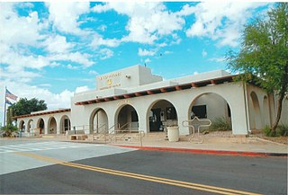
Phoenix Deer Valley Airport is a public airport 17 miles north of Phoenix, in Maricopa County, Arizona, United States. It is owned by the City of Phoenix. The FAA's National Plan of Integrated Airport Systems for 2009–2013 categorized it as a reliever airport for Phoenix Sky Harbor International Airport.
Iowa City Municipal Airport, is two miles southwest of downtown Iowa City, in Johnson County, Iowa. It is the oldest civil airport west of the Mississippi River still in its original location.
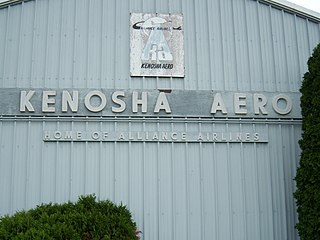
Kenosha Regional Airport is a city-owned public-use airport located four nautical miles (7 km) west of the central business district of Kenosha, a city in Kenosha County, Wisconsin, United States.

Southern Illinois Airport is a public airport in Jackson County, Illinois, United States. It is located three nautical miles (6 km) northwest of the central business district of Carbondale and east of Murphysboro. This airport is included in the FAA's National Plan of Integrated Airport Systems for 2015–2019, which categorized it as a general aviation facility.
Coles County Memorial Airport is between Mattoon and Charleston in Coles County, Illinois. Owned by the Coles County Airport Authority, it is five miles east of Mattoon and six miles west of Charleston. The National Plan of Integrated Airport Systems for 2011–2015 called it a general aviation facility.

Northeast Alabama Regional Airport is five miles southwest of Gadsden, in Etowah County, Alabama. It is owned by Gadsden Airport Authority and it used to be Gadsden Municipal Airport. The FAA's National Plan of Integrated Airport Systems for 2009–2013 categorized as a general aviation facility.

Marianna Municipal Airport is an airport in Marianna, Jackson County, Florida, 5 miles (8.0 km) northeast of Downtown Marianna. The Federal Aviation Administration (FAA)'s National Plan of Integrated Airport Systems for 2009–2013 categorized it as a general aviation airport. It was formerly Graham Air Base.

Blackwell Field is a public-use airport located two nautical miles southeast of the central business district of Ozark, in Dale County, Alabama, United States. The airport is owned by the Town of Ozark. It is included in the FAA's National Plan of Integrated Airport Systems for 2011–2015, which categorized it as a general aviation facility.
Manitowoc County Airport is located two miles northwest of Manitowoc, in Manitowoc County, Wisconsin. It is 21 miles from Whistling Straights golf course and 34 minutes from Road America.
Miami Homestead General Aviation Airport is a county-owned public-use airport in unincorporated Miami-Dade County, Florida, United States, located 4 miles (6.4 km) northwest of the central business district of Homestead.
Danville Regional Airport is three miles east of Danville, in southern Virginia. The Federal Aviation Administration (FAA) National Plan of Integrated Airport Systems for 2017–2021 categorized it as a regional general aviation facility.

Clinton Municipal Airport is seven miles southwest of Clinton, in Clinton County, Iowa. The FAA's National Plan of Integrated Airport Systems (2017-2021) categorizes it as a general aviation airport.

Richard B. Russell Airport is a county-owned public-use airport in Floyd County, Georgia, United States. The airport is located six nautical miles (11 km) north of the central business district of Rome, Georgia. It is also known as Richard B. Russell Regional Airport.
Camdenton Memorial - Lake Regional Airport is a city-owned public-use airport located three nautical miles southeast of the central business district of Camdenton, a city in Camden County, Missouri, United States. According to the FAA's National Plan of Integrated Airport Systems for 2009–2013, it is categorized as a general aviation facility.
Garfield County Regional Airport is a county-owned public-use airport in Garfield County, Colorado, United States. It is located three nautical miles (6 km) east of the central business district of Rifle, Colorado. According to the FAA's National Plan of Integrated Airport Systems for 2009–2013, it is categorized as a general aviation facility.
Menomonie Municipal Airport is a city-owned public use airport located three miles east of the central business district of Menomonie, a city in Dunn County, Wisconsin, United States. It is included in the Federal Aviation Administration (FAA) National Plan of Integrated Airport Systems for 2021–2025, in which it is categorized as a local general aviation facility.

General Wayne A. Downing Peoria International Airport is a civil/military public airport five miles west of Peoria, in Peoria County, Illinois, United States. It is on the northwest edge of Bartonville, near Bellevue. It is owned by the Metropolitan Airport Authority of Peoria, which often refers to it as Peoria International Airport. It was formerly the Greater Peoria Regional Airport.


