Vilas, South Dakota

Last updated

Vilas, South Dakota
Miner County South Dakota Incorporated and Unincorporated areas Vilas Highlighted.svg
Location in Miner County and the state of South Dakota
Coordinates: 44°00′30″N97°35′44″W / 44.00833°N 97.59556°W / 44.00833; -97.59556
Country United States
State South Dakota
County Miner
Incorporated1910 [1]
Area
[2]
  Total2.98 sq mi (7.71 km2)
  Land2.98 sq mi (7.71 km2)
  Water0.00 sq mi (0.00 km2)
Elevation
[3]
1,473 ft (449 m)
Population
 (2020) [4]
  Total29
  Density9.74/sq mi (3.76/km2)
Time zone UTC-6 (Central (CST))
  Summer (DST) UTC-5 (CDT)
ZIP code
57349
Area code 605
FIPS code 46-67340 [5]
GNIS feature ID1267616 [3]

Vilas is a town in Miner County, South Dakota, United States. The population was 29 at the 2020 census. [6]

Contents

History

Vilas was platted in 1883. [7] It was named for William Freeman Vilas, a U.S. Senator from Wisconsin. [7] A post office was established at Vilas in 1884, and remained in operation until it was discontinued in 1968. [8]

Geography

According to the United States Census Bureau, the town has a total area of 2.32 square miles (6.01 km2), all land. [9]

Demographics

Historical population
CensusPop.Note
1910 157
1920 144−8.3%
1930 106−26.4%
1940 91−14.2%
1950 71−22.0%
1960 49−31.0%
1970 33−32.7%
1980 28−15.2%
1990 280.0%
2000 19−32.1%
2010 205.3%
2020 2945.0%
U.S. Decennial Census [10] [4]

2010 census

As of the census [11] of 2010, there were 20 people, 9 households, and 6 families residing in the town. The population density was 8.6 inhabitants per square mile (3.3/km2). There were 13 housing units at an average density of 5.6 per square mile (2.2/km2). The racial makeup of the town was 100.0% White.

There were 9 households, of which 33.3% had children under the age of 18 living with them, 33.3% were married couples living together, 33.3% had a male householder with no wife present, and 33.3% were non-families. 33.3% of all households were made up of individuals, and 11.1% had someone living alone who was 65 years of age or older. The average household size was 2.22 and the average family size was 2.83.

The median age in the town was 42.5 years. 35% of residents were under the age of 18; 5% were between the ages of 18 and 24; 10% were from 25 to 44; 40% were from 45 to 64; and 10% were 65 years of age or older. The gender makeup of the town was 70.0% male and 30.0% female.

2000 census

As of the census [5] of 2000, there were 19 people, 7 households, and 5 families residing in the town. The population density was 8.2 people per square mile (3.2/km2). There were 9 housing units at an average density of 3.9 per square mile (1.5/km2). The racial makeup of the town was 100.00% White.

There were 7 households, out of which 42.9% had children under the age of 18 living with them, 71.4% were married couples living together, 14.3% had a female householder with no husband present, and 14.3% were non-families. 14.3% of all households were made up of individuals, and none had someone living alone who was 65 years of age or older. The average household size was 2.71 and the average family size was 3.00.

In the town, the population was spread out, with 36.8% under the age of 18, 5.3% from 18 to 24, 26.3% from 25 to 44, 21.1% from 45 to 64, and 10.5% who were 65 years of age or older. The median age was 38 years. For every 100 females, there were 90.0 males. For every 100 females age 18 and over, there were 100.0 males.

The median income for a household in the town was $25,625, and the median income for a family was $26,250. Males had a median income of $0 versus $18,750 for females. The per capita income for the town was $7,776. There are 33.3% of families living below the poverty line and 29.4% of the population, including no under eighteens and none of those over 64.

Related Research Articles

<span class="mw-page-title-main">Bushnell, South Dakota</span> Town in South Dakota, United States

Bushnell is a town in Brookings County, South Dakota, United States. The population was 71 at the 2020 census.

<span class="mw-page-title-main">Stratford, South Dakota</span> Town in South Dakota, United States

Stratford is a town in southern Brown County, South Dakota, United States. The population was 57 at the 2020 census.

<span class="mw-page-title-main">Mound City, South Dakota</span> Town in South Dakota, United States

Mound City is a town in and the county seat of Campbell County, South Dakota, United States. The population was 69 at the 2020 census.

<span class="mw-page-title-main">Garden City, South Dakota</span> Town in South Dakota, United States

Garden City is a town in Clark County, South Dakota, United States. The population was 33 at the 2020 census.

<span class="mw-page-title-main">Florence, South Dakota</span> Town in South Dakota, United States

Florence is a town in northwestern Codington County, South Dakota, United States. It is part of the Watertown, South Dakota Micropolitan Statistical Area. The population was 337 at the 2020 census.

<span class="mw-page-title-main">South Shore, South Dakota</span> Town in South Dakota, United States

South Shore is a town in Codington County, South Dakota, United States. The population was 189 at the 2020 census. It is part of the Watertown, South Dakota Micropolitan Statistical Area.

<span class="mw-page-title-main">Fairburn, South Dakota</span> Town in South Dakota, United States

Fairburn is a town in Custer County, South Dakota, United States. The population was 60 at the 2020 census.

<span class="mw-page-title-main">Ethan, South Dakota</span> Town in South Dakota, United States

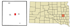
Ethan is a town in Davison County, South Dakota, United States. It is part of the Mitchell, South Dakota Micropolitan Statistical Area. The population was 365 at the 2020 census. Ethan is located 10 miles south of Mitchell.

<span class="mw-page-title-main">Astoria, South Dakota</span> Town in South Dakota, United States

Astoria is a town in Deuel County, South Dakota, United States. The population was 132 at the 2020 census.

<span class="mw-page-title-main">Isabel, South Dakota</span> Town in South Dakota, United States

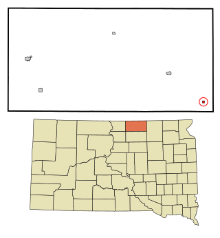
Isabel is a town in Dewey County, South Dakota, United States. The population was 145 at the 2020 census.

<span class="mw-page-title-main">La Bolt, South Dakota</span> Town in South Dakota, United States

La Bolt is a town in Grant County, South Dakota, United States. The population was 66 at the 2020 census.

<span class="mw-page-title-main">Cottonwood, South Dakota</span> Town in the United States

Cottonwood is a small rural hamlet in Jackson County, South Dakota, United States. The population was 12 at the 2020 census. There are no businesses or services at Cottonwood.

<span class="mw-page-title-main">Fairview, South Dakota</span> Town in South Dakota, United States

Fairview is a town in Lincoln County, South Dakota, United States. The population was 61 at the 2020 census.

<span class="mw-page-title-main">Wetonka, South Dakota</span> Town in South Dakota, United States

Wetonka is a town in McPherson County, South Dakota, United States. The population was 16 at the 2020 census.

<span class="mw-page-title-main">Roswell, South Dakota</span> Census-designated place in South Dakota, United States

Roswell is a CDP in Miner County, South Dakota, United States. The population was 8 at the 2020 census. It disincorporated as a town in 2012.

<span class="mw-page-title-main">Sherman, South Dakota</span> Town in South Dakota, United States

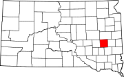
Sherman is a town in Minnehaha County, South Dakota, United States. The population was 81 at the 2020 census.

<span class="mw-page-title-main">Wasta, South Dakota</span> Town in South Dakota, United States

Wasta(Lakota: wašté) is a town in Pennington County, South Dakota, United States, situated along the Cheyenne River. It had a population of 65 at the 2020 census.

<span class="mw-page-title-main">White Rock, South Dakota</span> Town in South Dakota, United States

White Rock is a town in Roberts County, South Dakota, United States, along the Bois de Sioux River. The population was 6 at the 2020 census. White Rock is the most northeastern community in South Dakota, being along the Minnesota border and one mile south of North Dakota.

<span class="mw-page-title-main">Dolton, South Dakota</span> Town in South Dakota, United States

Dolton is a town in Turner County, South Dakota, United States. The population was 34 at the 2020 census.

<span class="mw-page-title-main">Lowry, South Dakota</span> Town in South Dakota, United States

Lowry is a town in Walworth County, South Dakota, United States. The population was 10 at the 2020 census. The town is home to Lowry Pilgrim Community Church, Swan Creek Harness Shop, J & C Repair, Karst Service and a fire station. Lowry also has an abandoned school, and a post office, which closed to service in the early 1970s.

References

  1. "SD Towns" (PDF). South Dakota State Historical Society . Retrieved February 16, 2010.
  2. "ArcGIS REST Services Directory". United States Census Bureau. Retrieved October 15, 2022.
  3. 1 2 U.S. Geological Survey Geographic Names Information System: Vilas, South Dakota
  4. 1 2 "Census Population API". United States Census Bureau. Retrieved October 15, 2022.
  5. 1 2 "U.S. Census website". United States Census Bureau . Retrieved January 31, 2008.
  6. "U.S. Census Bureau: Vilas town, South Dakota". www.census.gov. United States Census Bureau. Retrieved January 16, 2022.
  7. 1 2 Chicago and North Western Railway Company (1908). A History of the Origin of the Place Names Connected with the Chicago & North Western and Chicago, St. Paul, Minneapolis & Omaha Railways. p. 134.
  8. "Miner County". Jim Forte Postal History. Retrieved March 30, 2015.
  9. "US Gazetteer files 2010". United States Census Bureau. Archived from the original on January 25, 2012. Retrieved June 21, 2012.
  10. "Census of Population and Housing". Census.gov. Retrieved June 4, 2015.
  11. "U.S. Census website". United States Census Bureau . Retrieved June 21, 2012.