Related Research Articles

Transportation planning is the process of defining future policies, goals, investments, and spatial planning designs to prepare for future needs to move people and goods to destinations. As practiced today, it is a collaborative process that incorporates the input of many stakeholders including various government agencies, the public and private businesses. Transportation planners apply a multi-modal and/or comprehensive approach to analyzing the wide range of alternatives and impacts on the transportation system to influence beneficial outcomes.
Visual effects is the process by which imagery is created or manipulated outside the context of a live-action shot in filmmaking and video production. The integration of live-action footage and other live-action footage or CGI elements to create realistic imagery is called VFX.

The City Beautiful movement was a reform philosophy of North American architecture and urban planning that flourished during the 1890s and 1900s with the intent of introducing beautification and monumental grandeur in cities. It was a part of the progressive social reform movement in North America under the leadership of the upper-middle class, which was concerned with poor living conditions in all major cities. The movement, which was originally associated mainly with Chicago, Cleveland, Detroit, Kansas City and Washington, D.C., promoted beauty not only for its own sake, but also to create moral and civic virtue among urban populations.
Land use planning is the process of regulating the use of land by a central authority. Usually, this is done to promote more desirable social and environmental outcomes as well as a more efficient use of resources. More specifically, the goals of modern land use planning often include environmental conservation, restraint of urban sprawl, minimization of transport costs, prevention of land use conflicts, and a reduction in exposure to pollutants. In the pursuit of these goals, planners assume that regulating the use of land will change the patterns of human behavior, and that these changes are beneficial. The first assumption, that regulating land use changes the patterns of human behavior is widely accepted. However, the second assumption - that these changes are beneficial - is contested, and depends on the location and regulations being discussed.
Maestro (software) was a free program released by NASA to allow users to view photos and daily progress of the Spirit and Opportunity rovers. It served as an activity planner for Mars that utilized a combination of 2D and 3D visuals to track the movement and missions of the Spirit and Opportunity rovers in 2004.
In computing, a mouseover, mouse hover or hover box is a graphical control element that is activated when the user moves or hovers the pointer over a trigger area, usually with a mouse, but also possible with a digital pen. Mouseover control elements are common in web browsers. For example, hovering over a hyperlink triggers the mouseover control element to display a URL on the status bar. Site designers can define their own mouseover events using JavaScript or Cascading Style Sheets.
A charrette, often Anglicized to charette or charet and sometimes called a design charrette, is an intense period of design or planning activity.
A Form-Based Code (FBC) is a means of regulating land development to achieve a specific urban form. Form-Based Codes foster predictable built results and a high-quality public realm by using physical form as the organizing principle, with less focus on land use, through municipal regulations. An FBC is a regulation, not a mere guideline, adopted into city, town, or county law and offers a powerful alternative to conventional zoning regulation.
Placemaking is a multi-faceted approach to the planning, design and management of public spaces. Placemaking capitalizes on a local community's assets, inspiration, and potential, with the intention of creating public spaces that improve urban vitality and promote people's health, happiness, and well-being. It is political due to the nature of place identity. Placemaking is both a process and a philosophy that makes use of urban design principles. It can be either official and government led, or community driven grassroots tactical urbanism, such as extending sidewalks with chalk, paint, and planters, or open streets events such as Bogotá, Colombia's Ciclovía. Good placemaking makes use of underutilized space to enhance the urban experience at the pedestrian scale to build habits of locals.

Microsoft Robotics Developer Studio is a discontinued Windows-based environment for robot control and simulation that was aimed at academic, hobbyist, and commercial developers and handled a wide variety of robot hardware. It requires a Microsoft Windows 7 operating system or later.
Urban, city, or town planning is the discipline of planning which explores several aspects of the built and social environments of municipalities and communities:
TRANSIMS is an integrated set of tools developed to conduct regional transportation system analyses. With the goal of establishing TRANSIMS as an ongoing public resource available to the transportation community, TRANSIMS is made available under the NASA Open Source Agreement Version 1.3
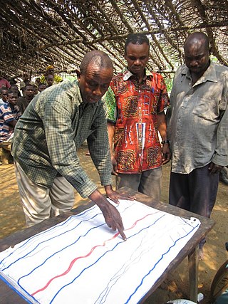
Participatory planning is an urban planning paradigm that emphasizes involving the entire community in the community planning process. Participatory planning emerged in response to the centralized and rationalistic approaches that defined early urban planning work.

In urban planning, walkability is the accessibility of amenities by foot. It is based on the idea that urban spaces should be more than just transport corridors designed for maximum vehicle throughput. Instead, it should be relatively complete livable spaces that serve a variety of uses, users, and transportation modes and reduce the need for cars for travel.

A site plan or a plot plan is a type of drawing used by architects, landscape architects, urban planners, and engineers which shows existing and proposed conditions for a given area, typically a parcel of land which is to be modified. Sites plan typically show buildings, roads, sidewalks and paths/trails, parking, drainage facilities, sanitary sewer lines, water lines, lighting, and landscaping and garden elements.
A walking audit is an assessment of the walkability or pedestrian access of an external environment. Walking audits are often undertaken in street environments to consider and promote the needs of pedestrians as a form of transport. They can be undertaken by a range of different stakeholders including:

Computer-generated imagery (CGI) is a specific-technology or application of computer graphics for creating or improving images in art, printed media, simulators, videos and video games. These images are either static or dynamic. CGI both refers to 2D computer graphics and 3D computer graphics with the purpose of designing characters, virtual worlds, or scenes and special effects. The application of CGI for creating/improving animations is called computer animation, or CGI animation.
The Hong Kong Institute of Planners is a professional body for town planners in Hong Kong. It officially began operation in 1978. It became a statutory body in 1991 when the Legislative Council of Hong Kong enacted the Hong Kong Institute of Planners Incorporation Ordinance.
Technical aspects of urban planning involve the technical processes, considerations and features that are involved in planning for land use, urban design, natural resources, transportation, and infrastructure.

Urban planning, also known as town planning, city planning, regional planning, or rural planning in specific contexts, is a technical and political process that is focused on the development and design of land use and the built environment, including air, water, and the infrastructure passing into and out of urban areas, such as transportation, communications, and distribution networks and their accessibility. Traditionally, urban planning followed a top-down approach in master planning the physical layout of human settlements. The primary concern was the public welfare, which included considerations of efficiency, sanitation, protection and use of the environment, as well as effects of the master plans on the social and economic activities. Over time, urban planning has adopted a focus on the social and environmental bottom lines that focus on planning as a tool to improve the health and well-being of people while maintaining sustainability standards. Sustainable development was added as one of the main goals of all planning endeavors in the late 20th century when the detrimental economic and the environmental impacts of the previous models of planning had become apparent. Similarly, in the early 21st century, Jane Jacobs's writings on legal and political perspectives to emphasize the interests of residents, businesses and communities effectively influenced urban planners to take into broader consideration of resident experiences and needs while planning.
References
- ↑ LGC: Resources: Community Design: Participation Tools: Public Participation and Visual Surveys
- ↑ NY Times: Architecture Rejuvenates Main Streets
- ↑ New Tools: Anton Nelessen/Nelessen Associates
- ↑ Downtown Denver Visual Preference Survey Summary
- ↑ City of Topeka – Visual Preference Survey Results
- ↑ New Castle Comprehensive Plan Visual Preference Survey
- ↑ City of Orlando Visual Preference Survey
- ↑ "National Model Design Code - Part 2 Guidance Notes" (PDF). GOV.UK. Retrieved 2024-03-08.
- ↑ "Submission on the Development of Pattern Books to Fight the NSW Housing Crisis". Street Level. Retrieved 2024-03-08.
- ↑ "Archived copy" (PDF). Archived from the original (PDF) on 2010-06-11. Retrieved 2010-01-22.
{{cite web}}: CS1 maint: archived copy as title (link)