
Roseland is an unincorporated community and census-designated place (CDP) in Indian River County, Florida, United States. The population was 1,472 at the 2010 census, down from 1,775 at the 2000 census. It is part of the Sebastian–Vero Beach Metropolitan Statistical Area.
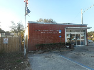
Waverly is a census-designated place (CDP) in east-central Polk County, Florida, United States. The population was 1,927 at the 2000 census. It is part of the Lakeland–Winter Haven Metropolitan Statistical Area.
Delta Charter Township, officially known as the Charter Township of Delta and commonly known as simply Delta Township, is a charter township of Eaton County in the U.S. state of Michigan. As of the 2010 census, it had a population of 32,408 making it the most populous municipality in Eaton County. The township operates its own fire department, but contracts with the Eaton County Sheriff Department for police protection. The township is a major community in metropolitan Lansing.

Argentine is an unincorporated community and census-designated place (CDP) in Argentine Township, Genesee County, in the U.S. state of Michigan. The population was 2,525 as of the 2010 census, up from 2,285 at the 2000 census. It was first settled in 1836.

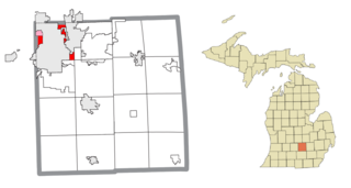
Edgemont Park is a census-designated place (CDP) in Ingham County in the U.S. state of Michigan. It is located within Lansing Charter Township. The population was 2,358 at the 2010 census.
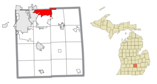
Haslett is a census-designated place (CDP) in Ingham County in the U.S. state of Michigan. It is located mostly within Meridian Charter Township with a small portion extending east into Williamstown Township. The population was 19,220 at the 2010 census. Haslett contains its own school district, as well as its own post office with the 48840 ZIP Code.
Lansing Charter Township is a charter township of Ingham County in the U.S. state of Michigan. The population was 8,143 at the 2020 census.

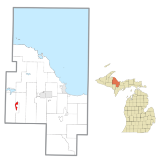
Big Bay is an unincorporated community in Marquette County of the U.S. state of Michigan. It is a census-designated place (CDP) for statistical purposes and does not have any legal status as an incorporated municipality. As of the 2010 census, the CDP had a population of 319. The community is located within Powell Township near the shore of "Big Bay" on Lake Superior.

Michigamme is an unincorporated community in Marquette County in the U.S. state of Michigan. It is located within Michigamme Township on the north shores of Lake Michigamme. For statistical purposes, the United States Census Bureau has defined Michigamme as a census-designated place (CDP). The CDP had a population of 271 at the 2010 census.

Palmer is an unincorporated community in Marquette County in the U.S. state of Michigan. It is a census-designated place (CDP) for statistical purposes and has no legal status as an incorporated municipality. The CDP had a population of 418 at the 2010 census. It is located within Richmond Township along M-35.
Republic is an unincorporated community in Marquette County in the U.S. state of Michigan. It is also a census-designated place (CDP) for statistical purposes and no legal status as an incorporated municipality. The CDP had a population of 570 at the 2010 census. The community is located mostly within Republic Township with a small portion extending north into Humboldt Township.

Canadian Lakes is an unincorporated community in Mecosta County in the U.S. state of Michigan. The area is mostly within the southwest portion of Morton Township, southwest of Mecosta and east of Stanwood.

Temperance is an unincorporated community and census-designated place (CDP) in Monroe County in the U.S. state of Michigan. The population was 9,188 at the 2020 census. The CDP is located within Bedford Township.

Twin Lake is an unincorporated community in Muskegon County of the U.S. state of Michigan. It is a census-designated place (CDP) for statistical purposes. Local government services are provided by Dalton Township. As of the 2000 census, the community population was 1,613. It is the home of Blue Lake Fine Arts Camp, the YMCA's Camp Pinewood, the Boy Scouts' Gerber Scout Reservation and Owasippe Scout Reservation.

Bridgeport is an unincorporated community in Bridgeport Charter Township, Saginaw County in the U.S. state of Michigan. It is also a census-designated place (CDP) for statistical purposes. The population was 7,849 at the 2000 census. Bridgeport is also the name of a post office with ZIP code 48722. The area served by the ZIP code includes the southeast portion of the CDP and includes southeastern portions of Bridgeport Charter Township outside of the CDP as well as portions of southwest Frankenmuth Township and a small area of northeastern Birch Run Township. The remainder of the CDP area is served by the Saginaw ZIP code 48601.

Burt is a census-designated place (CDP) and Unincorporated community for statistical purposes in Taymouth Township, Saginaw County in the U.S. state of Michigan. The CDP's population was 1,122 at the 2000 census. Burt is also the name of a post office with ZIP code 48417, which includes the area of the CDP as well as portions of Taymouth Township to the north of the CDP and the eastern part of Albee Township and a small area of southeastern Spaulding Township. The town is named for Wellington R. Burt.

Carrollton Township is a civil township of Saginaw County in the U.S. state of Michigan. The population was 6,103 at the 2010 census. Established in 1866, Carrollton contains a full-time police department, fire department, parks and recreation services, as well as its own public school system, Carrollton Public Schools. Along with being located on the Saginaw River, Carrollton offers close access to shopping malls, medical facilities, Saginaw Valley State University, and I-75.

Hemlock is an unincorporated community in Richland Township, Saginaw County in the U.S. state of Michigan. It is also a census-designated place (CDP) for statistical purposes, but without any legal status as an incorporated municipality. The population of the CDP was 1,585 at the 2000 census. The area included in the CDP is in the south central portion of Richland Township. The Hemlock post office, with ZIP code 48626, serves nearly all of Richland Township, as well as portions of Fremont Township to the south, small areas of Thomas and Swan Creek townships to the southeast, and part of Ingersoll Township to the north in Midland County.

Whitmore Lake is a census-designated place (CDP) and unincorporated community in the U.S. state of Michigan. The community spans the boundary between Green Oak Township in Livingston County and Northfield Township in Washtenaw County. The population of the CDP was 6,423 at the 2010 census.
Wheatland Township is a civil township of Mecosta County in the U.S. state of Michigan. The population was 1,474 at the 2000 census.

