The OGCWeb Processing Service (WPS) Interface Standard provides rules for standardizing inputs and outputs (requests and responses) for invoking geospatial processing services, such as polygon overlay, as a web service. The WPS standard defines how a client can request the execution of a process, and how the output from the process is handled. It defines an interface that facilitates the publishing of geospatial processes and clients’ discovery of and binding to those processes. The data required by the WPS can be delivered across a network or they can be available at the server. WPS can describe any calculation (i.e. process) including all of its inputs and outputs, and trigger its execution as a web service. WPS supports simultaneous exposure of processes via HTTPGET, HTTPPOST, and SOAP, thus allowing the client to choose the most appropriate interface mechanism. The specific processes served up by a WPS implementation are defined by the owner of that implementation. Although WPS was designed to work with spatially referenced data, it can be used with any kind of data.
WPS makes it possible to publish, find, and bind to processes in a standardized and thus interoperable fashion. Theoretically, it is transport/platform neutral (like SOAP), but in practice it has only been specified for HTTP.
DescribeProcess returns a description of a process including its inputs and outputs
Execute returns the output(s) of a process
WPS operations are invoked by submitting XML or URL-encoded requests to an Online Resource URL. When requesting an Execute operation the HTTP request identifies the inputs, the name of process to be executed, and the form of output to be provided.
Properties
WPS has the following properties:
Inputs can be web-accessible URLs or embedded in the request.
Outputs can be stored as web-accessible URLs or embedded in the response.
For a single output such as a GIF image, WPS can return the output directly, without any XML wrapper.
A WPS is usually not invoked directly. More often, it is invoked by a client application that provides the user with interactive controls. This client application may or may not be web-based.
WPS version 2.0 was released in 2015. Previous version 1.0.0 was released to the public in June 2007. Version 0.4.0 was released as an OGC Request for Public Comment in 2005 and implemented by several early adopters.
In computing, Common Gateway Interface (CGI) is an interface specification that enables web servers to execute an external program, typically to process user requests.
SOAP is a messaging protocol specification for exchanging structured information in the implementation of web services in computer networks. Its purpose is to provide extensibility, neutrality, verbosity and independence. It uses XML Information Set for its message format, and relies on application layer protocols, most often Hypertext Transfer Protocol (HTTP), although some legacy systems communicate over Simple Mail Transfer Protocol (SMTP), for message negotiation and transmission.
Jakarta Enterprise Beans is one of several Java APIs for modular construction of enterprise software. EJB is a server-side software component that encapsulates business logic of an application. An EJB web container provides a runtime environment for web related software components, including computer security, Java servlet lifecycle management, transaction processing, and other web services. The EJB specification is a subset of the Java EE specification.
In computing, the Java API for XML Processing, or JAXP, one of the Java XML Application programming interfaces, provides the capability of validating and parsing XML documents. It has three basic parsing interfaces:
In computing, the Open Geospatial Consortium Web Feature Service (WFS) Interface Standard provides an interface allowing requests for geographical features across the web using platform-independent calls. One can think of geographical features as the "source code" behind a map, whereas the WMS interface or online tiled mapping portals like Google Maps return only an image, which end-users cannot edit or spatially analyze. The XML-based GML furnishes the default payload-encoding for transporting geographic features, but other formats like shapefiles can also serve for transport. In early 2006 the OGC members approved the OpenGIS GML Simple Features Profile. This profile is designed both to increase interoperability between WFS servers and to improve the ease of implementation of the WFS standard.
XMLHttpRequest (XHR) is an API in the form of an object whose methods transfer data between a web browser and a web server. The object is provided by the browser's JavaScript environment. Particularly, retrieval of data from XHR for the purpose of continually modifying a loaded web page is the underlying concept of Ajax design. Despite the name, XHR can be used with protocols other than HTTP and data can be in the form of not only XML, but also JSON, HTML or plain text.
Apache Axis is an open-source, XML based Web service framework. It consists of a Java and a C++ implementation of the SOAP server, and various utilities and APIs for generating and deploying Web service applications. Using Apache Axis, developers can create interoperable, distributed computing applications. Axis development takes place under the auspices of the Apache Software Foundation.
XML Interface for Network Services (XINS) is an open-source technology for definition and implementation of internet applications, which enforces a specification-oriented approach.
A Web Map Service (WMS) is a standard protocol developed by the Open Geospatial Consortium in 1999 for serving georeferenced map images over the Internet. These images are typically produced by a map server from data provided by a GIS database.
The Windows Communication Foundation (WCF), previously known as Indigo, is a free and open-source runtime and a set of APIs in the .NET Framework for building connected, service-oriented applications.
Catalogue Service for the Web (CSW), sometimes seen as Catalogue Service - Web, is a standard for exposing a catalogue of geospatial records in XML on the Internet. The catalogue is made up of records that describe geospatial data, geospatial services, and related resources.
SensorML is an approved Open Geospatial Consortium standard. SensorML provides standard models and an XML encoding for describing sensors and measurement processes. SensorML can be used to describe a wide range of sensors, including both dynamic and stationary platforms and both in-situ and remote sensors.
Distributed GIS refers to GI Systems that do not have all of the system components in the same physical location. This could be the processing, the database, the rendering or the user interface. It represents a special case of distributed computing, with examples of distributed systems including web-based GIS and Mobile GIS. Distribution of resources provides corporate and enterprise-based models for GIS. Distributed GIS permits a shared services model, including data fusion based on Open Geospatial Consortium (OGC) web services. Distributed GIS technology enables modern online mapping systems, Location-based services (LBS), web-based GIS and numerous map-enabled applications. Other applications include transportation, logistics, utilities, farm / agricultural information systems, real-time environmental information systems and the analysis of the movement of people. In terms of data, the concept has been extended to include volunteered geographical information. Distributed processing allows improvements to the performance of spatial analysis through the use of techniques such as parallel processing.
The Open Geospatial Consortium Web Coverage Service Interface Standard (WCS) defines Web-based retrieval of coverages – that is, digital geospatial information representing space/time-varying phenomena.
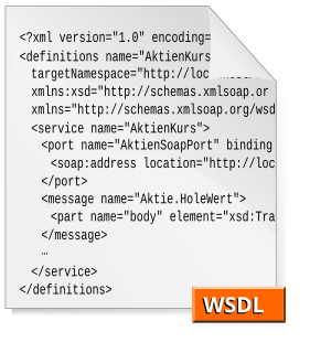
The Web Services Description Language is an XML-based interface description language that is used for describing the functionality offered by a web service. The acronym is also used for any specific WSDL description of a web service, which provides a machine-readable description of how the service can be called, what parameters it expects, and what data structures it returns. Therefore, its purpose is roughly similar to that of a type signature in a programming language.
The Open Geospatial Consortium (OGC), an international voluntary consensus standards organization, originated in 1994. In the OGC, more than 500 commercial, governmental, nonprofit and research organizations worldwide collaborate in a consensus process encouraging development and implementation of open standards for geospatial content and services, sensor web and Internet of Things, GIS data processing and data sharing.
The Sensor Observation Service (SOS) is a web service to query real-time sensor data and sensor data time series and is part of the Sensor Web. The offered sensor data consists of data directly from the sensors, which are encoded in the Sensor Model Language (SensorML), and the measured values in the Observations and Measurements encoding format. The web service as well as both file formats are open standards and specifications of the same name defined by the Open Geospatial Consortium (OGC).
The Web Coverage Processing Service (WCPS) defines a language for filtering and processing of multi-dimensional raster coverages, such as sensor, simulation, image, and statistics data. The Web Coverage Processing Service is maintained by the Open Geospatial Consortium (OGC). This raster query language allows clients to obtain original coverage data, or derived information, in a platform-neutral manner over the Web.
gSOAP is a C and C++ software development toolkit for SOAP/XML web services and generic XML data bindings. Given a set of C/C++ type declarations, the compiler-based gSOAP tools generate serialization routines in source code for efficient XML serialization of the specified C and C++ data structures. Serialization takes zero-copy overhead.
This page is based on this Wikipedia article Text is available under the CC BY-SA 4.0 license; additional terms may apply. Images, videos and audio are available under their respective licenses.