Wheatland, Vernon County, Wisconsin

Last updated

Town of Wheatland town hall.jpg
Town of Wheatland town hall
Vernon County Wisconsin incorporated and unincorporated areas Wheatland highlighted.svg
Location in Vernon County and the state of Wisconsin.
Coordinates: 43°26′47″N91°10′57″W / 43.44639°N 91.18250°W / 43.44639; -91.18250
Country Flag of the United States.svg  United States
State Flag of Wisconsin.svg  Wisconsin
County Vernon
Area
  Total27.6 sq mi (71.5 km2)
  Land26.5 sq mi (68.7 km2)
  Water1.1 sq mi (2.9 km2)
Elevation
[1]
1,155 ft (352 m)
Population
 (2000)
  Total533
  Density20.1/sq mi (7.8/km2)
Time zone UTC-6 (Central (CST))
  Summer (DST) UTC-5 (CDT)
Area code 608
FIPS code 55-86525 [2]
GNIS feature ID1584422 [1]
Website https://www.town-of-wheatland.com/

Wheatland is a town in Vernon County, Wisconsin, United States. The population was 533 at the 2000 census. The unincorporated communities of Red Mound, and Victory are located in Wheatland.

Contents

Geography

According to the United States Census Bureau, the town has a total area of 27.6 square miles (71.5 km2), of which, 26.5 square miles (68.7 km2) of it is land and 1.1 square miles (2.8 km2) of it (3.98%) is water.

Demographics

At the 2000 census there were 533 people in 236 households, including 160 families, in the town. The population density was 20.1 people per square mile (7.8/km2). There were 360 housing units at an average density of 13.6 per square mile (5.2/km2). The racial makeup of the town was 98.31% White, 0.19% Native American, 0.19% Asian, 0.56% from other races, and 0.75% from two or more races. Hispanic or Latino of any race were 1.31%. [2]

Of the 236 households 20.8% had children under the age of 18 living with them, 58.1% were married couples living together, 6.4% had a female householder with no husband present, and 31.8% were non-families. 27.1% of households were one person and 12.3% were one person aged 65 or older. The average household size was 2.26 and the average family size was 2.74.

The age distribution was 19.9% under the age of 18, 4.3% from 18 to 24, 19.7% from 25 to 44, 37.3% from 45 to 64, and 18.8% 65 or older. The median age was 47 years. For every 100 females, there were 105.0 males. For every 100 females age 18 and over, there were 103.3 males.

The median household income was $35,500 and the median family income was $40,000. Males had a median income of $30,583 versus $17,708 for females. The per capita income for the town was $19,247. About 4.9% of families and 7.9% of the population were below the poverty line, including 16.3% of those under age 18 and 7.5% of those age 65 or over.

Solar farm in the town of Wheatland, Wisconsin Solar farm in Wisconsin 01.jpg
Solar farm in the town of Wheatland, Wisconsin

Related Research Articles

<span class="mw-page-title-main">Platte County, Wyoming</span> County in Wyoming, United States

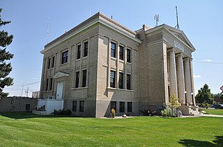
Platte County is a county located in the U.S. state of Wyoming. As of the 2020 United States Census, the population was 8,605. Its county seat is Wheatland.
<span class="mw-page-title-main">Wheatland, California</span> City in California, United States

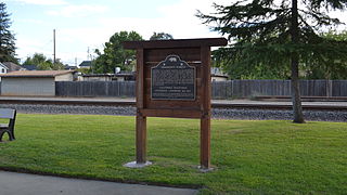
Wheatland is the second-largest city by population in Yuba County, California, United States. The population was 3,456 at the 2010 census, up from 2,275 at the 2000 census. Wheatland is located 12.5 miles (20 km) southeast of Marysville.

<span class="mw-page-title-main">Wheatland, Indiana</span> Town in Indiana, United States

Wheatland is a town in Steen Township, Knox County, Indiana, United States. The population was 480 at the 2010 census.

<span class="mw-page-title-main">Wheatland, Iowa</span> City in Iowa, United States

Wheatland is a city in Clinton County, Iowa, United States. The population was 775 at the time of the 2020 census.

<span class="mw-page-title-main">Grainfield, Kansas</span> City in Gove County, Kansas, United States

Grainfield is a city in northern Gove County, Kansas, United States. As of the 2020 census, the population of the city was 322.

<span class="mw-page-title-main">Grinnell, Kansas</span> City in Gove County, Kansas

Grinnell is a city in Gove County, Kansas, United States. As of the 2020 census, the population of the city was 260.

<span class="mw-page-title-main">St. Francis, Maine</span> Town in the state of Maine, United States

St. Francis is a town in Aroostook County, Maine, United States on the Canada–United States border at the junction of the St. Francis River and the Saint John River. The population was 438 at the 2020 census. First settled by English speakers from southern Maine, the original population has been supplanted by French-speaking Acadians.
<span class="mw-page-title-main">Penobscot, Maine</span> Town in the state of Maine, United States

Penobscot is a town in Hancock County, Maine, United States. The Bagaduce River flows through the town. The population was 1,136 at the 2020 census.

Stoneham is a town in Oxford County, Maine, United States. The population was 261 at the 2020 census.

<span class="mw-page-title-main">Wheatland, Missouri</span> City in Missouri, United States

Wheatland is a city in Hickory County, Missouri, United States. The population was 277 at the 2020 census.

Wheatland Township is a township located in the northwest corner of Rice County, Minnesota, United States. The population was 1,358 at the 2000 census.

<span class="mw-page-title-main">Wheatland, New York</span> Town in New York, United States

Wheatland is a town in Monroe County, New York, United States. The population was 4,775 at the 2010 census. The town is home to Genesee Country Village and Museum.

<span class="mw-page-title-main">Masury, Ohio</span> Census-designated place in Ohio, United States

Masury is an unincorporated community and census-designated place in eastern Trumbull County, Ohio, United States. The population was 2,001 at the 2020 census. It is part of the Youngstown–Warren metropolitan area.

<span class="mw-page-title-main">West Milford, West Virginia</span> Town in West Virginia, United States

West Milford is a town in Harrison County, West Virginia, United States. The population was 452 at the 2020 census.

<span class="mw-page-title-main">Anawalt, West Virginia</span> Town in West Virginia, United States

Anawalt is a town in McDowell County, West Virginia, United States. At one time it was known as Jeanette. It is named in honor of James White Anawalt, who was then manager of Union Supply Company, a subsidiary of the United States Steel Company. The population was 186 at the 2020 census. Coal mining was the town's chief industry.

<span class="mw-page-title-main">Summit, Juneau County, Wisconsin</span> Town in Wisconsin, United States

Summit is a town in Juneau County, Wisconsin, United States. The population was 623 at the 2000 census.

<span class="mw-page-title-main">Wheatland, Kenosha County, Wisconsin</span> Town in Wisconsin, United States

Wheatland is a town in Kenosha County, Wisconsin, United States. The population was 3,391 at the 2020 census. The census-designated place of Powers Lake is located partially in the town. The unincorporated communities of Lily Lake, New Munster, and Slades Corners are also located in the town.

<span class="mw-page-title-main">Greenfield, Monroe County, Wisconsin</span> Town in Wisconsin, United States

Greenfield is a town in Monroe County, Wisconsin, United States. The population was 626 at the 2000 census. The unincorporated communities of Raymore, Spring Bank Park, and Tunnel City are located within the town.

<span class="mw-page-title-main">Sherman, Sheboygan County, Wisconsin</span> Town in Wisconsin, United States

Sherman is a town in Sheboygan County, Wisconsin, United States whose population was 1,520 at the 2000 census. It is included in the Sheboygan, Wisconsin Metropolitan Statistical Area. The unincorporated communities of Gooseville and Silver Creek are located in the town.

Birch Lake is an unorganized territory in Saint Louis County, Minnesota, United States, located north of Babbitt, and south of Ely and Morse Township. The population was 648 at the 2000 census.

References

  1. 1 2 "US Board on Geographic Names". United States Geological Survey. October 25, 2007. Retrieved January 31, 2008.
  2. 1 2 "U.S. Census website". United States Census Bureau . Retrieved January 31, 2008.

Town of Wheatland