
John Wesley Powell was an American geologist, U.S. Army soldier, explorer of the American West, professor at Illinois Wesleyan University, and director of major scientific and cultural institutions. He is famous for his 1869 geographic expedition, a three-month river trip down the Green and Colorado rivers, including the first official U.S. government-sponsored passage through the Grand Canyon.

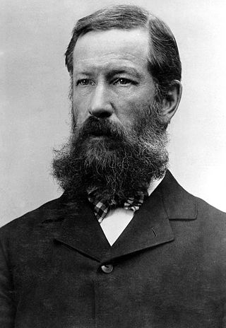
Clarence Rivers King was an American geologist, mountaineer, and author. He was the first director of the United States Geological Survey from 1879 to 1881. Nominated by Republican President Rutherford B. Hayes, King was noted for his exploration of the Sierra Nevada mountain range.

Thomas Moran was an American painter and printmaker of the Hudson River School in New York whose work often featured the Rocky Mountains. Moran and his family, wife Mary Nimmo Moran and daughter Ruth took residence in New York where he obtained work as an artist. He was a younger brother of the noted marine artist Edward Moran, with whom he shared a studio. A talented illustrator and exquisite colorist, Thomas Moran was hired as an illustrator at Scribner's Monthly. During the late 1860s, he was appointed the chief illustrator for the magazine, a position that helped him launch his career as one of the premier painters of the American landscape, in particular, the American West.

Israel Cook Russell, LL.D. was an American geologist and geographer who explored Alaska in the late 19th century.

Ferdinand Vandeveer Hayden was an American geologist noted for his pioneering surveying expeditions of the Rocky Mountains in the late 19th century. He was also a physician who served with the Union Army during the Civil War.

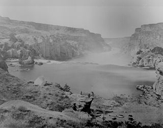
Timothy H. O'Sullivan was an American photographer widely known for his work related to the American Civil War and the Western United States.
Henry Gannett was an American geographer who is described as the "father of mapmaking in America." He was the chief geographer for the United States Geological Survey essentially from its founding until 1902. He was also a founding member and president of the National Geographic Society.

George Montague Wheeler was an American pioneering explorer and cartographer, leader of the Wheeler Survey, one of the major surveys of the western United States in the late nineteenth century.
The Geological Exploration of the Fortieth Parallel was a geological survey made by order of the Secretary of War according to acts of Congress of March 2, 1867, and March 3, 1869, under the direction of Brig. and Bvt. Major General A. A. Humphreys, Chief of Engineers, by Clarence King, U. S. geologist. More commonly known as the Fortieth Parallel Survey, the survey conducted field work from 1867 to 1872, exploring the area along the fortieth parallel north from northeastern California, through Nevada, to eastern Wyoming.

Benjamin Franklin Mudge was an American lawyer, geologist and teacher. Briefly the mayor of Lynn, Massachusetts, he later moved to Kansas where he was appointed the first State Geologist. He led the first geological survey of the state in 1864, and published the first book on the geology of Kansas. He lectured extensively, and was department chair at the Kansas State Agricultural College.

The San Bernardino meridian, established in 1852, is one of three principal meridians in the state of California. Because of the state's shape, three meridian–baseline sets are required for surveys in all parts of the state. The San Bernardino meridian is used for Southern California, and some townships in Arizona are also referenced to it.
Henry Crécy "H. C." Yarrow was an American ornithologist, herpetologist, naturalist, and surgeon.

John Karl Hillers was an American government photographer.
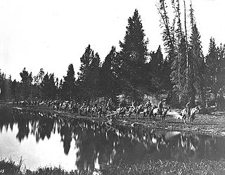
The Hayden Geological Survey of 1871 explored the region of northwestern Wyoming that later became Yellowstone National Park in 1872. It was led by geologist Ferdinand Vandeveer Hayden. The 1871 survey was not Hayden's first, but it was the first federally funded geological survey to explore and further document features in the region soon to become Yellowstone National Park, and played a prominent role in convincing the U.S. Congress to pass the legislation creating the park. In 1894, Nathaniel P. Langford, the first park superintendent and a member of the Washburn-Langford-Doane Expedition which explored the park in 1870, wrote this about the Hayden expedition:
We trace the creation of the park from the Folsom-Cook expedition of 1869 to the Washburn expedition of 1870, and thence to the Hayden expedition of 1871, Not to one of these expeditions more than to another do we owe the legislation which set apart this "pleasuring-ground for the benefit and enjoyment of the people"

Dallas Lynn Peck was an American geologist and vulcanologist. Peck was a native of Cheney, Washington. He received his bachelor's (1951) and master's (1953) degrees in geology from the California Institute of Technology. He received a doctorate in geology from Harvard University in 1960.

The United States Geological Survey (USGS), founded as the Geological Survey, is an agency of the United States government whose work spans the disciplines of biology, geography, geology, and hydrology. The agency was founded on March 3, 1879, to study the landscape of the United States, its natural resources, and the natural hazards that threaten it. The agency also makes maps of extraterrestrial planets and moons based on data from U.S. space probes.
The exploration of North America by European sailors and geographers was an effort by major European powers to map and explore the continent with the goal of economic, religious and military expansion. The combative and rapid nature of this exploration is the result of a series of countering actions by neighboring European nations to ensure no single country had garnered enough wealth and power from the Americas to militarily tip the scales over on the European continent. It spanned the late 15th to early 17th centuries, and consisted primarily of expeditions funded by Spain, England, France, and Portugal. See also the European colonization of the Americas.

Almon Harris Thompson, also known as A. H. Thompson, was an American topographer, geologist, explorer, educator and Civil War veteran. Often called "The Professor" or simply "Prof", Thompson is perhaps best known for being second in command of John Wesley Powell's Second Geographical Expedition (1871–1875), a federally funded scientific expedition that retraced the route of Powell's original expedition in order to further explore and map the drainages and canyons of the Green and Colorado Rivers in what is now southern Utah and northern Arizona. Thompson's diary of the expedition was originally published in the Utah Historical Quarterly in 1939. Through his work on the Powell expeditions and later as a geographer at the U.S. Geological Survey, he was responsible for naming many geographic locations in the Western United States. Thompson is also known for being a founding member of the National Geographic Society.

François Émile Matthes was a geologist and an expert in topographic mapping, glaciers, and climate change. He mapped remote areas of the American West for the United States Geological Survey (USGS). His maps coincided with the development of those areas into national parks. He is one of the founders of the Association of American Geographers and served as its president. Matthes resolved a dispute about formation of the Yosemite Valley and his findings on glaciers introduced the terms nivation and Little Ice Age.
Stone's Ferry is a former settlement founded by members of the Church of Jesus Christ of Latter-day Saints and ferry crossing of the Colorado River between Nevada and Arizona, in Clark County, Nevada, United States.
