Related Research Articles

Douds is a census-designated place (CDP) in Van Buren County, Iowa, United States. The population was 165 at the 2000 census.

Baskin is a village in Franklin Parish, Louisiana, United States. The population was 254 at the 2010 census, up from 188 in 2000. Baskin is located north of the parish seat of Winnsboro.

Onset is a census-designated place (CDP) in the town of Wareham, Massachusetts, United States. The population was 1,573 at the 2010 census.

Wareham Center is a census-designated place (CDP) in the town of Wareham in Plymouth County, Massachusetts, United States. The population was 2,896 at the 2010 census.

Salem Township is a civil township of Allegan County in the U.S. state of Michigan. The population was 4,446 at the 2010 census, up from 3,486 at the 2000 census.

Pittsburg is an unincorporated community in Van Buren County, Iowa, United States. It is located at 40.75639ºN and 91.99167ºW.
Basswood Island is a Wisconsin island in Lake Superior. It is one of the Apostle Islands and a part of the Apostle Islands National Lakeshore.

KOTZ is a non-commercial radio station in Kotzebue, Alaska, broadcasting on 720 AM.
The Oneota neighborhood is located within the West Duluth district of Duluth, Minnesota, United States. The neighborhood was named for the prehistoric Oneota Native American culture.

Metz is an unincorporated community in York Township, Steuben County, in the U.S. state of Indiana.

The Louisiana meridian, in longitude 92° 24′ 15″ west of Greenwich, extends from the Gulf of Mexico to the north boundary of Louisiana, and with the baseline through the initial point conforming to the parallel of 31° north latitude, governs all the surveys in the state west of the Mississippi River.
St. Onge Township is the sole township of Lawrence County, South Dakota, United States; the rest of the county is unorganized territory. The population was 191 as of the 2010 Census. It lies on the northern edge of the county.
Waki is a small town and commune in the Cercle of San in the Ségou Region of Mali. As of 1998 the commune had a population of 6,167.
Cobham Park is an unincorporated community in Richmond County, in the U.S. state of Virginia.

Kolin is an unincorporated community in Rapides Parish, Louisiana United States and is part of the Alexandria metropolitan area, Louisiana. Along with the nearby town of Libuse, it was founded in 1914 by Czech immigrants, and named after Kolín, Czech Republic.
WRZQ-FM 107.3 FM is a radio station broadcasting a hot adult contemporary format. Licensed to Greensburg, Indiana, the station serves the areas of Columbus, Indiana; Franklin, Indiana; and Seymour, Indiana, and is owned by Reising Radio Partners Inc.
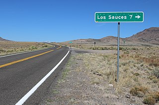
Lasauses or Los Sauces is a populated place in Conejos County, Colorado, United States, on the west side of the Rio Grande.
Short Bend is an unincorporated community in Dent County, in the U.S. state of Missouri.
Sweet Hollow Creek is a stream in Laclede County in the Ozarks of southern Missouri. The stream source area lies just west of Eldridge and it flows generally west to enter an entrenched meander of the Niangua River at Blue Spring.
Stokley is an unincorporated community in Pettis County, in the U.S. state of Missouri.
References
Coordinates: 31°44′47″N92°50′22″W / 31.74639°N 92.83944°W
| | This Louisiana state location article is a stub. You can help Wikipedia by expanding it. |