Related Research Articles

Grayson County is a county located in the southwestern part of the Commonwealth of Virginia. As of the 2020 census, the population was 15,333. Its county seat is Independence. Mount Rogers, the state's highest peak at 5,729 feet (1,746 m), is in Grayson County.

Potomac Heights is a census-designated place (CDP) in Charles County, Maryland, United States. The population was 1,117 at the 2010 census. It has a volunteer fire department and numerous older rambler homes built for workers at the nearby U.S. Navy munitions plant in Indian Head.

Marion is a town in, and the county seat of, Smyth County, Virginia, United States. It is positioned upon Interstate 81, in the Blue Ridge portion of the Southern Appalachian mountains in Southwest Virginia. The town is named for American Revolutionary War officer Francis Marion. The town limits had a population of approximately 6,000, per 2020 Census estimates. However, together with the neighborhoods, an additional 9,000 residents residing in unincorporated Smyth County have Marion mailing addresses, granting the Marion, VA ZIP code (24354) a total population of about 14,500, which is around half of the county's total population.

Abingdon is a town in Washington County, Virginia, United States, 133 miles (214 km) southwest of Roanoke. The population was 8,376 at the 2020 census. It is the county seat of Washington County. The town encompasses several historically significant sites and features a fine arts and crafts scene centered on the galleries and museums along Main Street.

Berkeley Springs is a town in, and the county seat of, Morgan County, West Virginia, United States, in the state's Eastern Panhandle. Berkeley Springs is also commonly used to refer to the area in and around the Town of Bath. In 1776, the Virginia Legislature incorporated a town around the springs and named it Bath. Since 1802, it has been referred to by the name of its original post office, Berkeley Springs. The population was 758 at the 2020 census. It is part of the Hagerstown–Martinsburg metropolitan area.
The Iron Mountains are a subrange of the Blue Ridge Mountains. These mountains are located around the common meeting point of Tennessee, Virginia, and North Carolina.

Whitetop Mountain is the second highest independent mountain in the U.S. state of Virginia, after nearby Mount Rogers. It is also the third highest named peak in Virginia, after Mount Rogers and its subsidiary peak, Pine Mountain. It is located at the juncture of Grayson, Smyth, and Washington Counties, and is also within the Mount Rogers National Recreation Area of the Jefferson National Forest. Whitetop was the location of the White Top Folk Festival from 1932 to 1939, with the exception of 1937. Like nearby Mount Rogers, it represents an ecological "island" of flora and fauna commonly found much farther north than Virginia, such as old growth red spruce and other northern softwoods.
Cox is an unincorporated community in Calhoun County, Florida, United States. It is located on State Road 71.
Moonville is an unincorporated community in Richland Township, Madison County, Indiana.
Columbia Furnace is an unincorporated community in Shenandoah County, in the U.S. state of Virginia.

Snell is an unincorporated community in Spotsylvania County, in the U.S. state of Virginia.
Axtell is an unincorporated community in Buckingham County, in the U.S. state of Virginia.
Mount Vinco is an unincorporated community in Buckingham County, in the U.S. state of Virginia.
Whitetop may refer to:
Barren Plains is an unincorporated community in Robertson County, Tennessee, in the United States.
Moscow Mills is a former town in Morgan County, in the U.S. state of Ohio. The GNIS classifies it as a populated place.
Sippo is an unincorporated community in Stark County, in the U.S. state of Ohio.
The North Carolina–Tennessee–Virginia Corners is a tripoint at which North Carolina, Tennessee and Virginia meet. The landmark is located in the Iron Mountains, and is roughly 16 miles north of Snake Mountain, and 8 miles southwest of Mount Rogers.
Boston is an unincorporated community in the Boston Mountains of southeastern Madison County, Arkansas, United States. The community is located on Arkansas Highway 16 between Pettigrew to the southwest and Red Star to the northeast. The community is on a high ridge at an elevation of 2,329 feet (710 m). The location is at the headwaters of four streams: Kings River to the northeast, War Eagle Creek to the northwest, the White River to the east and southwest and Little Mulberry Creek to the southeast.
References
- ↑ "Whitetop". Geographic Names Information System . United States Geological Survey, United States Department of the Interior . Retrieved March 1, 2014.
Municipalities and communities of Grayson County, Virginia, United States | ||
|---|---|---|
| Towns | 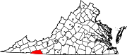 | |
| CDPs | ||
| Other communities | ||
| Footnotes | ‡This populated place also has portions in an adjacent county or counties | |
36°36′05″N81°37′32″W / 36.60139°N 81.62556°W
| | This Grayson County, Virginia state location article is a stub. You can help Wikipedia by expanding it. |