Williams Township, Michigan

Last updated
Williams Township, Michigan
Williams Charter Township
Williams Charter Township, MI location.png
Location within Bay County
USA Michigan location map.svg
Red pog.svg
Williams Township
Location within the state of Michigan
Coordinates: 43°36′34″N84°07′07″W / 43.60944°N 84.11861°W / 43.60944; -84.11861 Coordinates: 43°36′34″N84°07′07″W / 43.60944°N 84.11861°W / 43.60944; -84.11861
Country United States
State Michigan
County Bay
Established1858
Government
  SupervisorWill Butterfield
   Clerk Jerome Putt
Area
  Total33.6 sq mi (87.0 km2)
  Land33.5 sq mi (86.9 km2)
  Water0.0 sq mi (0.1 km2)
Elevation
633 ft (193 m)
Population
 (2020)
  Total5,058
  Density133.9/sq mi (51.7/km2)
Time zone UTC-5 (Eastern (EST))
  Summer (DST) UTC-4 (EDT)
ZIP code(s)
48611 (Auburn)
48623 (Freeland)
48642 (Midland)
Area code 989
FIPS code 26-87380 [1]
GNIS feature ID1627273 [2]
Website Official website

Williams Charter Township is a charter township of Bay County in the U.S. state of Michigan. The township's population was 5,058 as of the 2020 Census and is included in the Bay City Metropolitan Statistical Area.

Contents

Communities

The township has two unincorporated communities:

History

The Willams Post Office opened August 26, 1868 in what is now North Williams and operated until April 10, 1874. [5]

North Williams Post Office was opened on March 20, 1891 east of what is now North Williams at Garfield and Wheeler roads. [6] On April 22, the Colden Post Office was opened at Rockwell Road and James Savage Road in what is now the US-10 and M-20 interchange on the border with Midland County. [7]

The Laredo Post Office opened Aug 19, 1892 in what is now Fisherville. On January 15, 1898, the Laredo Post Office was closed until its February 8, 1899 reopening. [8] The last day that the North Williams Post Office was open was May 15, 1903. [6] On Apr 30, 1906, the Laredo PO was again closed. [8] The Colden Post Office was discontinued on January 15, 1907. [7]

Geography

According to the United States Census Bureau, the township has a total area of 33.6 square miles (87 km2), of which 33.5 square miles (87 km2) is land and 0.04 square miles (0.10 km2) (0.12%) is water.

Demographics

Historical population
CensusPop.Note
2000 4,492
2010 4,7726.2%
2020 5,0586.0%

As of the census [1] of 2000, there were 4,492 people, 1,623 households, and 1,283 families residing in the township. The population density was 133.9 inhabitants per square mile (51.7/km2). There were 1,703 housing units at an average density of 50.8 per square mile (19.6/km2). The racial makeup of the township was 97.57% White, 0.22% African American, 0.33% Native American, 0.18% Asian, 0.02% Pacific Islander, 0.56% from other races, and 1.11% from two or more races. Hispanic or Latino of any race were 1.91% of the population.

There were 1,623 households, out of which 37.4% had children under the age of 18 living with them, 68.4% were married couples living together, 7.4% had a female householder with no husband present, and 20.9% were non-families. 17.9% of all households were made up of individuals, and 5.9% had someone living alone who was 65 years of age or older. The average household size was 2.75 and the average family size was 3.13.

In the township the population was spread out, with 27.4% under the age of 18, 7.1% from 18 to 24, 30.6% from 25 to 44, 23.5% from 45 to 64, and 11.2% who were 65 years of age or older. The median age was 37 years. For every 100 females, there were 103.7 males. For every 100 females age 18 and over, there were 101.4 males.

The median income for a household in the township was $54,766, and the median income for a family was $61,907. Males had a median income of $45,450 versus $30,365 for females. The per capita income for the township was $22,262. About 2.9% of families and 4.8% of the population were below the poverty line, including 7.7% of those under age 18 and 2.3% of those age 65 or over.

Related Research Articles

<span class="mw-page-title-main">Au Train Township, Michigan</span> Civil township in Michigan, United States

Au Train Township is a civil township of Alger County in the U.S. state of Michigan. As of the 2010 census, the township population was 1,138.

<span class="mw-page-title-main">Munising Township, Michigan</span> Civil township in Michigan, United States

Munising Township is a civil township of Alger County in the U.S. state of Michigan. As of the 2010 census, the township population was 2,983.

Casco Township is a civil township of Allegan County in the U.S. state of Michigan. The population was 2,823 at the 2010 census.

<span class="mw-page-title-main">Bangor Township, Bay County, Michigan</span> Charter township in Michigan, United States

Bangor Charter Township is a charter township in Bay County in the U.S. state of Michigan. The township's population was 14,641 as of the 2010 Census and is included in the Bay City Metropolitan Statistical Area.

<span class="mw-page-title-main">Beaver Township, Bay County, Michigan</span> Civil township in Michigan, United States

Beaver Township is a civil township of Bay County in the U.S. state of Michigan. The township's population was 2,885 as of the 2010 census. It is included in the Bay City Metropolitan Statistical Area.

<span class="mw-page-title-main">Frankenlust Township, Michigan</span> Civil township in Michigan, United States

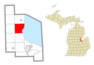
Frankenlust Township is a civil township of Bay County in the U.S. state of Michigan. The 2020 Census placed the population at 3,672. This is a 3.1% increase from the 3,562 recorded at the 2010 Census, the second largest increase in Bay County during that time period. The 2000 Census recorded 2,530. It is included in the Bay City Metropolitan Statistical Area. It is home to Delta College.

<span class="mw-page-title-main">Fraser Township, Michigan</span> Civil township in Michigan, United States

Fraser Township is a civil township of Bay County in the U.S. state of Michigan. The township's population was 3,192 as of the 2010 census. It is included in the Bay City Metropolitan Statistical Area.

<span class="mw-page-title-main">Garfield Township, Bay County, Michigan</span> Civil township in Michigan, United States

Garfield Township is a civil township of Bay County in the U.S. state of Michigan. The township's population was 1,743 as of the 2010 census. It is included in the Bay City Metropolitan Statistical Area.

<span class="mw-page-title-main">Gibson Township, Michigan</span> Civil township in Michigan, United States

Gibson Township is a civil township of Bay County in the U.S. state of Michigan. The township's population was 1,210 as of the 2010 census. It is included in the Bay City Metropolitan Statistical Area.

<span class="mw-page-title-main">Merritt Township, Michigan</span> Civil township in Michigan, United States

Merritt Township is a civil township of Bay County in the U.S. state of Michigan. The township's population was 1,441 as of the 2010 census. It is included in the Bay City Metropolitan Statistical Area.

<span class="mw-page-title-main">Monitor Township, Michigan</span> Charter township in Michigan, United States

Monitor Charter Township is a charter township of Bay County in the U.S. state of Michigan, organized in 1869. The township's population was 10,735 as of the 2010 census and is included in the Bay City Metropolitan Statistical Area.

<span class="mw-page-title-main">Mount Forest Township, Michigan</span> Civil township in Michigan, United States

Mount Forest Township is a civil township of Bay County in the U.S. state of Michigan. The township's population was 1,392 as of the 2010 census. It is included in the Bay City Metropolitan Statistical Area.

<span class="mw-page-title-main">Pinconning Township, Michigan</span> Civil township in Michigan, United States

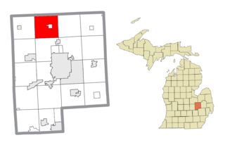
Pinconning Township is a civil township of Bay County in the U.S. state of Michigan. The township's population was 2,431 as of the 2010 census. It is included in the Bay City Metropolitan Statistical Area. Pinconning Township was organized on February 28, 1873. The city of Pinconning is surrounded by the township, but is administratively autonomous. The name "Pinconning" is said to come from the Native American word O-pin-nic-con-ing, meaning "potato place".

<span class="mw-page-title-main">Chesterfield Township, Michigan</span> Charter township in Michigan, United States

Chesterfield Charter Township is a charter township of Macomb County in the U.S. state of Michigan. As of the 2000 census, the township population was 37,405. The 2010 Census places the population at 43,381.

<span class="mw-page-title-main">Highland Township, Oakland County, Michigan</span> Charter township in Michigan, United States

Highland Township, officially the Charter Township of Highland, is a charter township of west Oakland County, Michigan. The population was 19,202 at the time of the 2010 census.

Greenleaf Township is a civil township of Sanilac County in the U.S. state of Michigan. As of the 2000 census, the township population was 804.

<span class="mw-page-title-main">Clyde Township, St. Clair County, Michigan</span> Civil township in Michigan, United States

Clyde Township is a civil township of St. Clair County in the U.S. state of Michigan. The population was 5,579 at the 2010 Census.

<span class="mw-page-title-main">Wales Township, Michigan</span> Civil township in Michigan, United States

Wales Township is a civil township of St. Clair County in the U.S. state of Michigan. The population was 3,248 at the 2010 Census.

Wisner Township is a civil township of Tuscola County in the U.S. state of Michigan. The population was 690 at the 2010 Census.

<span class="mw-page-title-main">Vienna Township, Genesee County, Michigan</span> Charter township in Michigan, United States

Vienna Charter Township is a charter township of Genesee County in the U.S. state of Michigan. The population was 13,255 at the 2010 census, slightly up from 13,108 at the 2000 census.

References

  1. 1 2 "U.S. Census website". United States Census Bureau . Retrieved 2008-01-31.
  2. U.S. Geological Survey Geographic Names Information System: Williams Township, Michigan
  3. U.S. Geological Survey Geographic Names Information System: Fisherville, Michigan & http://geonames.usgs.gov/pls/gazpublic/getgooglemap?p_lat=43.6041922&p_longi=-84.1088729&fid=626080 GNIS in Google Map].
  4. U.S. Geological Survey Geographic Names Information System: North Williams, Michigan & GNIS in Google Map.
  5. U.S. Geological Survey Geographic Names Information System: Willams Post Office (historical), Michigan & GNIS in Google Map.
    Citation: Ellis, David M. Michigan Postal History, The Post Offices 1805-1986. 12-Dec-1993.
  6. 1 2 U.S. Geological Survey Geographic Names Information System: North Williams Post Office (historical), Michigan & GNIS in Google Map.
    Citation: Ellis, David M. Michigan Postal History, The Post Offices 1805-1986. 12-Dec-1993.
  7. 1 2 U.S. Geological Survey Geographic Names Information System: Colden Post Office (historical), Michigan & GNIS in Google Map.
    Citation: Ellis, David M. Michigan Postal History, The Post Offices 1805-1986. 12-Dec-1993.
  8. 1 2 U.S. Geological Survey Geographic Names Information System: Laredo Post Office (historical), Michigan & GNIS in Google Map.
    Citation: Ellis, David M. Michigan Postal History, The Post Offices 1805-1986. 12-Dec-1993.