
Interstate 4 (I-4) is an Interstate Highway located entirely within the US state of Florida, maintained by the Florida Department of Transportation (FDOT). Spanning 132.30 miles (212.92 km) along a generally southwest–northeast axis, I-4 is entirely concurrent with State Road 400 (SR 400). In the west, I-4 begins at an interchange with I-275 in Tampa. I-4 intersects with several major expressways as it traverses Central Florida, including US Highway 41 (US 41) in Tampa; US 301 near Riverview; I-75 near Brandon; US 98 in Lakeland; US 27 in unincorporated Davenport; US 192 in Celebration; Florida's Turnpike in Orlando; and US 17 and US 92 in multiple junctions. In the east, I-4 ends at an interchange with I-95 in Daytona Beach, while SR 400 continues for roughly another four miles (6.4 km) and ends at an intersection with US 1 on the city line of Daytona Beach and South Daytona.

Interstate 295 (I-295), an auxiliary route of I-95, is a beltway around central Jacksonville, Florida, United States. The 61.04-mile-long (98.23 km) beltway consists of two segments, the West Beltway and the East Beltway, with I-95 serving as the dividing line between the two. The entire highway carries a hidden designation as SR 9A by the Florida Department of Transportation (FDOT). The West Beltway was constructed in the 1970s, with the East Beltway being built from the 1980s to the 2000s.

State Road 80 is a 123.5 miles (198.8 km) route linking US 41 Business in Fort Myers and State Road A1A in Palm Beach. The road is the northernmost of three linking Southwest Florida to South Florida via the Everglades. Due to increasing traffic, State Road 80 has experienced upgrades and widening in various sections since 2000.
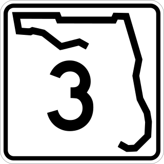
State Road 3, known locally as North Courtenay Parkway, is a north–south road located entirely on Merritt Island, serving as the southern access for the Kennedy Space Center near Cape Canaveral, Florida. The shortest of the one-digit Florida State Roads, its southern terminus is an intersection with SR 520 on Merritt Island, east of Cocoa.

State Road 404 (SR 404), the Pineda Causeway, is an east–west divided highway currently running from Interstate 95 (I-95) to SR A1A at Patrick Space Force Base, Florida, US. It was opened as a toll road in 1971 and classified as a state road two years later. The tolls were removed in 1990. It was named after Pineda, a former village east of Suntree on U.S. Route 1 (US 1). With interchanges at US 1 (SR 5), South Tropical Trail, and South Patrick Drive (SR 513), the Pineda Causeway is the primary access for Patrick Space Force Base and the southern end of Merritt Island. From US 1 to the eastern terminus, it is part of the Indian River Lagoon Scenic Highway system.
The Pinellas Bayway System is a series of bridges on two state roads in Pinellas County, Florida. It is a toll road complex maintained and operated by the Florida Department of Transportation. It also is compatible with the SunPass ETC system currently in use on all other FDOT-owned toll roads. The Pinellas Bayway consists of:

State Road 78 is the Florida Department of Transportation designation of the highway that historically extended from Pine Island Center on the Gulf Coast of Florida to the northern tip of Lake Okeechobee. In the 1980s, two segments of the route were removed from state maintenance to county maintenance and both were redesignated County Road 78. All three sections of SR 78 are signed east–west, even though the easternmost section is actually a north–south route.

Flagler Street is a 12.4-mile (20.0 km) main east–west road in Miami. Flagler Street is the latitudinal baseline that divides all the streets on the Miami-Dade County grid plan as north or south streets. Flagler Street is named after industrialist Henry Flagler and serves as a major commercial east–west highway through central Miami-Dade County, with a mixture of residential neighborhoods and strip malls, the commercial presence increasing as SR 968 approaches downtown Miami.
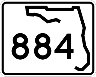
State Road 884, along with County Road 884, together create Lee County, Florida's primary east–west partially controlled access highway, linking Cape Coral in the western portion of the county to Lehigh Acres and Alva in the eastern portion. Currently, the highway consists of State Road 884, and two segments of County Road 884 on each end, and the entire highway is about 37.5 miles (60.4 km) long. The highway runs through the southern incorporated limits of the city of Fort Myers and through the mid part of Cape Coral, and has become a major commuter route.
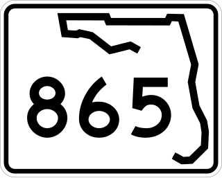
State Road 865 and County Road 865 are a series of roads serving Lee County, Florida. Originally a continuous state road extending from Bonita Springs to Tice by way of Fort Myers Beach and Fort Myers, SR 865 now consists of two segments connected by a part of CR 865, which also extends to the north and south of the state segments. Both the state and county controlled segments of the route combined stretch a distance of over 40 miles (64.37 km), making it the longest designation in Lee County.
State Road 739 is a 17-mile-long (27 km) commercial highway running from San Carlos Park, Florida to North Fort Myers that is also known as U.S. Route 41 Business for the northernmost six miles (9.7 km) of its route.

State Road 758 is an 5.4-mile-long (8.7 km) state road in Sarasota, Florida, United States. State Road 758 is locally known as Bee Ridge Road from Tamiami Trail east to its eastern terminus at Interstate 75 where it continues east as a county road.

State Road 789 is a 17.5-mile-long road along the Florida’s Gulf Coast that spans Bird Key, St. Armands Key, and Lido Key, in Sarasota; Longboat Key ; and Anna Maria Island. The southern terminus is the intersection of the John Ringling Causeway and Tamiami Trail in Sarasota; the northern terminus is the intersection of Gulf Drive, North and Manatee Avenue., West in Holmes Beach. Much of the northernmost five miles (8 km) has been designated Bradenton Beach Scenic Highway.

Interstate 75 (I-75) is a part of the Interstate Highway System that runs from the Hialeah–Miami Lakes border, a few miles northwest of Miami, to Sault Ste. Marie in the Upper Peninsula of Michigan. I-75 begins its national northward journey near Miami, running along the western parts of the Miami metropolitan area before traveling westward across Alligator Alley, resuming its northward direction in Naples, running along Florida's Gulf Coast, and passing the cities of Fort Myers, Punta Gorda, Venice, and Sarasota. The freeway passes through the Tampa Bay area before turning inward toward Ocala, Gainesville, and Lake City before leaving the state and entering Georgia. I-75 runs for 471 miles (758 km) in Florida, making it the longest Interstate in the state and also the longest in any state east of the Mississippi River. The Interstate's speed limit is 70 mph (110 km/h) for its entire length in Florida.

State Road 31 is a state highway in Southwest Florida in Lee, Charlotte, and DeSoto counties. It is about 36 miles long. The entire roadway is two lanes wide, even near Fort Myers. The highway crosses the Caloosahatchee River via the Wilson Pigott Bridge, a small drawbridge, a mile north of the southern terminus. The northern terminus is with an intersection of SR 70 near Arcadia. The southern terminus is with an intersection of SR 80 near Fort Myers Shores. The route is home to G. Pierce Wood Memorial Hospital, replacing the old De Soto Aircraft Field.

U.S. Highway 19 (US 19) runs about 262 miles (422 km) along Florida's west coast from an interchange with US 41 in Memphis, south of Tampa, and continues to the Georgia border north of Monticello.

State Road 64 extends from City Road 789 near the Gulf of Mexico in Holmes Beach on Anna Maria Island in Manatee County to US 27/US 98 in Avon Park in Highlands County. State Road 64 travels from west to east through the counties of Manatee, Hardee and Highlands. It is a mostly rural two-lane highway going through only two cities, Bradenton and Zolfo Springs. It crosses the Gulf Intracoastal Waterway as well as the Braden River, Lake Manatee, and the Myakka River. East of Avon Park, a bi-county extension runs northeast into Polk County which runs through Lake Wales Ridge State Forest and terminates at the Avon Park US Air Force Base. It is designated as the Florida Cracker Trail from Bradenton to the Hardee County Line.

The Pine Island Causeway is a roadway in Southwest Florida spanning Matlacha Pass connecting Pine Island, the largest island in Florida, to the main land in Cape Coral. The causeway carries Pine Island Road and consists of three bridges with dredged land sections in between them. The islands connected to the middle of the causeway are also home to the community of Matlacha. It provides the only vehicular access to both Matlacha and Pine Island.
County Road 876 is a major county road in Lee County, Florida spanning 22.92 miles (36.89 km). It is major east-west thoroughfare just south of Fort Myers city limits before becoming a north-south route through Lehigh Acres and Buckingham. The east-west portion is locally known as Cypress Lake Drive west of U.S. Route 41 and Daniels Parkway east of there. The north-south segment is known as Gunnery Road through Lehigh Acres and Buckingham Road through Buckingham.


