
Le Flore County is a county along the eastern border of the U.S state of Oklahoma. As of the 2020 census, the population was 48,129. Its county seat is Poteau. The county is part of the Fort Smith metropolitan area and the name honors a Choctaw family named LeFlore. The United States District Court for the Eastern District of Oklahoma is the federal district court with jurisdiction in LeFlore County.

Talihina is a town in LeFlore County, Oklahoma, United States, its name originating from two Choctaw words, tully and hena, meaning "iron road," a reference to the railroad around which the town was built. It is part of the Fort Smith, Arkansas–Oklahoma Metropolitan Statistical Area. The population was 925 at the time of the 2020 Census.

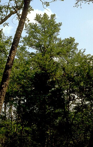
The Ouachita National Forest is a vast congressionally-designated National Forest that lies in the western portion of Arkansas and portions of extreme-eastern Oklahoma, USA.
The Ozark – St. Francis National Forest is a United States National Forest that is located in the state of Arkansas. It is composed of two separate forests, Ozark National Forest in the Ozark Mountains; and St. Francis National Forest on Crowley's Ridge. Each forest has distinct biological, topographical, and geological differences.

The Ouachita Mountains, simply referred to as the Ouachitas, are a mountain range in western Arkansas and southeastern Oklahoma. They are formed by a thick succession of highly deformed Paleozoic strata constituting the Ouachita Fold and Thrust Belt, one of the important orogenic belts of North America. The Ouachitas continue in the subsurface to the northeast, where they make a poorly understood connection with the Appalachians and to the southwest, where they join with the Marathon uplift area of West Texas. Together with the Ozark Plateaus, the Ouachitas form the U.S. Interior Highlands. The highest natural point is Mount Magazine at 2,753 feet (839 m).

The Shasta–Trinity National Forest is a federally designated forest in northern California, United States. It is the largest National Forest in California and is managed by the U.S. Forest Service. The 2,210,485 acre forest encompasses five wilderness areas, hundreds of mountain lakes and 6,278 miles (10,103 km) of streams and rivers. Major features include Shasta Lake, the largest man-made lake in California and Mount Shasta, elevation 14,179 feet (4,322 m).
The Robert S. Kerr Memorial Arboretum, Nature Center and Botanical Area is an arboretum and nature preserve in the Ouachita National Forest, near Talihina, Oklahoma, containing plant communities significant in their occurrence, variety, and location. It is bordered by U.S. 270-59 and Forest Road 6007 on the north and the Talimena Scenic Byway to the west and south.

State Highway 1, sometimes abbreviated as SH-1, is a 209.7-mile (337 km) highway maintained by the U.S. state of Oklahoma. It travels through the southeastern part of the state, nicknamed Little Dixie. SH-1 is signed east and west.
Ouachita National Recreation Trail is a 223-mile (359 km) long, continuous hiking trail through the Ouachita Mountains of Oklahoma and Arkansas. It is the longest backpacking trail in the Ouachita National Forest, spanning 192 miles across its length. Approximately 177 miles of the trail is in Arkansas and 46 miles of the trail is in Oklahoma. The trail is used by hikers, backpackers, hunters, and mountain bikers. It is a non-motorized single track trail open only to foot traffic and partially open to mountain bicycles. Segments opened to mountain bikes are from the western terminus of the Ouachita Trail at Talimena State Park to the Big Cedar trailhead on US Highway 259 at approximately Mile Marker (MM) 30.5 in Oklahoma, and from the Talimena Scenic Drive Trailhead at MM 54.1, east to Highway 7 at mile 160.4, north of Jessieville, Arkansas.
Winding Stair Mountain National Recreation Area is a United States national recreation area in the Ouachita National Forest. State Highway 1, known as the Talimena Scenic Byway in this area, bisects the recreation area. U. S. Highway 271 loops up through the summit. Winding Stair Mountain National Recreation Area and the nearby Upper Kiamichi River and Black Fork Mountain Wilderness areas were created by an act of Congress on October 18, 1988.

Choctaw Country is the Oklahoma Department of Tourism and Recreation's official tourism designation for Southeastern Oklahoma. The name was previously Kiamichi Country until changed in honor of the Choctaw Nation headquartered there. The current definition of Choctaw Country includes ten counties, being Coal, Atoka, Bryan, Choctaw, McCurtain, Pushmataha, Le Flore, Latimer, Haskell, and Pittsburg counties. The department created the term as one of six designated travel regions within the state. However, other definitions of Southeastern Oklahoma may include additional counties.

Highway 88 is a designation for five state highways in Arkansas. All routes are maintained by the Arkansas Department of Transportation (ArDOT).

The Talimena Scenic Drive is a National Scenic Byway in southeastern Oklahoma and extreme western Arkansas spanning a 54.0-mile (86.9 km) stretch of Oklahoma State Highway 1 (SH-1) and Arkansas Highway 88 (AR 88) from Talihina, Oklahoma, to Mena, Arkansas.

The Lariat Loop National Scenic and Historic Byway is a National Scenic Byway and a Colorado Scenic and Historic Byway located in Jefferson County, Colorado, USA. The byway is a 40-mile (64 km) loop in the Front Range foothills west of Denver through Golden, Lookout Mountain Park, Genesee Park, Evergreen, Morrison, Red Rocks Park, and Dinosaur Ridge. The Lariat Loop connects to the Mount Evans Scenic Byway at Bergen Park.

The Arkansas Scenic Byways Program is a list of highways, mainly state highways, that have been designated by the Arkansas Department of Transportation (ArDOT) as scenic highways. The Arkansas General Assembly designates routes for scenic byway status upon successful nomination. For a highway to be declared scenic, a group interested in preserving the scenic, cultural, recreational, and historic qualities of the route must be created. Mayors of all communities along the route and county judges from each affected county must be included in the organization. Scenic highways are marked with a circular shield in addition to regular route markers.

The Kiamichi Mountains are a mountain range in southeastern Oklahoma. A subrange within the larger Ouachita Mountains that extend from Oklahoma to western Arkansas, the Kiamichi Mountains sit within Le Flore, Pushmataha and McCurtain counties near the towns of Poteau, Albion and Smithville. The foothills of the Kiamichi Mountains sit within Haskell County, Northern Latimer County and Northern Pittsburg County. Its peaks, which line up south of the Kiamichi River, reach 2,500 feet in elevation. The range was the namesake of Kiamichi Country, the official tourism designation for southeastern Oklahoma, until the designation was changed to Choctaw Country.
Blackjack Mountain is 17 miles (27 km) long mountain ridge trending from northeast to southwest in Pushmataha County, Oklahoma. It is one of several such ridges in the Ouachita Mountains range. The highest peak has an elevation of 1,250 feet (380 m). The town of Rattan, Oklahoma is south of Blackjack Mountain.
Beech Creek National Scenic Area is a federally designated National Scenic Area within Ouachita National Forest. It is 6 miles (9.7 km) east and 5 miles (8.0 km)south of the unincorporated community of Big Cedar in Le Flore County, Oklahoma, USA. The 7,500-acre (30 km2) scenic area is administered by the U.S. Forest Service, a part of the U.S. Department of Agriculture. The scenic area includes 32 miles (51 km) of hiking trails, some on former roads. The original designated area, the Beech Creek Botanical Area, remains, conserving mature beech trees near the headwaters of Beech Creek.
Indian Nations National Scenic and Wildlife Area is a federally designated National Scenic Area within Ouachita National Forest 11 miles (18 km) south of Heavener, in Le Flore County, Oklahoma USA. The 41,051-acre (16,613 ha) scenic area is administered by the U.S. Forest Service. The scenic area includes the Homer L. Johnson Wildlife Management Area. There is also a 15-acre (6.1 ha) fishing lake atop Post Mountain, developed by the U. S. Forest Service during the 1930s, is included within the scenic area.
Talimena State Park is an Oklahoma state park located in LeFlore County in eastern Oklahoma. The 20 acres (8.1 ha) park is at the Oklahoma entrance to Talimena Scenic Drive, about 7 miles (11 km) north of Talihina, Oklahoma. and 20 miles (32 km) south of Wister. It offers opportunities for camping, hiking, biking, and wildlife watching.
