Wood Green High StreetAlexandra Palace, a 25 minute walk or 11 minute bus ride from Wood Green tube station
Wood Green is a suburban district in the borough of Haringey in London, England. Its postal district is N22, with parts in N8 or N15. The London Plan identifies it as one of the metropolitan centres in Greater London,[2] and today it forms a major commercial district of north London.[3]
Formerly lying within the western part of Tottenham and within the county of Middlesex, it became part of both Haringey and Greater London in 1965. Wood Green lies directly to the east of Alexandra Palace. It is 6.5 miles (10.5km) from Charing Cross in central London.
Toponymy
The name Wood Green derives from ‘Woodlegh’ or 'Woodlea', a Saxon word meaning open ground near a wood, which in this case relates to an opening in Tottenham Wood, an extensive area of woodland which formerly covered most of this area and westward to Muswell Hill.[4] The earliest surviving written record of ‘Woodlegh’ is a reference in documentation dating from 1256, which relates to a grant for Ducketts Manor, (a sub-manor of Tottenham) which used to be located just to the east of the present-day Wood Green High Road, roughly opposite the junction of Alexandra Road and the High Road.[5]
History
Records suggest that settlement around Wood Green did not start till after the Norman Conquest.[5] There is some limited evidence of Roman presence in the Wood Green area but none of any Saxon settlement. However, from the latter part of the 14th century, a number of estates developed around Wood Green. This included the Manor of Ducketts and a handful of smaller estates.
In the early Seventeenth Century, the lord of Tottenham Manor, the Earl of Dorset, conducted a major survey of his land. It showed that Wood Green, at the time roughly the Western half of Tottenham, had only sixteen houses and 50 inhabitants.[5][6]
“Round House” or “Mushroom House”. Built in 1822 as the gatehouse for Chitts Hill House, this building still stands at the edge of Woodside Park in Wood Green. It is Grade II listed.
At around the same time as the Dorset Survey, the New River was constructed through Wood Green. Winding through the area, the river looped across Chitts Hill and then passed along the northern side of Wood Green Common before turning south. The proximity of Wood Green to the new watercourse enhanced the area's reputation and between the 17th and early 19th Century, several large properties were constructed in the area, initially as country retreats for wealthy Londoners. Such dwellings included Cherson House, Wood Green Cottage, Moat Cottage and the Grange, all of which were situated on the fringes of Wood Green Common and dated from the 17th Century. Later, Wood Green House (c. 1780), Chitts Hill House (c. 1805) and Bounds Green House were constructed at the perimeter of the common. Despite the development of these dwellings, by 1798 the population of Wood Green stood at just 100 inhabitants and remained scattered. It was centred at this period on Wood Green Common.
Notice for 1806 sale of land in Wood Green (Exact location unknown).
At the same time as the population was growing so was the traffic along Green Lanes. As a result, Wood Green's first inn and recognisable business appeared. In 1770 George Chesser established a blacksmith's shop on the corner of Green Lanes and Lordship Lane (later known as Spouter's Corner). In 1781, the Three Jolly Butchers coaching inn was opened on the west side of Green Lanes between Lordship Lane and Bounds Green Road.[5]
During the early decades of the 19th Century, the number of inhabitants in the area began to increase significantly. By the middle of the nineteenth century the population had increased to 400[5] and the centre of Wood Green's gravity had moved north and east with most development taking place in a triangle directly north of St Michael's Church.[8] By the time of the publication of the 1869 Ordnance Survey map, Clarence Road, Truro Road, Nightingale Road, Finsbury Road and Commerce Road were all laid out and were becoming increasingly built up.
The opening of the Great Northern Railway Line station at Wood Green in 1859 encouraged further development. By the end of the nineteenth century, much of Wood Green had been built up. What remained was built over during the first part of the twentieth century.
The Victorian development was both residential and commercial in nature. Wood Green's industrial development was centred on the area bounded by Wood Green Common, the Great Northern Railway, Turnpike Lane and the High Street. Amongst the first companies to arrive in the early 1860s was E Welch & Co Tobacco Manufacturer. Then in short order came the Hornsey Steam Laundry, Henry A. Ivory & Co Piano Manufacturers and Davis and Timmins Screw Factory.[9] In 1880, Barratts arrived and grew to be one of the biggest confectionery manufacturers of the twentieth century.[10]
As Wood Green's population grew, so did its high street. The earliest retail developments had been in Commercial Road and Finsbury Road during the 1860s. However, by the early 1880s retail activity was clearly shifting to the High Road. At first, it focussed on the area between White Hart Lane and Truro Road. As the population grew, retail growth south of Lordship Lane began to exceed that north of it and by the end of the first decade of the twentieth Wood Green, High Street had become a popular shopping centre for North London. By 1976 Wood Green was the largest shopping centre in north London with a turnover of more than £20m.
River Park House, Wood Green High Road
With the reorganisation of local government in the 1960s, Haringey Council was formed from the former boroughs of Wood Green, Hornsey and Tottenham. The new unified administration wanted to reinvent Wood Green as a ‘Heart for Haringey’. It was one of a number of new suburban centres intended to counteract the pull of Central London. The Shopping City was constructed between 1976 and 1981.[11]
Governance history
Up to the nineteenth century, Wood Green came under the governance of the Manor and Parish of Tottenham. Tottenham developed from a parish in Middlesex into an Urban sanitary district in 1875, after a local board of health had been established in 1850.[12]
The constituency of Wood Green was created in 1918 and existed until 1983 when it was split. Some of the constituency was transferred to the neighbouring seat of Tottenham, but most was merged with the Hornsey parliamentary constituency to form the Hornsey and Wood Green parliamentary constituency. Since 2015, the seat has been represented in the House of Commons by the Labour PartyMember of Parliament (MP) Catherine West.[5]
Post-war
In mid century, Wood Green was known locally as the "Golden Mile of North London". Some shops and buildings were demolished in the 1960s and buildings were cleared to construct Shopping City, now known as The Mall Wood Green, which is one of London's major shopping centres.[13]
Entertainment history
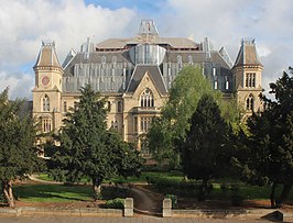
The Alexandra Palace, which is within Wood Green parish, played a leading role in the development of public service television. It is now an events and entertainment venue hosting exhibitions, concerts and sporting events.
Wood Green also played its part in the history of commercial television in the UK. In 1955, with the opening of Lew Grade's London weekend franchise Associated Television (ATV), the Wood Green Empire in Lymington Avenue was home to variety programmes on Independent Television (ITV); one of which was The Arthur Haynes Show, starring the host himself and his straight man Nicholas Parsons.[14] Only the frontage of The Wood Green Empire survives. It is now a branch of the Halifax.
As of 2018, Wood Green is the focus of two major regeneration programmes by the London Borough of Haringey. The Haringey Heartlands initiative covers an area to the west of the town centre, including the former Clarendon Gas Works, Olympia Trading Estate and land on Western Road. The programme aims to transform the area into a mixed sub-neighbourhood, with 1,700 homes, along with retail and office space. There are also plans for new public open space including a 'civic boulevard' linking the east and west of Wood Green and a public square for events and activities.[16]
The wider area of Wood Green is the focus of a second significant regeneration plan entering the final stages of consultation in early 2018. The Wood Green Area Action plan would see the transformation of Wood Green Town Centre with the creation of 6,400 new homes, 4,000 new jobs and a redeveloped town centre with a significant amount of high-rise building.[17]
Blue House Yard is a redevelopment of a former car park including creative work and retail space, a public square for markets and events.
Wood Green is also one of the suggested stations on the new Crossrail 2 transport development.
Geography
Wood Green stretches from Turnpike Lane in the south to the borough boundary in the north.[18] Its eastern and western boundaries have changed over time and today people have varying senses of what exactly is included in Wood Green. One definition sees the western boundary as formed by the Great Northern Railway Line. Others argue that Alexandra Park is still within Wood Green's boundaries. Less contentious is the eastern boundary. A common definition would roughly describe it by a line running from the southwestern corner of Tottenhall Park, to the junction of The Roundway and Lordship Lane, then along Downhills Way as far as Belmont Avenue. This part of the boundary is completed by a line running in a northwesterly direction as far as Westbury Avenue.[19]
The area rises from 66ft (20 m) to 98ft (30 m) above sea level.
Locale
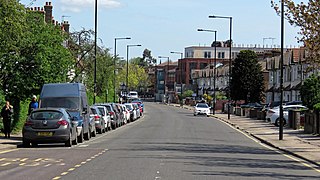
The shopping area and residential areas of Wood Green all offer quite different identities. The area to the west of the High Road, near Alexandra Palace, was developed as a mainly middle-class residential area, whereas the area to the east, towards Tottenham, mainly comprises smaller dwellings that were either built for railway workers in the 19th century or as social housing in the 20th. The High Road and the shopping mall host a variety of shops. There are regeneration plans approved for the old Marks and Spencer, and BHS buildings. There are a number of new restaurants which have opened along the High Road in recent years. Behind the High Road, Wood Green's streets include a high proportion of attractive high-quality Victorian houses. To the north and west of the tube station, a large number of green spaces weave through the streets and a number of larger open green areas remain.[20]
Haringey Civic Centre on Wood Green High Road is the official seat of the London Borough of Haringey and contains the council chambers. It was opened in 1958 and is a listed building.[21]
Demography
Wood Green does not fit neatly into wards. However, a significant part of the area is contained within the Noel Park and Woodside wards. The population of those wards is given as 28,453 in the 2011 Census. The same census reports that white groups make up 55% of the population of Noel Park ward.[22] The figures for the Woodside ward are 30% White Other, 23% White British, 14% Asian, 8% Black African, 6% Black Caribbean, 3% Black Other, 3% White Irish, 1% Arab and other ethnic groups.[23]
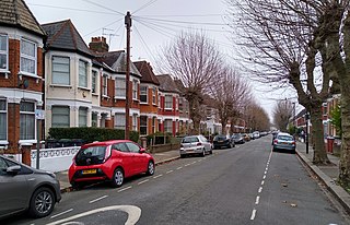
Houses at Wood Green
Economy
Wood Green is a busy urban activity centre with a sizeable shopping area with two cinemas, bars, nightclubs, numerous restaurants and cafes and a shopping area, The Mall, close to the tube station. The High Road, the main shopping spine, stretches from the Wood Green tube station to the next stop on the Piccadilly line, Turnpike Lane, and is lined with shops along its route. It joins with Green Lanes at both its northern and southern ends.
As of 2012, Wood Green has 120,757 square metres (1,299,820sqft) of total town centre floorspace.[24]
The Chocolate Factory was set up by Haringey Arts Council in 1996 to develop artists' studios and now has a second building. The project houses 200 local artists, music, film and multimedia studios, photographic studios, and several performing arts organisations.[25]
Wood Green Fatih Mosque is on Caxton Road, sharing premises with Haringey Council of Asian People.[30]
Sport
There are a number of sports facilities in the local area. Indoor and outdoor tennis, all-weather football, an athletics track and gym are available at New River Stadium. The local parks offer a variety of options for running and other sports, and many also have tennis courts. There are various gyms in the Wood Green area.
Hornsey is a district of north London, England, in the London Borough of Haringey. It is an inner-suburban, for the most part residential, area centred 10 km (6.2 mi) north of Charing Cross. It adjoins green spaces Queen's Wood to the west and Alexandra Park to the north, and lies in the valley of the now-culverted River Moselle. The central core of the area is known as Hornsey Village.
Muswell Hill is a suburban district of the London Borough of Haringey, north London. The hill, which reaches over 100 m (330 ft) above sea level, is situated 5.5 miles (8.9 km) north of Charing Cross.
The London Borough of Haringey is a London borough in North London, classified by some definitions as part of Inner London, and by others as part of Outer London. It was created in 1965 by the amalgamation of three former boroughs. It shares borders with six other London boroughs. Clockwise from the north, they are: Enfield, Waltham Forest, Hackney, Islington, Camden, and Barnet.
Seven Sisters is a district of Tottenham, north London, England, at the eastern end of Seven Sisters Road, which runs from Tottenham High Road to join the A1 in Holloway.
Crouch End is an area of North London, approximately five miles (8 km) from the City of London in the western half of the borough of Haringey. It is within the Hornsey postal district (N8). It has been described by the BBC as one of "a new breed of urban villages" in London. In 2023, it was voted the best place to live in London by the Sunday Times, saying "A creative edge and friendly neighbours give this lofty northern enclave social capital in the capital".
Harringay is a district of north London, England, within the London Borough of Haringey. It is centred on the section of Green Lanes running between the New River, where it crosses Green Lanes by Finsbury Park, and Duckett's Common, near Turnpike Lane.
Fortis Green is a ward in the extreme northwestern corner of the Borough of Haringey, north London. It is also the name of the road that runs between Muswell Hill and East Finchley which forms part of the A504.
Wood Green was a local government district in south east Middlesex from 1888 to 1965.
The London Borough of Haringey maintains 240 hectares of parks and open spaces. By 2015, 20 of these were accredited with a Green Flag Award. Until their disbandment in April 2009, the parks were patrolled by the Haringey Parks Constabulary.
Lordship Lane connects Wood Green (N22) with Tottenham High Road (N17). It lies in the London Borough of Haringey and forms part of the A109 road.
Woodside High School is a mixed 11–16 comprehensive school located in the Wood Green area of the London Borough of Haringey, England. With a student roll of 1200, the school has been judged by Ofsted as outstanding for two consecutive inspections.
The history of Harringay tells the story of the development of the district of London five miles from its centre, affected by, but not always part of, the great city's history.
West Green is a district in north London, England, in the United Kingdom; within the London Borough of Haringey. It is located 5.7 miles (9.22 km) north of Charing Cross.
The advance of late Victorian urbanisation during the last twenty years of the 19th century swept away the 18th and early 19th-century houses, their grounds and the farmland. By 1900 Harringay was completely urbanised.
Noel Park in north London is a planned community built in the late 19th and early 20th centuries consisting of 2,200 model dwellings, designed by Rowland Plumbe. It was developed as the Noel Park Estate on a tract of land on the edge of north London as part of the fast growing development of Wood Green. It is one of four developments on the outskirts of London built by the Artizans, Labourers & General Dwellings Company. From 2003 to sometime in 2009, the name was also given to a small park near the southern edge of Noel Park, formerly known – and now known again – as Russell Park.
Tottenham is a town in north London, England, within the London Borough of Haringey. It is located in the ceremonial county of Greater London. Tottenham is centred 6 mi (10 km) north-northeast of Charing Cross, bordering Edmonton to the north, Walthamstow, across the River Lea, to the east, and Stamford Hill to the south, with Wood Green and Harringay to the west.
Duckett's Green is an area of north London, England in the United Kingdom and part of the London Borough of Haringey. It is an inner-suburban area located 5.8 miles (9.4 km) north of Charing Cross.
John Samuel Alder FRIBA was a British architect known for his church buildings.
References
↑ 2011 CensusArchived 22 February 2014 at the Wayback Machine Wood Green does not fit exactly into electoral wards but the figures for Noel Park and Woodside give a rough approximation.
Harringay Online – for forum conversations about Wood Green and in particular for its wide selection of historical images and history articles on Wood Green and other local areas.
This page is based on this Wikipedia article Text is available under the CC BY-SA 4.0 license; additional terms may apply. Images, videos and audio are available under their respective licenses.