Related Research Articles

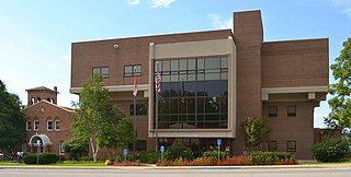
Clay County is located in the U.S. state of Missouri and is part of the Kansas City metropolitan area. As of the 2020 census, the county had a population of 253,335, making it the fifth-most populous county in Missouri. Its county seat is Liberty. The county was organized January 2, 1822, and named in honor of U.S. Representative Henry Clay from Kentucky, later a member of the United States Senate and United States Secretary of State.

Wright County is a county located in the southern portion of the U.S. state of Missouri. As of the 2010 census, the population was 18,815. Its county seat is Hartville. The county was officially organized on January 29, 1841, and is named after Silas Wright, a former Congressman, U.S. Senator and Governor of New York.

Warren County is a county located in the eastern portion of the U.S. state of Missouri. As of the 2010 census, the population was 32,513. The county is located on the north side of the Missouri River. Its county seat is Warrenton. The county was organized on January 5, 1833, and named for General Joseph Warren, who died in the Battle of Bunker Hill during the American Revolutionary War.

Stoddard County is a county located in the southeastern portion of the U.S. state of Missouri. As of the 2010 census, the population was 29,968. The county seat is Bloomfield. The county was officially organized on January 2, 1835, and is named for Amos Stoddard, the first American commandant of Upper Louisiana.

St. Francois County is a county located in the Lead Belt region in the U.S. state of Missouri. As of the 2020 census, the population was 66,922. The largest city and county seat is Farmington. The county was officially organized on December 19, 1821. It was named after the St. Francis River. The origin of the river's name is unclear. It might refer to St. Francis of Assisi. Another possibility is that Jacques Marquette, a Jesuit who explored the region in 1673, named the river for the Jesuit missionary Francis Xavier. Marquette had spent some time at the mission of St. Francois Xavier before his voyage and, as a Jesuit, was unlikely to have given the river a name honoring the Franciscans.

St. Clair County is a county located in the western portion of the U.S. state of Missouri. As of the 2020 census, the population was 9,284. Its county seat is Osceola. The largest city is Appleton City. The county was organized in 1841 and named after General Arthur St. Clair, Governor of the Northwest Territory. St. Clair was also the 9th president of the United States in Congress Assembled. Under his presidency, the Northwest Ordinance and United States Constitution were passed.
Pulaski County is a county located in the U.S. state of Missouri. As of the 2010 census, the population was 52,274. Its county seat is Waynesville. The county was organized in 1833 and named for Kazimierz Pułaski, a Polish patriot who died fighting in the American Revolution.

Marion County is a county located in the northeastern portion of Missouri. As of the 2010 census, the population was 28,781. Its county seat is Palmyra. Unique from most third-class counties in the state, Marion has two county courthouses, the second located in Hannibal. The county was organized December 23, 1826 and named for General Francis Marion, the "Swamp Fox," who was from South Carolina and served in the American Revolutionary War. The area was known as the "Two Rivers Country" before organization.

Lincoln County is located in the eastern part of the U.S. state of Missouri. As of the 2010 census, the population was 52,566. Its county seat is Troy. The county was founded December 14, 1818, and named for Major General Benjamin Lincoln of the American Revolutionary War.

Laclede County is a county located in the U.S. state of Missouri. As of the 2010 census, the population was 35,571. Its county seat is Lebanon. The county was organized February 24, 1849, and was named after Pierre Laclède, founder of St. Louis.

Johnson County is a county located in western portion of the U.S. state of Missouri. As of the 2010 census, the population was 52,595 with a 2018 estimate of 53,652. Its county seat is Warrensburg. The county was formed December 13, 1834 from Lafayette County and named for Vice President Richard Mentor Johnson.

Jasper County is a county located in the southwest portion of the U.S. state of Missouri. As of the 2020 census, the population was 122,761. Its county seat is Carthage, and its largest city is Joplin. The county was organized in 1841 and named for William Jasper, a hero of the American Revolutionary War.

Hickory County is located in the U.S. state of Missouri. As of the 2020 census, the population was 8,279. Its county seat is Hermitage. The county was organized February 14, 1845, and named after President Andrew Jackson, whose nickname was "Old Hickory." The Pomme de Terre Dam, a Corps of Engineers facility, is located three miles south of Hermitage and forms Lake Pomme de Terre by damming the Pomme de Terre River and Lindley Creek. The county is also home to Lucas Oil Speedway at Wheatland that includes a major circle dirt racing track, an off-road racing track as well as a large man-made water drag racing facility. Truman Reservoir, also a Corps of Engineers facility, floods the Pomme de Terre Reservoir from the northern border of the county southward to the city limits of Hermitage.

Greene County is located in the U.S. state of Missouri. As of the 2020 census, its population was 298,915 making it the fourth most-populous county in Missouri. Its county seat and most-populous city is Springfield. The county was organized in 1833 and is named after American Revolutionary War General Nathanael Greene.

Cass County is a county located in the western part of the U.S. state of Missouri and is part of the Kansas City metropolitan area. As of the 2020 census, the population was 107,824. Its county seat is Harrisonville, however the county contains a portion of Kansas City, Missouri. The county was organized in 1835 as Van Buren County, but was renamed in 1849 after U.S. Senator Lewis Cass of Michigan, who later became a presidential candidate.
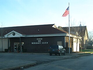
Wright City is a city in Warren County, Missouri, United States. It is located on Interstate 70 at mile marker 200 approximately 50 miles (80 km) west of downtown St. Louis. Wright City is a small, semi-rural community area with primarily single-family housing, with some multi-family dwellings. The population was 3,119 at the 2010 census. It has a number of small stores and restaurants. It has various types of light to heavy industrial businesses.

Missouri City is a city in the U.S. state of Texas, within the Houston–The Woodlands–Sugar Land metropolitan area. The city is mostly in Fort Bend County, with a small portion in Harris County. As of the 2010 census, the city had a population of 67,358, up from 52,913 in 2000. The population was estimated at 75,457 in 2019.

St. Charles County is in the central eastern part of the U.S. state of Missouri. As of the 2010 census, the population was 360,485, making it Missouri's third-most populous county. Its county seat is St. Charles. The county was organized October 1, 1812 and named for Saint Charles Borromeo, an Italian cardinal. The county executive is Steve Ehlmann, since January 2007.

Warrenton High School is a secondary school located in Warrenton, United States, in Warren County, Missouri. It is part of the Warren County R-3 School District. The current building was built in 1996. Prior to that period, the high school was housed in the current Black Hawk Middle School/Daniel Boone Building. Warrenton High School officially had 1006 students enrolled for the 2008-2009 academic year, according to the Missouri Department of Elementary and Secondary Education,.
Wright City High School (WCHS) is a public high school in Wright City, Missouri, part of the Wright City R-II School District. It was established in 1922.
References
- ↑ "Wright City R-II Board adopts $18.9 million budget". Warren County Record. July 13, 2014. Retrieved December 20, 2018.
- ↑ "Missouri Comprehensive Data System – Wright City R-II of Warren Co". Missouri Department of Elementary & Secondary Education. Retrieved December 20, 2018.