Slope County is a county in the U.S. state of North Dakota. As of the 2020 census, the population was 706, making it the least populous county in North Dakota and the 20th-least populous county in the United States. The county seat is Amidon.

McKenzie County is a county in the U.S. state of North Dakota. As of the 2020 census, the population was 14,704. Its county seat is Watford City.

Dunn County is a county in the U.S. state of North Dakota. As of the 2020 census, the population was 4,095. Its county seat is Manning.

Bowman County is a county in the U.S. state of North Dakota. As of the 2020 census, the population was 2,993. Its county seat is Bowman.
Billings County is a county in the U.S. state of North Dakota. As of the 2020 census, the population was 945, making it the second-least populous county in North Dakota. Its county seat and only incorporated place is Medora.
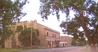
Marmarth is the largest city in Slope County in the U.S. State of North Dakota with a population of 101 as of 2020 census. It is situated in the southwestern part of Slope County, along the Bowman County line in the southwestern part of North Dakota, just seven miles east of the Montana border. Marmarth was founded as a railroad town along the Milwaukee Road from Seattle, WA to Chicago, IL. By 1920, Marmarth had over 1,300 residents. The town's population declined during most of the 20th century and was only 101 in 2021. There is one restaurant and one bar still located in Marmarth in 2013.

The Little Missouri River is a tributary of the Missouri River, 560 miles (900 km) long, in the northern Great Plains of the United States. Rising in northeastern Wyoming, in western Crook County about 15 miles (24 km) west of Devils Tower, it flows northeastward, across a corner of southeastern Montana, and into South Dakota. In South Dakota, it flows northward through the Badlands into North Dakota, crossing the Little Missouri National Grassland and all three units of Theodore Roosevelt National Park. In the north unit of the park, it turns eastward and flows into the Missouri in Dunn County at Lake Sakakawea, where it forms an arm of the reservoir 30 miles (48 km) long called Little Missouri Bay and joins the main channel of the Missouri about 25 miles (40 km) northeast of Killdeer.

The Knife River is a tributary of the Missouri River, approximately 120 mi (193 km) long, in North Dakota in the United States.

Theodore Roosevelt National Park is an American national park of the badlands in western North Dakota comprising three geographically separated areas. Honoring U.S. President Theodore Roosevelt, it is the only American national park named directly after a single person.

Little Missouri National Grassland is a National Grassland located in western North Dakota, USA. At 1,028,051 acres (416,037 ha), it is the largest grassland in the country. Enclaved within its borders is Theodore Roosevelt National Park, which is managed by the National Park Service. The Little Missouri National Grassland was once a part of the Custer National Forest, but is now a part of the Dakota Prairie Grasslands, a National Forest unit consisting entirely of National Grasslands. A predominant feature of the grassland is colorful and beautiful badlands, a rugged terrain extensively eroded by wind and water. It is a mixed grass prairie, meaning it has both long and short grass.

Cattle drives were a major economic activity in the 19th and early 20th century American West, particularly between 1850s and 1910s. In this period, 27 million cattle were driven from Texas to railheads in Kansas, for shipment to stockyards in St. Louis and points east, and direct to Chicago. The long distances covered, the need for periodic rests by riders and animals, and the establishment of railheads led to the development of "cow towns" across the frontier.

James "Scotty" Philip was a Scottish-born American rancher and politician in South Dakota, remembered as the "Man who saved the Buffalo" due to his role in helping to preserve the American Bison from extinction.

The Great Western Cattle Trail is the name used today for a cattle trail established during the late 19th century for moving beef stock and horses to markets in eastern and northern states. It is also known as the Western Trail, Fort Griffin Trail, Dodge City Trail, Northern Trail and Texas Trail. It ran west of and roughly parallel to the better known Chisholm Trail into Kansas, reaching an additional major railhead there for shipping beef to Chicago, or longhorns and horses continuing on further north by trail to stock open-range ranches in the Dakotas, Wyoming, Montana, and two provinces in Canada. A full-length drive from the trailhead south of Bandera, Texas took almost one hundred days to reach its destination in Kansas.

Bartlett Richards was a Cattle Baron and Banker who owned or fenced in vast acreage in Wyoming and Nebraska.

The Maltese Cross Cabin is a cabin used by Theodore Roosevelt, before he was President. The cabin is currently located at the visitor center at Theodore Roosevelt National Park, just outside the town of Medora, North Dakota.

The Elkhorn Ranch was established by Theodore Roosevelt on the banks of the Little Missouri River 35 miles north of Medora, North Dakota in the summer of 1884. Roosevelt hired Bill Sewall and Wilmot Dow, two Maine woodsmen, to run the ranch. Sewall and Dow built the ranch house, "a long, low house of logs," in the winter of 1884–1885.

Peaceful Valley Ranch is about 3 miles (4.8 km) from the town of Medora, North Dakota in the South Unit of Theodore Roosevelt National Park, in western North Dakota. The ranch dates from 1885, when Benjamin Lamb bought the land and built its first buildings. After operating as a ranch, primarily raising horses, the ranch was developed by the Olsen family as a dude ranch before it was acquired by the National Park Service, and incorporated into the Roosevelt Recreation Demonstration Area, which eventually became the present national park. The ranch forms the core of the national park's South Unit. It overlooks the Little Missouri River, in the Little Missouri badlands.

The Brule Formation was deposited between 33 and 30 million years ago, roughly the Rupelian age (Oligocene). It occurs as a subunit of the White River Formation in Nebraska, Colorado, North Dakota, South Dakota, and Wyoming.

Samuel Burk Burnett was an American cattleman and rancher from Texas, owner of the 6666 Ranch, and namesake of Burkburnett, Texas.
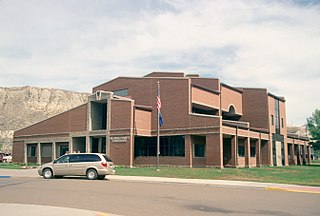
Bowman County School District 1 is a school district headquartered in Bowman, North Dakota.