Lithuania is a country in the Baltic region of Europe. The most populous of the Baltic states, Lithuania has 262 km (163 mi) of coastline consisting of the continental coast and the "Curonian Spit" coast. Lithuania's major warm-water port of Klaipėda (Memel) lies at the narrow mouth of Curonian Lagoon, a shallow lagoon extending south to Kaliningrad and separated from the Baltic sea by Curonian Spit, where Kuršių Nerija National Park was established for its remarkable sand dunes.

Klaipėda County is one of ten counties in Lithuania, bordering Tauragė County to the southeast, Telšiai County to the northeast, Kurzeme in Latvia to the north, and Kaliningrad Oblast in Russia to the south. To the west is the Baltic Sea. It lies in the west of the country and is the only county to have a coastline and not landlocked. Its capital is Klaipėda. On 1 July 2010, the county administration was abolished, and since that date, Klaipėda County remains as the territorial and statistical unit.
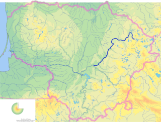
The Šventoji is the longest river that flows entirely within Lithuania and the largest tributary of the Neris. It originates from the Lake Samanis in the Gražutė Regional Park and flows into Neris near Jonava. The longest tributary of the Šventoji is the Širvinta.

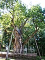
Stelmužė is a village in Zarasai district municipality of Lithuania. There is a wooden chapel built in 1650 not using saws or iron nails; it is the oldest wooden religious building in Lithuania. Stelmužė is also known for the Tower of Slaves, a rectangular building constructed of stone and bricks in the 18th century, used for imprisonment of serfs.

Palanga is a resort town in western Lithuania, on the shore of the Baltic Sea.

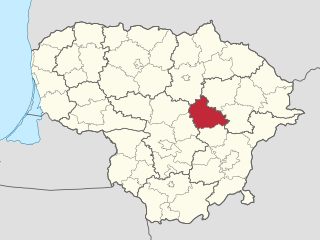
Širvintos District Municipality is a municipality in Lithuania, it is in territory of Vilnius County and its capital is Širvintos.

Vilnius District Municipality is one of 60 municipalities in Lithuania. It surrounds the capital city of Vilnius on 3 sides. The municipality is also bordering Trakai district and Elektrėnai municipality in the west, Astravyets and Ashmyany districts of Belarus in the east, Širvintos, Molėtai and Švenčionys districts in the north and Šalčininkai district in the south.
The Ukmergė District Municipality is a municipality in Vilnius County, Lithuania. The capital of the municipality is Ukmergė, the largest settlement and only city in the municipality. The entire municipality belongs to Aukštaitija ethnographic region.
Anykščiai is a ski resort town in Lithuania, 20 miles west of Utena. The Roman Catholic Church of St. Matthias in Anykščiai is the tallest church in Lithuania, with spires measuring 79 metres in height. Anykščiai has a resort status in Lithuania and is a popular destination of domestic tourism.

Vepriai is the largest town in Ukmergė district, Lithuania, situated south-west of Ukmergė with population of about 549 (2011). The capital of Vepriai elderate.

Selonia, also known as Augšzeme, is one of the Historical Latvian Lands encompassing the eastern part of the historical region of Semigallia as well as a portion of northeastern Lithuania. Its main city and cultural center is Jēkabpils. The Selonian language has become extinct, though some of the inhabitants still speak a Latgalian dialect.

The Nevėžis is the sixth longest river in Lithuania and one of the main tributaries of the Nemunas. Its length is 209 km (130 mi), and it flows only within the geographical confines of Lithuania. It is the second longest river in Lithuania, after the Šventoji, that flows exclusively within its borders. Its source is in the Anykščiai District Municipality, and the river first flows in a northwesterly direction, but then at Panevėžys turns towards the southwest, and passing Kėdainiai, flows into the Neman just west of Kaunas near Raudondvaris.
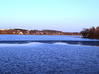
Zarasai is a city in northeastern Lithuania, surrounded by many lakes and rivers: to the southwest of the city is Lake Zarasas, to the north – Lake Zarasaitis, to the southeast – Lake Baltas, and the east – Lake Griežtas. Lakes Zarasaitis and Griežtas are connected by the River Laukesa. Zarasai holds the record for the highest recorded daytime temperature in Lithuania at 37.5 °C (99.5 °F) on 30 July 1994. A few music festivals are held in Zarasai in summer, such as Mėnuo Juodaragis and Roko naktys.
Dusetos is a city in Zarasai district municipality, northeastern Lithuania, 30 km (19 mi) west of Zarasai, near Lake Sartai.
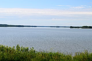
The Lake Dysnai is the second largest lake in Lithuania. With average depth of only 6 m (20 ft) it is one of the shallowest lakes in Lithuania. It is located in the Ignalina district municipality, about 3 km (1.9 mi) south from Dūkštas city. Dūkštas Train Station is the closest train station to the Lake Dysnai. It is approximately a 2 hours ride by train from Vilnius, the capital of Lithuania.
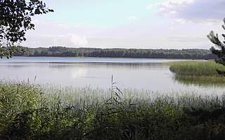
Sartai is a lake located in Rokiškis and Zarasai municipalities, northeastern Lithuania. The lake's 79 km shoreline is the longest in Lithuania. There are six islands in the lake. River Šventoji flows through it.
Luodis Lake is situated in Zarasai district municipality, Lithuania. It is the 6th largest lake in Lithuania. Lake contains two large islands. Town of Salakas is situated near the lake.
Daugavpils Municipality was a municipality in Latgale, Latvia from 2009 to 2021.
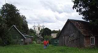
Antalieptė is a small town in Zarasai district municipality, near the Duseta–Daugailiai road and the right bank of the Šventoji riverhead. The town is also 4 km from the village of Zabičiūnai.
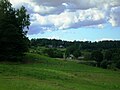
Vasaknai Manor is a former residential manor. It is located 6 kilometres (4 mi) from Antalieptė and 7 kilometres (4 mi) from Dusetos, in the East coast of Vasaknai Lake.