Related Research Articles
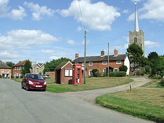
Middleton is a village in the east of the English county of Suffolk. It is located approximately 3 miles (5 km) north-west of Leiston, 5 miles (8 km) north east of Saxmundham and 3 miles (5 km) from the Suffolk coast. The village is on the B1122 around 2 miles (3 km) east of Yoxford and had a population of 359 at the 2001 census, falling to 343 at the 2011 Census.

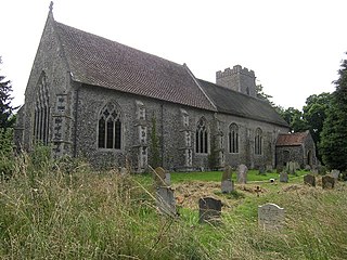
Iken is a small village and civil parish in the sandlands of the English county of Suffolk, an area formerly of heathland and sheep pasture. It is near the estuary of the River Alde on the North Sea coast and is located south east of Snape and due north of Orford. To its west is Tunstall Forest, created since the 1920s by the Forestry Commission and now part of the Sandlings Forest.
The National Pub of the Year is an annual competition held by CAMRA, the winner of which is announced in the February of the year following that in which the competition is run, that finds the best pub in the UK. Established in 1988, the competition helps to highlight quality pubs around the UK that are worth seeking out and visiting. Each year, each local CAMRA branch nominates one pub in their area to be entered. These 200 pubs then go through to the regional competition, which then whittles down to 4 pubs to go to the national final.

Weston is a village and civil parish in the English county of Suffolk. It is around 2 miles (3 km) south of Beccles in the East Suffolk district. The parish lies either side of the A145 road and is crossed by the Ipswich to Lowestoft railway line. Neighbouring parishes include Ellough, Ringsfield, Willingham St Mary and Shadingfield. The village is largely dispersed with a population of around 230.

Somersham is a village and civil parish in the Mid Suffolk district of Suffolk in eastern England, approximately 5 miles (8.0 km) northwest of Ipswich, with a population of 710 (2005).
Westhall is a village and civil parish in the East Suffolk district, in the county Suffolk, England about 3 miles (5 km) north east of Halesworth, 1 mile (1.6 km) south west of Brampton and 5 miles (8 km) south of Beccles, close to the A145. The mid-2005 population estimate for Westhall parish was 390. Sotherton is located to the south east and Holton to the south west.
Hawkedon is a village and civil parish in the West Suffolk district of Suffolk in eastern England. Located around 7 miles (11 km) south-south-west of Bury St Edmunds, the parish also contains the hamlet of Thurston End, and in 2005 had a population of 120. The majority of the village is classed as a conservation area.

Swilland is a village and civil parish, in the East Suffolk district, in the English county of Suffolk. It is north of the large town of Ipswich. Swilland has a church called St Mary's Church and a pub called The Moon & Mushroom Inn which has been awarded Suffolk Pub of The Year on two occasions by the Evening Star. Swilland shares a parish council with Witnesham called "Swilland and Witnesham Grouped Parish Council".

Falkenham is a village and a civil parish in the East Suffolk district, in the English county of Suffolk, near the village of Kirton and the towns of Ipswich and Felixstowe. The population of the civil parish as of the 2011 census was 170.

Naughton is a village and former civil parish, now in the civil parish of Nedging-with-Naughton, in the Babergh district, in the county of Suffolk, England. It is 10 miles (16 km) north-west of Ipswich and 7 miles (11 km) south-west of Stowmarket. It was historically within the Cosford Hundred of Suffolk. The civil parish was merged with Nedging on 1 April 1935 to create "Nedging with Naughton". In 1931 the civil parish had a population of 98.

Southolt is a village and civil parish in Suffolk, about 4+1⁄2 miles (7 km) southeast of Eye, on the road between Bedingfield and Worlingworth.

The Butt and Oyster is an old inn on the River Orwell in Pin Mill, Suffolk.
The Falcon Inn is a public house located at the junction of Queen Street and Falcon Street in Ipswich Suffolk. Located at 1 Falcon street it was owned by the Falcon Brewery located next door at 5 Falcon Street.
There have been a large number of pubs in Ipswich. The term covers a number of different sorts of public houses, including coaching inns, beerhouses, taverns hotels and alehouses. However, many of the distinctions which existed between these words have sometimes been lost as the terms became blurred.

The Steam Packet Inn was a public house located at 2/4 Duke Street, Ipswich, Suffolk, England. It closed on 18 September 1960. The building had been owned by Cobbold Brewery but after closure it was sold to Eastern Counties Farmers (ECF). The Burns family then lived there, Mr Burns being employed by ECF.


The Cock and Pye is public house in Ipswich, Suffolk. It is located in Upper Brook Street. It was included in the 1689 list of pubs in Ipswich, where it was stated to be in St Margarets Parish, Ipswich. The pub was formerly a large coaching inn, but by the late nineteenth century, was much smaller.

The Parrot and Punchbowl is a 16th-century English pub in the Suffolk village of Aldringham in the Aldringham-cum-thorpe parish. It is a grade II listed building associated with a history of smuggling. Its current title is The Parrot.
References
- ↑ "The Suffolk Pubs Guide". suffolk.camra.org.uk. Suffolk Camra. Retrieved 25 October 2021.
- ↑ Evelyn-White, Charles Harold (1886). "The Old Inns and Taverns of Ipswich" (PDF). Proceedings of the Suffolk Institute of Archaeology & History. VI (Part 2): 137–183.