Related Research Articles

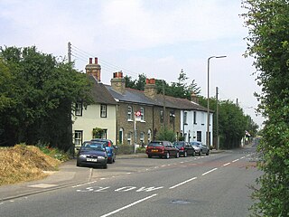
Hornchurch is a suburban town in East London in the London Borough of Havering. It is located 15.2 miles (24.5 km) east-northeast of Charing Cross. It comprises a number of shopping streets and a large residential area. It historically formed a large ancient parish in the county of Essex that became the manor and liberty of Havering. The economic history of Hornchurch is underpinned by a shift away from agriculture to other industries with the growing significance of nearby Romford as a market town and centre of administration. As part of the suburban growth of London in the 20th century, Hornchurch significantly expanded and increased in population, becoming an urban district in 1926 and has formed part of Greater London since 1965. It is the location of Queen's Theatre, Havering Sixth Form College and Havering College of Further and Higher Education.
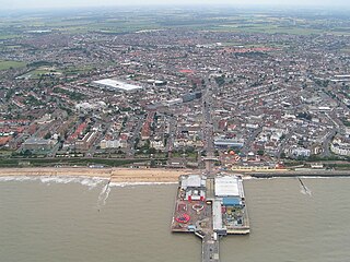
Tendring District is a local government district in north-east Essex, England. Its council is based in Clacton-on-Sea, the largest town. Other towns are Brightlingsea, Harwich, Frinton-on-Sea and Walton-on-the-Naze.

Braintree District is a local government district in Essex, England. The district is named after the town of Braintree, where the council is based. The district also includes the towns of Halstead and Witham and surrounding rural areas.

The City of Colchester is a local government district with city status in Essex, England, named after its main settlement, Colchester. The district also includes the towns of West Mersea and Wivenhoe and the surrounding rural areas stretching from Dedham Vale on the Suffolk border in the north to Mersea Island in the Colne Estuary in the south.

Epping Forest District is a local government district in Essex, England. It is named after the ancient woodland of Epping Forest, a large part of which lies within the district. The district covers northeastern parts of the urban area of London, including the suburban towns of Epping, Loughton, Waltham Abbey, Chigwell, and Buckhurst Hill, as well as rural areas beyond it. The district is situated in the west of the county, bordering north-eastern Greater London.

The Borough of Basildon is a local government district with borough status in Essex, England. It is named after its largest town, Basildon, where the council is based. The borough also includes the towns of Billericay and Wickford and surrounding rural areas.
Maldon District is a local government district in Essex, England. The district is managed by Maldon District Council, which is based in Maldon, the largest town in the district. The district also includes the town of Burnham-on-Crouch and numerous villages, including Heybridge, Wickham Bishops, Southminster, Tolleshunt D'Arcy and Tollesbury. The district covers the Dengie peninsula to the south of Maldon and the Thurstable Hundred area to the north of the Blackwater Estuary, a total area of 358.78 km2.
Rochford is a local government district in Essex, England. It is named after one of its main settlements, Rochford, where the council is based. The largest town in the district is Rayleigh. Other places in the district include Hockley, Ashingdon, Great Wakering, Canewdon and Hullbridge.
The Borough of Brentwood is a local government district with borough status in Essex, England. The borough is named after its main town of Brentwood, where the council is based; it includes several villages and the surrounding rural area.
North Ockendon is the easternmost settlement of Greater London, England, and part of the London Borough of Havering. It is 18 miles (29 km) east-northeast of Central London and consists of a dispersed settlement within the Metropolitan Green Belt. It was historically an ancient parish in the county of Essex, which was abolished for civil purposes in 1936. North Ockendon is the only inhabited area in Greater London outside the M25 London Orbital Motorway. North Ockendon is north of South Ockendon, in Thurrock, Essex.

Waltham Holy Cross was a local government district in the county of Essex, England. It was created as a local board of health district in 1850 when the parish of Waltham Holy Cross adopted the Public Health Act 1848 and was governed by Waltham Holy Cross Local Board of Health. In 1894 it became an urban district and the board became Waltham Holy Cross Urban District Council.

Hornchurch was a local government district in southwest Essex from 1926 to 1965, formed as an urban district for the civil parish of Hornchurch. It was greatly expanded in 1934 with the addition of Cranham, Great Warley, Rainham, Upminster and Wennington; and in 1936 by gaining North Ockendon. Hornchurch Urban District Council was based at Langtons House in Hornchurch from 1929. The district formed a suburb of London and with a population peaking at 131,014 in 1961, it was one of the largest districts of its type in England. It now forms the greater part of the London Borough of Havering in Greater London.
Chingford was a local government district in south west Essex, England from 1894 to 1965, around the town of Chingford. It was within the London suburbs, forming part of the London postal district and Metropolitan Police District. Its former area now corresponds to the northern part of the London Borough of Waltham Forest in Greater London.

Leyton was a local government district in southwest Essex, England, from 1873 to 1965. It included the neighbourhoods of Leyton, Leytonstone and Cann Hall. It was suburban to London, forming part of the London postal district and Metropolitan Police District. It now forms the southernmost part of the London Borough of Waltham Forest in Greater London.

Walthamstow was a local government district in southwest Essex, England from 1873 to 1965, around the town of Walthamstow. It was within the London suburbs, forming part of the London postal district and Metropolitan Police District. Its former area now corresponds to the central part of the London Borough of Waltham Forest in Greater London. Its population and area grew rapidly as London continued to develop its suburbs.
Romford Rural District was a local government district in southwest Essex, England from 1894 to 1934. It surrounded, but did not include, Romford which formed a separate urban district. During the life of the district the area changed in use from rural farm land to sprawling London suburb and in 1926 much of it was removed to form new urban districts.

Hadham Rural District was a rural district in Hertfordshire, England from 1894 to 1935, covering an area in the east of the county.
Hylands Park is a public park in the London Borough of Havering in northwest Hornchurch, near to Romford. It is owned and managed by Havering London Borough Council and has Green Flag Award status.
Havering Residents Association (HRA) is a group of residents' associations and registered political party in London, England. It is active in the London Borough of Havering and as of 2023 forms a 21-councillor group on Havering London Borough Council. At the 2022 London borough council elections they were the largest party on Havering Council, largest elected residents group in London, and the fourth largest political party represented on all London borough councils. Not all residents groups in Havering are affiliated with the HRA, usually indicating this by standing as 'independent resident' candidates. In 2014 eight members of the Havering Residents Association group split off to form the East Havering Residents Group.
Harlow District Council is the local authority for Harlow in Essex, England. Harlow is a non-metropolitan district, covering just the town of Harlow itself. The council generally styles itself Harlow Council.