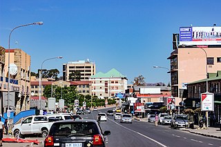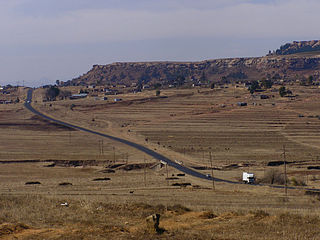
Lesotho, formally the Kingdom of Lesotho, is a landlocked country in Southern Africa. As an enclave of South Africa, with which it shares a 1,106 km (687 mi) border, it is the largest sovereign enclave in the world, and the only one outside of the Italian Peninsula. It is situated in the Maloti Mountains and contains the highest peak in Southern Africa. It has an area of over 30,000 km2 (11,600 sq mi) and has a population of about two million. Its capital and largest city is Maseru. The country is also known by the nickname The Mountain Kingdom.

The economy of Lesotho is based on tourism, manufacturing, mining, and agriculture, and depends heavily on remittances from its diaspora. Lesotho, a lower middle income country, is geographically surrounded by South Africa and is economically integrated with it as well. A significant portion of the population subsists on farming with a gradual ongoing transition into tourism and manufacturing.

Maseru is the capital and largest city of Lesotho. It is also the capital of the Maseru District. Located on the Caledon River, Maseru lies directly on the Lesotho–South Africa border. Maseru had a population of 330,760 in the 2016 census. The city was established as a police camp and assigned as the capital after the country became a British protectorate in 1869. When the country achieved independence in 1966, Maseru retained its status as capital. The name of the city is a Sesotho word meaning "red sandstones".
SothoSesotho, also known as Southern Sotho or Sesotho sa Borwa is a Southern Bantu language of the Sotho–Tswana ("S.30") group, spoken in Lesotho, and South Africa where it is an official language.

The National University of Lesotho, the main and oldest university in Lesotho, is located in Roma, 34 km (21 mi) southeast of Maseru, the capital of Lesotho. The Roma valley is broad and is surrounded by a barrier of rugged mountains which provides magnificent scenery. The university enjoys a temperate climate with four distinct seasons. The governing body of the university is the council and academic policy is in the hands of Senate, both Council and Senate being established by the Act.

Leribè is a district of Lesotho. It has an area of 2,828 km2 and a population in 2016 of approximately 337,500. Hlotse is the capital or camptown of the district. The district has one additional town, namely Maputsoe. In the west, Leribe borders on the Free State Province of South Africa. Domestically, it borders Butha-Buthe District in the north, Mokhotlong District in the east, Thaba-Tseka District in southeast and Berea District in southwest.

Lesotho is a Southern African nation surrounded entirely by South Africa. The largest ethnic group is the Basotho. The Basotho culture is immersed in musical traditions.

The Highveld is the portion of the South African inland plateau which has an altitude above roughly 1,500 m (4,900 ft), but below 2,100 m (6,900 ft), thus excluding the Lesotho mountain regions to the south-east of the Highveld. It is home to some of the country's most important commercial farming areas, as well as its largest concentration of metropolitan centres, especially the Gauteng conurbation, which accommodates one-third of South Africa's population.

The Senate of Lesotho is the upper chamber of the Parliament of Lesotho, which, along with the National Assembly of Lesotho, comprises the legislature of Lesotho.

The Central Bank of Lesotho is the central bank of Lesotho, in southern Africa. The bank is located in Maseru and its current governor is Dr. Emmanuel Letete. The bank was established in 1978 as the Lesotho Monetary Authority.
Marakabei is a town in central Lesotho. It is located southeast of the capital Maseru, close to the banks of the Senqunyane River, between the God Help Me Pass and Mokhoabong Pass.
The God Help Me Pass, or Lekhalong-la-Molimo-Nthuse in seSotho, is a mountain pass at an elevation of 2,318 m (7,605 ft) in western Lesotho. It is the second mountain pass on the A3 road going into the central highlands. The road ascends steeply from the village of Setibing, and near the summit is the Basotho Pony Trekking Centre, which offers a variety of trekking expeditions. The Makhaleng River flows close by Setibing, and its valley forms the western approach to the pass. The higher Blue Mountain Pass, 2,641 m (8,665 ft), Lekhalong-la-Thaba-Putsoa, is a few kilometres further east, and the first mountain pass, Bushman's Pass, Lekhalong-la-Baroa, 2,266 m (7,434 ft) is about 10 kilometres (6 mi) to the west, rising from the town of Nazareth.
The Mokhoabong Pass is a mountain pass in central Lesotho. The A3 highway crosses this pass between the towns of Mantsonyane and Thaba-Tseka.

Ha Lejone is a village in the Leribe District of northern Lesotho. It is on a ridge above a bend of the Malibamat'so River, 15 kilometres (9.3 mi) east of the Mafika-Lisiu Pass, which links Ha Lejone with the community of Pitseng.

The Malibamat'so River is a river in northern Lesotho. Its origin is near the South African border, where it drains the eastern slopes of the Maloti Range. It flows southwards past the village of Lejone, and eventually joins the Senqu River 5 kilometres (3.1 mi) northeast of Mohlanapeng.
Morija is a town in western Lesotho, located 35 kilometres south of the capital, Maseru. Morija is one of Lesotho's most important historical and cultural sites, known as the Selibeng sa Thuto— the Well-Spring of Learning. It was the site of the first French Protestant mission in Lesotho, founded in 1833. The town also houses the Morija Museum and Archives, well known for supporting research and preserving valuable records and documents of Lesotho's history.
Mavuka is a town in eastern Lesotho, close to the border with South Africa. It lies close to the Drakensberg, and is connected to both South Africa and the Lesotho towns of Matebeng and Paolosi by twisting mountain roads.
Notochampsa is an extinct genus of protosuchian crocodyliform. Fossils have been found from the lower Clarens Formation of the Karoo Supergroup in South Africa, dating back to the Pliensbachian stage of the Early Jurassic. Notochampsa comes from a period of relative fossil scarcity, and is the youngest known occurrence of a crocodylomorph from the Karoo Basin of South Africa.

The Lesotho Highlands are formed by the Drakensberg and Maloti mountain ranges in the east and central parts of the country of Lesotho. Foothills form a divide between the lowlands and the highlands. Snow is common in the highlands in the winter.
Cannabis in Lesotho is a traditional crop that remains illegal for any use, but largely tolerated. The plant is known as matekoane in Sesotho language but also called khomo ea fatše, likata or kakana.


