Related Research Articles

The Northrop Grumman E-8 Joint Surveillance Target Attack Radar System is a United States Air Force airborne ground surveillance, battle management and command and control aircraft. It tracks ground vehicles and some aircraft, collects imagery, and relays tactical pictures to ground and air theater commanders. The aircraft is operated by both active duty U.S. Air Force and Air National Guard units and also carries specially trained U.S. Army personnel as additional flight crew.

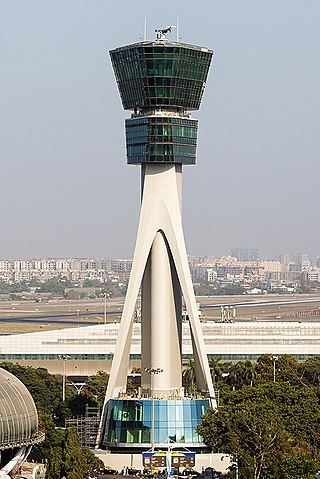
Air traffic control (ATC) is a service provided by ground-based air traffic controllers who direct aircraft on the ground and through a given section of controlled airspace, and can provide advisory services to aircraft in non-controlled airspace. The primary purpose of ATC worldwide is to prevent collisions, organize and expedite the flow of air traffic, and provide information and other support for pilots.

In aviation, the instrument landing system (ILS) is a precision radio navigation system that provides short-range guidance to aircraft to allow them to approach a runway at night or in bad weather. In its original form, it allows an aircraft to approach until it is 200 feet (61 m) over the ground, within a 1⁄2 mile (800 m) of the runway. At that point the runway should be visible to the pilot; if it is not, they perform a missed approach. Bringing the aircraft this close to the runway dramatically increases the range of weather conditions in which a safe landing can be made. Other versions of the system, or "categories", have further reduced the minimum altitudes, runway visual ranges (RVRs), and transmitter and monitoring configurations designed depending on the normal expected weather patterns and airport safety requirements.

A precision approach path indicator (PAPI) is a system of lights on the side of an airport runway threshold that provides visual descent guidance information during final approach. It is generally located on the left-hand side of the runway approximately 300 meters beyond the landing threshold of the runway.

In aviation, an instrument approach or instrument approach procedure (IAP) is a series of predetermined maneuvers for the orderly transfer of an aircraft operating under instrument flight rules from the beginning of the initial approach to a landing, or to a point from which a landing may be made visually. These approaches are approved in the European Union by EASA and the respective country authorities and in the United States by the FAA or the United States Department of Defense for the military. The ICAO defines an instrument approach as, "a series of predetermined maneuvers by reference to flight instruments with specific protection from obstacles from the initial approach fix, or where applicable, from the beginning of a defined arrival route to a point from which a landing can be completed and thereafter, if landing is not completed, to a position at which holding or en route obstacle clearance criteria apply."

Princess Juliana International Airport is the main airport on the Caribbean island of Saint Martin. The airport is located on the Dutch side of the island, in the country of Sint Maarten, close to the shore of Simpson Bay Lagoon. In 2015, the airport handled 1,829,543 passengers and around 60,000 aircraft movements. The airport serves as a hub for Winair and is the major gateway for the smaller Leeward Islands, including Anguilla, Saba, Saint Barthélemy and Sint Eustatius. It is named after Queen Juliana of the Netherlands, who landed there while she was heir presumptive in 1944, the year after the airport opened. The airport has very low-altitude flyover landing approaches because one end of its runway is extremely close to the shore and Maho Beach. While Princess Juliana International is the primary aviation gateway to the island, there is also a smaller public-use airport on the French side, in the French Collectivity of Saint Martin, called Grand Case-Espérance Airport.

Precision approach radar (PAR) is a type of radar guidance system designed to provide lateral and vertical guidance to an aircraft pilot for landing, until the landing threshold is reached. Controllers monitoring the PAR displays observe each aircraft's position and issue instructions to the pilot that keep the aircraft on course and glidepath during final approach. After the aircraft reaches the decision height (DH) or decision altitude (DA), further guidance is advisory only. The overall concept is known as ground-controlled approach (GCA), and this name was also used to refer to the radar systems in the early days of its development.

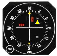
A course deviation indicator (CDI) is an avionics instrument used in aircraft navigation to determine an aircraft's lateral position in relation to a course to or from a radio navigation beacon. If the location of the aircraft is to the left of this course, the needle deflects to the right, and vice versa.

A marker beacon is a particular type of VHF radio beacon used in aviation, usually in conjunction with an instrument landing system (ILS), to give pilots a means to determine position along an established route to a destination such as a runway.

A transponder landing system (TLS) is an all-weather, precision landing system that uses existing airborne transponder and instrument landing system (ILS) equipment to create a precision approach at a location where an ILS would normally not be available.

An airport surveillance radar (ASR) is a radar system used at airports to detect and display the presence and position of aircraft in the terminal area, the airspace around airports. It is the main air traffic control system for the airspace around airports. At large airports it typically controls traffic within a radius of 60 miles (96 km) of the airport below an elevation of 25,000 feet. The sophisticated systems at large airports consist of two different radar systems, the primary and secondary surveillance radar. The primary radar typically consists of a large rotating parabolic antenna dish that sweeps a vertical fan-shaped beam of microwaves around the airspace surrounding the airport. It detects the position and range of aircraft by microwaves reflected back to the antenna from the aircraft's surface. The secondary surveillance radar consists of a second rotating antenna, often mounted on the primary antenna, which interrogates the transponders of aircraft, which transmits a radio signal back containing the aircraft's identification, barometric altitude, and an emergency status code, which is displayed on the radar screen next to the return from the primary radar.

Canadian Forces Station Saglek is a Royal Canadian Air Force radar base in the former Pinetree Line and currently part of the North Warning System, located near Saglek Bay in Newfoundland and Labrador, 367.7 miles (591.8 km) north-northwest of CFB Goose Bay.
In aviation, approach surveillance radar is a type of radar instrument approach provided with active assistance from air traffic control. The only airborne radio equipment required for radar approaches is a functioning radio transmitter and receiver. The radar controller vectors the aircraft to align it with the runway centerline. The controller continues the vectors to keep the aircraft on course until the pilot can complete the approach and landing by visual reference to the surface.
In aviation, a ground-controlled approach (GCA) is a type of service provided by air-traffic controllers whereby they guide aircraft to a safe landing, including in adverse weather conditions, based on primary radar images. Most commonly, a GCA uses information from either a precision approach radar or an airport surveillance radar. The term GCA may refer to any type of ground radar guided approach such as a PAR, PAR without glideslope or ASR. When both vertical and horizontal guidance from the PAR is given, the approach is termed a precision approach. If no PAR glidepath is given, even if PAR equipment is used for lateral guidance, it is considered a non-precision approach.

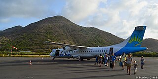
L'Espérance Airport, also known as Grand Case Airport, is a public use airport located in Grand Case, on the French side of the Caribbean island of Saint Martin. The airport is mainly used for flights by regional passenger aircraft (ATR) flying to Guadeloupe and Saint Barth, as well as used by private aircraft. It is the second and smaller airport of Saint Maarten, after Princess Juliana International Airport (SXM) which is located on the Dutch side of the island.
ASR-11 is a Digital Airport Surveillance Radar (DASR,) an advanced radar system utilized by the United States as the next generation of terminal air traffic control. The ASR-11 is an upgraded, advanced version of the previous ASR-9 radar. This next generation radar system has been developed through a joint effort by the Federal Aviation Administration, the Department of Defense and the United States Air Force, who took most of the lead development tasks.

Modern United States Navy aircraft carrier air operations include the operation of fixed-wing and rotary aircraft on and around an aircraft carrier for performance of combat or noncombat missions. The flight operations are highly evolved, based on experiences dating back to 1922 with USS Langley.
The AN/MPN is a mobile Ground-controlled approach radar first used during World War II. "MPN" is Joint Electronics Type Designation System nomenclature for (Ground) Mobile (M), Pulsed (P), Navigation aid (N).

Anchorage Air Route Traffic Control Center (PAZA/ZAN) is located just outside the main gate of Joint Base Elmendorf-Richardson at 700 North Boniface Parkway in Anchorage, Alaska, United States. The Anchorage ARTCC is one of 22 Air Route Traffic Control Centers in the United States.
The Cape TRACON (K90) is a radar approach facility located at Joint Base Cape Cod, Massachusetts next to the airfield for Coast Guard Air Station Cape Cod. It is operated by the Federal Aviation Administration (FAA).
References
235th ATCS Equipment Accessed August 29, 2006.