The province of Burgos is a province of northern Spain, in the northeastern part of the autonomous community of Castile and León. It is bordered by the provinces of Palencia, Cantabria, Vizcaya, Álava, La Rioja, Soria, Segovia, and Valladolid. Its capital is the city of Burgos.

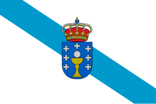
Ourense is a province of northwestern Spain, in the southeastern part of the autonomous community of Galicia. It is bordered by the provinces of Pontevedra in the west, Lugo in the north, León and Zamora in the east, and by Portugal in the south. With an area of 7,278 square km it is the only landlocked province in Galicia. The provincial capital, Ourense, is the largest population centre, with the rest of the province being predominantly rural.

The Adams–Onís Treaty of 1819, also known as the Transcontinental Treaty, the Florida Purchase Treaty, or the Florida Treaty, was a treaty between the United States and Spain in 1819 that ceded Florida to the U.S. and defined the boundary between the U.S. and New Spain. It settled a standing border dispute between the two countries and was considered a triumph of American diplomacy. It came in the midst of increasing tensions related to Spain's territorial boundaries in North America against the United States and Great Britain in the aftermath of the American Revolution; it also came during the Latin American wars of independence.

Arija is a small town and municipality in the Province of Burgos, located to the north of the provincial capital Burgos, in the autonomous community of Castile-Leon, Spain. The town's history dates back more than thousand years. Is divided into 'neighborhood above' and 'neighborhood below' or 'Vilga'. It consisted of the Santa Gadea de Alfoz.
Carcastillo is a town and municipality located in the province and autonomous community of Navarre, in the north of Spain. It is the site of the Cistercian monastery of Santa María de la Oliva.

Unzué is a town and municipality located in the province of Navarre, in the autonomous community of Navarre, in the North of Spain.
Monterroso is a municipality in Lugo province in Galicia in north-west Spain.

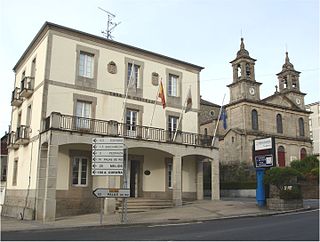
Navia de Suarna is a municipality in Lugo province in Galicia in north-west Spain.

Las Merindades is a comarca located north of the province of Burgos, in the autonomous community of Castile and León. It is bounded on the north-west by the province of Cantabria, north-east by the province of Biscay, south by La Bureba, south-east by Ebro, south-west by Páramos, and on the east by the province of Álava.

Barbadás is a municipality in the Province o Ourense in the Galicia region of north-west Spain. It is located towards the north-west of the province.

Sotragero is a municipality and town located in the province of Burgos, Castile and León, Spain. According to the 2007 census (INE), the municipality has a population of 230 inhabitants. Sotragero is 8 km north from Burgos, and it is member of the Alfoz de Burgos in the valley of the Ubierna river.
San Andrés del Rabanedo is a municipality located in the Province of León, Castile and León, Spain. According to the 2011 census (INE), the city has a population of 31,562 inhabitants, and is the third largest city in the province after León and Ponferrada. The municipality includes the districts of San Andrés del Rabanedo, Trobajo del Camino, Barrio Pinilla, Villabalter and Ferral del Bernesga.

Villaquilambre is a municipality located in the Province of León, Castile and León, Spain. According to the 2007 census (INE), the municipality has a population of 15,597.
Sabero is a village in the province of León, Castile and León, in north-western Spain. According to the 2004 census (INE), the municipality has a population of 1,615 inhabitants.

Villablino is a municipality located in the Laciana comarca, province of León, Castile and León, Spain. According to the 2011 Census, the municipality had a population of 10,353 inhabitants. It has the largest commercial, economic and social center of Northwest province, and it is one of the judicial districts in the province of León.
Shipton-on-Cherwell Halt was a railway halt constructed in 1929 by the Great Western Railway to serve the Oxfordshire village of Shipton-on-Cherwell as well as the adjacent Oxford and Shipton Cement Company limestone quarry and cement works.

Sierra de la Demanda is a comarca located south-east of the province of Burgos in the autonomous community of Castile and León, Spain. It is bounded on the north-east by the Montes de Oca comarca, north-west by the Alfoz de Burgos, south-east by the province of Soria, south-west by the Ribera del Duero comarca, on the east by the province of La Rioja and west by the Arlanza comarca. It is named after the mountain sub-range of Sierra de la Demanda, the northwesternmost end of the Sistema Ibérico.
Presqu'île-Robillard Ecological Reserve is an ecological reserve in Quebec, Canada. It was established on May 17, 2000.
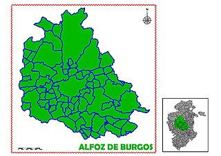
Alfoz de Burgos is a comarca located in the center of the province of Burgos, in the autonomous community of Castile and León. It is bounded on the north-west by La Bureba, north-east by the Páramos comarca, south-west by the Arlanza comarca, south-east by the Sierra de la Demanda, on the east by the Odra-Pisuerga comarca and west by the Montes de Oca.
The following lists include the extreme and significant geographic points of the islands of the Caribbean Sea.