Related Research Articles

The Yamuna is the second-largest tributary river of the Ganges by discharge and the longest tributary in India. Originating from the Yamunotri Glacier at a height of about 4,500 m (14,800 ft) on the southwestern slopes of Bandarpunch peaks of the Lower Himalaya in Uttarakhand, it travels a total length of 1,376 kilometres (855 mi) and has a drainage system of 366,223 square kilometres (141,399 sq mi), 40.2% of the entire Ganges Basin. It merges with the Ganges at Triveni Sangam, Prayagraj, which is a site of the Kumbh Mela, a Hindu festival held every 12 years.
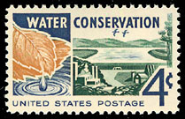
Water conservation includes all the policies, strategies and activities to sustainably manage the natural resource of fresh water, to protect the hydrosphere, and to meet the current and future human demand. Population, household size and growth and affluence all affect how much water is used. Factors such as climate change have increased pressures on natural water resources especially in manufacturing and agricultural irrigation. Many countries have already implemented policies aimed at water conservation, with much success. The key activities to conserve water are as follows: any beneficial reduction in water loss, use and waste of resources, avoiding any damage to water quality; and improving water management practices that reduce the use or enhance the beneficial use of water. Technology solutions exist for households, commercial and agricultural applications. Water conservation programs involved in social solutions are typically initiated at the local level, by either municipal water utilities or regional governments.


Krishna Raja Sagara, also popularly known as KRS, is a lake and the dam that creates it. They are close to the settlement of Krishna Raja Sagara in the Indian State of Karnataka. The gravity dam made of surki mortar is below the confluence of river Kaveri with its tributaries Hemavati and Lakshmana Tirtha, in the district of Mandya.
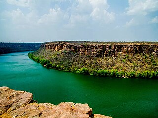
The Chambal River is a tributary of the Yamuna River in Central and Northern India, and thus forms part of the drainage system of the Ganges. The river flows north-northeast through Madhya Pradesh, running for a time through Rajasthan then forming the boundary between Rajasthan and Madhya Pradesh before turning southeast to join the Yamuna in Uttar Pradesh state.

Ranthambore National Park is a national park in Rajasthan, India, with an area of 1,334 km2 (515 sq mi). It is bounded to the north by the Banas River and to the south by the Chambal River. It is named after the historic Ranthambore Fort, which lies within the park.

Parvati River is a river in Madhya Pradesh and Rajasthan, India that flows into the Chambal River. The river rises at a height of 610 m in the Vindhya range in Sehore district Madhya Pradesh And flows in Sehore District, Rajgarh District, Guna District of Madhya Pradesh and then enters in Rajasthan and flows from Baran District and Sawai Madhopur District of Rajasthan where it falls into Chambal River in Sawai Madhopur District and runs for 436 km. It is one of the Chambal River's three main tributaries, along with the Banas River and the Kali Sindh River. Ramgarh crater is located on its eastern bank. Many small villages and tribes are situated on its bank, which utilise it for various purposes, such as irrigation, drinking, washing, etc.

The Banas is a river which lies entirely within the state of Rajasthan in western India. It is a tributary of the Chambal River, itself a tributary of the Yamuna, which in turn merges into the Ganga. The Banas is approximately 512 kilometres in length.

National Chambal Sanctuary, also called the National Chambal Gharial Wildlife Sanctuary, is a 5,400 km2 (2,100 sq mi) tri-state protected area in northern India for the protection of the Critically Endangered gharial, the red-crowned roof turtle and the Endangered Ganges river dolphin. Located on the Chambal River near the tripoint of Rajasthan, Madhya Pradesh and Uttar Pradesh, it was first declared in Madhya Pradesh in 1978, and now constitutes a long narrow eco-reserve co-administered by the three states. Within the sanctuary, the pristine Chambal River cuts through mazes of ravines and hills with many sandy beaches.

GandhisagarDam is situated at a distance of 168 km from the District headquarter. The Dam is constructed on the Chambal River.
Dholpur District is a district of Rajasthan state in Northern India. The town of Dholpur is the district headquarters. Dholpur District is a part of Bharatpur Divisional Commissionerate. It was carved out from the erstwhile Bharatpur District on 15 April 1982.

The Indian Rivers Inter-link is a proposed large-scale civil engineering project that aims to effectively manage water resources in India by linking Indian rivers by a network of reservoirs and canals to enhance irrigation and groundwater recharge, reduce persistent floods in some parts and water shortages in other parts of India. India accounts for 18% of the world population and about 4% of the world’s water resources. One of the solutions to solve the country’s water woes is to link rivers and lakes.

Jawai Bandh is a dam built across the Jawai River, a tributary of Luni River, in Rajasthan.

Rawatbhata is a city, Tehsil and Nagar Palika in Chittorgarh District, Rajasthan, India. It is 131 km from Chittorgarh city, 50 km from the nearest city, Kota. The city has eight nuclear power stations, an under-construction nuclear fuel complex and a heavy water plant. Rawatbhata also has the biggest dam of Rajasthan, Rana Pratap Sagar Dam, which is built on the Chambal River. The dam is equipped with a 172 MW hydroelectric power station.

The Rana Pratap Sagar Dam is a gravity masonry dam of 53.8 metres (177 ft) height built on the Chambal River at Rawatbhata in Rajasthan in India. It is part of integrated scheme of a cascade development of the river involving four projects starting with the Gandhi Sagar Dam in the upstream reach in Madhya Pradesh and the Jawahar Sagar Dam on the downstream with a terminal structure of the Kota Barrage in Rajasthan for irrigation.
The Jawahar Sagar Dam is the third dam in the series of Chambal Valley Projects on the Chambal River, located 29 km upstream of Kota city and 26 km downstream of Rana Pratap Sagar dam. It is a concrete gravity dam, 45 meters high and 393 meters long, generating 60 MW of power with an installed capacity of 3 units of 33 MW. Its construction was completed in 1972. The dam's gross storage capacity is 67.07 million cubic meters. The total catchment area of the dam is 27,195 km2, of which only 1,496 km2 are in Rajasthan. The free catchment area below Rana Pratap Sagar dam is 2,331 km2. The dam is located after the Gandhi Sagar Dam and Rana Pratap Sagar Dam, but before the Kota Barrage.
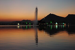
Fateh Sagar Lake is situated in the city of Udaipur in the Indian state of Rajasthan. It is an artificial lake named after Maharana Fateh Singh of Udaipur and Mewar, constructed north-west of Udaipur, to the north of Lake Pichola in the 1680s.

Water resources are natural resources of water that are potentially useful for humans, for example as a source of drinking water supply or irrigation water. 97% of the water on Earth is salt water and only three percent is fresh water; slightly over two-thirds of this is frozen in glaciers and polar ice caps. The remaining unfrozen freshwater is found mainly as groundwater, with only a small fraction present above ground or in the air. Natural sources of fresh water include surface water, under river flow, groundwater and frozen water. Artificial sources of fresh water can include treated wastewater and desalinated seawater. Human uses of water resources include agricultural, industrial, household, recreational and environmental activities.

The Narmada Canal is a contour canal in Western India that brings water from the Sardar Sarovar Dam to the state of Gujarat and then into Rajasthan state. The main canal has a length of 532 kilometres (331 mi). It is the second longest canal in India and the largest canal by water carrying capacity. The main canal is connected with 42 branch canals providing irrigation to 2,129,000 hectares farmland. The canal is designed to transfer 9.5 million acre-feet water annually from the Narmada Basin to areas under other river basins in Gujarat and Rajasthan..
References
- ↑ Jain, Sharad K.; Agarwal, Pushpendra K.; Singh, Vijay P. (2007-05-16). Hydrology and Water Resources of India. Springer Science & Business Media. p. 352. ISBN 978-1-4020-5180-7.
- ↑ Sustainable Development of Water and Energy Resources: Energy. Central Board of Irrigation and Power. 2000. p. 2.
- ↑ The Indian Forester. R. P. Sharma, Business Manager, Indian Forester. 1970. p. 506.
| | This article related to a location in Rajasthan is a stub. You can help Wikipedia by expanding it. |