Related Research Articles

The Neolithic period is the final division of the Stone Age, with a wide-ranging set of developments that appear to have arisen independently in several parts of the world. It is first seen about 12,000 years ago when the first developments of farming appeared in the Epipalaeolithic Near East, and later in other parts of the world. The Neolithic lasted until the transitional period of the Chalcolithic from about 6,500 years ago, marked by the development of metallurgy, leading up to the Bronze Age and Iron Age.

Abingdon-on-Thames, known just as Abingdon between 1974 and 2012, is a historic market town and civil parish in the ceremonial county of Oxfordshire, England, on the River Thames. Historically the county town of Berkshire, since 1974 Abingdon has been administered by the Vale of White Horse district within Oxfordshire. The area was occupied from the early to middle Iron Age and the remains of a late Iron Age and Roman defensive enclosure lies below the town centre. Abingdon Abbey was founded around 676, giving its name to the emerging town. In the 13th and 14th centuries, Abingdon was an agricultural centre with an extensive trade in wool, alongside weaving and the manufacture of clothing. Charters for the holding of markets and fairs were granted by various monarchs, from Edward I to George II.

There are three related types of Neolithic earthwork that are all sometimes loosely called henges. The essential characteristic of all three is that they feature a ring-shaped bank and ditch, with the ditch inside the bank. Because the internal ditches would have served defensive purposes poorly, henges are not considered to have been defensive constructions. The three henge types are as follows, with the figure in brackets being the approximate diameter of the central flat area:
- Henge (> 20 m). The word henge refers to a particular type of earthwork of the Neolithic period, typically consisting of a roughly circular or oval-shaped bank with an internal ditch surrounding a central flat area of more than 20 m (66 ft) in diameter. There is typically little if any evidence of occupation in a henge, although they may contain ritual structures such as stone circles, timber circles and coves. Henge monument is sometimes used as a synonym for henge. Henges sometimes, but by no means always, featured stone or timber circles, and circle henge is sometimes used to describe these structures. The three largest stone circles in Britain are each within a henge. Examples of henges without significant internal monuments are the three henges of Thornborough Henges. Although having given its name to the word henge, Stonehenge is atypical in that the ditch is outside the main earthwork bank.
- Hengiform monument (5 – 20 m). Like an ordinary henge, except the central flat area is between 5 and 20 m (16–66 ft) in diameter, they comprise a modest earthwork with a fairly wide outer bank. The terms Mini henge or Dorchester henge are sometimes used as synonyms for hengiform monument. An example is the Neolithic site at Wormy Hillock Henge.
- Henge enclosure (> 300 m). A Neolithic ring earthwork with the ditch inside the bank, with the central flat area having abundant evidence of occupation and usually being more than 300 m (980 ft) in diameter. Some true henges are as large as this, but lack evidence of domestic occupation. Super henge is sometimes used as a synonym for a henge enclosure. However, sometimes Super henge is used to indicate size alone rather than use, e.g. "Marden henge ... is the least understood of the four British 'superhenges' ".

The West Kennet Long Barrow, also known as South Long Barrow, is a chambered long barrow near the village of Avebury in the south-western English county of Wiltshire. Probably constructed in the thirty-seventh century BC, during Britain's Early Neolithic period, today it survives in a partially reconstructed state.
The Windmill Hill culture was a name given to a people inhabiting southern Britain, in particular in the Salisbury Plain area close to Stonehenge, c. 3000 BC. They were an agrarian Neolithic people; their name comes from Windmill Hill, a causewayed enclosure near Avebury. Together with another Neolithic tribe from East Anglia, a tribe whose worship involved stone circles, it is thought that they were responsible for the earliest work on the Stonehenge site.

A causewayed enclosure is a type of large prehistoric earthwork common to the early Neolithic in Europe. More than 100 examples are recorded in France and 70 in England, while further sites are known in Scandinavia, Belgium, Germany, Italy, Ireland and Slovakia.

The Medway Megaliths, sometimes termed the Kentish Megaliths, are a group of Early Neolithic chambered long barrows and other megalithic monuments located in the lower valley of the River Medway in Kent, South-East England. Constructed from local sarsen stone and soil between the 4th and 3rd millennia BCE, they represent the only known prehistoric megalithic group in eastern England and the most south-easterly group in Britain.
Hambledon Hill is a prehistoric hill fort in Dorset, England, situated in the Blackmore Vale five miles northwest of Blandford Forum. The hill itself is a chalk outcrop, on the southwestern corner of Cranborne Chase, separated from the Dorset Downs by the River Stour. It is owned by the National Trust.

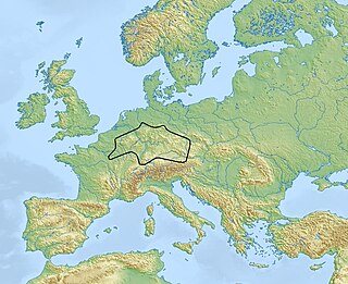
Approximately 120–150 Neolithic earthworks enclosures are known in Central Europe. They are called Kreisgrabenanlagen in German, or alternatively as roundels. They are mostly confined to the Elbe and Danube basins, in modern-day Germany, Austria, Czech Republic, Slovakia, as well as the adjacent parts of Hungary and Poland, in a stretch of Central European land some 800 km (500 mi) across. They date to the first half of the 5th millennium BC; they are associated with the late Linear Pottery culture and its local successors, the Stroke-ornamented ware and Lengyel cultures. The best known and oldest of these Circular Enclosures is the Goseck circle, constructed c. 4900 BC.

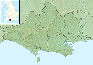
Figsbury Ring is an 11.2 hectare biological Site of Special Scientific Interest in Wiltshire, notified in 1975. It is owned and managed by the National Trust.

The prehistory of the County of Norfolk, England is broken into specific time periods.
The Karanovo culture is a Neolithic culture named after the Bulgarian village of Karanovo. The culture, which is part of the Danube civilization, is considered the largest and most important of the Azmak River Valley agrarian settlements.
The Michelsberg culture is an important Neolithic culture in Central Europe. Its dates are c. 4400–3500 BC. Its conventional name is derived from that of an important excavated site on Michelsberg hill near Untergrombach, between Karlsruhe and Heidelberg (Baden-Württemberg).

Balbridie is the site of a Neolithic long house in Aberdeenshire, Scotland, situated on the south bank of the River Dee, east of Banchory. The site is one of the earliest known permanent Neolithic settlements in Scotland, dating from 3400 to 4000 BC. This is the largest Neolithic long house to be excavated in Britain. In a European context, Whittle has indicated the rarity of such large Neolithic timber houses, citing Balbridie, a hall in Cambridgeshire, and Fengate as a small set of such finds.

The Trundle is an Iron Age hillfort on St Roche's Hill about 4 miles (6 km) north of Chichester, Sussex, England, built on the site of a causewayed enclosure, a form of early Neolithic earthwork found in northwestern Europe. Causewayed enclosures were built in England from shortly before 3700 BC until about 3300 BC; they are characterized by the full or partial enclosure of an area with ditches that are interrupted by gaps, or causeways. Their purpose is not known; they may have been settlements, or meeting places, or ritual sites. A chapel dedicated to St Roche was built on the hill around the end of the 14th century; it was in ruins by 1570. A windmill and a beacon were subsequently built on the hill.

Parc Cwm long cairn, also known as Parc le Breos burial chamber, is a partly restored Neolithic chambered tomb, identified in 1937 as a Severn-Cotswold type of chambered long barrow. The cromlech, a megalithic burial chamber, was built around 5850 years before present (BP), during the early Neolithic. It is about seven 1⁄2 miles (12 km) west south–west of Swansea, Wales, in what is now known as Coed y Parc Cwm at Parc le Breos, on the Gower Peninsula.

Whitehawk Camp is the remains of a causewayed enclosure on Whitehawk Hill near Brighton, East Sussex, England. Causewayed enclosures are a form of early Neolithic earthwork that were built in England from shortly before 3700 BC until about 3300 BC, characterized by the full or partial enclosure of an area with ditches that are interrupted by gaps, or causeways. Their purpose is not known; they may have been settlements, or meeting places, or ritual sites. The Whitehawk site consists of four roughly concentric circular ditches, with banks of earth along the interior of the ditches evident in some places. There may have been a timber palisade on top of the banks. Outside the outermost circuit there are at least two more ditches, one of which is thought from radiocarbon evidence to date to the Bronze Age, about two thousand years after the earliest dated activity at the site.

Knap Hill lies on the northern rim of the Vale of Pewsey, in northern Wiltshire, England, about a mile north of the village of Alton Priors. At the top of the hill is a causewayed enclosure, a form of Neolithic earthwork which began to appear in England from about 3700 BC onwards, characterized by the full or partial enclosure of an area with ditches that are interrupted by gaps, or causeways. Their purpose is not known—they may have been settlements, or meeting places, or ritual sites of some kind. The site has been scheduled as an ancient monument.
Alexandra Bayliss is a British archaeologist and academic. She is Head of Scientific Dating at Historic England, and a part-time Professor of Archaeological Science at the University of Stirling in Scotland. Her research focuses on the construction of exact chronologies of European Neolithic archaeological sites, through the application of Bayesian statistical modelling of radiocarbon dates.
Frances Healy is a British archaeologist and prehistorian, specialising in the British Neolithic and lithic technology. She has worked for Norfolk Archaeological Unit, English Heritage, Wessex Archaeology, and Oxford Archaeology. She has been a research associate at Newcastle University and Cardiff University, where she has been an honorary research fellow since 2007.