The topic of this article may not meet Wikipedia's notability guideline for geographic features .(August 2024) |
Abutia, also: Abutia Area, is a Kingdom in West Africa, in the East of the Republic of Ghana, Volta Region.
The topic of this article may not meet Wikipedia's notability guideline for geographic features .(August 2024) |
Abutia, also: Abutia Area, is a Kingdom in West Africa, in the East of the Republic of Ghana, Volta Region.
Abutia is a traditional area in Ghana with Teti, Agorve and Kloe as its three (3) main towns.
In colonial time Abutia was part of Togoland as German Colony from 1884 to 1916 and British Colony from 1916 to 1945. [1] When Ghana gained independence on 6 March 1957, Abutia became part of the Republic of Ghana. [2]
In 1992 the parliament enacted the new constitution of the Republic of Ghana, in which the traditional areas got cultural sovereignty (subnational monarchy). In 2008 a special decree of the chieftaincy was established. [3]
Since 1998 the Togbe (King) and traditional ruler is Togbe Abutia Kodzo Gidi V. [4]
The traditional national territory of Abutia is located between latitudes 6.33˚ 3ˈ N and 6.93˚ 6ˈ N and longitudes 0.17˚ 4ˈ E and 0.53˚ 39ˈ E. It shares boundaries with the Afadjato area to the North, the Adaklu District to the South, South Dayi District to the West, Ho Municipal and the Republic of Togo to the East.
It has a total land area of 1.002,79 km2.

Today's towns and villages of Abutia are:

The Kalakpa Resource Reserve is a national park in Abutia, Ghana. It is located in the South-East of the Abutia Hills Forest Reserve between 6°18' and 6°28' N and 0°17' and 0°30' E and in the Abutia and Adaklu traditional areas. The Kalakpa River divides the Abutia land from the Adaklu land. The Reserve covers an area of about 325 km2 square of forest/savanna transition zone, and the dominant vegetation is the dry Borassus-Combretum woodland. [5] [6]
Benin, officially the Republic of Benin, and also known as Dahomey, is a country in West Africa. It is bordered by Togo to the west, Nigeria to the east, Burkina Faso to the north-west, and Niger to the north-east. The majority of its population lives on the southern coastline of the Bight of Benin, part of the Gulf of Guinea in the northernmost tropical portion of the Atlantic Ocean. The capital is Porto-Novo, and the seat of government is in Cotonou, the most populous city and economic capital. Benin covers an area of 114,763 km2 (44,310 sq mi), and its population in 2021 was estimated to be approximately 13 million. It is a tropical country with an economy heavily dependent on agriculture, and is an exporter of palm oil and cotton.
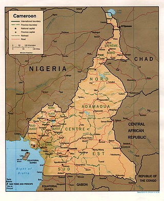
At 475,440 km2 (183,570 sq mi), Cameroon is the world's 53rd largest country. It is slightly larger than the nation of Sweden and the US state of California. It is comparable in size to Papua New Guinea. Cameroon's landmass is 472,710 km2 (182,510 sq mi), with 2,730 km2 (1,050 sq mi) of water.

Niger is a landlocked nation in West Africa located along the border between the Sahara and Sub-Saharan regions. Its geographic coordinates are longitude 16°N and latitude 8°E

South Africa is divided into nine provinces. On the eve of the 1994 general election, South Africa's former homelands, known as Bantustans, were reintegrated into the country, and the four provinces were increased to nine. The borders of Natal and the Orange Free State were retained, while the Cape Province and Transvaal were divided into three provinces each, plus North West Province which straddles the border of and contains territory from both these two former provinces. The twelfth, thirteenth and sixteenth amendments to the Constitution of South Africa changed the borders of seven of the provinces.

A nature reserve is a protected area of importance for flora, fauna, funga, or features of geological or other special interest, which is reserved and managed for purposes of conservation and to provide special opportunities for study or research. They may be designated by government institutions in some countries, or by private landowners, such as charities and research institutions. Nature reserves fall into different IUCN categories depending on the level of protection afforded by local laws. Normally it is more strictly protected than a nature park. Various jurisdictions may use other terminology, such as ecological protection area or private protected area in legislation and in official titles of the reserves.
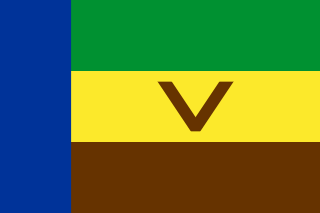
Venda or Tswetla, officially the Republic of Venda, was a Bantustan in northern South Africa. It was fairly close to the South African border with Zimbabwe to the north, while, to the south and east, it shared a long border with another black homeland, Gazankulu. It is now part of the Limpopo province. Venda was founded by the South African government as a homeland for the Venda people, speakers of the Venda language. The United Nations and international community refused to recognise Venda as an independent state.
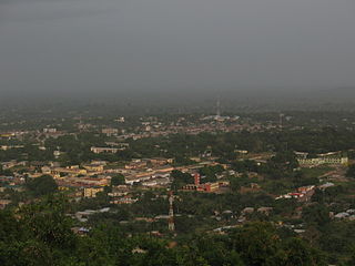
Ho is the a city and the capital of the Ho Municipal District and the Volta Region of Ghana. The city lies between Mount Adaklu and Mount Galenukui or Togo Atakora Range, and is home to the Volta Regional Museum, a cathedral, and a prison. The city is the capital of unrecognised Western Togoland. It was formerly the administrative capital of British Togoland now part of the Volta Region. The population of Ho Municipality according to the 2010 Population and Housing Census is 177,281 representing 8.4 percent of the region's total population. Females constitute 52.7 percent and males represent 47.3 percent. The population in Ho grew up to 180,420 National Population Census. About 62 percent of the population resides in urban localities. The Municipality shares boundaries with Adaklu and Agotime-Ziope Districts to the South, Ho West District to the North and West and the Republic of Togo to the East. Its total land area is 2,361 square kilometers thus representing 11.5 percent of the region's total land area.
Framlingham is a rural township located by the Hopkins River in the Western District of Victoria, Australia, about 20 kilometres (12 mi) north-east of the coastal city of Warrnambool. In the 2016 census, the township had a population of 158.

Adaklu-Anyigbe District is a former district that was located in Volta Region, Ghana. Originally it was formerly part of the then-larger Ho District on 10 March 1989, until the southern part was split off to create Adaklu-Anyigbe District on 13 August 2004; thus the remaining part has been retained as Ho Municipal District. However, on 28 June 2012, it was split off into two new districts: Agotime-Ziope District and Adaklu District. The district assembly was located in the central part of Volta Region and had Agortime-Kpetoe as its capital town.
East Timor, also known as Timor-Leste, officially the Democratic Republic of Timor-Leste, is a country in Southeast Asia. It comprises the eastern half of the island of Timor, the exclave of Oecusse on the island's north-western half, and the minor islands of Atauro and Jaco. The western half of the island of Timor is administered by Indonesia. Australia is the country's southern neighbour, separated by the Timor Sea. The country's size is 14,950 square kilometres (5,770 sq mi). Dili, on the north coast of Timor, is its capital and largest city.

Congo, officially the Republic of the Congo or Congo Republic, also known as Congo-Brazzaville is a country located on the western coast of Central Africa to the west of the Congo River. It is bordered to the west by Gabon, to the northwest by Cameroon, to the northeast by the Central African Republic, to the southeast by the Democratic Republic of the Congo, to the south by the Angolan exclave of Cabinda, and to the southwest by the Atlantic Ocean.

The Birim River is one of the main tributaries of the Pra River in Ghana and the country's most important diamond-producing area, flowing through most of the width of the Eastern region. The river rises in the east of the Atewa Range, flows north through the gap between this range and the Kwahu Plateau, then runs roughly south-west until it joins the Pra. It gives its name to the Birimian rock formation, which yields most of the gold in the region. Ghana is the second largest producer of gold in Africa.

The Dzanga-Sangha Special Reserve is a protected reserve of southwestern Central African Republic. It was established in 1990 and covers 6,865.54 km2 (2,650.80 sq mi). It is one of several areas within the Dzanga-Sangha Complex of Protected Areas (DSCPA), each within its own protective status and along with Lobéké National Park in Cameroon and Nouabalé-Ndoki National Park in Republic of Congo, it is part of the Sangha Trinational Landscape. Other areas within the DSCPA include the Dzanga Ndoki National Park which has two sectors, the 495 km2 (191 sq mi) Dzanga park and the 725 km2 (280 sq mi) Ndoki park. A conference of the Ministers of Forests of Central African Forest Commission (COMIFAC) had resolved to establish within the Congo basin, the Sangha River Tri-national Protected area (STN) encompassing these three parks. The forest special reserve is operated by the Central African Forest Commission (COMIFAC).
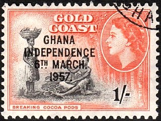
Ghana gained independence from the British on 6 March 1957. It is a member of the Commonwealth of Nations. The country became a republic on July 1, 1960.
Abutia-Kpota is a farming community located at South-Western part of Ho, the capital town of Volta Region, Ghana. Abutia Kpota is one of the towns within the Ho West Parliamentary Constituency. The town is near the Kalapa Re-source Reserve.
Kalakpa Game Production Reserve is a 32,020 hectare forest reserve in Ghana.

Ho West District is one of the eighteen districts in Volta Region, Ghana. Originally it was formerly part of the then-larger Ho District on 10 March 1989, until the western part was split off to create Ho West District on 28 June 2012; thus the remaining part was elevated to municipal district assembly status on that same year to become Ho Municipal District. The district assembly is located in the central part of Volta Region and has Dzolokpuita as its capital town.
Gbi-Godenu is a divisional chieftaincy of the traditional area of Hohoe recognized within of the Constitution of Ghana and legislation regulating the "Headquarters" in Ghanaian society. It is located in the Volta River region of Ghana.

Have is a town located in the western valley of the Akwapim Togo mountain range, locally called Ewetogbeka or Nyito, in the Afadzato South District of the Volta Region of Ghana. It is bounded on the south by Agate, on the north by Nyagbo, on the east by the mountain range and in the west by river Dayi. The citizens of Have are called Haveawo.
The Political history of Ghana recounts the history of varying political systems that existed in Ghana during pre-colonial times, the colonial era and after independence. Pre-colonial Ghana was made up of several states and ethnic groups whose political system was categorized by 3 main administrative models; Centralized, Non-centralized and Theocratic states. In the colonial era, the British Empire employed different forms of government among its four territorial possessions in the Gold Coast. Indirect rule was implemented in the late 19th century after its success in Northern Nigeria. From the 1940s, native Ghanaians yearned for more autonomy. This resulted in the several constitutional reforms as well as the creation of the office of the Prime Minister in 1952.