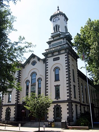
Northumberland County is a county in the Commonwealth of Pennsylvania. It is part of Northeastern Pennsylvania. As of the 2020 census, the population was 91,647. Its county seat is Sunbury.

Sunbury is a city and county seat of Northumberland County, Pennsylvania, United States. The principal city in the Sunbury, PA Micropolitan Statistical Area, it is also one of three principal cities in the Bloomsburg-Berwick-Sunbury, PA Combined Statistical Area.

Upper Augusta Township is a township in Northumberland County, Pennsylvania, United States. It was formed in 1846 by the division of Augusta Township into Upper and Lower sections. The population at the 2010 Census was 2,586, an increase over the figure of 2,556 tabulated in 2000.

Shamokin Dam is a borough in Snyder County, Pennsylvania, United States. The population was 1,647 at the 2020 census.

The West Branch Susquehanna River is one of the two principal branches, along with the North Branch, of the Susquehanna River in the Northeastern United States. The North Branch, which rises in upstate New York, is generally regarded as the extension of the main branch, with the shorter West Branch being its principal tributary.

Pennsylvania Route 61 is an 81.8-mile-long (131.6 km) state highway that is located in the Commonwealth of Pennsylvania in the United States. The route is signed on a north–south direction, running from U.S. Route 222 Business in Reading northwest to US 11/US 15/PA 147 in Shamokin Dam.

Shamokin was a multi-ethnic Native American trading village on the Susquehanna River, located partially within the limits of the modern cities of Sunbury and Shamokin Dam, Pennsylvania. It should not be confused with present-day Shamokin, Pennsylvania, located to the east. The village was the focus of missionary efforts, and then was the staging area for raids on English settlements in Pennsylvania during the French and Indian War. It was burned and abandoned by the Lenape in May, 1756. A few months later, Fort Augusta was constructed on the site of the village.
Augusta Township was one of the seven original townships of Northumberland County, Pennsylvania in the United States. It was formed in 1772 and ceased to exist on April 13, 1846 when it was divided into Upper Augusta and Lower Augusta townships.

The Great Island Path was a major Native American trail in the U.S. state of Pennsylvania that ran from the village of Shamokin along the right bank of the West Branch Susquehanna River north and then west to the Great Island.

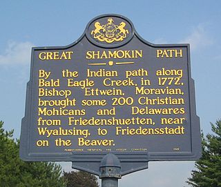
The Great Shamokin Path was a major Native American trail in the U.S. State of Pennsylvania that ran from the native village of Shamokin along the left bank of the West Branch Susquehanna River north and then west to the Great Island. There it left the river and continued further west to Chinklacamoose and finally Kittanning on the Allegheny River.

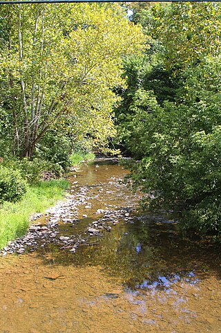
Shamokin Creek is a tributary of the Susquehanna River in Northumberland County, Pennsylvania, in the United States. It is approximately 32.4 miles (52.1 km) long and flows through Mount Carmel, Mount Carmel Township, Coal Township, Shamokin, Ralpho Township, Shamokin Township, Snydertown, Upper Augusta Township, and Sunbury. The watershed of the creek has an area of 137 square miles (350 km2). It experiences significant impacts by abandoned mine drainage and many abandoned mine drainage discharges are in its watershed. Various other impairments also affect parts of the creek's watershed. Shamokin Creek is in the Appalachian Mountains section of the Ridge and Valley physiographic province. Rock formations consisting of sandstone, shale, and anthracite deposits occur in the watershed.

Shikellamy State Park is a 132-acre (53 ha) Pennsylvania state park located at the confluence of the West Branch Susquehanna River and Susquehanna River in Pennsylvania. The park is divided into two sections. The older part, on a bluff on the western bank of the Susquehanna River, is the 78-acre (32 ha) Shikellamy overlook in Union Township, Union County. The newer part is the 54-acre (22 ha) marina on the southern end of Packer Island in Upper Augusta Township, Northumberland County. Packer's Island lies between the city of Sunbury and the borough of Northumberland at the confluence of the two branches of the river.
Fort Augusta was a stronghold in Northumberland County, Pennsylvania, in the upper Susquehanna Valley from the time of the French and Indian War to the close of the American Revolution.

Pennsylvania Route 147 is a north–south route that runs for 58.3 miles (93.8 km) along the east shore of the Susquehanna River in central Pennsylvania, United States. The southern terminus is at an interchange with U.S. Route 22 /US 322 in Reed Township. The northern terminus is at an interchange with Interstate 80 (I-80) and I-180 in Turbot Township.

Shikellamy, also spelled Shickellamy and also known as Swatana, was an Oneida chief and overseer for the Iroquois confederacy. In his position as chief and overseer, Shikellamy served as a supervisor for the Six Nations, overseeing the Shawnee and Lenape tribes in central Pennsylvania along the Susquehanna River and protecting the southern border of the Iroquois Confederacy. While his birth date is not known, his first recorded historical appearance was in Philadelphia in 1728. In 1728 he was living in a Shawnee village in Pennsylvania near modern Milton, and moved in 1742 to the village of Shamokin, modern day Sunbury, at the confluence of the West and North Branches of the Susquehanna. Shikellamy was an important figure in the early history of the Province of Pennsylvania and served as a go-between for the colonial government in Philadelphia and the Iroquois chiefs in Onondaga. He welcomed Conrad Weiser to Shamokin and served as Weiser's guide on his journeys into the frontier of Pennsylvania and New York.

Shikellamy School District is a midsized, suburban/rural, public school district in Northumberland County, Pennsylvania. It serves Northumberland Borough, Point Township, Rockefeller Township, Snydertown Borough, the City of Sunbury, and Upper Augusta Township. The administrative offices are located at Administration Center, 200 Island Blvd, Sunbury, Pennsylvania. Shikellamy School District encompasses approximately 71 square miles (180 km2). According to 2000 federal census data, Per the US Census Bureau, by 2010, the district's population declined to 22,554 people. The educational attainment levels for the Shikellamy School District population 25 and over were 83.6% high school graduates and 15.3% college graduates.
Inflatable rubber dams are cylindrical rubber fabrics placed across channels, streams and act as a weir or dam to raise the upstream water level when inflated. The membrane is a multi-layer fabric made of synthetic fibre and rubberised on one or both sides. The fabric is flexible and yet exhibits good wear-resistance characteristics. A layer of stainless steel mesh or ceramic chips can be embedded in the surface layer to reduce or prevent vandal damage.

Little Shamokin Creek is a 15.0-mile-long (24.1 km) tributary of Shamokin Creek and a sub-tributary of the Susquehanna River in Northumberland County, Pennsylvania, in the United States. The watershed of the creek has an area of 37 square miles, spread out over Upper Augusta Township, Lower Augusta Township, Rockefeller Township, and Shamokin Township. The creek's watershed contains four rock formations. These are the Hamilton Group, the Spechty Kopf formation, the Irish Valley formation, and the Buddy Run formation. The watershed also contains three main soil types. They are the Berks-Weikert-Bedington series, the Leck Kill-Meckesville-Calvin series and the Hazelton-Dekalb-Buchanan series.
The Bloody Spring is a historical site in the Sunbury, Pennsylvania area. Located on school district property, it is purported to be the location where a soldier from Fort Augusta that was guarding cattle was ambushed and murdered by a Native American tribe member in 1756, during the French and Indian War. His blood is said to have colored the water in the spring red, resulting in the name, The Bloody Spring. The site, located on Memorial Drive and .1 miles south of Shikellamy Avenue, is marked with a historical marker.


