
Togo, officially the Togolese Republic, is a country in West Africa. It is bordered by Ghana to the west, Benin to the east and Burkina Faso to the north. It is one of the least developed countries and extends south to the Gulf of Guinea, where its capital, Lomé, is located. It is a small, tropical country, which covers 56,785 square kilometres and has a population of approximately 8 million, and has a width of less than 115 km (71 mi) between Ghana and its eastern neighbor Benin.

Mogilev Region, also known as Mogilev Oblast or Mahiliow Voblasts, is one of the regions of Belarus. Its administrative center is the city of Mogilev.

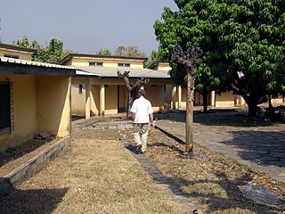
Kpalimé is a city in the Plateaux Region of Togo, 120 km north of Lomé and 15 km from the border with Ghana. It is the administrative capital of Kloto Prefecture. Kpalimé has a population of 75,084, making it the fourth-biggest town in Togo, after Lomé, Sokodé and Kara. The town has a cathedral, a scientific lycée, and a post-office, as well as several banks, medical centres, pharmacies, cyber-cafés and petrol stations.
Badou is a town in western Togo near the Ghanaian border, in Plateaux Region. Its main industries are cocoa- and coffee-farming. The Akloa Falls lie nearby.
Bassar is a town in Bassar Prefecture, Kara Region in Togo, situated west of Kara. The town borders Tatale which is in Ghana. The town has a population of 64,888.
Dapaong is a city in northern Togo and prefecture seat of Tône in the Savanes Region, of which it is also the capital. It had a population of 58,071 at the 2010 Census. It is situated 638 km north of the capital Lomé, near the border with Burkina Faso. It is a market town and has a small museum.
Bunkpurugu is a small town and is the capital of Bunkpurugu Nyankpanduri district, a district in the North East Region of Ghana adjacent to the border with Togo. It was formerly the capital of the Bunkpurugu-Yunyoo District.
The Upper East Region is located in north Ghana and is the third smallest of the 16 administrative regions in Ghana. It occupies a total land surface of 8,842 square kilometers or 2.7 per cent of the total land area of Ghana. The Upper East regional capital is Bolgatanga, sometimes referred to as Bolga. Other major towns in the region include Navrongo, Paga, Bawku and Zebilla.

Savanes Region is the northernmost of the five Regions of Togo. Dapaong is the regional capital. Another major town in the region is Mango.
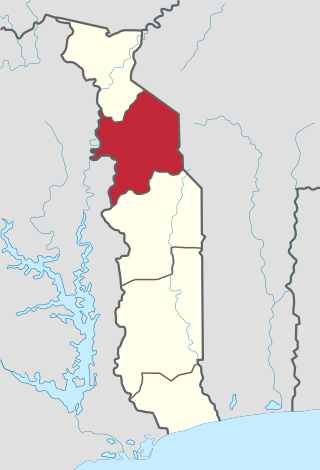
Kara Region is one of Togo's five regions. Kara is the regional capital.

Volta Region is one of Ghana's sixteen administrative regions, with Ho designated as its capital. It is located west of Republic of Togo and to the east of Lake Volta. Divided into 25 administrative districts, the region is multi-ethnic and multilingual, including groups such as the Ewe, the Guan, and the Akan peoples. The Guan peoples include the Lolobi, Likpe, Akpafu, Buem, and Nkonya people. This region was carved out of the Volta Region in December 2018 by the New Patriotic Party. The people of the Volta Region are popularly known as Ewes. The people of the Volta Region are popular known for their rich cultural display and music some of which include Agbadza, Borborbor and Zigi.
Mango, formerly Sansanné-Mango , is a city in northern Togo. It is situated on the Oti River in the Savanes Region. The town is located near Kéran National Park and 26 kilometres (16 mi) from the border with Ghana. The population is about 41,464 people (2007).
Tsévié is a city and canton in the Maritime Region of Togo. It is situated 32 km north of the capital Lomé and at the 2010 Census had a population of 54,474. The city is inhabited primarily by Ewe people. It is the capital of the prefecture of Zio and the Maritime Region.
Kpando is a town and capital of Kpando Municipal District in the northern Volta Region of Ghana. It is near the north eastern arm of Lake Volta and the Togo border. Kpando is the fifty-fourth most populous place in Ghana, in terms of population, with a population of 28,334 people. Kpando is connected by ferry and road to Gbefi, Hohoe, Ho and Dambai. It is about a 4-hour journey from Accra. The Kpando Municipality is a district in the Volta Region, and one of the oldest administrative districts in Ghana.
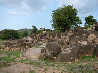
The Togo Mountains is a mountain range which stretches across the central region of the West African country of Togo and across the eastern and western borders of that country into Ghana and Benin. In Ghana, the range is also known as the Akwapim Hills, and in Benin it is also known as the Atakora Mountains. Part of the range is associated with the country of Niger, where the W National Park is found. The African wild dog, Lycaon pictus, was historically found in this region but may now be extirpated from this locale.
Amlamé is a town in the Plateaux Region of Togo. It is located on the main highway between Atakpame and Kpalime. Administratively, it is the seat of the Amou Prefecture.
Boungbale is a town in the Bassar Prefecture in the Kara Region of Togo. Nearby towns and villages include Bongbon, Lidialabo (1.6 km [1.0 mi]), Demon (3.2 km [2.0 mi]), Diabirdo (3.2 km [2.0 mi]), and Tipakpane (3.5 km [2.2 mi]).
Mont Sokbaro is a hill that is mostly cited as the highest point of Benin, with an elevation of 658 metres (2,159 ft). This designation is contested, as SRTM readings at coordinates 10°17′22″N1°32′38″E give an elevation of 672 metres (2,205 ft). This is a location 2.5 kilometres (1.6 mi) southeast of Kotoponga.
Garu is a town and is the administrative capital of Garu District, a district in the Upper East Region of northern Ghana.

